You could have been here
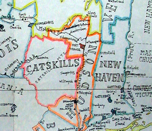
A clip of where the Capital Region would be on a map of "New Netherland"
Check out this fun map based on an alternate history in which the Dutch held onto their North American colonies. (The picture above is just one section of the map -- the whole thing includes a good portion of the Northeast.) Here's a little explanation from the Strange Maps blog:
New Amsterdam never gave way to New York. The Dutch kept the whole of their North American colony out of the hands of the perfidious English, in fact. New Netherland today constitutes a thriving Republic stretching from the Atlantic coast to Quebec, dividing New England from the rest of the United States.
This Republik van Nieuw Nederland is the brainchild of Paul Burgess, who's been fleshing out its allohistorical details since his mid-20s - he's even devised a pretty cool flag for the Republic, not to mention an anthem ('Onze Patrie' - 'Our Fatherland'), names for the baseball teams in the Knickerbocker League, a list of the best places to smuggle goods across the border to the US and even call letters for New Netherland radio stations. And, of course, this map.
So, in this alternate history most of us would be living in the State of Hudson.
And this site would be called All Over Fort Orange.
(via)
map: Paul Burgess via Strange Maps
... said KGB about Drawing: What's something that brought you joy this year?