Google Street View now covers Capital Region

We're just living in Google's world.
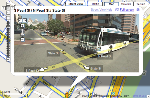
As part of Google's quest to know seemingly everything, the company has been running cars with panorama cameras through cities. The images it captures are then used to create interactive street level maps. The program started last year in San Francisco and it's been slowly spreading across the country. Yesterday Google announced that street level pictures of the Capital Region are now available.
Take a look: here's the intersection of Pearl and State in downtown Albany on Google Street View.
So when did Google come through this area? The Daily Gazette is guessing sometime last August after it checked out the image of the marquee at Proctor's.
Hi there. Comments have been closed for this item. Still have something to say? Contact us.
Comments
Look at the I-890 to Thruway tolls (eastbound): You can see the driver's hand ready to accept the toll ticket from the booth operator.
... said George on Feb 13, 2008 at 1:31 PM | link
This is both really cool and kind of scary.
... said Gina on Feb 13, 2008 at 3:50 PM | link
And here I totally would have thought that the Google Mobile would use E-ZPass.
... said Greg on Feb 13, 2008 at 4:53 PM | link
AOA should sponsor a contest to see who can find the "wackiest" Google street image form the Capital Region... So far its the Google Guy getting his thruway ticket... There must be other more weirdness....
... said H R GREEN on Feb 17, 2008 at 10:06 AM | link