New Congressional districts for the Capital Region

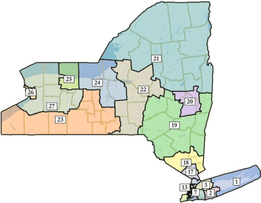
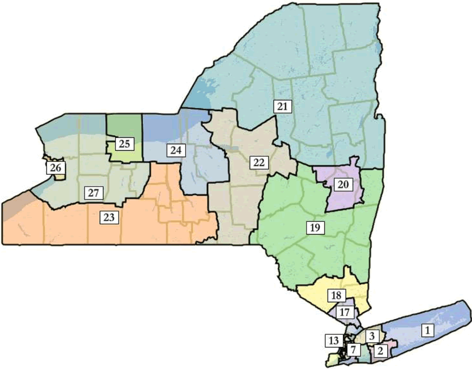
Here's the map of new Congressional districts for New York State approved by a panel of federal judges (large format). The state is down two districts, from 29 to 27, after the most recent census.
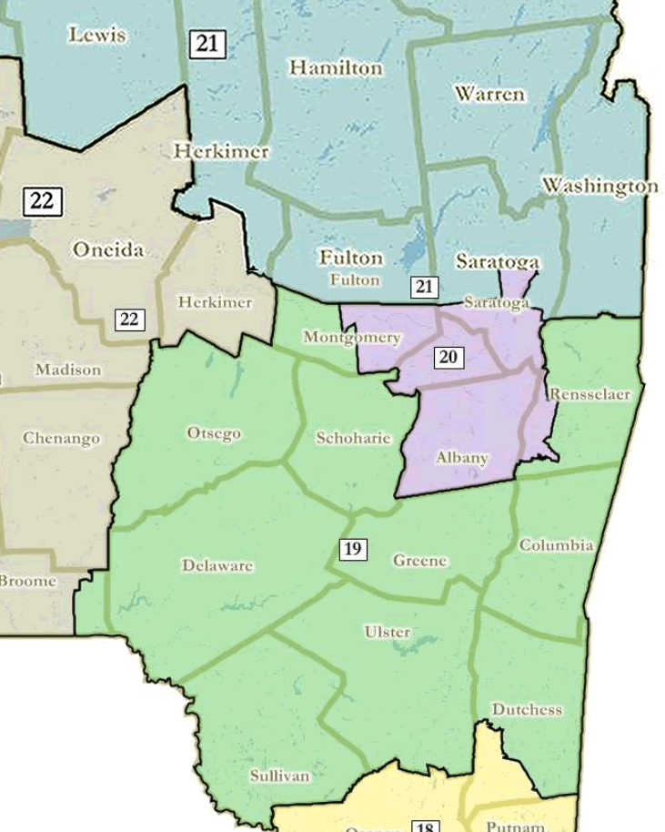
Under the new lines, the Capital Region is now spread over three districts: NY 19 (currently Chris Gibson), NY 20 (currently Paul Tonko), and NY 21 (currently Bill Owens). There's some significant reorganization, especially in the core of the area -- the cities of Albany, Saratoga Springs, Schenectady, and Troy are now in the same district (they had been split between districts represented by Tonko and Gibson).
The New York Times has posted a very good interactive map comparing the new and old districts.
All the new maps from the federal judges are embedded after the jump.
Hi there. Comments have been closed for this item. Still have something to say? Contact us.


Comments
A major change for southern and central Saratoga County. It had been in a primarily rural-Republican Congressional district for years (remember Gerald Solomon?), but will now be in a mostly urban-suburban, and presumably Democratic, district.
... said Bob on Mar 20, 2012 at 11:40 AM | link
These look like real districts; not squiggly lines of districts that meander all around. Kudos to the feds!
... said Joe on Mar 20, 2012 at 2:24 PM | link
Here are links to interactive maps for New York for all new and old districts:
New York US Congress:
http://nycd2001.ballotpedia.censusviewer.com
http://nycd2011.ballotpedia.censusviewer.com
New York State Senate:
http://nyssd2001.ballotpedia.censusviewer.com
http://nyssd2011.ballotpedia.censusviewer.com
New York State House:
http://nyshd2001.ballotpedia.censusviewer.com
http://nyshd2011.ballotpedia.censusviewer.com
As you navigate around the maps you are experiencing a technical feat that was unthinkable the last time that the district lines were drawn. Ten years ago there was no Bing Maps, there were no online satellite and aerial photos, no ubiquitous high speed Internet and there were no mapped voter files that could be visualized in real time from the cloud. Over ten million voter records are mapped each time that you zoom and pan over the state of New York. Visitors can zoom in to see fine details on the exact position of every district line. As you move the mouse from district to district voter counts are updated in a chart instantly.
... said Eimar Boesjes on Sep 7, 2012 at 6:53 PM | link