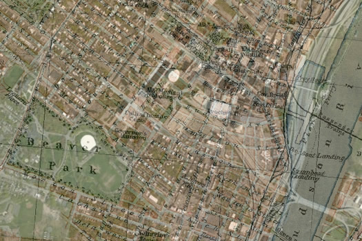
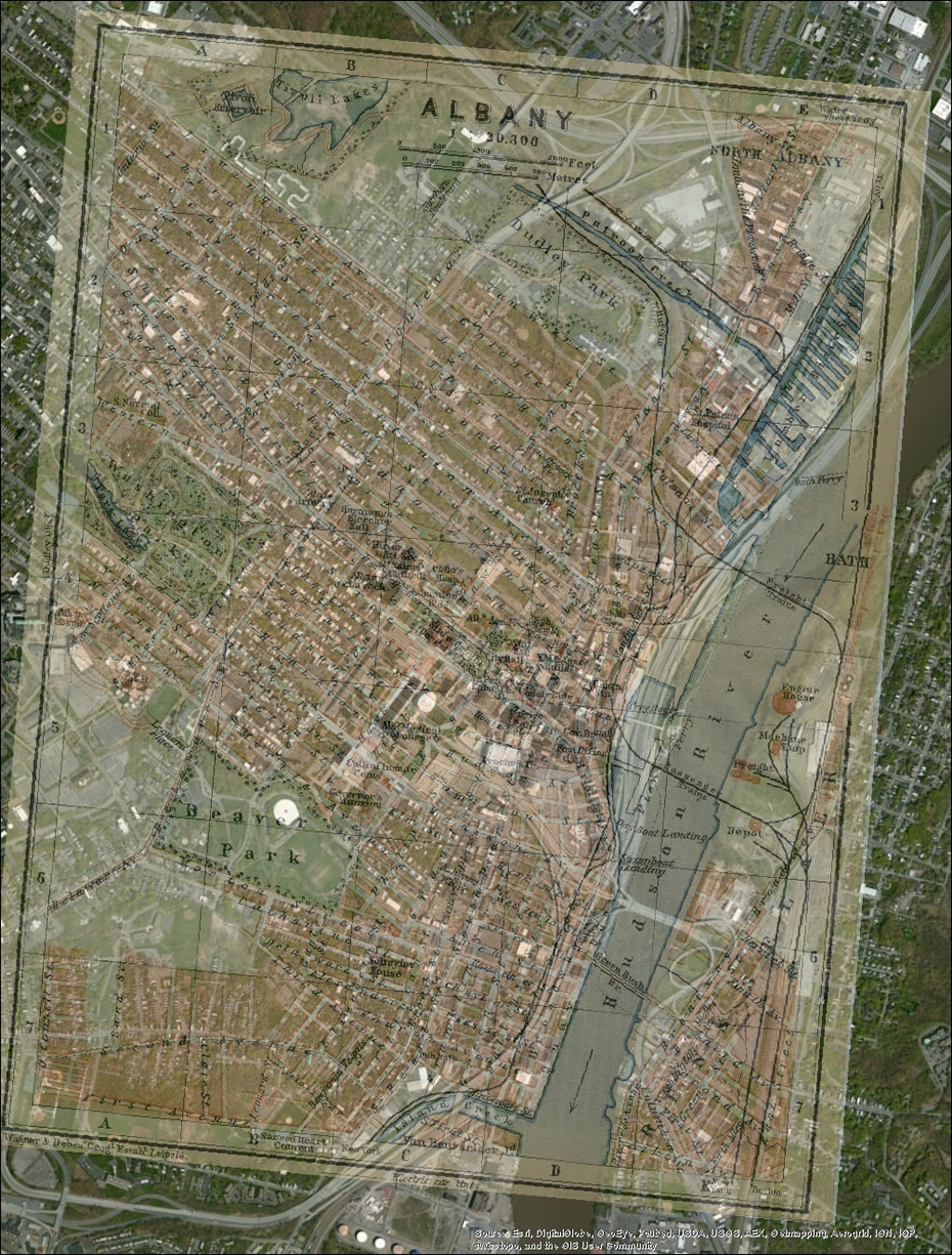
1910 Albany on top of now

Because we're always interested in an old map... B sent along this superimposed map of Albany he created -- it's a 1910 map laid on top of a current map. He says in an email: "Found this 1910 map that snapped in pretty well. A lot of interesting stuff here, especially the blocks that became the Plaza and the Erie Canal before it became Erie Blvd."
A large-format image of the map is after the jump.
A few things that caught our eye:
+ As B mentions, it's remarkable how the ESP interrupted the flow of streets from the Lark/Washington Park area toward the riverfront.
+ And, hey, there was once a park on the north side of Arbor Hill, up against the Patroon Creek.
This looks like it's the original 1910 map.
(Thanks, B!)
See also: Old map overlays created by Albany Bagel -- 1877 Albany and 1857 Albany Lumber District
The map is in large format above -- click or scroll all the way up.
Say Something!
We'd really like you to take part in the conversation here at All Over Albany. But we do have a few rules here. Don't worry, they're easy. The first: be kind. The second: treat everyone else with the same respect you'd like to see in return. Cool? Great, post away. Comments are moderated so it might take a little while for your comment to show up. Thanks for being patient.

Comments
Does anybody know why Washington Avenue west of Townsend Park is called "Speedway"?
... said MW on Oct 30, 2013 at 12:31 PM | link
Sad how the plaza totally killed the flow of the city. The Lark/Washington area and downtown might as well be two separate cities. Totally isolated from each other. Hurts the city more than people realize. The long stretches of sparsely developed streets that link them psychologically discourage walking between them. You need densely developed streets. The pedestrian wants a feeling of enclosure.
Long list of urban planning disasters that Albany and so many other cities have done to themselves.
... said Parma Ham on Oct 30, 2013 at 8:19 PM | link
Look at all of those streets going down to the river, I could cry.
... said Parma Ham on Oct 30, 2013 at 8:29 PM | link
@Parma Ham-- Yes, the streets went TOWARD the river, however they did not go TO the river. The big buildings that block the river today were there back then as well-- intentionally. The few additional streets you see going to Quay Street were probably little more than alleyways that no one in their right mind would walk down. Let's not turn this into another "if only I-787 weren't there the riverfront would be sooooo awesome". The riverfront is awesome, and is accessible by a pedestrian bridge. It would not be better if streets went there and Taco Bells and Rite Aides were there.
... said RealityCheck on Oct 30, 2013 at 11:29 PM | link
Thanks for the Albany Bagel Co. links, those interactive maps are nice and I hope they implement this one too. I haven't gotten that far along in my GIS lessons... though I could probably make a higher resolution version of this if anyone really wants to pore over it. The "Speedway" question is a great one and the type of thing I love to look at these maps for.
... said B on Oct 31, 2013 at 12:18 AM | link
@realitycheck - not too many people feel like the current Albany riverfront is awesome. 787 was a disaster to the city, no question about. So were the maze of elevated highways and the 98.5 acre ESP.
... said Parma Ham on Oct 31, 2013 at 1:54 PM | link
FWIW, in the search for old maps I found plenty of photos and paintings of downtown that provide even more insight into How Things Used To Be. Just in case you want to check reality check's reality.
... said B on Oct 31, 2013 at 5:36 PM | link