When is the coldest day of the year?

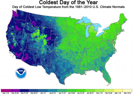
Because winter is happening, apparently: This map depicts the when the typical coldest day of the year occurs around the United States.
The map is the creation of the federal National Climatic Data Center, based on 1981-2010 climate averages. Blurbage:
The map reveals several interesting regional differences across the country. Most prominently, the western half of the Lower 48 typically reaches its climatological coldest day in December, whereas most eastern stations reach their minimum in January. In addition, areas with higher snowfall Normals, such as the Northeast and high-altitude regions in the West, tend to reach their climatological coldest day much later, which is likely because of the increased reflection of solar radiation at the Earth's surface due to the presence of snow cover.
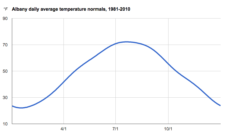
This map prompted us to look up the typical "coldest" day of the year for the Albany area. And it's actually multiple days -- a stretch from January 14 to January 20 when the normal average daily temperature is 22.1 degrees.
Here's a gratuitous graph of Albany daily temperature average normals.

... said KGB about Drawing: What's something that brought you joy this year?