Icy, Snowy Apocalypse Watch (updated)

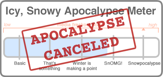
Tuesday morning 8:20 am update: The storm took a track more to the east, which caused snowfall totals here to stay low. (Classic Nor'easter move, getting people hyped up and then bailing at the last moment.) So, we are canceling the apocalypse.
The new forecast includes a projection of something like 3-6 inches of snow through the Capital Region core.
That's not an icy, snowy apocalypse -- that's just a Tuesday in a January.
____

The winter of 2014-2015 has been been a relatively calm one on the icy, snowy apocalypse front. But that changes this week with an impressive Nor'easter plowing its way along the East Coast. And there is a winter storm warning in effect for this area.
The paraphrased forecast:
Monday: Cloudy, highs in the 10s. Maybe a bit of snow, but not much.
Monday night: It begins. Snow could be heavy at times, though overall accumulation isn't expected to be all that high. Lows in the 10s.
Tuesday: The thick of it. Heavy snow at times, maybe 1-2 inches per hour. Tuesday accumulation of 6-10 inches of snow. Highs in the low 20s.
Tuesday night: Maybe a bit more snow, windy. Cold. Low 10s.
Wednesday: Sunny and 24.
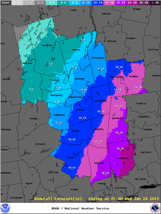
The NWS probabilistic snowfall map has the Capital Region core pegged at a 50-50 chance of getting 12 or more inches of snow during the next 48 hours. And the chances of 8+ inches are about 70 percent. As with most of these Nor'easter type storms, though, there appears to be a sharp gradient through this region for potential snowfall -- northwest Connecticut is projected to get as much as 3 feet of snow, while parts of northwest Saratoga County are predicted to get maybe a little more than 6 inches.
As you well know, small changes to the track of the storm along the coast can prompt big differences in the amount of snow we get. So totals could shift a lot depending on what happens.

The NWS Albany snowfall total projection map as of 9:45 am on Monday, January 26.
The upside to this storm is that temperatures are relatively cold, and NWS is projecting a very high snow-to-liquid ratio -- 15 inches of snow for every inch of liquid precipitation. That's a good thing because that should mean light, fluffy, easy-to-shovel snow. It's also not the kind of the snow that typically pulls down tree branches and power lines.
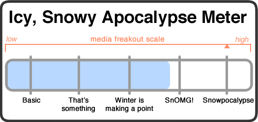
So we're going to rate this a robust "winter's making a point" icy, snowy apocalypse. A foot of snow is a solid effort on winter's part, and there's a possibility of a few more inches depending on last minute changes. It will be cold, and it will be blustery. Also, the timing of the storm should make Tuesday morning's commute, um, interesting.
Shovels at the ready, hardy upstaters!
Media freakout forecast: REPENT NOW YOUR SINS THROUGH THE RITUALISTIC PURCHASE OF BREAD, MILK, AND EGGS!!!!!!!!!!!!!
The storm is expected to dump record totals of snow in major cities such as New York and Boston. This will no doubt be treated with the sort of restraint we've all come to expect from modern media.
Necessary note: You should take this all with an enormous bag of rock salt. AOA has absolutely no weather forecasting expertise. At all. That said, the world will probably not end because of some snow. Most likely.
Say Something!
We'd really like you to take part in the conversation here at All Over Albany. But we do have a few rules here. Don't worry, they're easy. The first: be kind. The second: treat everyone else with the same respect you'd like to see in return. Cool? Great, post away. Comments are moderated so it might take a little while for your comment to show up. Thanks for being patient.
Comments
Time for an update.. most of the Capital District to the north and west now only forecast for 4-8.Schools already closed, though, so we'll have an "I don't believe them" stay-open some other time this year!
... said Alex on Jan 27, 2015 at 5:24 AM | link