Mapping a way toward education
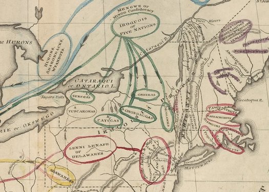
Willard’s History of the United States, or, Republic of America started off with a map of Native American nations.
Maybe you know (if a bit vaguely) about the significance of Emma Willard as a pioneer in advocating for educational opportunities for women. She, of course, founded the Troy Female Seminary in 1821, which is still around today -- though with a different name: the Emma Willard School.
But maybe you, like us, did not know about Willard's interest in geography and teaching geography. From the Worlds Revealed: Geography & Maps blog at the Library of Congress:
As head of the Troy Female Seminary, Willard was an early promoter for teaching science to young women. Troy's curriculum included mathematics, science, philosophy, and geography. Geography, in particular, played a major role in a student's education at Troy. Willard believed that studying geography laid the foundation for solid scholarship, "sound judgement, and an enlarged understanding." In addition, she found that studying geography "brings into action the powers of comparing and abstracting." Willard was adamant that it was more important to teach students how to think, rather than what to think and that the study of geography could promote this teaching philosophy.
Willard's pedagogical approach to geography was groundbreaking many different ways. As opposed to starting with global geography or the composition of the universe, she urged her fellow teachers to start on a more local scale. "Instead of commencing the study of maps with the map of the world, which is the most difficult to understand," she and her co-author William Woodbridge wrote, "the pupil here begins, in the most simple manner imaginable, to draw a map of his own town." This pedagogy is reflected not only in the geography textbooks she wrote with Woodbridge, but also in the atlas she published to accompany her "Willard's History of the United States, or, Republic of America."
The map above is the introductory map from the 1828 version of the book -- it depicts the location of the various Native American nations along the East Coast.
The Library of Congress has posted a series of maps from the book online if you'd like to look.
[via... someone... we misplaced the reference... if it was you, sorry about that]
... said KGB about Drawing: What's something that brought you joy this year?