Tracking the paths of many steps

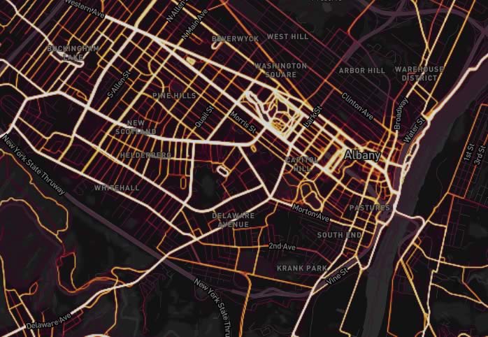
Maybe you've seen this heat map of activity posted by the exercise tracking service Strava. It basically shows the most popular routes taken by people using the service when they when do things like bike or run. That link above will jump you right to the Capital Region.
As with a lot of this sort of stuff, the map just kind of reiterates what you'd expect -- like there's a lot of running and biking activity on main corridors. But there were a few things that caught our eye:
+ The way many parks -- such as Central Park in Schenectady -- are "lit up" with bright activity squiggles.
+ The wispy trails left by activities on water, such as what we suspect are rowers on the Hudson River near Albany.
+ The way the winter map highlights the few cold weather hot spots -- including people taking laps on the ESP ice skating rink.
Of course, this map should be taken with a bunch of grains of salt. It only includes data for people who use Strava (some background), and it's not clear exactly how many people that is here. But it is kind of fun to look around.
screengrab: Strava
Hi there. Comments have been closed for this item. Still have something to say? Contact us.
Comments
That is very cool, thanks.
> The wispy trails left by activities on water, such as what
> we suspect are rowers on the Hudson River
Correct, that is the path we take up and down the river, from the boat launch under the overpass.
... said -S on Nov 22, 2017 at 9:09 PM | link
The squiggles in Central Park are due the mountain bike trails there. Everybody's shooting for the Strava KOM awards there. I imagine North Bethlehem park is even more squiggly nowadays.
... said James at 46 or so on Nov 27, 2017 at 8:21 AM | link