This just in: the Adirondacks have a lot trees

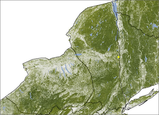
Where the trees are in New York. (We added the star for the approximate location of Albany as a point of reference.)
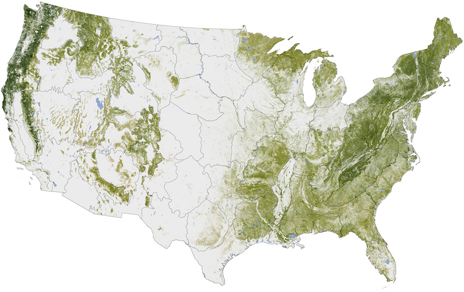
Forestry fact of the day: the Adirondacks are one of the areas with the most tree mass in the country, according to a map of "above ground woody biomass" created by the NASA Earth Observatory.
A clip from the map, of New York State, is above. The darker the green, the more tree mass there is.
The national map is posted after the jump in large format. You can see the large swath of forest that runs from Maine, through New Hampshire and Vermont, includes eastern New York, and then runs along the Applachians. And as dense as parts of the swath are, the long, narrow (relatively speaking) forests of the West Coast still trump the East for density of tree stuff (the trees are rather large out there).
Researchers built the map as part of an effort to better understand how much carbon is stored in forests -- and which way that amount is trending.
[via Buzzfeed]
Earlier on AOA: The darkness just to the north
Scroll all the way up for the large format national map.
images: NASA Earth Observatory map by Robert Simmon, based on multiple data sets compiled and analyzed by the Woods Hole Research Center.
Hi there. Comments have been closed for this item. Still have something to say? Contact us.

Comments
Enjoy it while we've got it!
... said B on Jan 12, 2012 at 3:55 PM | link
WAIT! There are TREES in the Adriondacks?!?!?!?!?! ZOMFG!!
Wait, I already knew that. :)
... said Andy on Jan 12, 2012 at 6:42 PM | link
Any idea what the boundary lines mean? There's one slicing down the middle of the state.
... said Bob on Jan 13, 2012 at 10:08 AM | link
Not only do they have more trees, but they usually have lots more snow. I've been known to head up there in search of winter. For those needing a winter escape, I recommend the Ausable Club golf course for sledding, and Baxter Mountain for a quick snowshoe hike. Supplemented by a thermos of hot cocoa, these two stops make for a wonderful winter adventure.
... said Laura on Jan 13, 2012 at 10:55 AM | link
I'm curious about that too, Bob. The boundaries don't seem to make much sense in NY.
... said Slacker on Jan 13, 2012 at 1:52 PM | link
If you look at the US map you'll see that the boundaries they've created have almost nothing to do with state lines (NY is one of the very few that has boundaries roughly looking like the state itself). The Woods Hole Research Center says "Production of the NLCD 2001 and LANDFIRE projects was based on a mapping zone approach in which the conterminous U.S. is split into 66 ecoregionally distinct mapping zones." For NY, that most likely means that the relatively high-elevation Adirondack and Catskills regions are distinct from the "lakier" central/western area. Yes I'm staking claim to the word "lakier" for now (can't wait to play Scrabble). Specifically, I'm guessing that the Adirondack/Catskill region has a higher density of pine/evergreen coverage where western/central NY has a higher density of deciduous trees and wetlands (comparatively).
Interestingly, a document on the MRLC website illustrating NLCD 2001 classification uses New York and specifically Albany as examples. (pdf)
... said B on Jan 13, 2012 at 4:11 PM | link