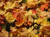
Fall foliage maps and reports
 Everybody loves some good fall foliage. So it's probably not surprising there are a bunch of fall foliage maps and reports.
Here are a few that might be useful for planning walks, hikes and drives, and weekends over the next month or so.
+ Yankee Magazine has a great foliage map that's built using reports from "foliage ambassadors." If you'd like to engage in foliage diplomacy, you can sign up.
+ I Love NY, The New York tourism site, has a good map -- but its text report of conditions is extensive.
+ A site called the Foliage Network has maps based on reports, but they're not very fine grained. But the site does include a "leaf drop report" -- which we didn't see anywhere else.
+ And there's a site dedicated to Vermont foliage called -- surprise! -- Foliage Vermont. It has a "best bets" report for the Green Mountain state.
Or, of course, you could just look out your window. Higher elevations tend to change sooner. So places like the Adirondacks and Catskills are usually a week or two ahead of places such as Albany.
Here's more about the science, from the National Forest Service.
(Thanks, Lou)
Earlier on AOA:
+ 12 Hours in Ulster County
+ 12 Hours in Bennington
+ 12 Hours in Schoharie County
+ Leaving a mark
Say Something!
We'd really like you to take part in the conversation here at All Over Albany. But we do have a few rules here. Don't worry, they're easy. The first: be kind. The second: treat everyone else with the same respect you'd like to see in return. Cool? Great, post away. Comments are moderated so it might take a little while for your comment to show up. Thanks for being patient.
Comments
Weather Channel also has a map for your Nation-wide folliage stalking.
http://www.weather.com/activities/driving/fallfoliage/?from=ff_breadcrumb
... said Diana on Sep 29, 2009 at 3:18 PM | link