Items tagged with 'history'
Clinton Square, every hundred years or so
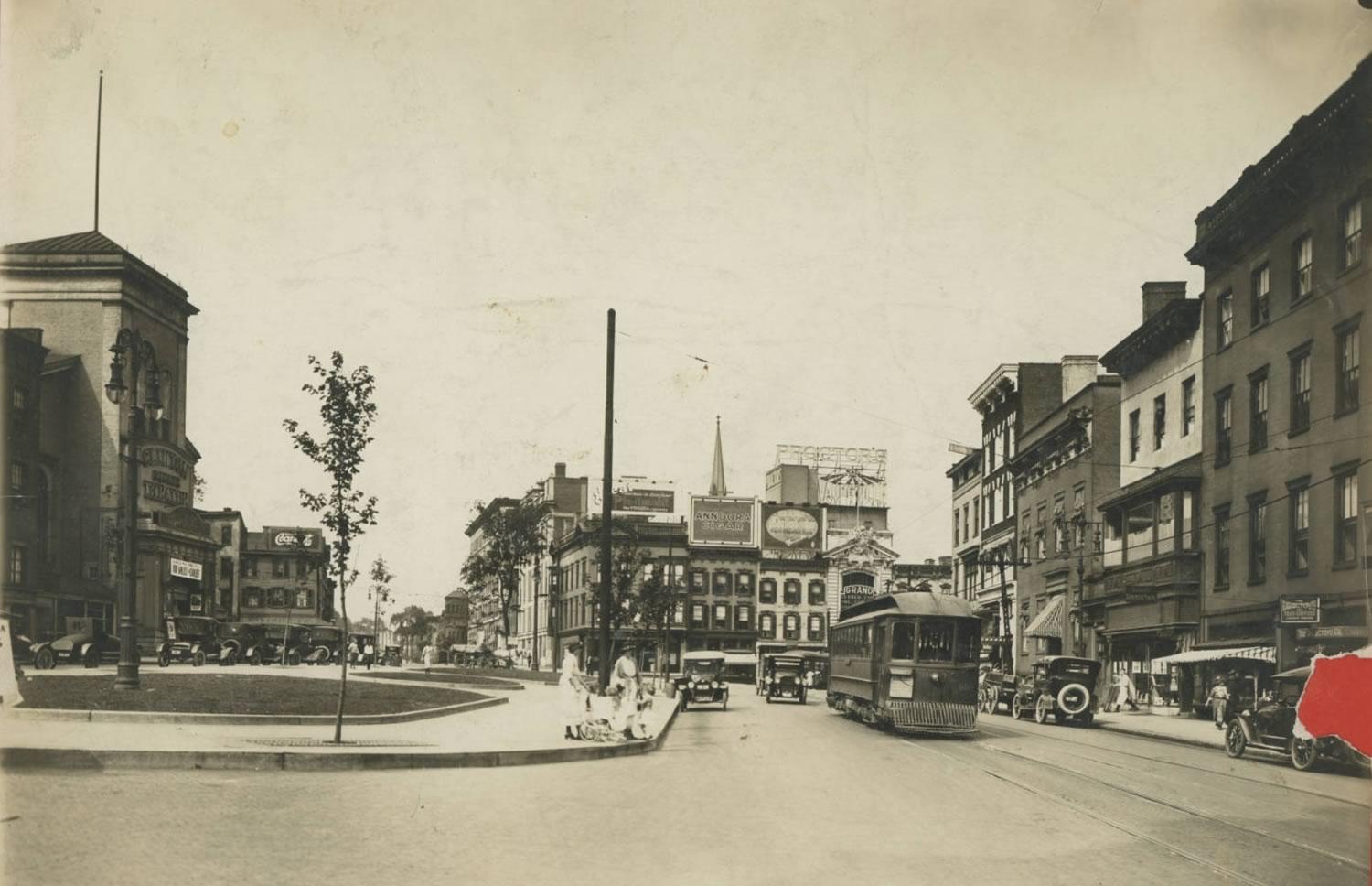
We've had a bunch of items lately about the Clinton Square section of downtown Albany because the city is in the process of figuring out which projects there should get a slice of the $10 million from the state's Downtown Revitalization Initiative.
So we thought you might find this photo interesting. It's Clinton Square -- the area around the intersection of North Pearl Street and Orange Street -- from (we're guessing) the 1920s. The photo is from the Albany Public Library History Collection. If you follow that link you can zoom into the photo and see a bunch of details.
One of the things that struck us about this photo is just how different this part of the city is now. There's no Palace Theater -- the old movie house wouldn't be built until 1930. There's no federal building in the background. And that row of buildings along the east side is now Wallenberg Park.
More than anything, though, there's just something overall about this scene that feels more human scale. At least, it does via the photo. (Also: Streetcars!)
Clinton Square is one one of the oldest major intersections in the city and it's been a topic of debate and discussion regarding development there for 200 years.
Farther off, down the block
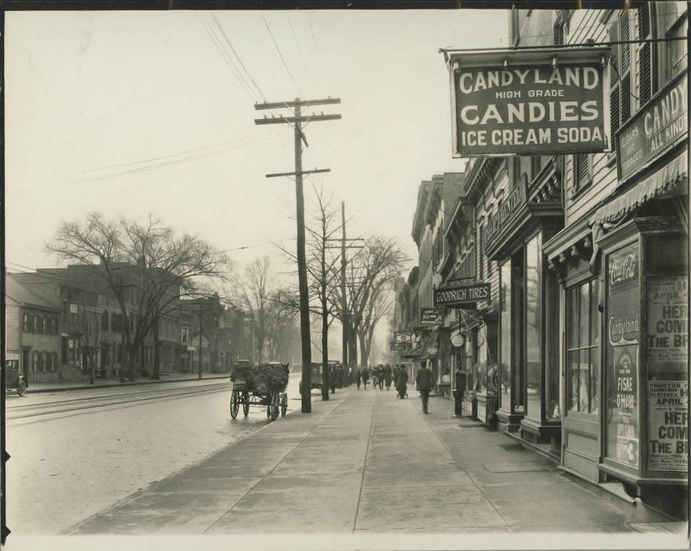
Our conversation with Erik Schlimmer this week about his book of Albany street name histories set us off looking through the Albany Public Library's online collection of local history photos.
And we happened across this photo of Central Ave from sometime during the 1920s. It's looking west from what was then Northern Boulevard and is now Henry Johnson Boulevard. Two things that caught your eye:
1. "High grade" candies.
2. The scene off in the distance. If you head over to the New York Heritage site that hosts the image, you can zoom in very close. And the little details are great. The store signs, a man wearing a bowler, a horse-drawn wagon with straw or hay, a man pushing what looks like a carriage, a buttoned-up couple walking arm in arm, kids, and the obligatory guy staring toward the camera with the what-is-going-on look.
photo: Albany Public Library History Collection
A few of the 700some stories about the street names of Albany
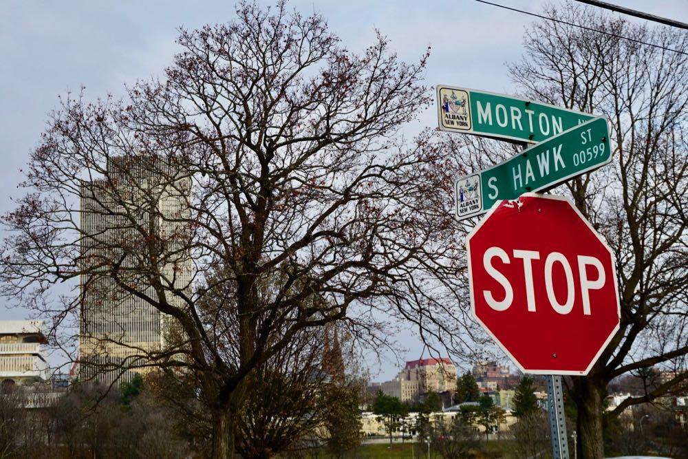
Morton was named after Washington Morton, husband of Cornelia Schuyler Morton. (He was the son-in-law of Philip Schuyler.) As for the other street... is that Hawk or Hawke?
There are 785 streets in the city of Albany. And Erik Schlimmer has figured out the backstory for the name of almost every one of them.
That monumental effort -- it took him four years -- is collected in the new book Cradle of the Union: A Street by Street History of New York's Capital City. (Mentioned earlier.) And the result is like a bag of local history potato chips. Once you snack on a few of the street name histories it's hard to stop.
"In all place names -- street, the town they live in, a mountain range, a stream, a pond, a building -- there's usually a story behind the name," Schlimmer told us this week when we met up with him. "And the story is usually pretty good."
Here are a few of those important or funny or surprising or sometimes dramatic stories...
That project to figure out the history of every Albany street name has been completed, and there's a new book based on it
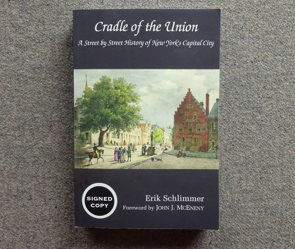
More than three years ago we heard there was a guy working to figuring out the backstory for the name of every street in the city of Albany. And we were very intrigued. (Because... obviously.)
We also admit that the project sounded, well, really hard. Like a mountain you start hiking up knowing you're probably never going to quite make it to the top.
But Erik Schlimmer got it done. And the book based on his efforts -- Cradle of the Union: A Street by Street History of New York's Capital City -- is now available. Blurbage:
Within Albany's city limits there are 785 streets, and author Erik Schlimmer figured it was time to historically decode every single street name. During his four-year-long research project he examined nearly 1,000 print and online sources and interviewed historians, residents, and fellow researchers. ...
Schlimmer is most at home decoding names in the Adirondack Mountains. In 2014, his first place name book to that range, History Inside the Blue Line, was released. Two years later a second one, Among the Cloud Splitters, was published. He found urban history just as interesting. "I'm drawn to mountain history, especially when it comes to who settled the valleys and who climbed the mountains first. But street name history is equally fascinating. It's what I call 'obvious history.' These are the streets we live on and travel down every day. Who can tell you why even their own street is named so? It's neglected history."
The book includes a foreword by Jack McEneny. It's $22 and available online (see the link above).
We haven't the seen the book, yet, but we're looking forward to checking it out.
A look inside 2 Judson Street
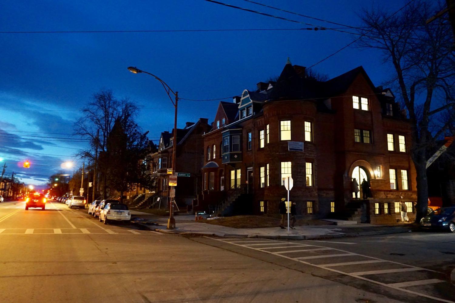
We got a chance this week to stop by the open house for 2 Judson Street, one of the properties that's for sale as part of the Albany County Land Bank's Neighbors for Neighborhoods program (a few details about that program below).
There are handful of photos to go along with this post, in case you'd like to gawk. Because, you know, we definitely wanted to gawk.
The property is part of the McPherson Terrace row on Clinton Ave in West Hill, a string of buildings (not all have survived) that date to the late 1880s/early 1890s. And they're related to Albany architectural royalty: The great Albany architect Edward Ogden participated in developing the strip. (Ogden and his son Charles, also an architect, designed a bunch of beautiful buildings around the city.)
A few words about Thanksgiving, and a few more about William Seward
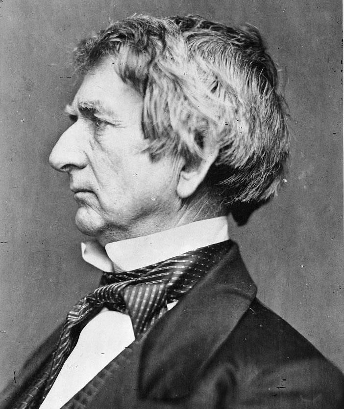
An undated photo of William Seward in the collection of the Library of Congress.
Thanksgiving as we know it today -- a national holiday, on a Thursday late in November -- has its origins in the Civil War when, in 1863, Abraham Lincoln declared* a national Thanksgiving Day. And he did so in a proclamation written by New York's William Seward.
Seward -- a Union College graduate** -- is a fascinating, important figure. He was a state Senator, the 12th governor of New York, a US Senator, and the Secretary of State for both Lincoln and Andrew Johnson. He was a Lincoln rival and then a great friend. He was connected to a New York political machine that twisted both arms and the law. He was an outspoken abolitionist, his home sheltered people escaping from slavery, and he was a friend of Harriet Tubman. He was stabbed, and his children injured, in an assassination attempt by a John Wilkes Booth co-conspirator. And, yes, he helped the United States acquire Alaska.
So Thanksgiving is as good a time as any to learn a little bit about William Seward. A clip from this 2012 New Yorker piece by Dorothy Wickenden that's worth reading -- it reviews a biography of Seward by Walter Stahr and recaps Seward's life and career:
The gubernatorial debate -- 36 years ago
The clip embedded above is a New York gubernatorial debate from 1982, a matchup of Democratic lieutenant governor Mario Cuomo and Republican Lewis Lehrman. It's hard to imagine watching a debate like this today.
The debate was posted on YouTube by the Empire Center as part of a piece by EJ McMahon contrasting the level of dialog then with what passes political discourse now. We saw the post earlier this month and thought about it again last night while watching the debate train wreck between Andrew Cuomo and Marc Molinaro.
The back and forth in the debate is often pointed -- and they use some of the same annoying debate moves that show up today -- but it's also detailed and suggests two people with differing perspectives trying to solve problems.
It's also notable that some of the prominent topics Cuomo and Lehrman discussed -- including New York's relatively high taxes, and the exodus of people and jobs from the state -- are still among the big topics now.
By the way
It's remarkable seeing Mario Cuomo freestyle about policy and values in this debate with such rhythm and speed. It's like watching the inspiration for an entire cast of Sorkin characters.
The Albany Hardware & Iron Co.
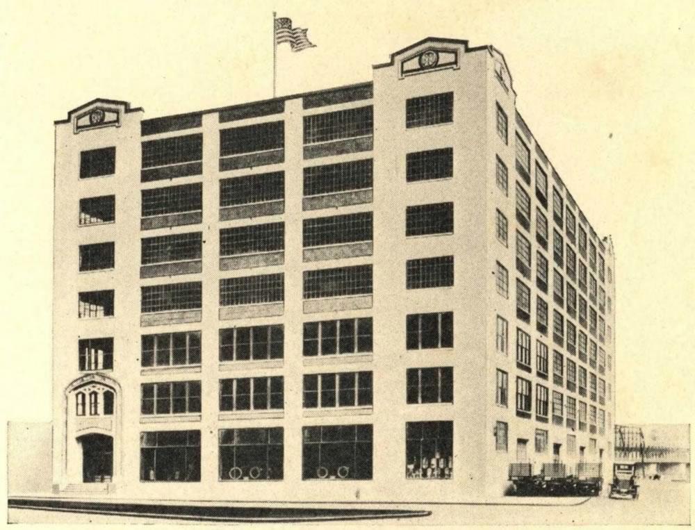
That image above is from a 1927 catalog and it depicts a building in Albany that still stands to this day. You totally know this building. Recognize it?
Look a little closer. Yep, now you probably see it.
It's the U-Haul building on Broadway in Albany, the one that stands tucked between 787 and the river, with the truck on the roof.
The building was originally the home of the Albany Hardware & Iron Co. Flipping through its almost-century-old catalog we couldn't help but think of Amazon, the dying embers of Sears, and the ongoing effort to get stuff to people when they want it.
Also: It's just really fun to gawk at all the stuff for sale in the old catalog.
A walkthrough of the old Kenmore Hotel and Steuben Club buildings in downtown Albany
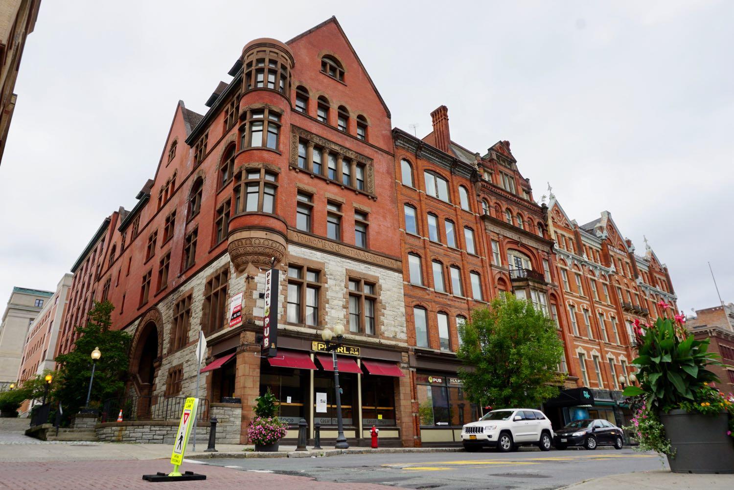
The old Kenmore Hotel and Steuben Club buildings landmark buildings on one of downtown Albany's most prominent blocks. They've also sat largely vacant for years.
That could be changing, though. Both buildings are at the center of a huge in-progress real estate deal. Redburn Development Partners is currently working to close the purchase of the Kenmore Hotel and Steuben Club buildings -- along with a handful of other notable downtown properties -- and redevelop them with residential and retail uses. (See recent planning board discussion about the Kenmore and Steuben as well as the old Times Union building on Sheridan Ave.)
We've passed these buildings hundreds -- maybe thousands -- of times. They're anchors of downtown Albany -- but we had very little sense of what they're actually like on the inside. And we were curious about that, especially now that the buildings could be on the verge of their next lives. We figured you might, too
So we got Redburn to give us a tour. Here are a bunch of photos...
The old riverfront and the old bridge
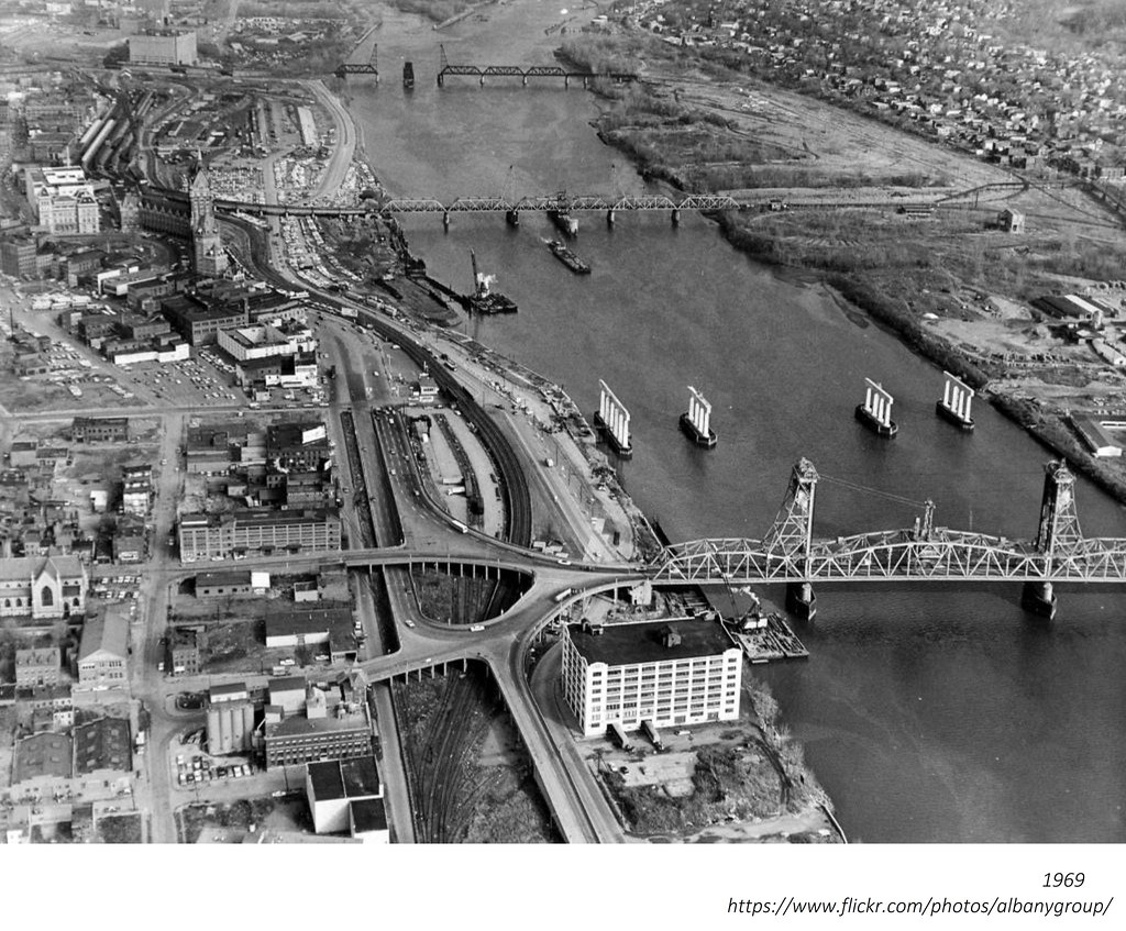
Random historical photo we stumbled across while looking for something else: This aerial photo of the Albany riverfront is from 1969 and shows the old Dunn Memorial Bridge as the new (that is, current) Dunn is being constructed just up river. It's from the local history rabbit hole that is the Albany Group Archive on Flickr.
Two things about this photo:
1. There is an ongoing conversation about how Albany can make its riverfront more accessible and hospitable to people. And one of the things that often gets lost in that discussion is that Albany riverfront has really been a place for people in a very long time. Like, a century or more. That's not say it shouldn't be in the future -- it just provides some context for the challenge.
2. The old Dunn Memorial Bridge had a section that lifted to make way for passing ships, sort of like the Green Island Bridge does today. That allowed the bridge to be closer to the water, and as a result, its connections on either end were much closer to street level. See the photo below -- also from the Albany Group Archive.
Livestock, vegetables, farm equipment, and an object of unceasing admiration
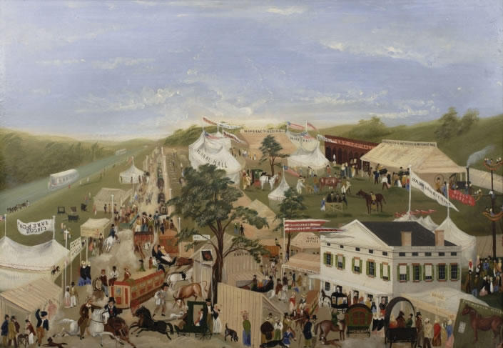
We charmed by this painting of the New York Agricultural Fair that was held in what's now Menands in 1850. It's attributed to John Wilson* and it's part of the collection of the Albany Institute. A clip from the description in the museum's online catalog (link added):
Held just north of Albany, the 1850 Tenth Annual Fair and Exhibition of the New York State Agricultural Society was the second hosted in the capital city. It opened for spectators on September 3rd and ran through September 6th. According to the Society's report*, "never was the attendance so great." This animated work captures the excitement of the fair and the throngs of people who attended the four-day event to see livestock, displays of fruits and vegetables, machinery, and farm equipment. The displays of flowers received special notice in the Society's report: "Floral Hall, in which every form of beauty was combined, under the direction of Dr. Herman Wendell, of Albany, was the object of unceasing admiration." Indeed, Floral Hall appears as the largest and most prominent tent in Wilson's painting.
In addition to agricultural displays, visitors had two circuses to enjoy, the Spalding & Rogers Circus and the June & Co. circus, also carnival sideshows and amusement rides. (A four-gondola ride similar to the later Ferris Wheel can be seen at the far right of the painting.)
If you head over to the Friends of Albany History, there's a walk through some of the history of the history of this fair and the fairgrounds and how the modern Altamont Fair grew out of an animal fair on the parade grounds of what's now Washington Park in Albany.
* John Wilson was also painted the 1848 watercolor "View of State Street, Albany" (also in the Albany Institute collection), which you might have seen before.
A row of buildings gone, except for one
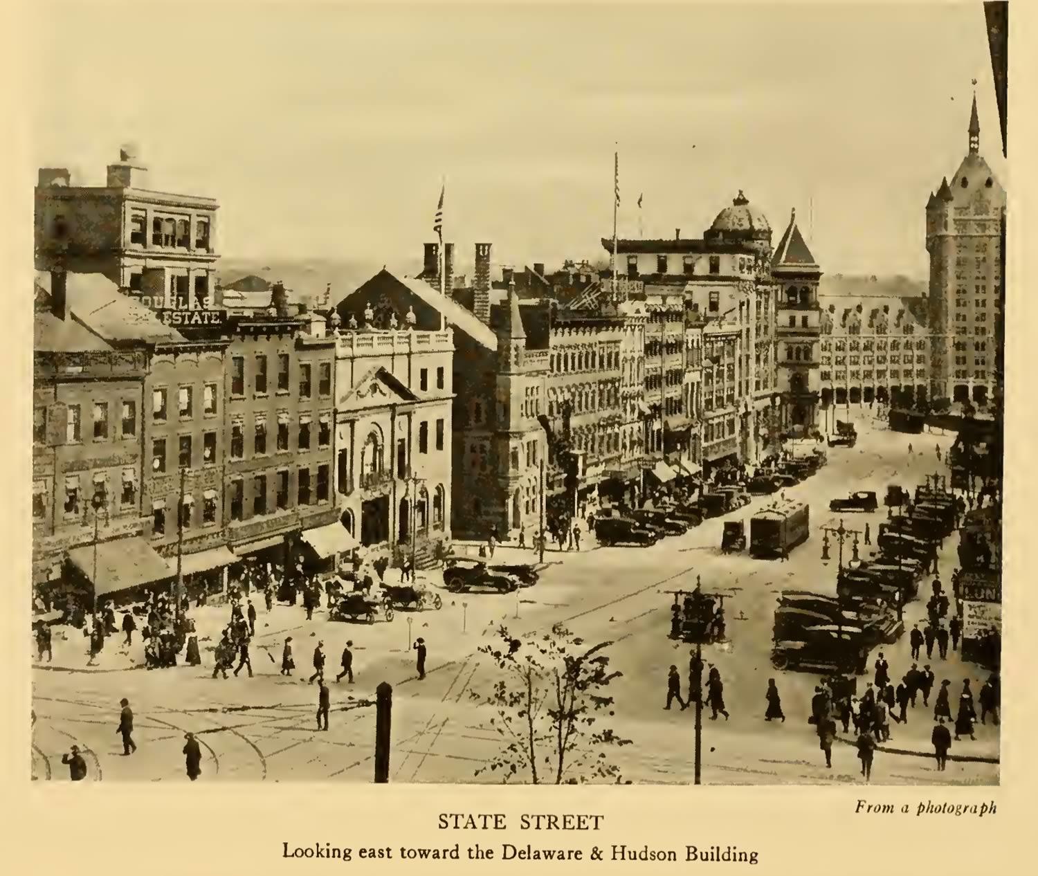
A follow up of sorts about the old, beautiful Mechanics and Farmers Bank building at the corner of State and James in downtown Albany and it's now missing architectural neighbors.
The image above is from a 1918 history of State Street published by the National Savings Bank of Albany (it was the bank's 50th anniversary). The viewpoint is from Pearl Street. And, as you can see, those whole two blocks of State Street are very different now. (Current street view.) But the Mechanics and Farmers is still there.
There's a bonus image below showing the opposite side of State Street.
Albany's old and its streets have changed -- many times.
Same place, very different map
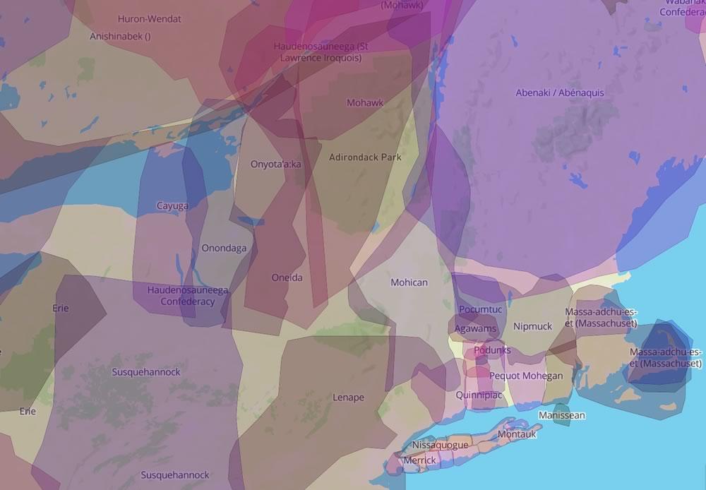
The history of Albany as a city stretches back 400 years. But the history of this land -- and people living here -- is, of course, much longer than that. When the Europeans showed up this place was already inhabited by the Mahican people (or Mohican).
With that history in mind, have a look at this interesting map site called Native Land that charts the lands of indigenous people here in the northeastern US, the Americas more widely, as well as other places around the world. It highlights one aspect of the rich and diverse and complicated history of this place prior to the 17th century. That clip above shows this area.
The map is the creation of a Canadian programmer named Victor Temprano. Atlas Obscura recently talked with him about how the map came about, along with the ongoing work to build it and make it more accurate.
By the way: If you're curious about the pre-Columbus history of this hemisphere, the Charles C. Mann book 1491 is an interesting place to find more of it.
Earlier: The Cornplanter pipe tomahawk
Illustrations of Albany's history
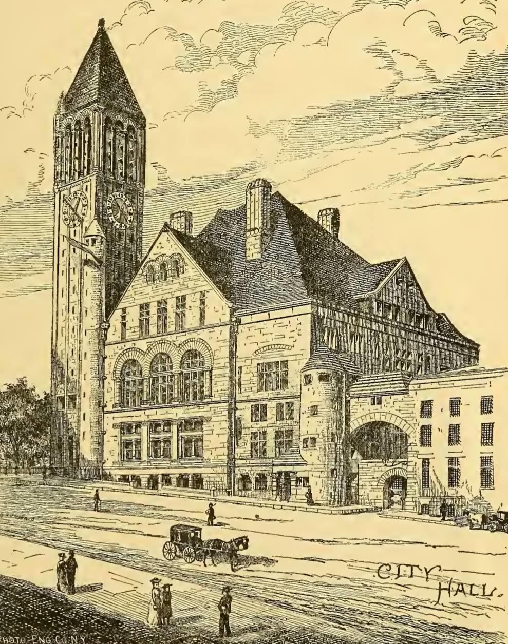
City Hall once had a jail attached to it.
Earlier this week we posted an old illustration of the Farmers and Mechanics Bank building in downtown Albany that showed how the beautiful, but oddly narrow building, was once part of two intersecting rows of buildings.
That illustration was the 1884 The History of The City of Albany, New York by Arthur James Weise. (Tip o' the hat, Albany Archives.) And it includes a bunch of these sorts of illustrations.
So we thought it'd be fun/interesting to pull out a few, along with some blurbs associated with them. See blow.
Also: If you're interested in local history, the book itself is worth skimming through, at the very least. There's a lot of time spent on the history of Albany before the United States. (Albany as a city predates the country by about a century.) And sure there's a lot of discussion about beavers (because Albany wouldn't be here without them), but it also highlights how Native Americans played a large role in the city's history.
OK, on to those illustrations...
A downtown corner in context
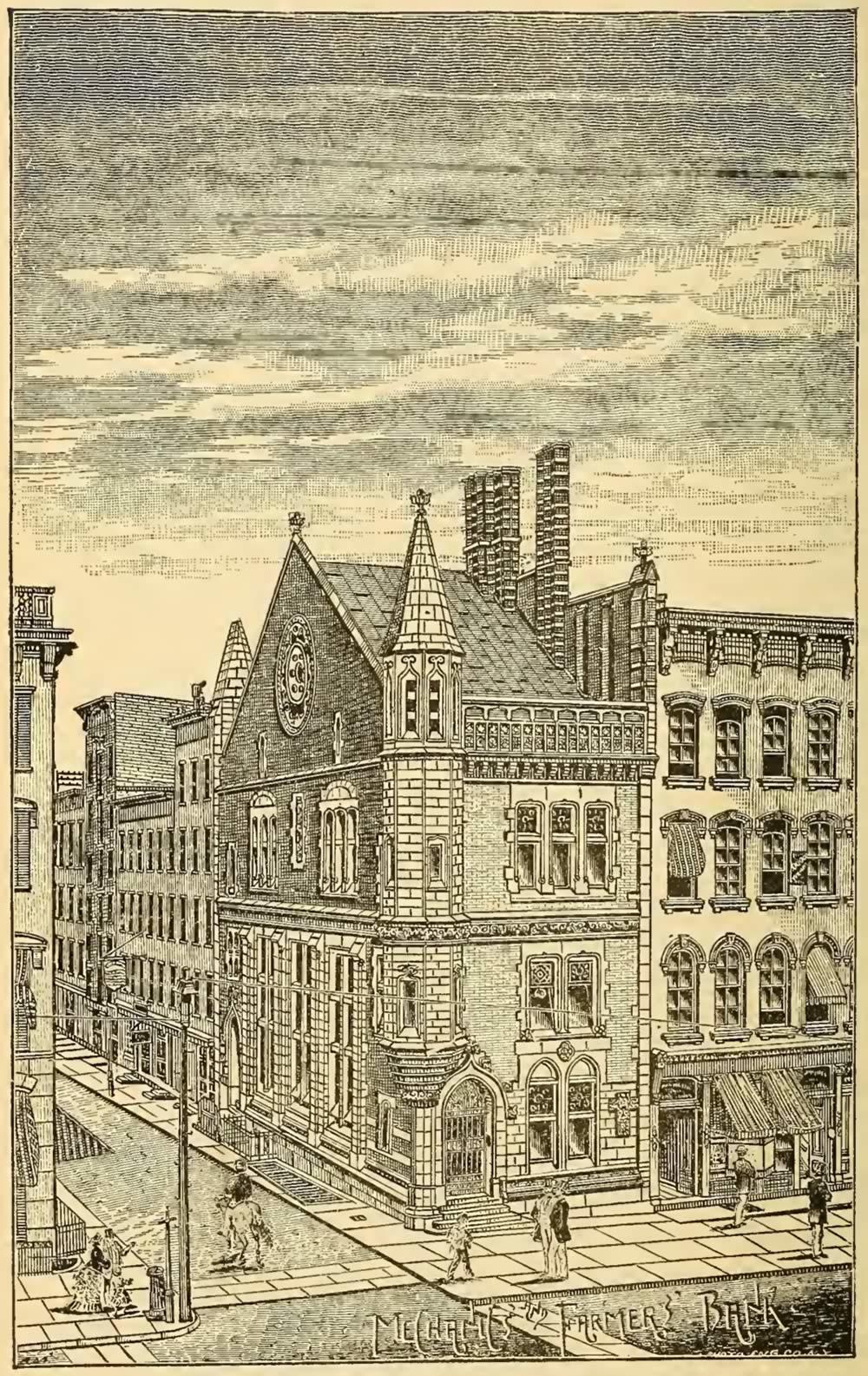
Albany is an old city, and it has a lot of old buildings. For all sorts of reasons, many of these old buildings are missing their architectural neighbors. And the resulting effect is that sometimes buildings appear like a fragment of conversation heard without context.
The old Mechanics and Farmers Bank building at the corner of State and James in downtown Albany is a prime example. It's a beautiful old building. It also looks odd, standing there all skinny and by itself. (Here's a thing we wrote about the history of the building.)
But it only looks like that way because the buildings around it are missing. And that's why we were delighted to see the above illustration today.
It's from the 1884 The History of The City of Albany, New York by Arthur James Weise. Credit to Albany Archives for surfacing it today on Twitter. (Matt has a "Lincoln in Albany" walking tour downtown this Thursday, by the way.)
From the illustration you can see how the building, designed by Russell Sturgis, once served as the corner piece of two intersecting rows of downtown buildings. It still stands out as a beauty, but it makes a more sense.
Oh, and here's the snippet from Weise about the founding of the bank...
The Cornplanter pipe tomahawk
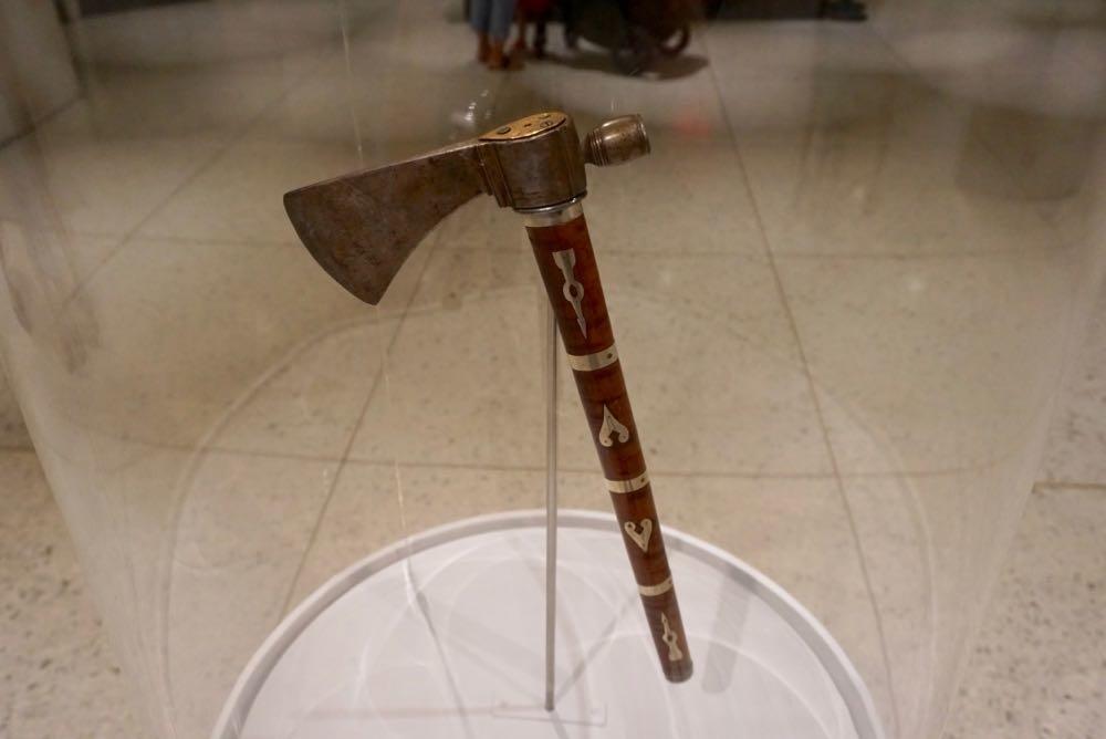
It's currently on display in the the lobby behind the information desk.
We got a chance this week to stop in the State Museum and see an interesting artifact that's newly on display, Cornplanter's Pipe Tomahawk.
The piece was stolen from the museum sometime between 1947 and 1950, and only returned this past June by an anonymous donor. From the State Museum:
This tomahawk has particular significance--at one of several meetings between the U.S. and Haudenosaunee (Iroquois) leaders in the years 1792-1794, President George Washington gifted it to Gy-ant-waka, or Cornplanter, a respected Seneca leader, skilled diplomat, and eloquent speaker. On one side of the blade Cornplanter's name is engraved, and on the other side is the name John Andrus, possibly the maker. Pipe tomahawks emerged in the early 1700s and were commonly presented to Native American leaders by 18th-century colonial officials. They were considered prized objects because they could be used to smoke tobacco, a plant of cultural and spiritual significance to Indigenous people.
This pipe tomahawk was purchased around 1840 by Tonawanda Seneca Ely Parker from the widow of a Seneca named O-ya-weh-te, or Small Berry. Since the original handle, or haft, was missing, Parker replaced it to reflect what it once may have looked like, based on descriptions from Small Berry's widow. He also added a brass plate engraved with his name on bore end of the tomahawk's haft, just above the blade.
As with any object like this, it's kind of cool to examine and think about how it was probably once held by figures such as George Washington and a great Seneca leader. But maybe more importantly the object is a way to drop into the story of the past and get a better sense of it.
So let's follow a few the threads that connect here.
Ghosts on a street that no longer exists
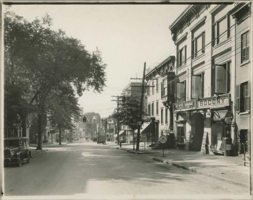
The photo above is looking east along Hudson Ave near Swan Street in Albany in (we're guessing) the 1920s. And it's from the Albany Public Library History Collection.
There were a few things that caught our eye about this photo:
1) Obviously, this is place that is now radically different because of the Empire State Plaza. And it really gives some sense of the neighborhood layout that got wiped away by the project.
2) If you head over to the New York Heritage site where the image is hosted, you can zoom in on a high-resolution version of the photo sort of "look" down the street. It's interesting reading the various signs for luncheonettes, and laundries, and garages.
3) Because photography back then required long exposure times, the photo also captures faint images of cars and people that moved while the photo was being taken. The figures have a ghostly quality to them, which is somehow fitting given that the blocks literally no longer exist.
How a strawberry grown from a "wasteland" in Albany helped spread a national strawberry craze
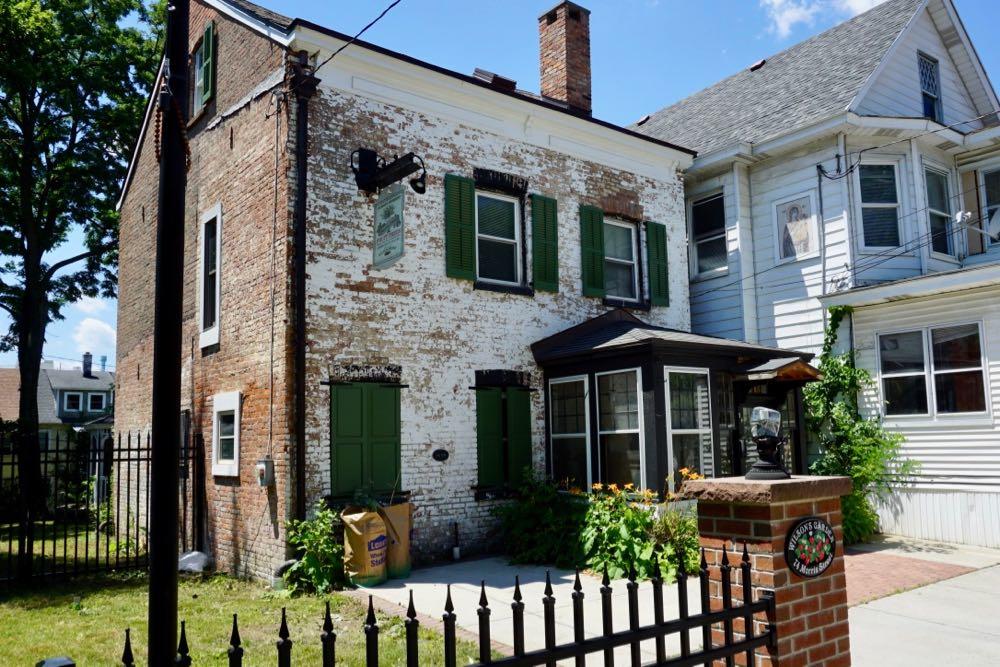
At the corner of Morris and Knox next to a small neighborhood park stands a two-story brick building, its front bearing a worn coat of paint. Built in 1838 in the Federal Style, it's the oldest still-standing building in Albany's Park South neighborhood.
But maybe more notable than its age is the fact that home and the land around it played a vital role in the growth of the strawberry trade in the United States, helping to set off a "strawberry fever."
This is the story of 74 Morris Street and The Wilson's Albany strawberry.
Stories from streets that no longer exist
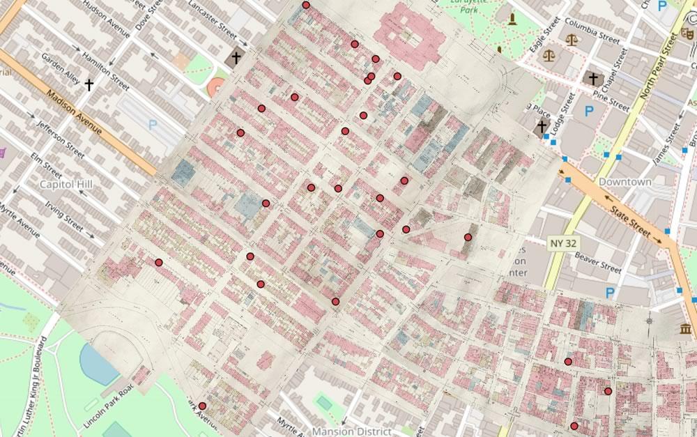
A screengrab from the map.
Check it out: The 98 Acres in Albany project now has a clickable map of its stories from the area replaced by the Empire State Plaza. Here's a little bit of background on the map effort.
One of the things we really like this map is the way it overlays the old pre-ESP street map on top of the modern map. Having the old map there does a few things: 1) It makes the geographic context for a story more clear, and 2) it highlights how many streets/buildings and just overall space that was taken up by the ESP and the South Mall Expressway.
The new clickable map is part of a work-in-progress, stand-alone website for the project. That site also includes photo galleries, such as this collection of pre-demolition streetscapes.
One photo that immediately caught our eye: This view looking up the old South Hawk Street toward what's now the ESP side of the Capitol. (South Hawk is mostly gone now.)
Earlier:
+ 98 Acres in Albany
+ Who lived in the neighborhood knocked down for the Empire State Plaza?
+ What would Albany be like today if the Empire State Plaza had not been built?
"The Normanskill" by Edward B. Gay
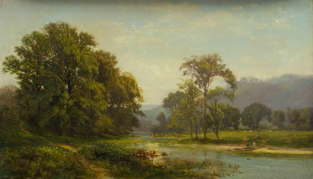
If you head over to the museum's online collection you can zoom in on the painting.
Art break? Yes, let's engage in an art break.
The painting above is "The Normanskill" by the landscape painter Edward B. Gay. It's in the collection of the Albany Institute of History and Art, and it's also currently on display in the museum. It dates to around 1865.
Gay was born in Ireland in 1837. His family emigrated to the United States in 1848 because of political unrest related to Irish nationalism (there was also famine at the time). The Gays found their way to Albany and settled. By the time they got here they were not doing well financially and the children were put to work to earn money.
Edward Gay, who was about 11 years old, had jobs at a bowling alley and as a page in the state Assembly. He also, somewhat improbably for someone his age, ended up with a job mixing drinks. And even more improbably, it was at that job that his artistic talent was discovered.
The seed for so many backyard gardens
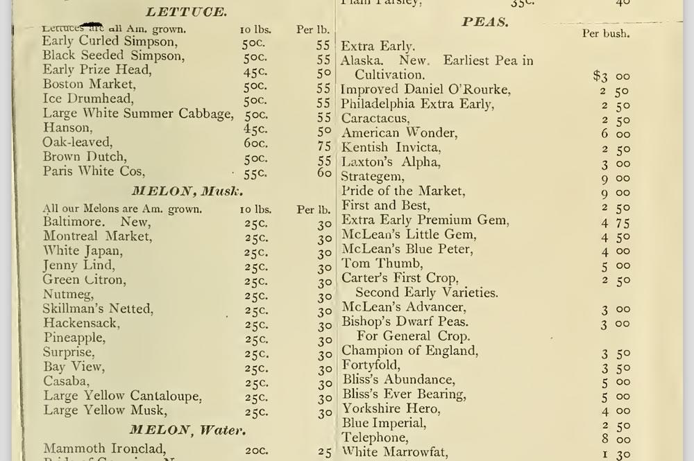
From an 1888 Shaker Seed Co. wholesale catalog from Mount Lebanon, New York. / via Archive.org (U.S. Department of Agriculture, National Agricultural Library)
Some ideas seem so obvious that the might has well have just sprouted from ground, everywhere, after a rain and people just happened upon them. But at the beginning they're not so obvious and someone has to be the first person to recognize the idea and grow it.
So it was with some delight that we recently learned more about how the Shaker communities in this region were probably the first people in the United States to start businesses selling seeds for backyard or "kitchen" gardens. And putting the seeds in the ubiquitous paper envelopes? Yep, Shakers. And store displays, kind of like the racks that stand in hardware stores and supermarkets today? Shakers did that, too.
Here are a handful of facts about the Shaker seed business and its roots here.
Frederick Hinckel and the Hinckel Brewery
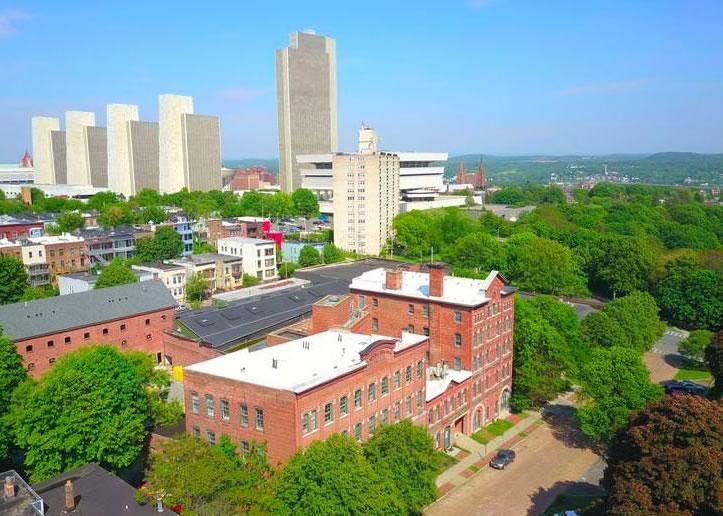
The Hinckel Brewery building with the Empire State Plaza in the background. / photo: Tim Jackson
On the northwest corner of Park Avenue and South Swan Street in Albany's Hudson/Park neighborhood, a multi-building complex takes up almost half a city block and dominates the immediate area. Constructed in the late 1880s, this behemoth played a vital role in the brewing and distribution of beer across the city and the country.
This is the story of immigrant, brewmaster, and former Albany resident Frederick Hinckel -- and the Hinckel Brewery.
Walking tour of Albany's Normanskill Farm
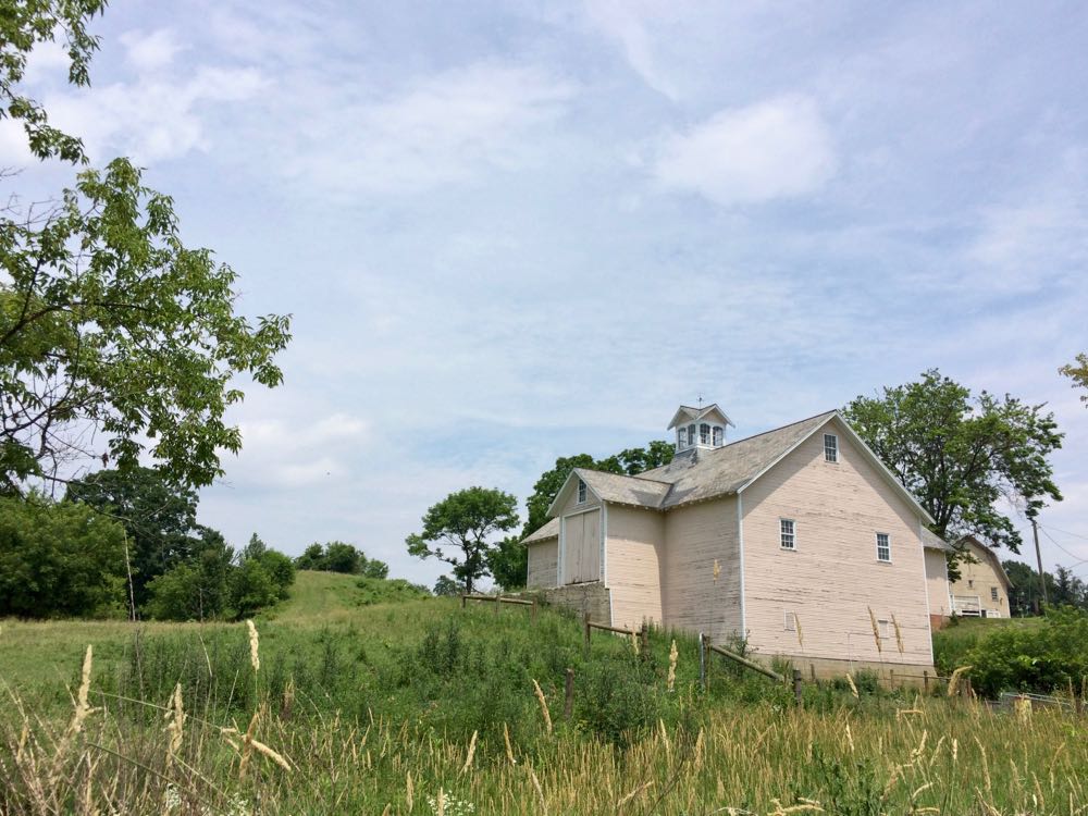
The Historic Albany Foundation's Walkabout Wednesday series has a tour at the Normanskill Farm June 20. It starts at 5:30 pm. Tickets are $10. (These tours often sell out.)
A few bits about the history of the farm, which is in the city of Albany...
One corner, many different buildings
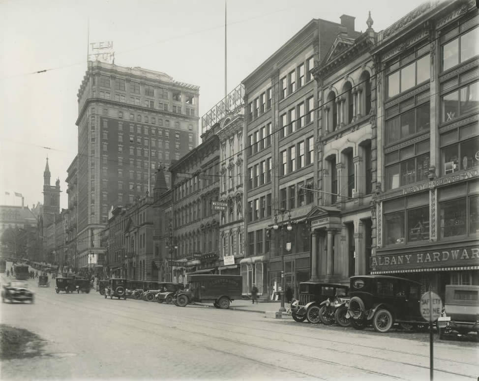
Looking up State Street to Pearl Street in (we're guessing) the 1920s. That's the old Ten Eyck Hotel on the northwest corner. / photo via Albany Public Library History Collection
The northwest corner of State and Pearl in downtown Albany is one of the city's most prominent and historic spots. And as Mike DeMasi reported this week, SUNY is buying the office/bank building there. [Biz Review]
The 1970s-era building that's currently on the site is an odd fit -- its size, its style, the way it sits on such a busy corner but is largely closed off to the sidewalk. It sticks out even even more when you view the building in the historical context of what's stood there before.
So, let's take a quick look at that...
The hills of Albany, almost 175 years ago
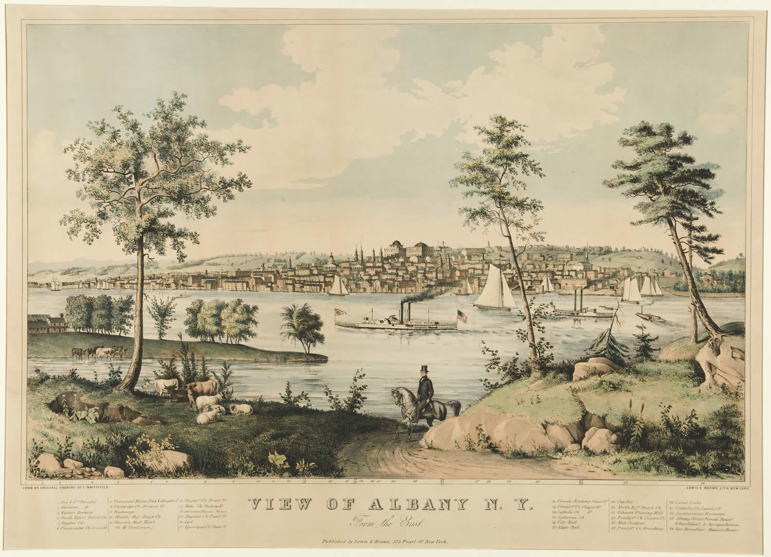
Here's a larger version.
The work above is "View of Albany, NY From the East." It's a print, the original of which was created by the artist Edwin Whitefield in 1845. And it's part of the new exhibit at the State Museum, Art of the Erie Canal.
The print caught our eye while looking through the exhibit because 1) Albany (obviously) and 2) it depicts an Albany that hadn't quite totally spread west up the hills from the river. Those hills are obscured by buildings in so many images of the city.
Whitefield apparently had a thing for cities and wanted to document them for history. Among his other cities works is the aptly-titled "View of Troy, N.Y. From the West."
The print on display in Art of the Erie Canal is from the State Museum's collection. The image above is via the Yale University Art Gallery.
... said KGB about Drawing: What's something that brought you joy this year?