Items tagged with 'transportation'
Bike share grew in both use and reach this year -- here's what CDTA's thinking about for next year
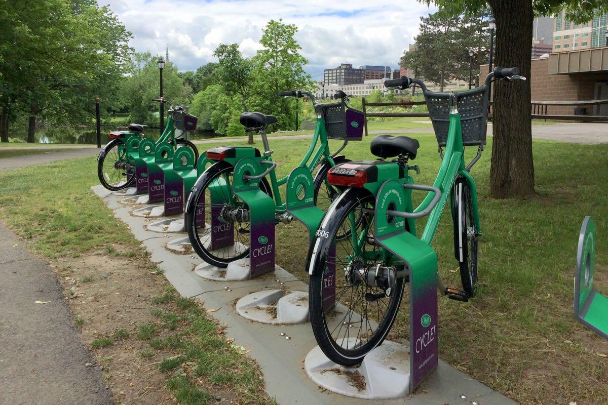
The bike share rack in Corning Riverfront Park in Albany was the most active hub in the system this past season.
The bike share run by CDTA -- CDPHP Cycle -- wrapped up its second season last week, and the transit org reported this week that people took 23,535 trips on the bikes between April and the end of November. That's more than double the total of last year's season.
CDTA pushed to expand the program this year, doubling the number of bikes to more than 300, and increasing the number of rack locations from 40 to more than 70 across larger service areas in Albany, Schenectady, Troy, and Saratoga Springs. It also managed to get more than 4,000 new members for the system, bringing the total to almost 6,600.
And here's what CDTA's thinking about for next year...
(Also: The most popular hub locations and a few other numbers.)
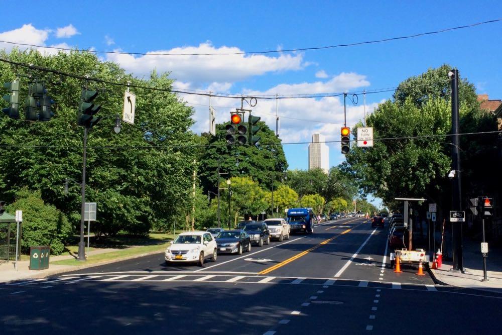
How that new connector between the Northway and ALB will work
Major construction on that new connector from the Northway for Albany International Airport is set to begin this winter, the Cuomo admin announced this week. The plan is for the $50 million exit reconfiguration to be finished by spring 2020.
That video embedded above is a Cuomo admin explainer about how the new connector ramps will work. We found it helpful in understanding the reconfiguration.
You might remember ALB is also getting a new parking garage and some makeovers, a $42 million project that's backed by $22 million from the state.
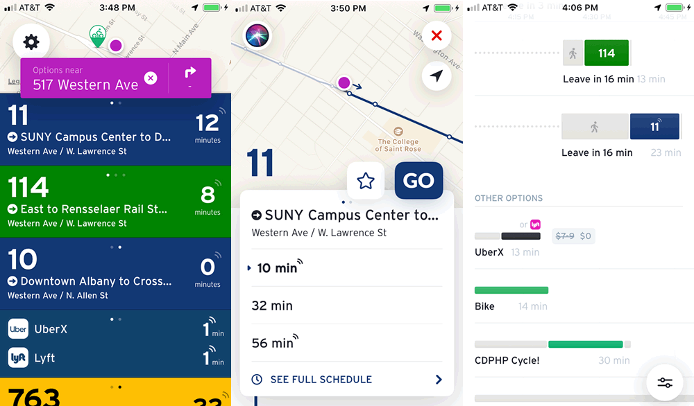
Realtime info for CDTA bus routes and ride hailing services in one place
A few screenshots.
Check it out: An app called Transit has rolled together CDTA route info with ride hailing services such as Uber and Lyft into one place.
So you can open the app and see which buses are nearby and also when you might be able to get a car via a ride hailing service and how much that might cost.
CDTA is one of a handful of transit orgs around the country that are part of the new feature. And playing around with the app today, we were surprised with how smoothly it blends together bus arrivals, Uber/Lyft rides, walking, biking, and even bike share. We might use it now instead of the CDTA app.
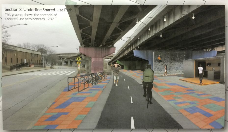
Albany is set to build the link between Helderberg-Hudson Rail Trail and the Mohawk-Hudson Bike-Hike Trail -- here's the plan
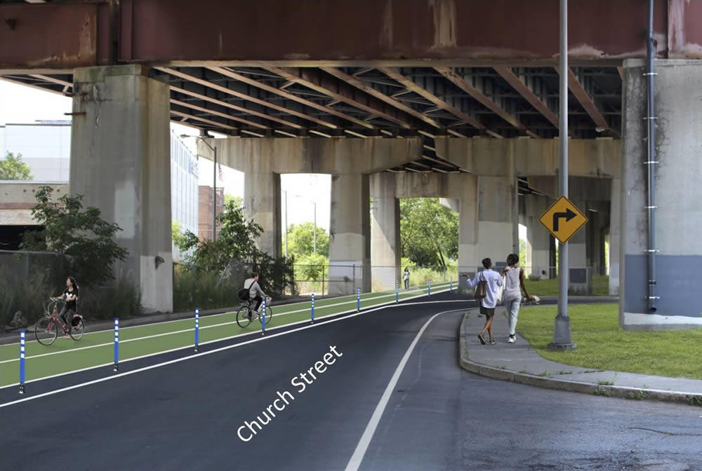
What part of the trail underneath 787 could look like.
The city of Albany is planning to start construction next year on the much-anticipated link between the Helderberg-Hudson Rail Trail and the Mohawk-Hudson Bike-Hike Trail.
The South End Connector is a key piece of the region's growing network of alternative transportation paths. When finished, it will offer a protected path for cyclists and pedestrians along the two miles from the rail trail's South End trailhead and the Mohawk-Hudson trail on the Hudson River. And it holds the potential to offer people within the South End a safer way to the riverfront.
The South End Connector has been in public planning for more two years, and the idea for the trail stretches back even farther. The city unveiled the construction plan and a new timeline last week at a public meeting.
Here's a look at what's in the works...
Here are some of the options for remaking upper Washington Ave in Albany
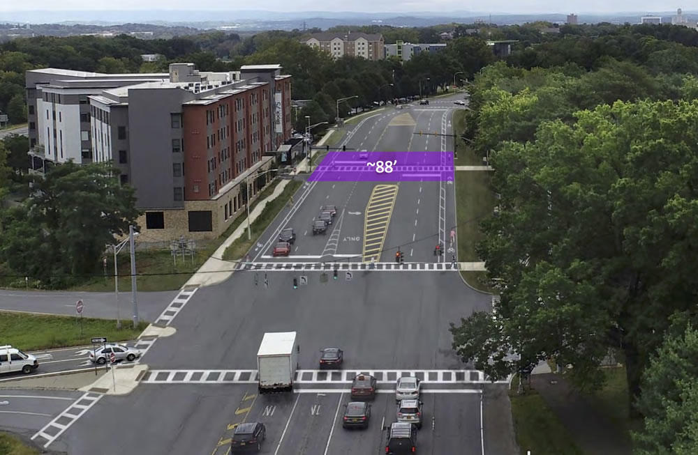
One of the options would re-stripe the road to include bike lanes.
The part of Washington Ave by UAlbany and the Harriman State Office Campus is a weird stretch. It's really wide. All sorts of ramps slip on and off it. There's been a lot of development, but it's hard to get from one thing to another. Pedestrians dart across it. And the speed limit probably feels frustratingly slow for drivers.
So: Are there ways to fix some of these issues, making the street work better and feel better for all sorts of people -- pedestrians, cyclists, drivers?
For the past six months the Washington Avenue-Patroon Creek Corridor Study -- a collaboration between the Capital District Transportation Committee, city of Albany, University at Albany, and engineering consultants -- has been looking into that question.
And Thursday evening during a crowded public meeting at UAlbany the engineers showed off a trio of possible designs for making over the road...
Making it someone's job (literally) to push Albany toward streets that are safer and friendlier for all sorts of people

Update: Kathy Sheehan tells Amanda Fries the city won't be adding the position, but will be assigning one of its current engineers to oversee complete streets and ADA compliance. [TU]
____
Should the city of Albany have a staff member whose full-time job is to keep the city on track towards its goal of creating streets that are safer and friendly to pedestrians, cyclists, and people with disabilities?
A group called Capital Region Complete Streets is pushing for the city to create such a position -- a complete streets coordinator -- and it would like to see the job included in the budget the city's working to finalize. The group has posted a doc outlining its argument (also embedded below). A clip:
It is evident that the City of Albany is making some progress with ADA Compliance, Complete Streets, and combating climate change, but the progress is slow. A Complete Streets Coordinator will help move things forward more efficiently, leading to a more inclusive, safe, walkable, and inviting city. One indicator that this position would be useful is that the city has had a Bicycle Master Plan in place since 2009, nearly a decade, yet has not come close to establishing a connected bicycle network. In fact, since 2009, the city has only managed to construct 4 mostly unconnected bike lanes (Clinton Ave, Northern Blvd, Madison Ave and Ten Broeck) that amount to about 2.8 miles.
A leading 21st century city is a safe and inviting place to live and work. Walkable streets, and navigable bike and transit networks are hallmark quality-of-life essentials for today's families, students, businesses and innovators. A Complete Streets Coordinator will allow Albany to be more responsive to the needs of its residents, while increasing its competitiveness with surrounding communities.
The city already has an ordinance requiring it to work toward "complete" streets, and a few years ago it put together what's essentially a recipe book for laying out streets with pedestrians and bikes in mind.
That look at traffic and pedestrian safety along New Scotland Ave is happening, and there's a meeting coming up to talk about it
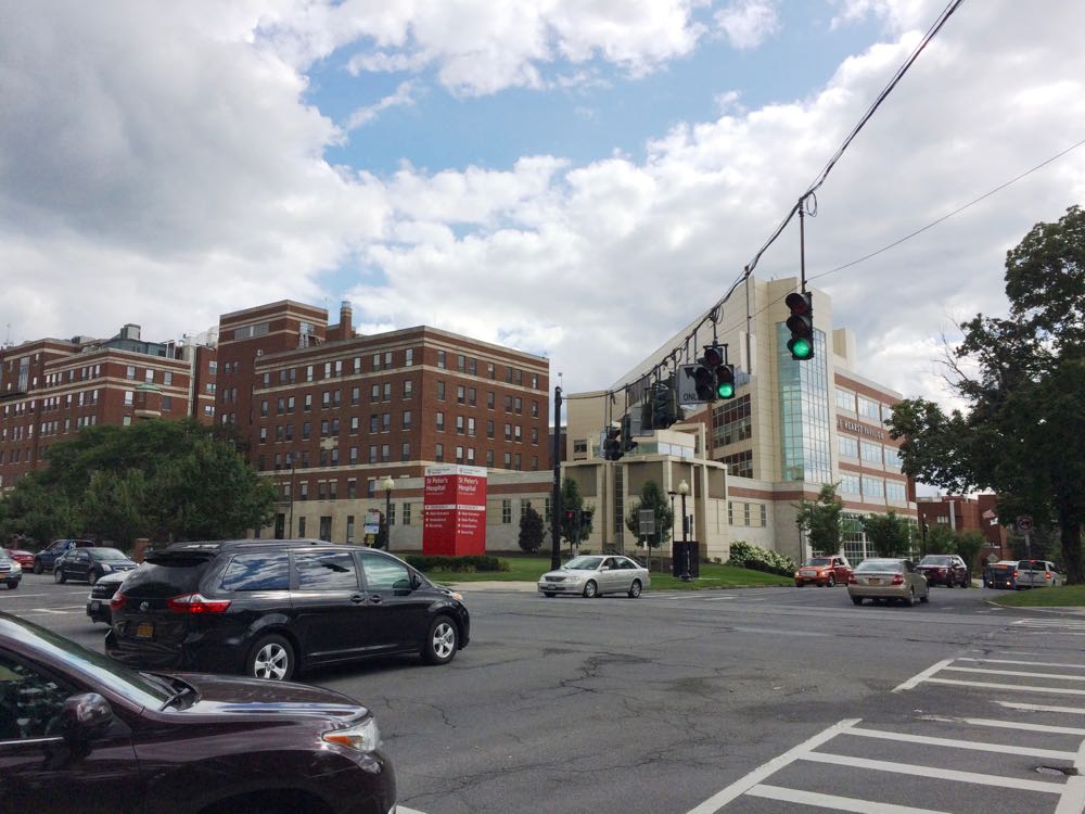
The city of Albany has a public meeting November 13 to talk about the long-awaited New Scotland/Whitehall/Buckingham Corridor Traffic Study.
You might remember the city announced back in August 2017 that St. Peter's Health Partners was putting up $100k to study what mayor Kathy Sheehan described as "a significant increase in traffic" along the New Scotland Ave corridor, a major channel for the daily influx of commuters into the city. Speeding, pedestrian safety, and congestion have all become common complaints in neighborhoods along the corridor.
The city has hired the engineering firm Creighton Manning to assist with the project. Meeting blurbage:
This meeting will provide a brief overview of the study and draft project objectives. Community members will also have an opportunity to provide comments regarding existing needs and ideas for transportation improvements, and will help shape the future traffic patterns in this
It will be interesting to hear some of the ideas for the corridor. There are certainly some things that could be done with the street itself. Example: The segment of New Scotland from St. Peter's to Buckingham currently has a make-your-own-rules feel because of the (lack of) design and marking.
But it's also probably true that addressing the issues people are concerned about will also mean changing behaviors and other patterns. Is it possible for St. Peter's and Albany Med and other employers along the corridor to get fewer people driving to work alone? Are there ways to encourage development and residential choices so that more people can walk or bike to where they're going along the corridor?
There are a lot of pieces to fit together.
The public meeting is Tuesday, November 13 from 5:30-7:00 pm at the Mercy Auditorium at St. Peter's Hospital's 310 South Manning Blvd building. It's across the street from the main hospital building.
By the way: That's the same night at the South End Connector Trail meeting at the Howe Branch of the APL. That meeting's open house starts at 7 pm.
Earlier and elsewhere
+ Studying one of the channels of the daily commuting tide into and out of Albany
+ Parking as a daily choice
+ CityLab: Durham's Plan to 'Nudge' Drivers Out of Cars
The city of Albany is planning to start building that connector between the rail trail and the riverfront next year -- and there's a chance next month to see the plans
One of the renderings from 2017 of what the section under 787 might look like.
The city of Albany will show off the concept plans for the South End Connector Trail at a public meeting November 13 at the Howe Branch of the Albany Public Library.
The South End Connector is planned to be a roughly two-mile path to connect the end of the Helderberg Hudson Rail Trail in the South End with the Mohawk Hudson Bike Hike Trail along the riverfront. The public planning process for the project started more than two years ago, and the city and its consultants unveiled a plan in May 2017.
It's an important project because of the connection it will form between the two popular bike trails and the progress toward building a larger regional trail network. And it also potentially will open a safer way for people in the South End to get to the riverfront.
There are a two bits of news in the city's meeting announcement:
+ The city says it's anticipating that construction of the project's multi-use pathwill start in the summer of 2019.
+ A second phase -- that "include enhancements such as additional lighting and public art to the section of the route that goes under I-787" -- is scheduled for 2020. The city is calling that segment the "South End Connector Underline."
The public meeting is Tuesday, November 13 at at the Howe Branch of the APL (105 Schuyler Street). There's an open house from 7-7:30 pm and a project presentation from 7:30-8:30 pm.
Earlier
+ The plan to connect two major bike paths at the Albany waterfront (2017 May)
+ Plotting a path for the Albany waterfront bike trail connector (2016 June)
+ Mapping out the future for an alternative transportation network in the Capital District (2018 September)
+ Elsewhere: "Miami's Underline underscores potential of park projects" [Curbed]
CDTA is starting up another free shuttle service around downtown Albany on the weekends
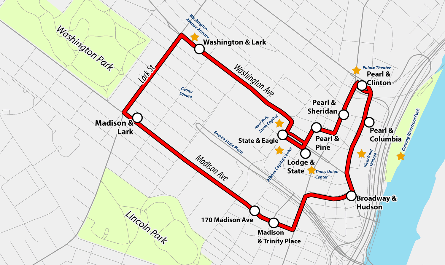
CDTA is starting up a free downtown Albany service it's calling Capital City Trolley today. Blurbage:
The Capital City Trolley will begin on Thursday, October 25 and operate Thursday, Friday and Saturday nights. Service will begin at 5:00 p.m. and conclude at 12:30 a.m. with a trolley arriving every 20 minutes. Schenectady-based software and logistics company, Transfinder has enhanced its CityFinder mobile application that allows users to track trolley location and highlights detailed points of interest.
The service will offer convenient stops near key attractions, including the Albany Capital Center, the Times Union Center, the State Capitol, the Palace Theatre, the Corning Riverfront Park, Quackenbush Square, the Riverfront Parking Garage and the Washington Avenue Armory.
That's the route map above (here's a larger version).
You might remember that CDTA ran a similar service -- the Capital City Shuttle -- during the summer of 2017. The route for the shuttle stretched from the Warehouse District to Washington Park. At the time CDTA CEO Carm Basile said they were thinking the service could eventually be a loop for downtown. And that looks a lot like the new map.
The CDTA press release touts the new service as a link between commercial corridors of Lark Street and downtown Albany.
But another way to think of it is like an extender for other options. You could take a bus, bike, Uber/Lyft, car and then use the trolley service to circulate through a few different spots in the same night.
CDTA advertises on AOA.
Gawking at the new Schenectady train station
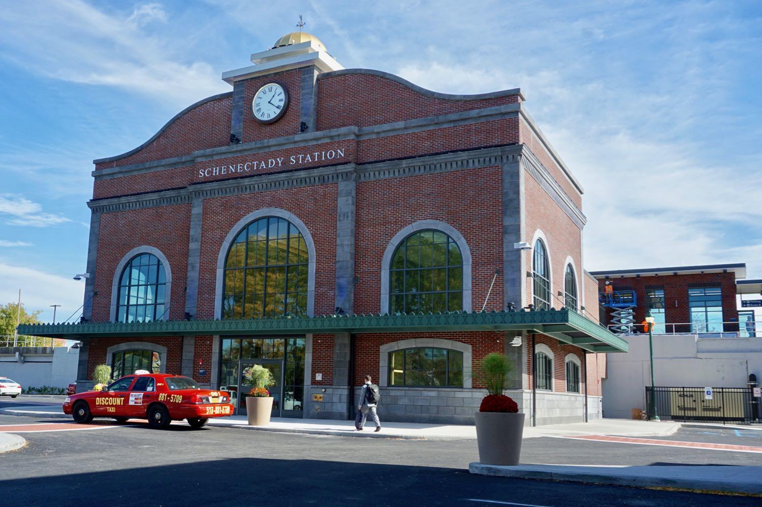
In a bit of a surprise the new Schenectady train station opened this past Wednesday, a few weeks ahead of the announced schedule. The $23 million station is the replacement for the old 1970s station that was demolished last year.
We had a few free minutes in downtown Schenectady today, so we stopped by to gawk at the station. It's small, but nice. And it has that new station smell.
We've included a handful of photos if you'd like to have a look.
The design is said to be inspired by the old-old Schenectady train station -- Schenectady Union Station, the one built in 1910 -- that was knocked down in 1971. For a while Schenectady's train service was moved to a stop in Colonie. See Carl's history of the demise of the old-old station.
As nice as the new station is, the best thing about it might be its location downtown just off the corner of Erie Boulevard and State Street. Of the Capital Region's four core cities, Schenectady is the only one that still has an operating train station right in its downtown. It's a reminder of what could have been for a place like Albany.
It's kind of great that you can walk to a train in the heart of Manhattan, say, and hop off right in downtown Schenectady and walk to a destination there.
A little push up the hill
Wrapped into my update this past week about what it's been like to use a bike as one of my primary ways of getting around town was a lament/complaint/whining about pedaling up the rather large hill in downtown Albany.
Because of that -- and because it's Friday afternoon -- here's a video of the CycloCable, sort of a ski lift for bikes, in Trondheim, Norway. (See also this CityLab article about it a few years ago.)
The odds of something like this being built in downtown Albany are essentially zero, and probably for some good reasons. But part of me kind of wants to see it proposed just to watch the reaction to the idea.
I mean, it's no gondola...
A year later I'm still using a bike to get around town -- here are a few thoughts about how that's worked out
About this time last year I shared how I ended up becoming a person who uses a bike as one of my primary ways of of getting around town.
A year later I am still that person. (Even the Times Union says I'm a cyclist.)
And here are a few thoughts about how that's worked out...
Walkable Albany survey
The new local group Walkable Albany has posted a survey looking for public feedback about places in the city that could use some attention in terms of pedestrian amenities and safety. Survey blurbage:
Walkable Albany is seeking your input about what places in Albany need improvement so that we can build a list of places in Albany to focus on in our advocacy efforts.
Walkable Albany is a group of Albanians who want to advocate for better streets. We believe Albany is a beautiful city with a historic walkable core and transit-friendly outer neighborhoods. Its core should be embraced for its walkable urban potential and its outer neighborhoods should be improved to make walking easier, safer, and more useful.
Pedestrian safety and complete streets should be a top priority for the City of Albany. Neighborhood and downtown streets should be designed to protect pedestrians and slow traffic whenever it is appropriate. Safe spaces for all road users, including bicyclists and alternative transportation options, are essential.
These sorts of topics -- walkability, dangerous intersections, urban planning -- get discussed fairly often here at AOA, so we figured you might be interested in this survey.
The founder of Walkable Albany is Andrew Neidhardt. The group has a meeting next Monday, October 15 at the Washington Ave Branch of the Albany Public Library at 6:30 pm.
Mapping out the future for an alternative transportation network in the Capital District
The Capital Region already has a handful of popular biking and walking trails, but if you zoom out a little bit and look at the whole picture you can the see the outline of something a lot bigger.
That something is what Jennifer Ceponis, a senior transportation planner for the Capital District Transportation Committee, describes as an alternative transportation network: "Much like we have a highway system for cars -- with supporting roads and arterials that feed into that -- we want people to be thinking that the region can have a similar system but for bicycling, walking, and other recreational activities."
Toward that goal, the planning org has put together the Capital District Trails Plan, a map toward a future in which you might be able to ride a bike from, say, Voorheesville to Saratoga Springs and beyond on a network of paths.
Here are a few highlights.
The Albany Police Department has e-bikes -- they're still not exactly legal for the rest of us
Thank you, Home Leasing Construction who donated three pedal assist bicycles to the Neighborhood Engagement Unit this morning! Check out Chief Hawkins taking one for a spin on Madison Avenue. #Albany #CommunityPolicing pic.twitter.com/sIVE2sEvNe
— Albany Police (@albanypolice) September 12, 2018
Noted: The Albany Police Department has e-bikes, as that tweet above pointed out this week.
"Pedal-assist" e-bikes are the same sort of bikes that advocates had been trying to get formally legalized in New York State during the past session of the legislature. The push didn't make it over the finish line.
E-bikes are increasingly popular around the country because the little electric motor -- which kicks in when you pedal -- makes it easier to go up hills and maintain speed. So they can be helpful for people who commute by bike, have gotten a little older, and or have a physical limitation that might otherwise keep them from biking. (Also: They're really fun. Riding one feels a bit magical.)
You can buy the bikes in shops here. But they're still not technically legal because of state law. (New York City has pursued its own rules.) That not only puts them in a gray area for regular bike riders, it also means bike share systems won't hop on board with them here, even though the major bike share companies are heading in that direction other places.
Earlier
+ E-bikes stretch the idea of what a bike can be in interesting ways, but they're stuck in a gray area here in New York
+ Another push to get e-bikes up the hill to legalization in New York State
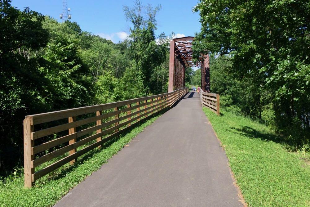
Crossing the Black Bridge
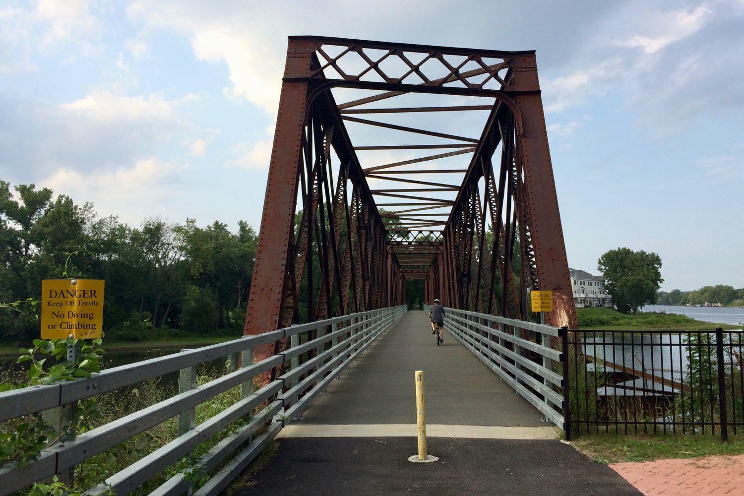
We finally got a chance to check out the new paved path in Green Island that leads up to the southern end of the Black Bridge. And short story short: it's nice.
The Black Bridge is worth checking out sometime if you haven't already. There's a small parking lot at the end of Cannon Street on the Green Island side, and it's a short pedal from downtown Troy via the Green Island Bridge.
The bridge connects Green Island and Van Schaick Island in Cohoes across one of the Mohawk River's curling paths into the Hudson River. And it's part of a multi-use path that connects Green Island, Van Schaick Island, Peebles Island, and Waterford. The roughly two-mile corridor -- the Delaware Ave path in Cohoes -- is a nice walk or pedal as you pass by the fairways of the Van Schaick Island Country Club, the Van Schaick Mansion, a bunch of new residential developments in Cohoes, the old Matton Shipyard, cross the bridge onto the northern end of Peebles Island, and then cross another bridge over to Waterford with a view of the locks.
The setting is beautiful -- and a little bit wild. Late Sunday afternoon we glided past a deer and saw a bald eagle from the Black Bridge.
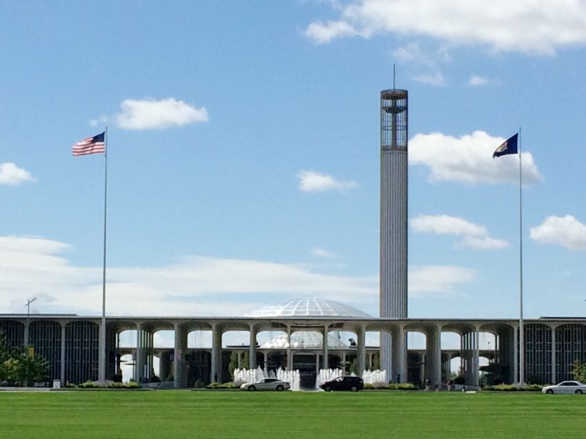
The Albany airport's getting terminal upgrades, a new parking garage, and a new connector road from Exit 4
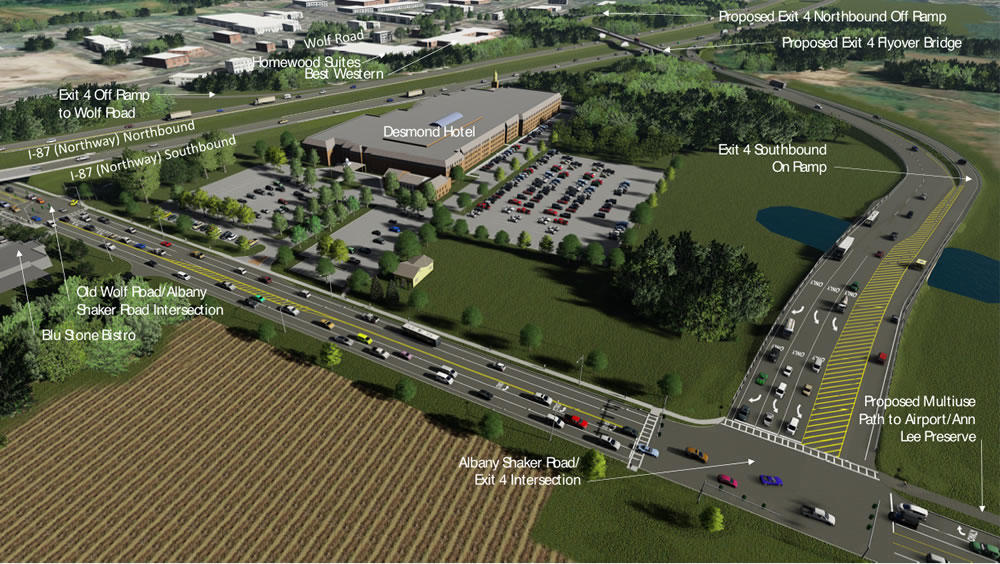
The Albany International Airport is set to get terminal upgrades and a new parking garage as part of a $42 million renovation -- and there's now a set plan for a new "airport connector" roadway at Exit 4 off the Northway.
The Cuomo admin announced the upgrades and exit reconfiguration Tuesday. Press release blurbage about the planned upgrades for ALB, for which the state is chipping in $22 million and the Albany County Airport Authority is providing the rest:
New Parking Garage -- The project will construct a 1,000-unit, multi-level parking garage, expanding airport parking capacity by 20 percent. The pre-cast concrete garage will provide a heated pedestrian walkway to the airport terminal. Energy-efficient LED lights will illuminate that bridge, enhancing visibility as well as vehicular and pedestrian safety.
Parking Access Improvements -- The project will install new LED electronic signage, car counting devices, and interactive access control devices that utilize advanced GPS technology to locate available parking spaces and provide wayfinding messages that direct motorists to them. The existing parking system is nearly 20 years old and its electronic controls are in disrepair.
Terminal Rehabilitation and Passenger Amenities - The project will rehabilitate the terminal, including escalators, restrooms, waiting rooms and the food court. Improvements will include new carpets, wall finishes, tile floors, energy-efficient lighting fixtures and better Internet connectivity.
(We hope the airport's art gallery and public art get some dollars, too -- they're our favorite part of ALB.)
And here are some bits -- and explainer renderings -- about the new $50 million airport connector roadway and the reconfiguration at exits 4 and 5:
Here's the proposed design for the Albany Skyway
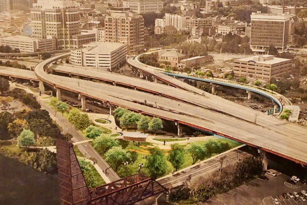
Over the years thousands of people have driven along the off-ramp leading to Clinton Ave in downtown Albany that's in line to become the Albany Skyway elevated park. But walked the almost half-mile curve? That's probably just a handful.
"It was an amazing surprise to be walking on the Skyway," said Capitalize Albany president Sarah Reginelli, one of the few people to trace the route on foot. "Even with none of the amenities in place, it was still this really enchanting walk because you get all of these vistas and vantage points you wouldn't otherwise."
Last week at The Palace, Capitalize Albany -- the city of Albany's economic development arm -- presented the work of the team that's been designing the Albany Skyway.
Here are a handful of renderings, bits about the design plan and cost, along with a few questions and thoughts.
A piece of street with new purpose
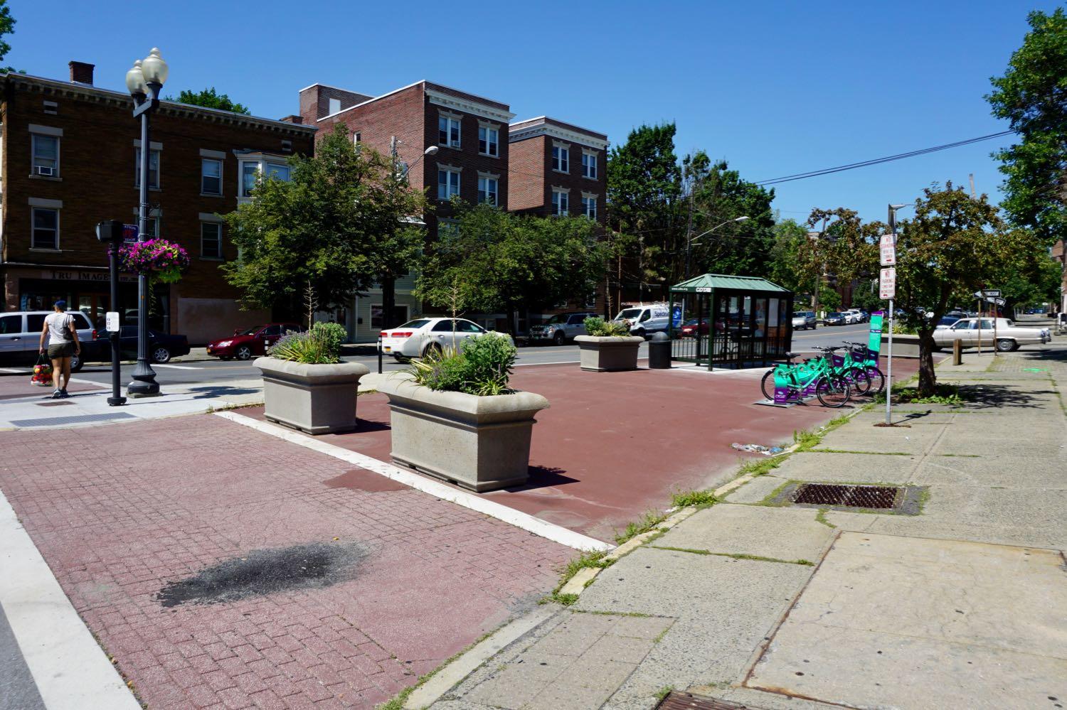
Check out this re-purposed street segment at Washington Ave and Henry Johnson Boulevard in Albany. The segment is closed off and now serves as bus stop and parking spot for a bike share hub. (Here's how it looked before.)
That bus stop is one of the new/moved stops connected the new consolidated bus stop / pedestrian upgrades on Washington Ave at the Albany Public Library. The consolidated stop allows the #10 (Western Ave) and $12 (Washington Ave) to run straight up their respective trunk streets. (The old bus stop in front of the armory didn't allow the buses enough room to switch lanes and drive along the south side of Townsend Park.)
The transportation planner/engineer term for this sort of street segment is a "slip lane."
A few more bits about the present and future of the Helderberg-Hudson Rail Trail
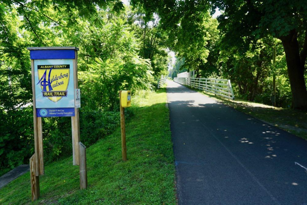
The second segment of Albany County's Helderberg-Hudson Rail Trail is now paved -- as noted earlier this week -- meaning there's now 9 miles of (almost) continuous pavement from the South End in Albany all the way out to Voorheesville.
We got a chance this week to talk with Albany County exec Dan McCoy about the present and future of the popular trail.
"I go around doing my state of the county every year, people are like rooting us on -- when's it going to be done, when's it going to be done, when are you going to fix the problem with it," McCoy said in reference to the remarkable popularity of the rail trail. "And these are good issues to have."
Here are a few bits about paving, the depot building in Slingerlands, new amenities, bathrooms, bike share, and what's still ahead...
The second section of the Helderberg Hudson Rail Trail is now paved
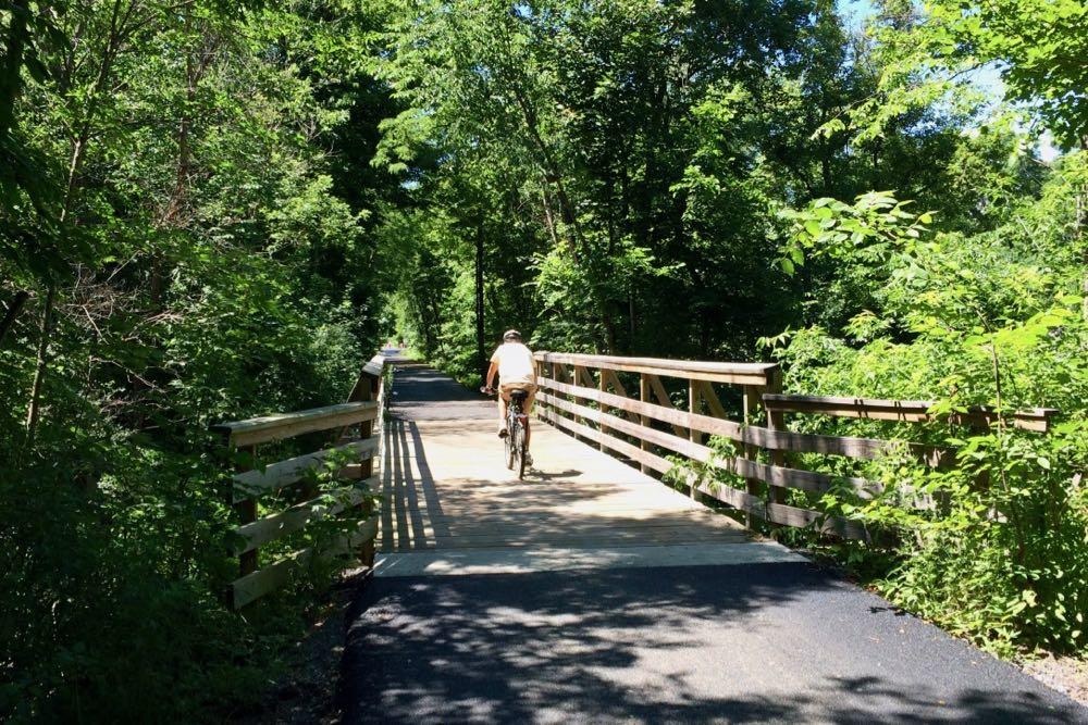
Check it out: The second segment of the Albany County's Helderberg-Hudson Rail Trail -- from Slingerlands to Voorheesville -- is now paved.
We took a spin on the 4-mile segment this Saturday. The newly-paved section starts just west of the Slingerlands parking lot, crosses the Font Grove roads, slices through many shady sections alongside fields with views of the Helderbergs through the trees, passes the Hilton Barn in New Scotland, spans State Farm Road, traverses the Vly Creek, and ends at Grove Street in Voorheesville. The pavement is luxuriously smooth.
That makes (almost) nine miles of continues paved trail from South Pearl Street in the city of Albany out through Bethlehem, New Scotland, and Voorheesville.
Here's the new consolidated CDTA stop / pedestrian upgrades at Washington and Lark
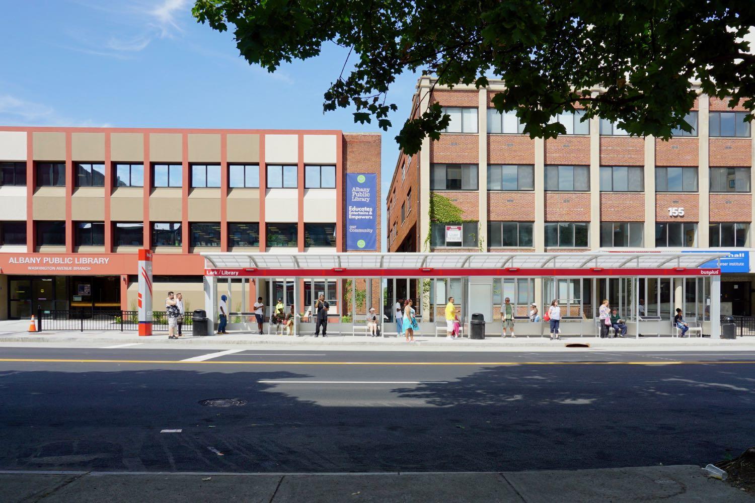
Some quick follow-up about that project to consolidate the bus stops near Washington Ave and Lark Street and add in a few pedestrian amenities. (The project has been in the works for a few years and there was some drama involved.)
The new bus stop shelter is installed in front of the Albany Public Library. The new mid-block traffic signal and cross walk is operating. (The queue jumper light for the bus wasn't unwrapped as of Tuesday.) And this past Sunday CDTA switched a bunch of bus lines over to the stop and their new, more streamlined routes west. Update: Here are large-format diagrams from CDTA explaining the route and stop changes.
The eastbound -- that is, toward downtown -- routes and stops didn't change.
The goal of the project was to make the intersection work better for buses and pedestrians. The previous stop arrangement was cramped, and it forced the the lines headed west along Western and Washington to first make their way up Central and then cut back to their intended path. The new consolidate stop has more space and allows the buses to directly head up either Washington or Western.
And the new mid-block signal and crosswalk is intended to make it safer to cross the long block between Lark and Dove. (So use the crosswalk!)
The cost of the project was $1.3 million and it was backed by state and federal money.
Here are a few more pics -- and those diagrams -- if you'd like gawk...
The Madison Ave traffic calming project is finished -- so what's next?
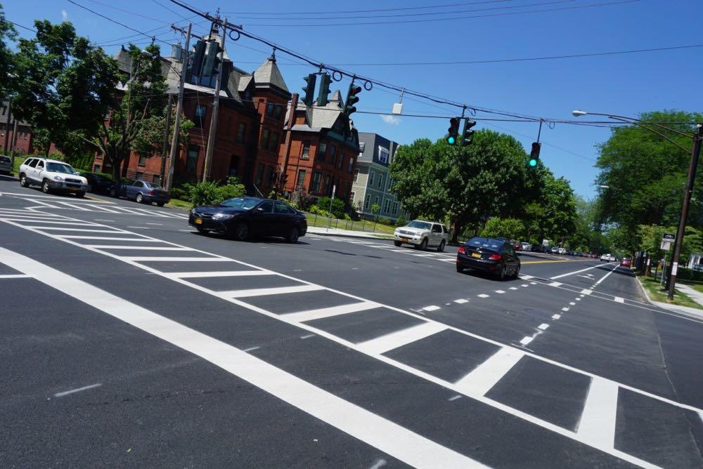
The new section of the Madison Ave traffic calming project in Albany -- the "road diet" -- has been in place for more than a week. But now it's press conference-official after an event this past Friday.
"Investments like these help to spur economic development and we need to be focused on growing our tax base, growing businesses, making sure that our neighborhoods are neighborhoods of choice for people so that we can continue to attract them to the City of Albany," said mayor Kathy Sheehan after the event at Madison and South Lake. "So this was about taking that opportunity of looking at the fact that we were going to repave this road and building an infrastructure that helps to make everybody safer."
And people have had a lot to say about this project. During the planning process, during the first phase, and now that it's finished.
So here are a few more things -- about new amenities that aren't bike lanes, about the city figuring out how to implement these sorts of ideas faster, and what might be next.
Here are the most popular drop-off spots for Uber and Lyft in this area
A popular spot for both Uber and Lyft.
It's now been a year since ride-hailing services such as Uber and Lyft have been allowed to operate across New York State.
And this week the two companies shared lists of their most popular drop-off destinations in the Capital Region.
Let's have a look.
Cruising along the second phase of the Madison Ave Road Diet
We got a chance to bike along the new section of the Madison Ave traffic calming project late Monday afternoon. New pavement + freshly-striped bike lanes = a nice ride, even alongside plenty of vehicle traffic.
The second phase of the "road diet" stretches from Partridge to Lark. It's part of an overall effort to reconfiguration the Madison Ave corridor from Allen to Lark to increase road safety and amenities for cyclists and pedestrians.
The new layout replaced a four-lane configuration (two vehicle lanes in each direction) with a three-lane layout (one vehicle lane in each direction, with a turn lane in the middle) and bike lanes on each side. Phase two also includes new traffic and pedestrians signals. Those signals are one of the keys to project -- traffic modeling indicated that signal coordination should be able to keep vehicle traffic travel times along the corridor at levels close to the old layout.
The new section isn't quite finished. Some of the striping -- including the zones for buses -- isn't down yet. But the city said Monday that the phase will be completed soon -- probably within the next week or so.
We'll circle back around to the project when it's officially complete (Update: And here's that post.), but just on first look it's remarkable how much different the corridor feels with the new configuration.
Here are a few more pics if you'd like to gawk...
... said KGB about Drawing: What's something that brought you joy this year?