Items tagged with 'urban planning'
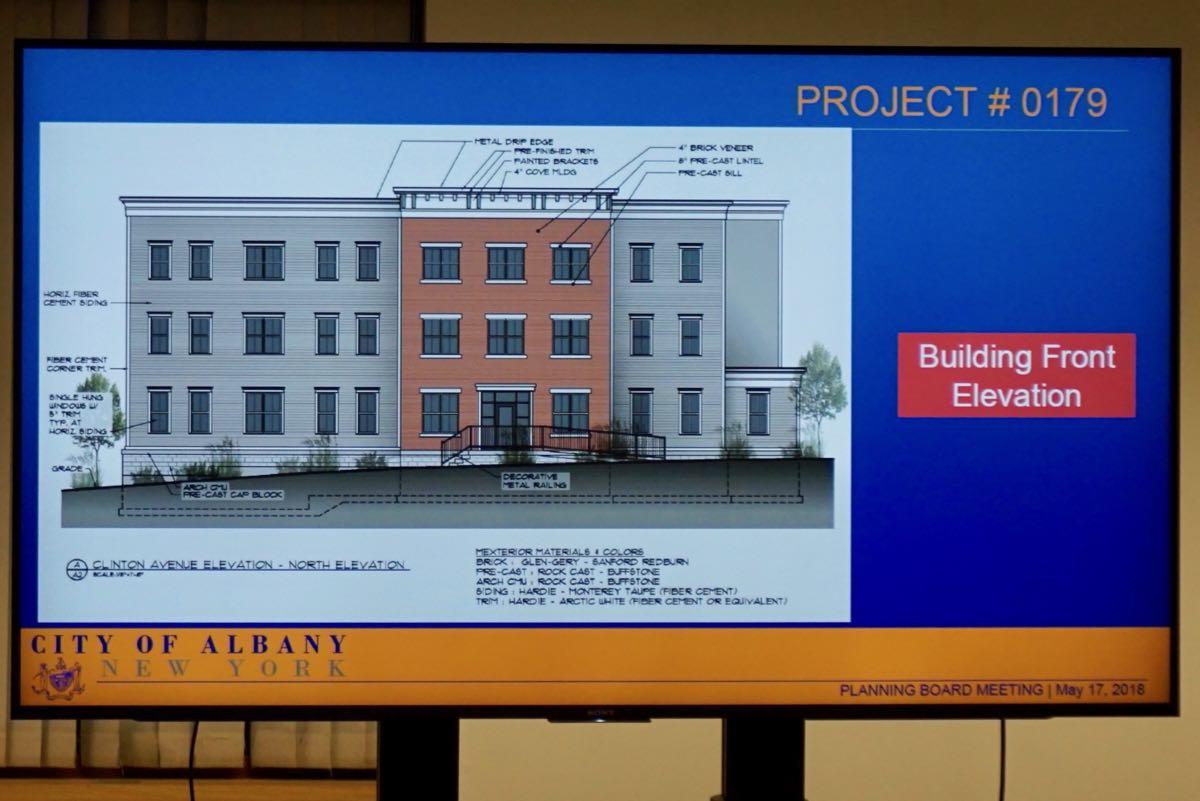
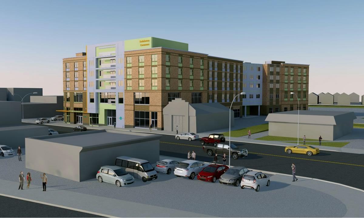
The apartments on Elm Street, The Lionheart, Colvin Ave mixed-use, and more exciting tales of the Albany Planning Board
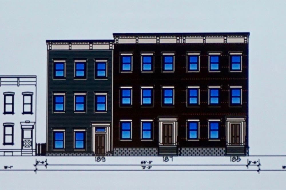
Exciting Tales of the Albany Planning Board is a program recorded before a live studio audience once a month in which the fates of multi-million dollar projects around the city are (partially) decided.
Included this month: Approval for those controversial Elm Street apartment buildings, a Colvin Ave apartment proposal, The Lionheart, The Wilson, demolitions and how big is that sign...
Clinton Square, every hundred years or so
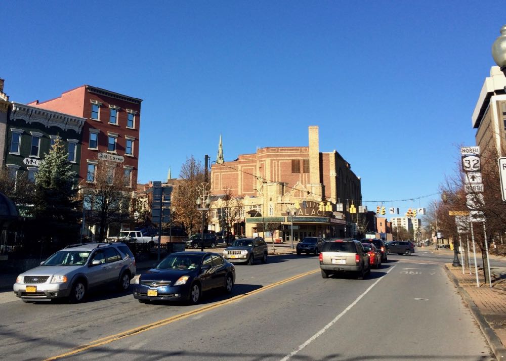
We've had a bunch of items lately about the Clinton Square section of downtown Albany because the city is in the process of figuring out which projects there should get a slice of the $10 million from the state's Downtown Revitalization Initiative.
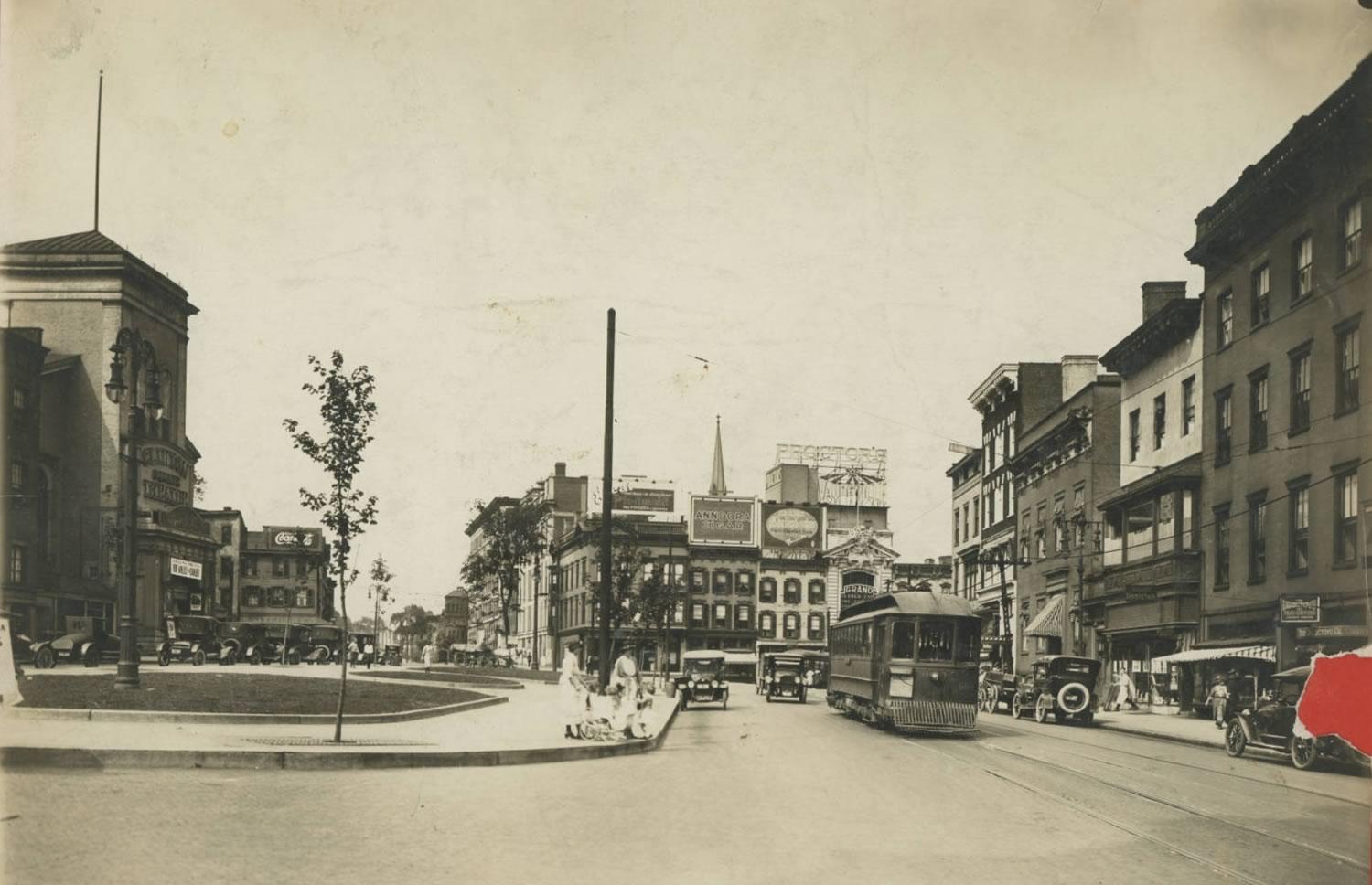
So we thought you might find this photo interesting. It's Clinton Square -- the area around the intersection of North Pearl Street and Orange Street -- from (we're guessing) the 1920s. The photo is from the Albany Public Library History Collection. If you follow that link you can zoom into the photo and see a bunch of details.
One of the things that struck us about this photo is just how different this part of the city is now. There's no Palace Theater -- the old movie house wouldn't be built until 1930. There's no federal building in the background. And that row of buildings along the east side is now Wallenberg Park.
More than anything, though, there's just something overall about this scene that feels more human scale. At least, it does via the photo. (Also: Streetcars!)
Clinton Square is one one of the oldest major intersections in the city and it's been a topic of debate and discussion regarding development there for 200 years.
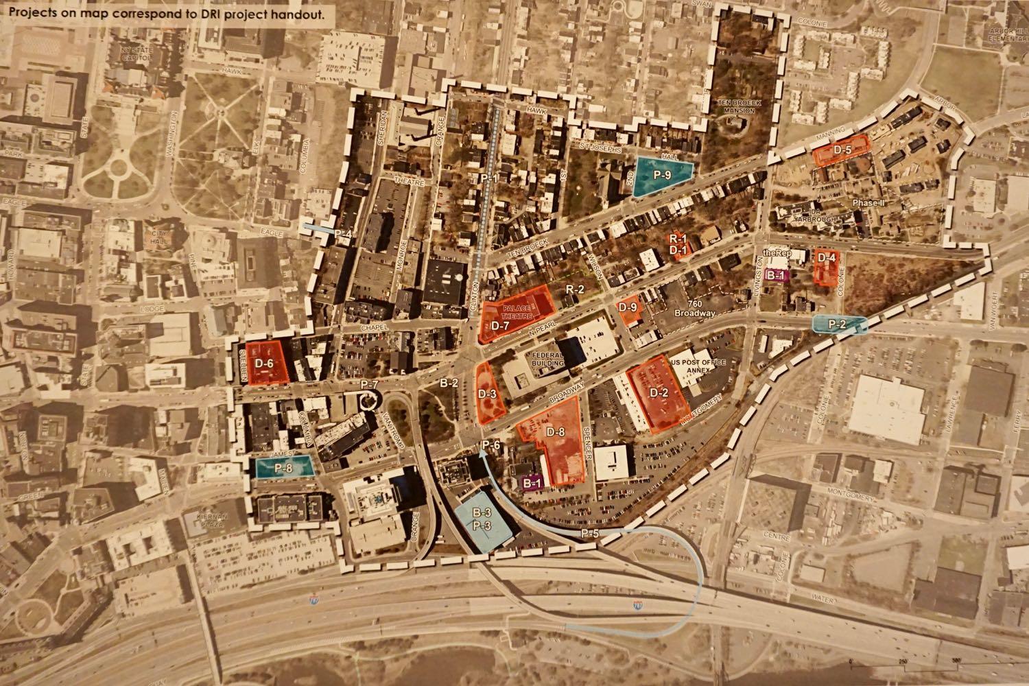
Here are the projects in the mix for that $10 million that Albany has from the state for the Clinton Square area of downtown
The city of Albany has $10 million to spend in the Clinton Square section of downtown after winning the latest round of the state's Downtown Revitalization Initiative.
Now it has to figure out what exactly that money should be spent on.
And here are the projects in the mix so far...
A few of the ideas that are in the mix for the future of Albany's Lincoln Park
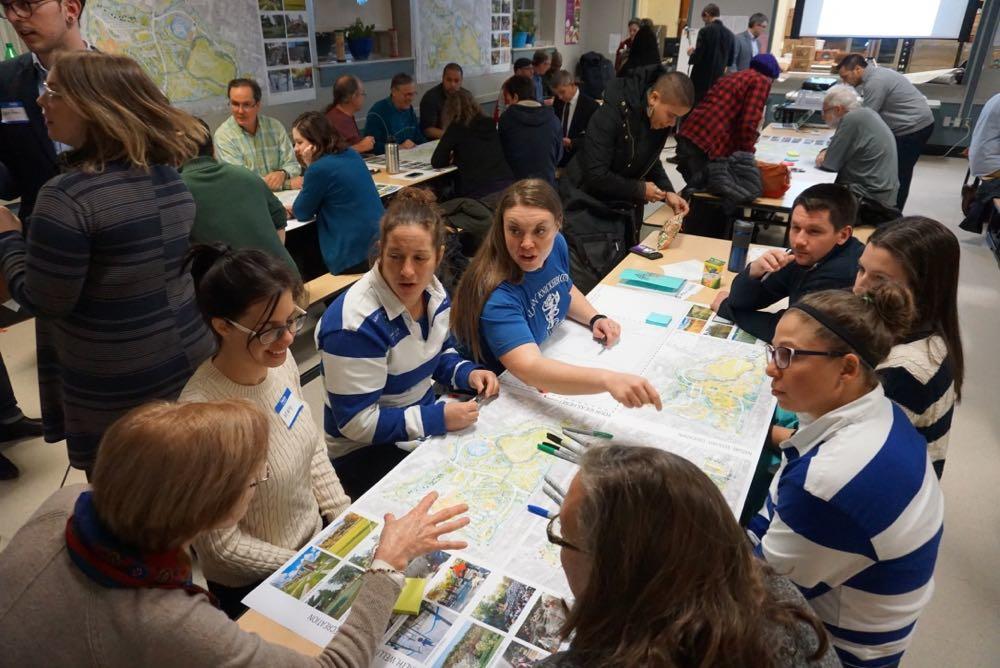
What should Albany's Lincoln Park look like five years from now? Or 10 years from now? Or even 50 years from now?
That's the question at the center of the ongoing process to develop a master plan for the city's second largest park.
"This is an iterative process, this is about asking you what you want," mayor Kathy Sheehan told the crowd at a public planning meeting at TOAST Elementary Tuesday evening. "And creating a vision for a park that will live on for decades -- and be a vision for the park that reflects the community."
The city has hired a landscape architecture firm out of Boston to help it develop this plan. On Tuesday the firm's reps presented a few ideas they have in mind, and members of the public highlighted what they like so far...
How that new connector between the Northway and ALB will work
Major construction on that new connector from the Northway for Albany International Airport is set to begin this winter, the Cuomo admin announced this week. The plan is for the $50 million exit reconfiguration to be finished by spring 2020.
That video embedded above is a Cuomo admin explainer about how the new connector ramps will work. We found it helpful in understanding the reconfiguration.
You might remember ALB is also getting a new parking garage and some makeovers, a $42 million project that's backed by $22 million from the state.
The plan for a sewer facility in Lincoln Park is set to move forward next year -- with a significant change
The plan for the Beaver Creek Clean River Project -- the sewer facility planned for Albany's Lincoln Park that prompted an upswell of community skepticism this past spring -- has changed, officials announced at a public meeting Tuesday evening at TOAST Elementary.
The project still includes a new sewer facility and park space in the old Beaver Creek ravine, but engineers have made a significant design change that officials say will result in both a smaller footprint and smaller impact.
Here's what's up.
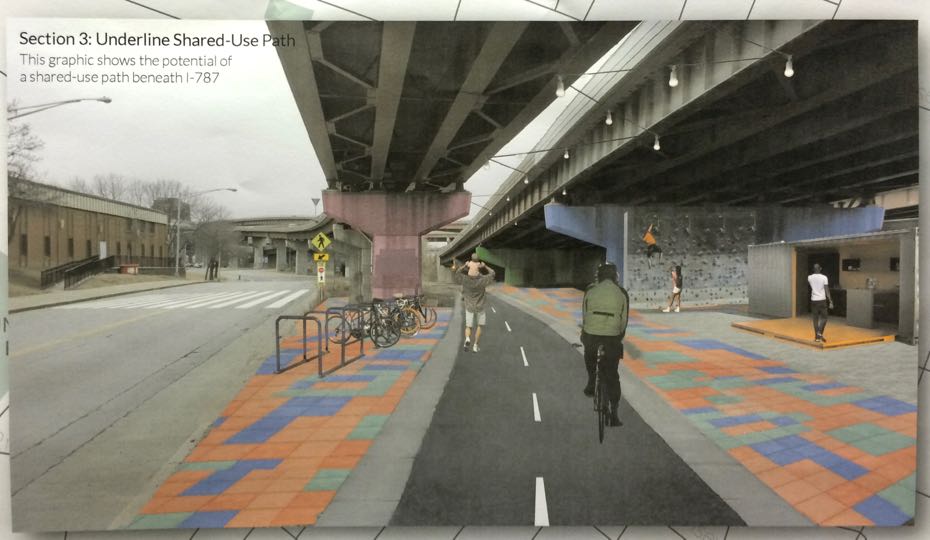
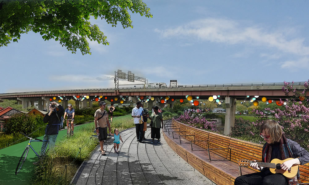
Albany is set to build the link between Helderberg-Hudson Rail Trail and the Mohawk-Hudson Bike-Hike Trail -- here's the plan
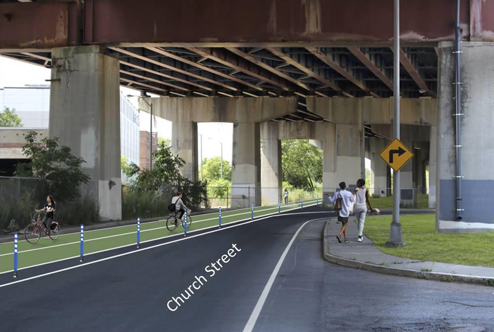
What part of the trail underneath 787 could look like.
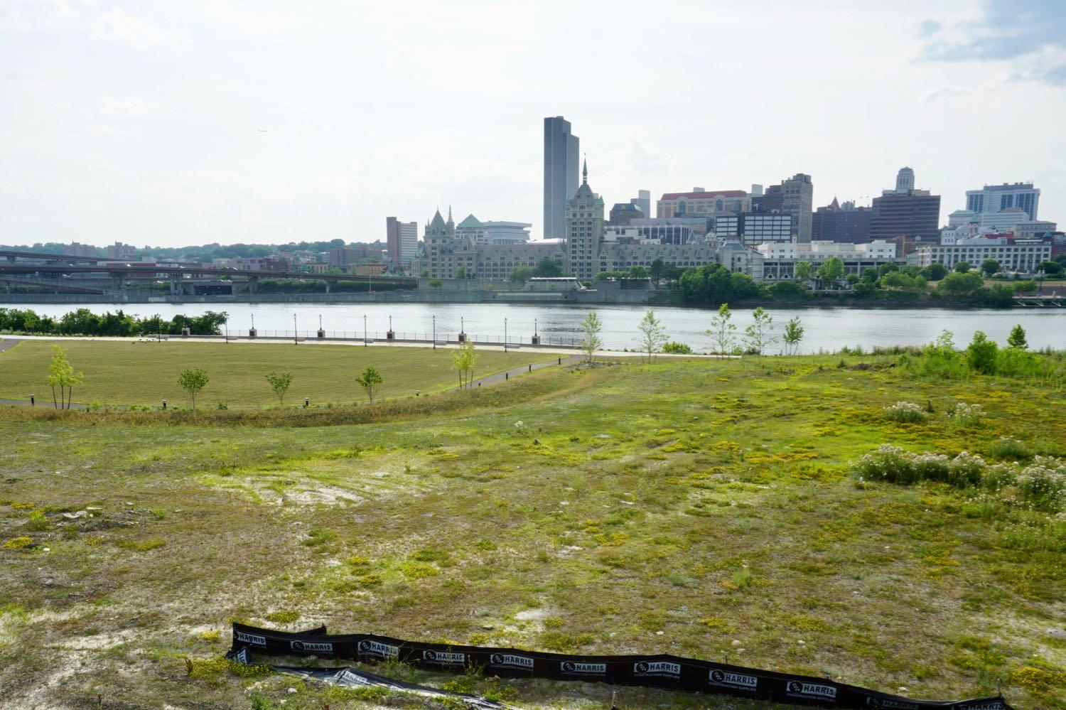
The city of Albany is planning to start construction next year on the much-anticipated link between the Helderberg-Hudson Rail Trail and the Mohawk-Hudson Bike-Hike Trail.
The South End Connector is a key piece of the region's growing network of alternative transportation paths. When finished, it will offer a protected path for cyclists and pedestrians along the two miles from the rail trail's South End trailhead and the Mohawk-Hudson trail on the Hudson River. And it holds the potential to offer people within the South End a safer way to the riverfront.
The South End Connector has been in public planning for more two years, and the idea for the trail stretches back even farther. The city unveiled the construction plan and a new timeline last week at a public meeting.
Here's a look at what's in the works...
Approval to convert two prominent downtown buildings, a warm response to increased density, and more exciting tales of the Albany Planning Board
This block is in line to get new life.
Exciting Tales of the Albany Planning Board is a program recorded before a live studio audience once a month in which the fates of multi-million dollar projects around the city are (partially) decided.
This month: Approval for residential conversion of two notable downtown buildings, a historic parking garage, that big residential/retail project across from St. Peter's, stormwater concerns, an addition to the Lionheart, a practice gym, and that enormous Kenwood project...
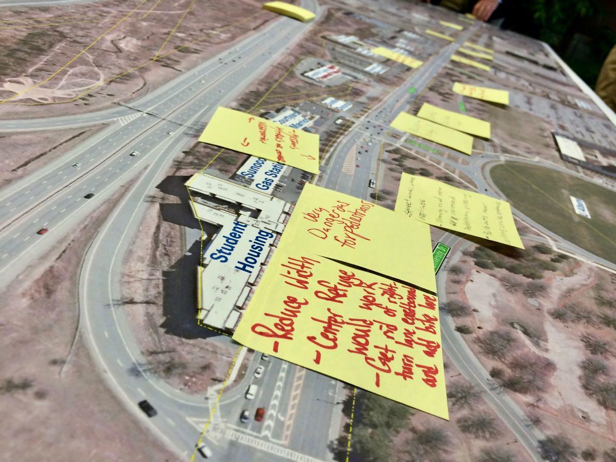
Here are some of the options for remaking upper Washington Ave in Albany
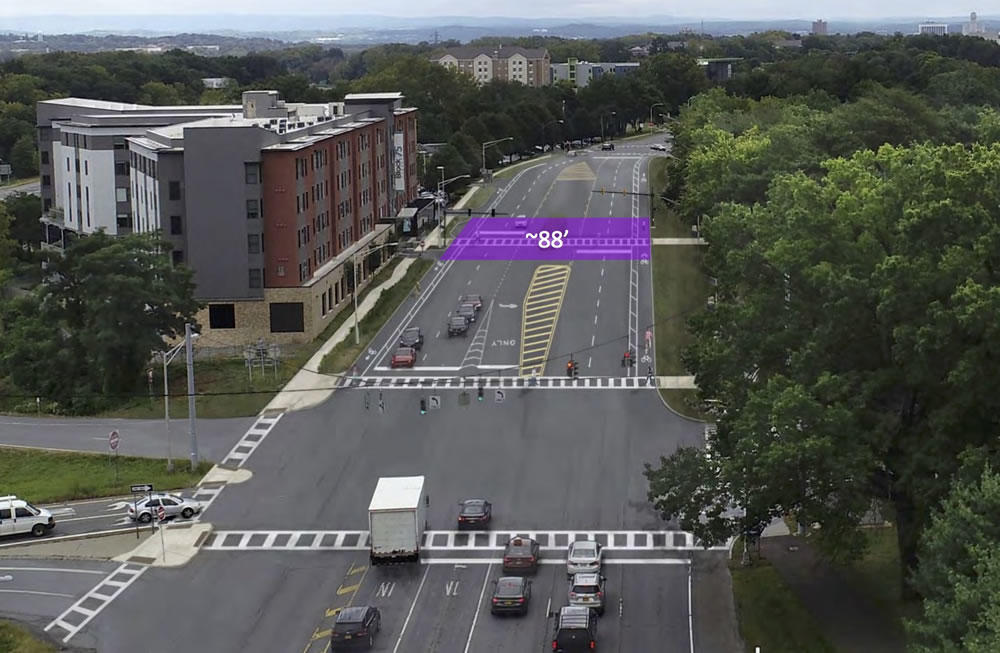
One of the options would re-stripe the road to include bike lanes.
The part of Washington Ave by UAlbany and the Harriman State Office Campus is a weird stretch. It's really wide. All sorts of ramps slip on and off it. There's been a lot of development, but it's hard to get from one thing to another. Pedestrians dart across it. And the speed limit probably feels frustratingly slow for drivers.
So: Are there ways to fix some of these issues, making the street work better and feel better for all sorts of people -- pedestrians, cyclists, drivers?
For the past six months the Washington Avenue-Patroon Creek Corridor Study -- a collaboration between the Capital District Transportation Committee, city of Albany, University at Albany, and engineering consultants -- has been looking into that question.
And Thursday evening during a crowded public meeting at UAlbany the engineers showed off a trio of possible designs for making over the road...
How Albany is figuring out what to spend $10 million on downtown
The proposed zone in which the funding will be focused. (Here's a larger version.)
Earlier this fall the state announced that the city of Albany is getting $10 million in the latest round of the Downtown Revitalization Initiative for a series of projects centered on Clinton Square.
Now the city has to spend that money. Quickly.
So... how to do that? That was the topic of a public meeting Wednesday at The Palace.
Here are a few takeaways -- about why Clinton Square, what sort of stuff will and won't get funded, and how your project might be able to land some money.
Making it someone's job (literally) to push Albany toward streets that are safer and friendlier for all sorts of people

Update: Kathy Sheehan tells Amanda Fries the city won't be adding the position, but will be assigning one of its current engineers to oversee complete streets and ADA compliance. [TU]
____
Should the city of Albany have a staff member whose full-time job is to keep the city on track towards its goal of creating streets that are safer and friendly to pedestrians, cyclists, and people with disabilities?
A group called Capital Region Complete Streets is pushing for the city to create such a position -- a complete streets coordinator -- and it would like to see the job included in the budget the city's working to finalize. The group has posted a doc outlining its argument (also embedded below). A clip:
It is evident that the City of Albany is making some progress with ADA Compliance, Complete Streets, and combating climate change, but the progress is slow. A Complete Streets Coordinator will help move things forward more efficiently, leading to a more inclusive, safe, walkable, and inviting city. One indicator that this position would be useful is that the city has had a Bicycle Master Plan in place since 2009, nearly a decade, yet has not come close to establishing a connected bicycle network. In fact, since 2009, the city has only managed to construct 4 mostly unconnected bike lanes (Clinton Ave, Northern Blvd, Madison Ave and Ten Broeck) that amount to about 2.8 miles.
A leading 21st century city is a safe and inviting place to live and work. Walkable streets, and navigable bike and transit networks are hallmark quality-of-life essentials for today's families, students, businesses and innovators. A Complete Streets Coordinator will allow Albany to be more responsive to the needs of its residents, while increasing its competitiveness with surrounding communities.
The city already has an ordinance requiring it to work toward "complete" streets, and a few years ago it put together what's essentially a recipe book for laying out streets with pedestrians and bikes in mind.
Here's the new concept plan for 1 Monument Square in downtown Troy
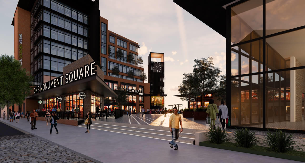
There's a new plan for 1 Monument Square -- and a long way still to go.
That's the big takeaway from Monday's meeting in which the city of Troy and its consultants showed off concept plan for the redevelopment of Monument Square that's centered on a large public plaza.
The new plan is the product of a public input process pursued this year in an attempt to create a solid consensus about what to do with the site -- at the heart of downtown Troy -- and then pursue developers interested in following that vision.
"Don't get too hung up on the particulars of the design, it's meant to illustrate proportions more than a specific design or specific building materials," mayor Patrick Madden told a packed crowd at the Arts Center of the Capital Region. "And don't get too wigged out at this point about the challenges -- not yet, anyway."
Let's a have a look at some renderings and a few of those challenges...
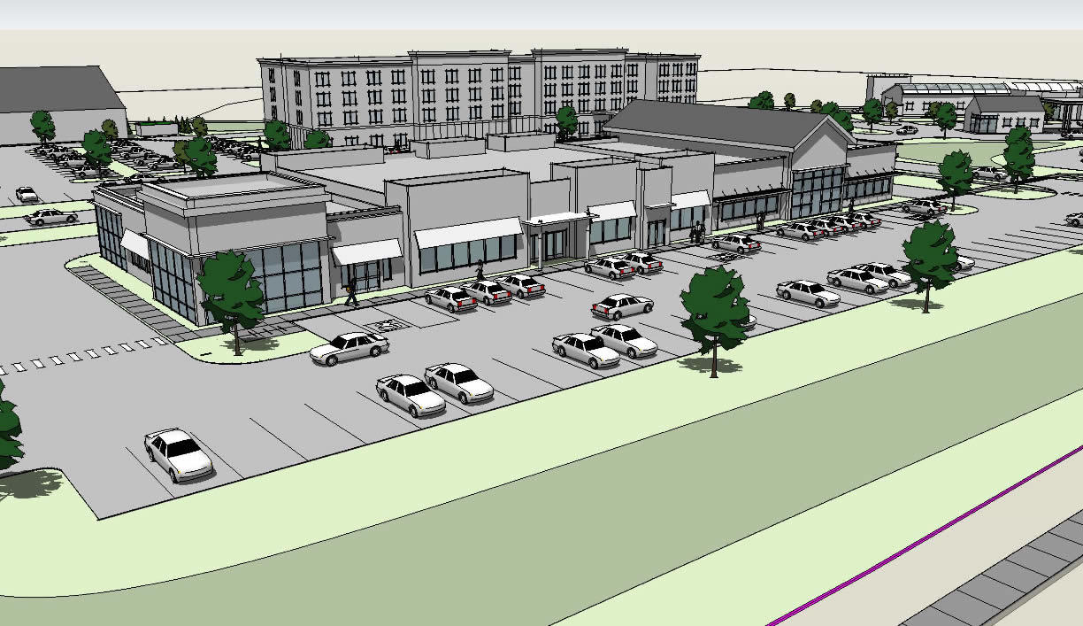
There's a new, bigger proposal for residential + retail development on New Scotland Ave across from St. Peter's Hospital
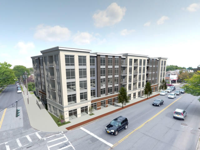
A rendering of the building that would stand at New Scotland and South Allen in the new proposal.
There's proposal for a new residential/retail development across from St. Peter's Hospital on New Scotland Ave is back -- bigger, this time, and will a new developer.
In planning docs filed with the city of Albany, the Jankow Companies is proposing to demolish seven structures on the site to make way for four new buildings that would include 188 apartments along with more than 13,000 square feet of retail.
You might remember a somewhat similar proposal -- "New Scotland Village" -- came up late last year under a different developer. It prompted a strong negative response from neighbors, and the planning board was less than impressed with that design.
This new proposal is one of 14 projects on the tentative agenda for the November 15 Albany planning board meeting -- there's a workshop meeting about the agenda, open to the public, tonight (Monday, November 5) at 5:45 pm at the 200 Henry Johnson building.
That tentative agenda includes a bunch of high-profile and/or controversial projects. So here's a quick overview of the new New Scotland Ave proposal, and a few bits about the rest of the projects.
Here's a chance to provide input on how the city of Albany should spend $10 million downtown
Back in September the city of Albany won the latest round of the state's Downtown Revitalization Initiative and it's now in line to get $10 million for a variety of projects. And next Wednesday, November 7 there's a public meeting at the The Palace to talk about how to spend that money. Blurbage:
The city's DRI application focused on the Clinton Square section of downtown, a gateway into the city off 787 and the intersection of downtown proper, Sheridan Hollow, Arbor Hill, and the area that sits between downtown and the Warehouse District. The application specifically names a bunch of projects that could be in line for funding. The Skyway, affordable housing, and streetscape improvements were among the proposed ideas (see that link).
But, as we pointed out in September, those projects aren't necessarily guaranteed to get a slice of the money. That decisions about which projects get money -- and how much -- will be part of a plan developed by the city and a committee. Here's a list of the members of that committee.
So, if there's a particular project or projects in that area that you think should definitely get funding (or conversely, shouldn't get funding), this is a chance to say something.
The public meeting is Wednesday, November 7 from 6:30-8 pm at The Palace.
That look at traffic and pedestrian safety along New Scotland Ave is happening, and there's a meeting coming up to talk about it
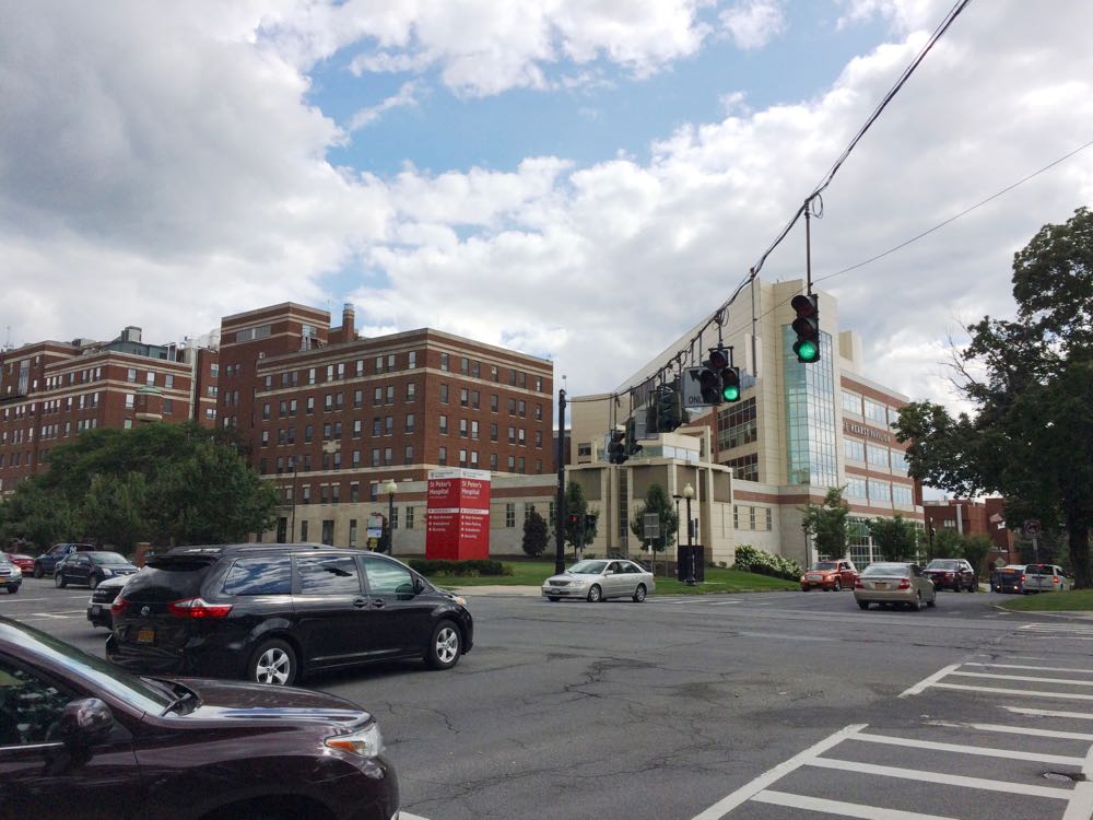
The city of Albany has a public meeting November 13 to talk about the long-awaited New Scotland/Whitehall/Buckingham Corridor Traffic Study.
You might remember the city announced back in August 2017 that St. Peter's Health Partners was putting up $100k to study what mayor Kathy Sheehan described as "a significant increase in traffic" along the New Scotland Ave corridor, a major channel for the daily influx of commuters into the city. Speeding, pedestrian safety, and congestion have all become common complaints in neighborhoods along the corridor.
The city has hired the engineering firm Creighton Manning to assist with the project. Meeting blurbage:
This meeting will provide a brief overview of the study and draft project objectives. Community members will also have an opportunity to provide comments regarding existing needs and ideas for transportation improvements, and will help shape the future traffic patterns in this
It will be interesting to hear some of the ideas for the corridor. There are certainly some things that could be done with the street itself. Example: The segment of New Scotland from St. Peter's to Buckingham currently has a make-your-own-rules feel because of the (lack of) design and marking.
But it's also probably true that addressing the issues people are concerned about will also mean changing behaviors and other patterns. Is it possible for St. Peter's and Albany Med and other employers along the corridor to get fewer people driving to work alone? Are there ways to encourage development and residential choices so that more people can walk or bike to where they're going along the corridor?
There are a lot of pieces to fit together.
The public meeting is Tuesday, November 13 from 5:30-7:00 pm at the Mercy Auditorium at St. Peter's Hospital's 310 South Manning Blvd building. It's across the street from the main hospital building.
By the way: That's the same night at the South End Connector Trail meeting at the Howe Branch of the APL. That meeting's open house starts at 7 pm.
Earlier and elsewhere
+ Studying one of the channels of the daily commuting tide into and out of Albany
+ Parking as a daily choice
+ CityLab: Durham's Plan to 'Nudge' Drivers Out of Cars
The city of Albany is planning to start building that connector between the rail trail and the riverfront next year -- and there's a chance next month to see the plans
One of the renderings from 2017 of what the section under 787 might look like.
The city of Albany will show off the concept plans for the South End Connector Trail at a public meeting November 13 at the Howe Branch of the Albany Public Library.
The South End Connector is planned to be a roughly two-mile path to connect the end of the Helderberg Hudson Rail Trail in the South End with the Mohawk Hudson Bike Hike Trail along the riverfront. The public planning process for the project started more than two years ago, and the city and its consultants unveiled a plan in May 2017.
It's an important project because of the connection it will form between the two popular bike trails and the progress toward building a larger regional trail network. And it also potentially will open a safer way for people in the South End to get to the riverfront.
There are a two bits of news in the city's meeting announcement:
+ The city says it's anticipating that construction of the project's multi-use pathwill start in the summer of 2019.
+ A second phase -- that "include enhancements such as additional lighting and public art to the section of the route that goes under I-787" -- is scheduled for 2020. The city is calling that segment the "South End Connector Underline."
The public meeting is Tuesday, November 13 at at the Howe Branch of the APL (105 Schuyler Street). There's an open house from 7-7:30 pm and a project presentation from 7:30-8:30 pm.
Earlier
+ The plan to connect two major bike paths at the Albany waterfront (2017 May)
+ Plotting a path for the Albany waterfront bike trail connector (2016 June)
+ Mapping out the future for an alternative transportation network in the Capital District (2018 September)
+ Elsewhere: "Miami's Underline underscores potential of park projects" [Curbed]
The saga of the Western Ave apartment project and more exciting tales of the Albany Planning Board
One of the latest renderings for the proposed 1211 Western Ave apartment project.
Exciting Tales of the Albany Planning Board is a program recorded before a live studio audience once a month in which the fates of multi-million dollar projects around the city are (partially) decided.
This month: The ongoing fight over a big apartment project on Western Ave, a place for school buses, a gym plan delayed, and the conversion of a tiny church...
There's another public meeting coming up to talk about ideas for 1 Monument Square
The fifth major attempt to redevelop the 1 Monument Square site in the heart of downtown Troy takes another step November 5 with a public meeting to formally present ideas developed during the public planning sessions this past summer.
City press release blurbage:
During the meeting, project designers and planners will present a refined concept for the site. Following the presentation, the City, along with the design team, will analyze project costs, available grant funding, and other factors necessary to move the project forward. The City previously held a multi-day workshop to study the site, inviting Troy residents, business owners, employees and the general public to participate in developing a shared vision for the One Monument Square site. The feedback provided during the meetings were used to develop a series of site illustrations which feature significant open public space, two levels of parking, views of the Hudson River, and pedestrian connections down to the adjacent William D. Chamberlain Riverfront Park.
Officials have said the idea this time around is to figure out some sort of consensus on how the site should be used before finding developers interested in the site.
This next meeting is Monday, November 5 at 7 pm at the Arts Center of the Capita Region (265 River Street).
Earlier: Five takeaways from the start of the fifth major effort to redevelop 1 Monument Square
A year later I'm still using a bike to get around town -- here are a few thoughts about how that's worked out

About this time last year I shared how I ended up becoming a person who uses a bike as one of my primary ways of of getting around town.
A year later I am still that person. (Even the Times Union says I'm a cyclist.)
And here are a few thoughts about how that's worked out...
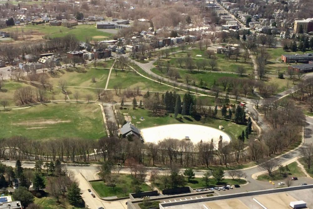
Talking about the future of Lincoln Park
You could understand if Albany's Lincoln Park feels a little left out.
Washington Park gets the events, the tulips, the Instagram pics, the fame. It's the older sibling, the first born, the one who gets all the praise and attention.
Meanwhile, Lincoln Park stands not that far away, roughly the same size, with a loved-but-leaky pool, some sports fields, and an overgrown ravine. It hasn't had any sort of official, overall planning done for it in more than a century.
That's now changing. The city of Albany has started a process to develop a master plan for Lincoln Park. And it's brought in a consulting firm, Stimson, to help things along.
"It's like no other park in Albany and it's really of a huge scale," said Stimson's Glen Valentine at a public meeting to gather input this week at Hackett Middle School. "And we hope that this will lead to those kind of big ideas because people aren't afraid in this forum to speak whatever they want to do, whatever they think is interesting."
Here's an overview of the ideas that have bubbled up so far...
Walkable Albany survey
The new local group Walkable Albany has posted a survey looking for public feedback about places in the city that could use some attention in terms of pedestrian amenities and safety. Survey blurbage:
Walkable Albany is seeking your input about what places in Albany need improvement so that we can build a list of places in Albany to focus on in our advocacy efforts.
Walkable Albany is a group of Albanians who want to advocate for better streets. We believe Albany is a beautiful city with a historic walkable core and transit-friendly outer neighborhoods. Its core should be embraced for its walkable urban potential and its outer neighborhoods should be improved to make walking easier, safer, and more useful.
Pedestrian safety and complete streets should be a top priority for the City of Albany. Neighborhood and downtown streets should be designed to protect pedestrians and slow traffic whenever it is appropriate. Safe spaces for all road users, including bicyclists and alternative transportation options, are essential.
These sorts of topics -- walkability, dangerous intersections, urban planning -- get discussed fairly often here at AOA, so we figured you might be interested in this survey.
The founder of Walkable Albany is Andrew Neidhardt. The group has a meeting next Monday, October 15 at the Washington Ave Branch of the Albany Public Library at 6:30 pm.
A call for ideas for Rensselaer Riverfront Park
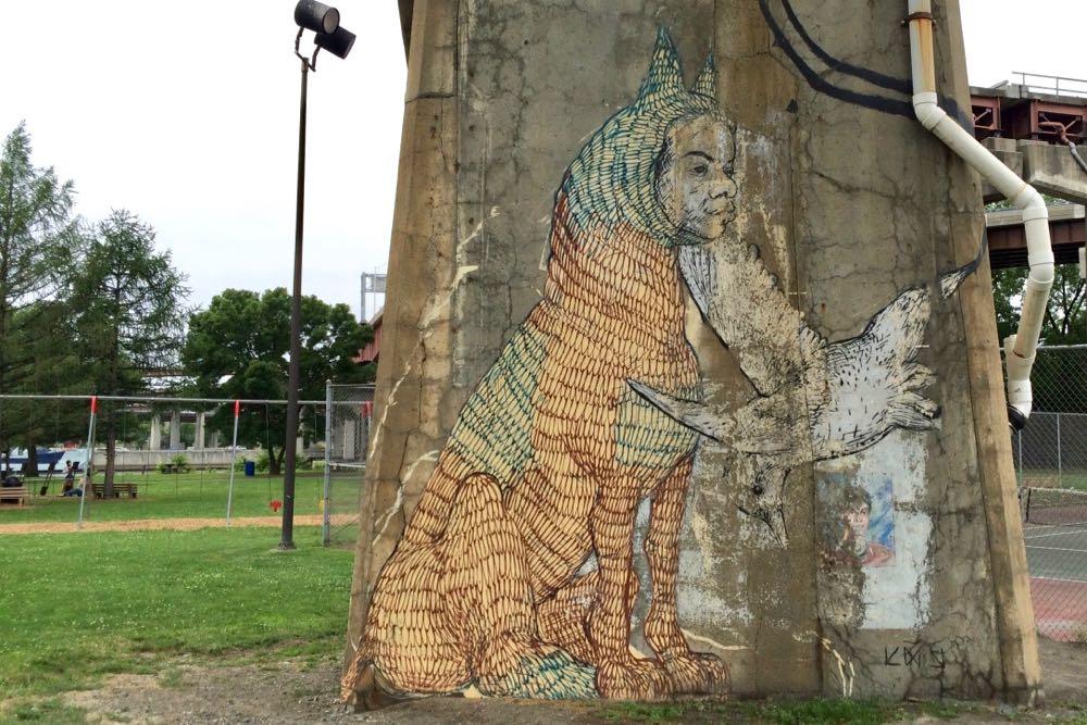
One of the murals in Rensselaer's Riverfront Park.
The city of Rensselaer is looking to make some improvements to its Riverfront Park -- and it's hoping you have some ideas.
There's a quick online survey asking people about their preferences for updated park amenities such as new lighting, pathways, benches, or even the many murals that are around the park. The survey will be collecting responses through November 15. (There are also physical copies of the survey at City Hall and the Rensselaer Public Library.)
Ketura Vics -- the assistant director of planning and development for Rensselaer -- said the city has $125,000 state grant via Assembly member John McDonald to pay for improvements, so it wants to get a sense of what's important to people. And while the city won't be able to make every suggested improvement -- that money will only go so far -- the feedback will also allow the city to plan for the future.
Speaking of the future... Rensselaer recently officially opened a new esplanade just a bit north of Riverfront Park. And Vics said via email the city is thinking about the bigger picture here: "As the city continues to grow and develop, we hope to have trails all along the waterfront and through the city that are connected via 'complete street' designs in order to improve access and mobility throughout our small, linear city."
Albany-Rensselaer
We've mentioned this a few times before, but it's worth saying again: The cities of Albany and Rensselaer could both benefit from a better pedestrian/bike/whatever connection across the river.
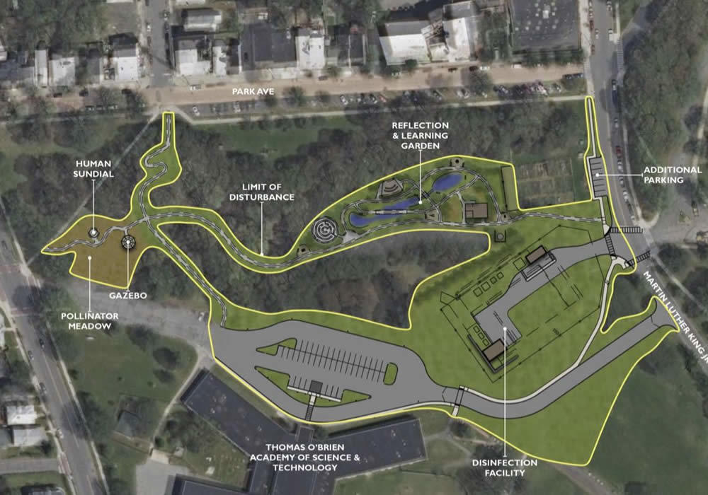
An update on what's in the works for the public portion of that sewer project in Lincoln Park
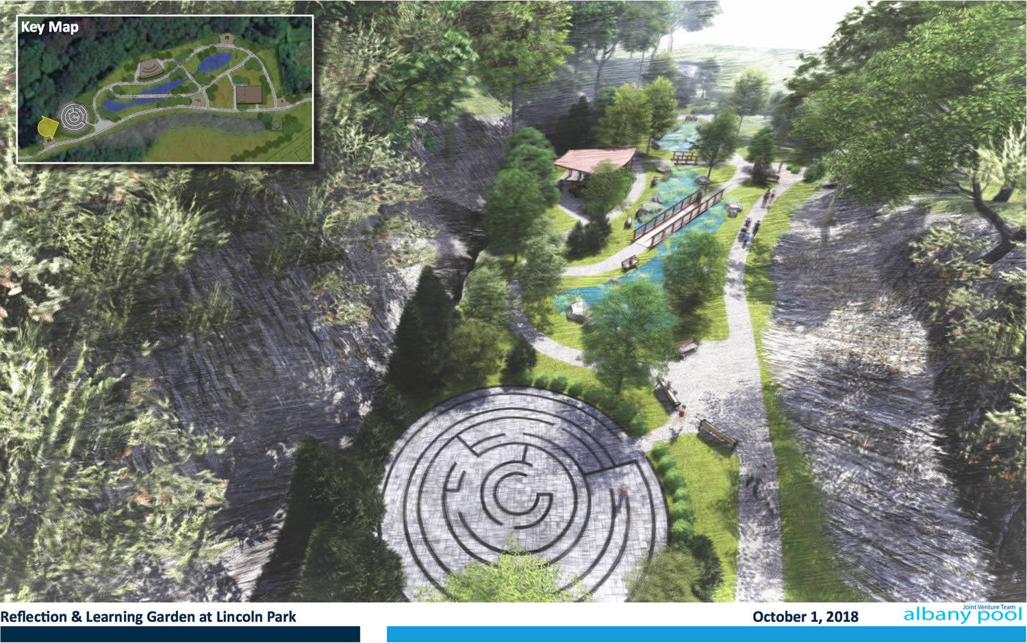
A sketch of what the proposed meditation labyrinth and garden could look like.
Here's a quick update on that reflection and learning garden* that's to go along with the planned Beaver Creek Clean River Project sewer facility in Albany's Lincoln Park.
Here are the city-posted notes from the latest meeting of the community board that's providing input on the project. They include updates from CHA -- the firm working with the city on the project -- about the possible design for the indoor/outdoor classroom, meditation labyrinth, walking paths, play structures, and wetland that would occupy the Beaver Creek ravine.
There are also new renderings of the possible design, and they're probably the fastest way of getting a sense of what's being discussed. So we've clipped a few of them -- see below.
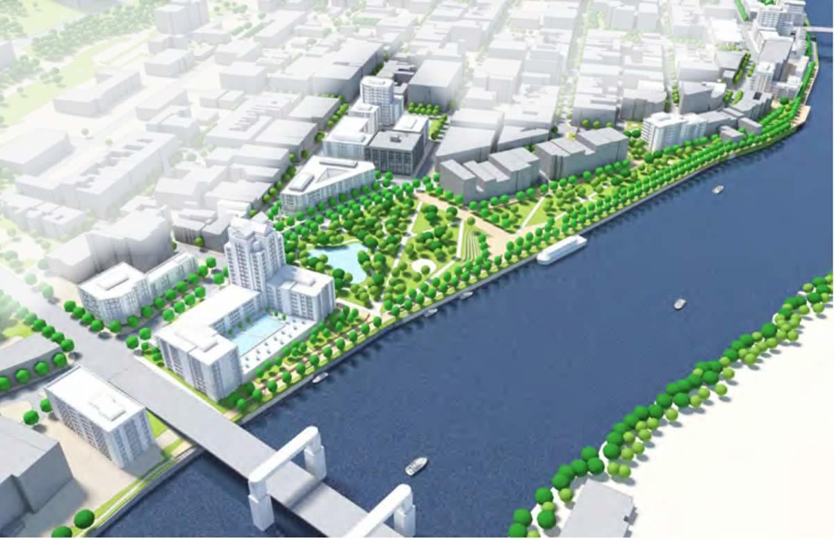
Downtown Albany is in line to get $10 million from the state -- here are some of the projects that could get a slice of that money
A rendering of a potential gateway at Broadway and Clinton that Capitalize Albany released last year.
A bunch of projects in downtown Albany are in line to get a slice of a $10 million block of money from New York State after the city was named one of the winners in the latest round of the state's Downtown Revitalization Initiative.
Specifically, Capitalize Albany -- the development arm of the city -- put together an application that focused on the Clinton Square area of downtown. It's the section more or less centered on the intersection of North Pearl Street and Clinton Ave. The pitch was that this area is a major gateway to the city, is the interface for multiple neighborhoods, and already has some momentum in the form of real estate development, affordable housing, and the arts.
Albany was in the running against a handful of other cities in this region, including Troy and Cohoes.
So what's up for the cash? Here's the list, along with a few thoughts.
Here's a chance to help map out the future of Albany's Lincoln Park
What should be the future of Albany's Lincoln Park?
That's the question at the center of a public meeting the city of Albany has lined up for October 9 as it works toward putting a master plan for the large park. Blurbage:
Mayor Kathy Sheehan, the City of Albany Department of Planning & Development, and STIMSON Studio Landscape Architects will host a public meeting to provide an overview and receive community input regarding the Lincoln Park Master Plan design project. This is an exciting opportunity for residents, visitors, and community organizations to learn about the original design intent of Lincoln Park, take part in shaping its future, and help to prioritize projects and initiatives within the Park.
The meeting is Tuesday, October 9 at 6:30 pm at Hackett Middle School (45 Delaware Ave). If you can't make it to the meeting and want to offer a comment -- or just feel comfortable submitting a prepared statement -- there's ran online comment form.
Lincoln Park occupied a big chunk of Albany's south side, almost 70 acres.* And in addition to figuring an overall plan for the future and potential upgrades, there are two important projects facing the city there:
+ The Albany Water Department is planning the Beaver Creek Clean River Project, a sewer facility that's part of an effort to reduce sewage overflows in the Hudson River. The largely underground facility would also add some park amenities and address a longstanding problem with a sewer line and a ravine.
+ The Lincoln Park Pool is leaking huge amounts of water and has probably reached the end of its life. The city needs map out a plan for the next version of the pool.
So there's a lot to talk about.
* Washington Park is a little more than 80 acres.
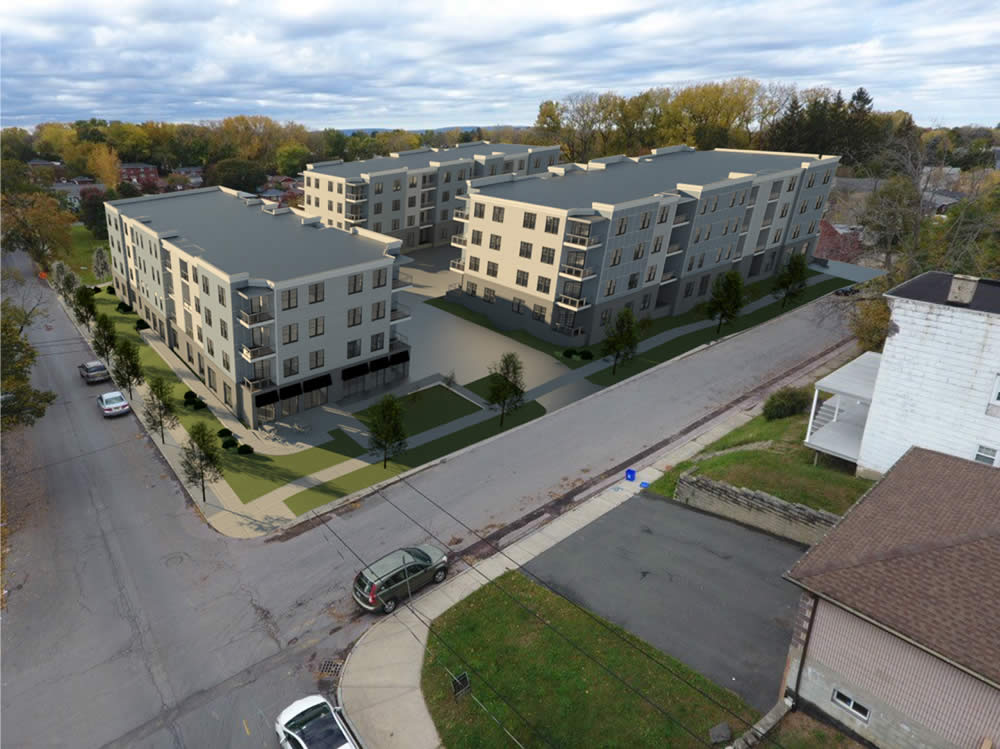
The Kenmore Hotel and Steuben Club, uproar on Elm Street, and other exciting tales of the Albany Planning Board
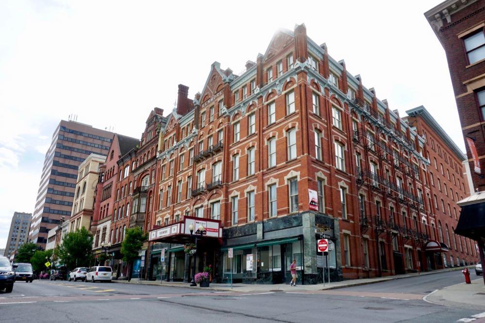
Exciting Tales of the Albany Planning Board is a program recorded before a live studio audience once a month in which the fates of multi-million dollar projects around the city are (partially) decided.
This month: uproar over infill development in Hudson/Park, the plans for the old Steuben Club and Kenmore Hotel downtown, taking over a street segment, demolitions, and school buses...
The old riverfront and the old bridge
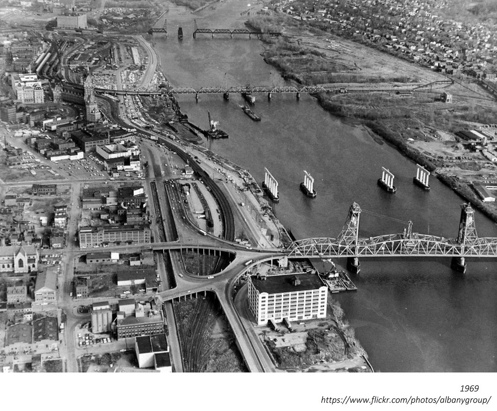
Random historical photo we stumbled across while looking for something else: This aerial photo of the Albany riverfront is from 1969 and shows the old Dunn Memorial Bridge as the new (that is, current) Dunn is being constructed just up river. It's from the local history rabbit hole that is the Albany Group Archive on Flickr.
Two things about this photo:
1. There is an ongoing conversation about how Albany can make its riverfront more accessible and hospitable to people. And one of the things that often gets lost in that discussion is that Albany riverfront has really been a place for people in a very long time. Like, a century or more. That's not say it shouldn't be in the future -- it just provides some context for the challenge.
2. The old Dunn Memorial Bridge had a section that lifted to make way for passing ships, sort of like the Green Island Bridge does today. That allowed the bridge to be closer to the water, and as a result, its connections on either end were much closer to street level. See the photo below -- also from the Albany Group Archive.
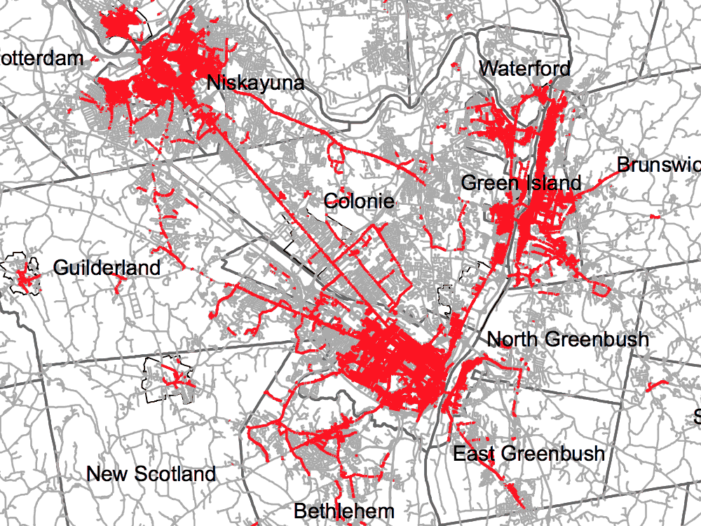
Mapping out the future for an alternative transportation network in the Capital District
The Capital Region already has a handful of popular biking and walking trails, but if you zoom out a little bit and look at the whole picture you can the see the outline of something a lot bigger.
That something is what Jennifer Ceponis, a senior transportation planner for the Capital District Transportation Committee, describes as an alternative transportation network: "Much like we have a highway system for cars -- with supporting roads and arterials that feed into that -- we want people to be thinking that the region can have a similar system but for bicycling, walking, and other recreational activities."
Toward that goal, the planning org has put together the Capital District Trails Plan, a map toward a future in which you might be able to ride a bike from, say, Voorheesville to Saratoga Springs and beyond on a network of paths.
Here are a few highlights.
Laying out a new path for Maiden Lane, one of Albany's very oldest streets
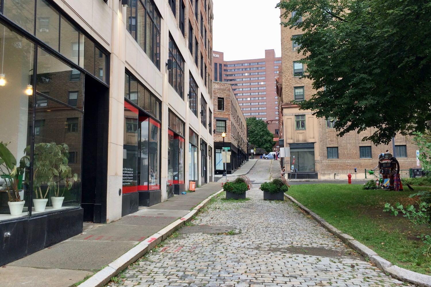
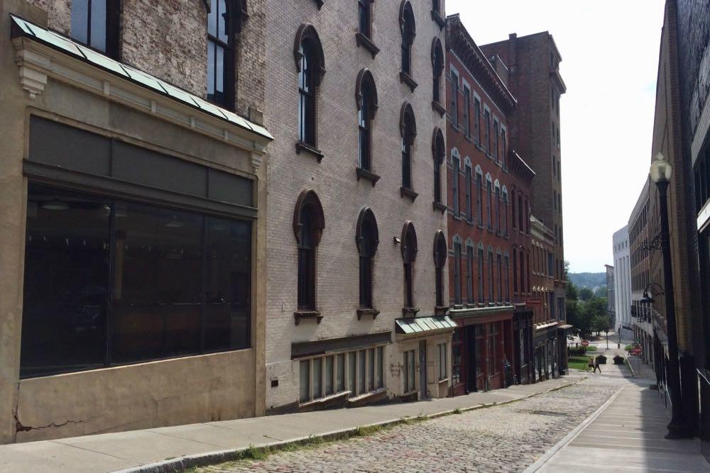
Maiden Lane is one of Albany's oldest streets -- it dates back to the mid 1600s -- with a scale that makes it feel today like it's from a different time.
It's also a path straight from the heart of downtown to the pedestrian bridge leading over to Corning Riverfront Park and the waterfront.
But the current design and streetscape in that part of town don't really do a good job of communicating those ideas or drawing people in.
So the city of Albany is looking to change things up.
Here's what's in the mix...
Talking about a new look for one of Albany's oldest streets
Is there a new look for one of Albany's oldest streets?
That's one of the questions what will be at the center of a public meeting this Thursday, September 6 about the future of Maiden Lane in downtown Albany. The city's planning department is bringing in a consultant to gather input toward using "urban design, lighting, and landscape architecture to create a visible gateway to Albany's waterfront from the City's downtown core." The city says it would like to hear from "residents, visitors, and businesses."
Specifically, the project will be looking at the area that includes Maiden Lane from Pearl to the pedestrian bridge over 787 to the waterfront, along with pieces of nearby Pine Street, the small wedge of a park between the two streets, and the chunk of Broadway there. Here's the request for proposals the city issued earlier this year. (There's also a clip from that below.)
The meeting is Thursday from 5:30-7:30 pm in the arcade of the Arcade Building at Broadway and Maiden Lane (488 Broadway).
The long past, leaky present, and uncertain future of the Lincoln Park Pool
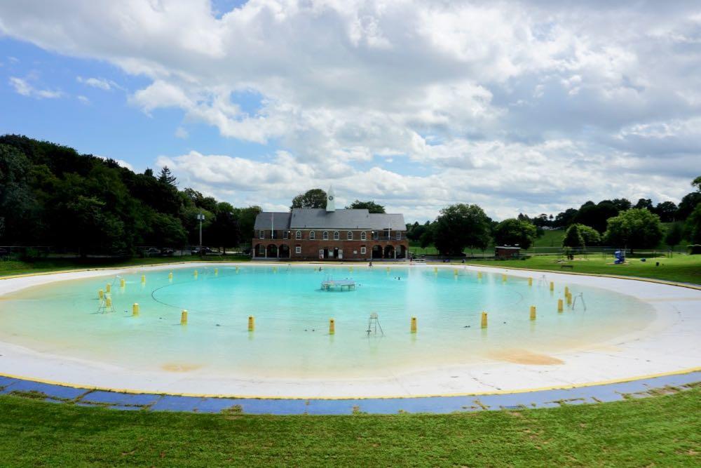
Albany's Lincoln Park Pool will close out its current season on Labor Day. It's the 86th season the pool has been open as a place for people from the city and beyond to splash around, learn to swim, cool off, and relax on a summer day.
It's a landmark space. And it's near the end of its current life.
The pool first opened in 1931 and all those years are showing. It has cracked surfaces, operates below its designed capacity, and doesn't measure up to modern codes. Most notably, the pool simply struggles to hold water, leaking as much as 500,000 gallons a day.
That condition prompted a consultant hired by the city to conclude last fall that the Lincoln Park Pool has reached the end of its useful life and should be completely replaced.
The price tag for that? Maybe as much as $12 million.
Another large residential project in downtown Albany that's part of a package of notable projects, and other exciting tales of the Albany Planning Board
This building in downtown Albany is in line to become 133 apartments -- and get another story.
Exciting Tales of the Albany Planning Board is a program recorded before a live studio audience once a month in which the fates of multi-million dollar projects around the city are (partially) decided.
This month: The first in a series of notable developments for downtown Albany, a tear-down-and-rebuild in Park South, and potential new life for a problem property...
The Albany airport's getting terminal upgrades, a new parking garage, and a new connector road from Exit 4
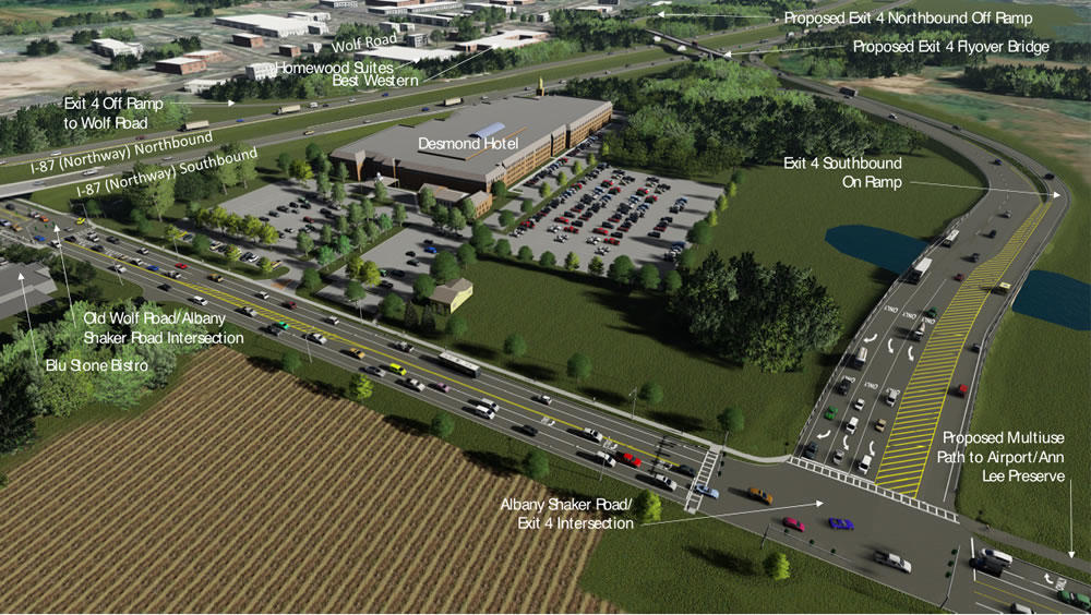
The Albany International Airport is set to get terminal upgrades and a new parking garage as part of a $42 million renovation -- and there's now a set plan for a new "airport connector" roadway at Exit 4 off the Northway.
The Cuomo admin announced the upgrades and exit reconfiguration Tuesday. Press release blurbage about the planned upgrades for ALB, for which the state is chipping in $22 million and the Albany County Airport Authority is providing the rest:
New Parking Garage -- The project will construct a 1,000-unit, multi-level parking garage, expanding airport parking capacity by 20 percent. The pre-cast concrete garage will provide a heated pedestrian walkway to the airport terminal. Energy-efficient LED lights will illuminate that bridge, enhancing visibility as well as vehicular and pedestrian safety.
Parking Access Improvements -- The project will install new LED electronic signage, car counting devices, and interactive access control devices that utilize advanced GPS technology to locate available parking spaces and provide wayfinding messages that direct motorists to them. The existing parking system is nearly 20 years old and its electronic controls are in disrepair.
Terminal Rehabilitation and Passenger Amenities - The project will rehabilitate the terminal, including escalators, restrooms, waiting rooms and the food court. Improvements will include new carpets, wall finishes, tile floors, energy-efficient lighting fixtures and better Internet connectivity.
(We hope the airport's art gallery and public art get some dollars, too -- they're our favorite part of ALB.)
And here are some bits -- and explainer renderings -- about the new $50 million airport connector roadway and the reconfiguration at exits 4 and 5:
Here's the proposed design for the Albany Skyway
Over the years thousands of people have driven along the off-ramp leading to Clinton Ave in downtown Albany that's in line to become the Albany Skyway elevated park. But walked the almost half-mile curve? That's probably just a handful.
"It was an amazing surprise to be walking on the Skyway," said Capitalize Albany president Sarah Reginelli, one of the few people to trace the route on foot. "Even with none of the amenities in place, it was still this really enchanting walk because you get all of these vistas and vantage points you wouldn't otherwise."
Last week at The Palace, Capitalize Albany -- the city of Albany's economic development arm -- presented the work of the team that's been designing the Albany Skyway.
Here are a handful of renderings, bits about the design plan and cost, along with a few questions and thoughts.
A piece of street with new purpose
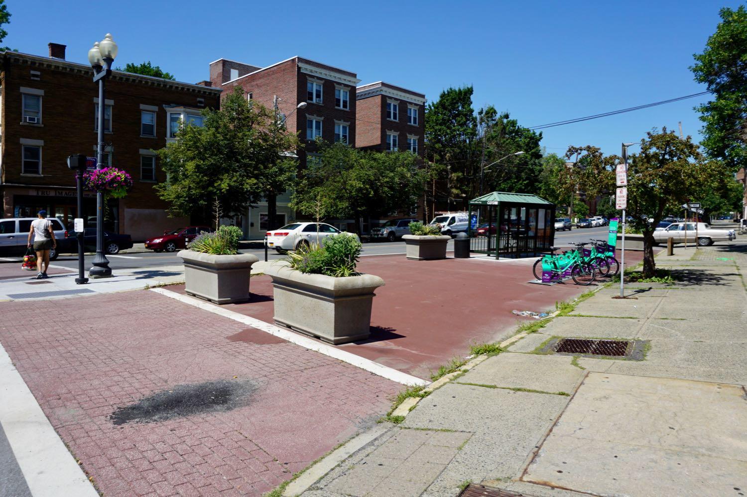
Check out this re-purposed street segment at Washington Ave and Henry Johnson Boulevard in Albany. The segment is closed off and now serves as bus stop and parking spot for a bike share hub. (Here's how it looked before.)
That bus stop is one of the new/moved stops connected the new consolidated bus stop / pedestrian upgrades on Washington Ave at the Albany Public Library. The consolidated stop allows the #10 (Western Ave) and $12 (Washington Ave) to run straight up their respective trunk streets. (The old bus stop in front of the armory didn't allow the buses enough room to switch lanes and drive along the south side of Townsend Park.)
The transportation planner/engineer term for this sort of street segment is a "slip lane."
An opinion on blood plasma centers, methadone clinics, a large logo, and other exciting tales of the Albany Planning Board
There's been a lot of back and forth about this space (even though it's technically not about this space specifically).
Exciting Tales of the Albany Planning Board is a program recorded before a live studio audience once a month in which the fates of multi-million dollar projects around the city are (partially) decided.
This month's much-belated edition: blood plasma centers, methadone clinics, an elementary school, and a large logo....
Checking out the new Rensselaer esplanade
We got a chance Friday afternoon to hop over the river and check out the new esplanade along the riverfront in Rensselaer. There are some large-format photos below if you'd like to gawk a bit.
The city formally announced the opening of the $3.1 million project that morning. The 1,000-foot-long linear park, which was funded by the state, currently includes a walkway along the river and really some nice views of the Albany skyline.
That said, there's not a lot there right now. The park is tucked behind the deLaet's Landing construction site where Broadway passes over the Amtrak tracks. And you have to walk along a gravel construction road to reach the park.
But you can see how it's the start of something. When the park's fully completed it will have a bike path and the possibility of hosting outdoor events. And the deLaet's Landing project -- it's the under-construction building you can see from the Jennings Landing in Albany -- will include 96 residential units and some commercial retail space. So there's some room for interesting things to happen.
More connections
One other thing: Seeing the esplanade reinforced the idea for us that the cities of Albany and Rensselaer could both benefit from a better pedestrian/bike/whatever connection across the river. Between the improvements in Corning Riverfront Park, the in-planning Albany Skyway, the development at the Rensselaer esplanade, and the plans for the Albany South End Connector and the Albany-Hudson Electric Trail, there are possibilities to create an interesting cross-river zone (if that's the word) of parks and trails and even commuting.
It's just one more reason to think about how to incorporate a pedestrian/bike path on the next version of the nearby Livingston Ave Bridge.
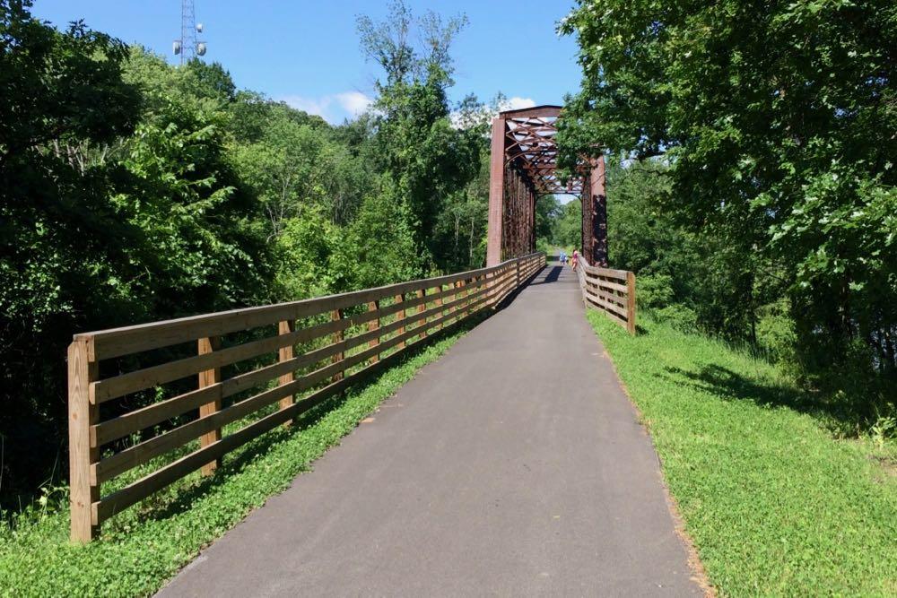
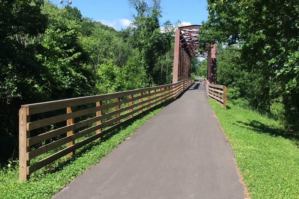
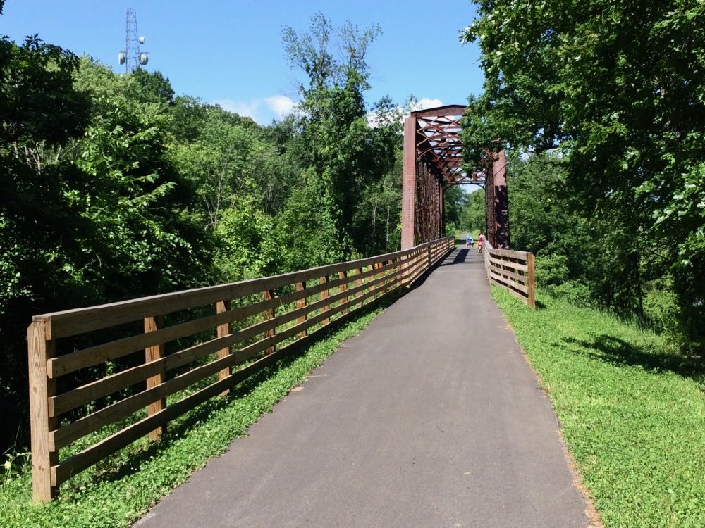
A few more bits about the present and future of the Helderberg-Hudson Rail Trail
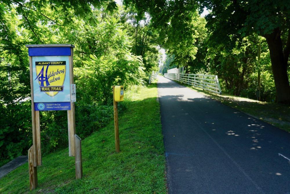
The second segment of Albany County's Helderberg-Hudson Rail Trail is now paved -- as noted earlier this week -- meaning there's now 9 miles of (almost) continuous pavement from the South End in Albany all the way out to Voorheesville.
We got a chance this week to talk with Albany County exec Dan McCoy about the present and future of the popular trail.
"I go around doing my state of the county every year, people are like rooting us on -- when's it going to be done, when's it going to be done, when are you going to fix the problem with it," McCoy said in reference to the remarkable popularity of the rail trail. "And these are good issues to have."
Here are a few bits about paving, the depot building in Slingerlands, new amenities, bathrooms, bike share, and what's still ahead...
Here's the new consolidated CDTA stop / pedestrian upgrades at Washington and Lark
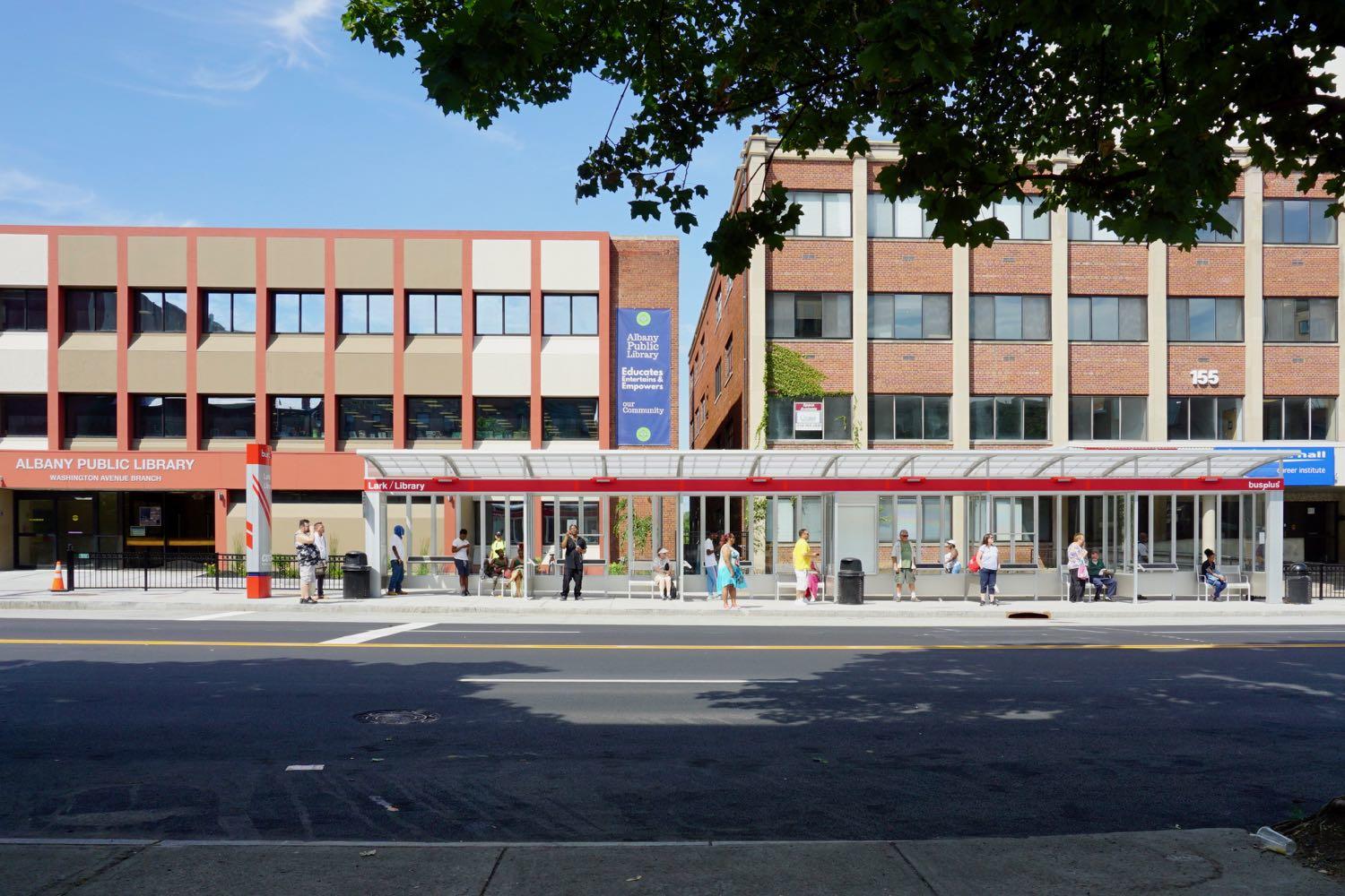
Some quick follow-up about that project to consolidate the bus stops near Washington Ave and Lark Street and add in a few pedestrian amenities. (The project has been in the works for a few years and there was some drama involved.)
The new bus stop shelter is installed in front of the Albany Public Library. The new mid-block traffic signal and cross walk is operating. (The queue jumper light for the bus wasn't unwrapped as of Tuesday.) And this past Sunday CDTA switched a bunch of bus lines over to the stop and their new, more streamlined routes west. Update: Here are large-format diagrams from CDTA explaining the route and stop changes.
The eastbound -- that is, toward downtown -- routes and stops didn't change.
The goal of the project was to make the intersection work better for buses and pedestrians. The previous stop arrangement was cramped, and it forced the the lines headed west along Western and Washington to first make their way up Central and then cut back to their intended path. The new consolidate stop has more space and allows the buses to directly head up either Washington or Western.
And the new mid-block signal and crosswalk is intended to make it safer to cross the long block between Lark and Dove. (So use the crosswalk!)
The cost of the project was $1.3 million and it was backed by state and federal money.
Here are a few more pics -- and those diagrams -- if you'd like gawk...
The Madison Ave traffic calming project is finished -- so what's next?
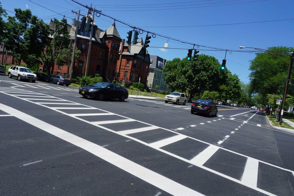
The new section of the Madison Ave traffic calming project in Albany -- the "road diet" -- has been in place for more than a week. But now it's press conference-official after an event this past Friday.
"Investments like these help to spur economic development and we need to be focused on growing our tax base, growing businesses, making sure that our neighborhoods are neighborhoods of choice for people so that we can continue to attract them to the City of Albany," said mayor Kathy Sheehan after the event at Madison and South Lake. "So this was about taking that opportunity of looking at the fact that we were going to repave this road and building an infrastructure that helps to make everybody safer."
And people have had a lot to say about this project. During the planning process, during the first phase, and now that it's finished.
So here are a few more things -- about new amenities that aren't bike lanes, about the city figuring out how to implement these sorts of ideas faster, and what might be next.
Splitting up buildings for apartments, in-fill development in Arbor Hill, school expansions and other exciting tales of the Albany planning board
In-fill residential development Rehabilitation Support Services has planned for Arbor Hill.
Exciting Tales of the Albany Planning Board is a program recorded before a live studio audience once a month in which the fates of multi-million dollar projects around the city are (partially) decided.
This month's much-belated edition: splitting up homes in apartments, school expansions, in-fill development in Arbor Hill, a new gym for Albany Academy....
Here are the upgrades in the mix for the commercial strip along New Scotland Ave in the Helderberg neighborhood
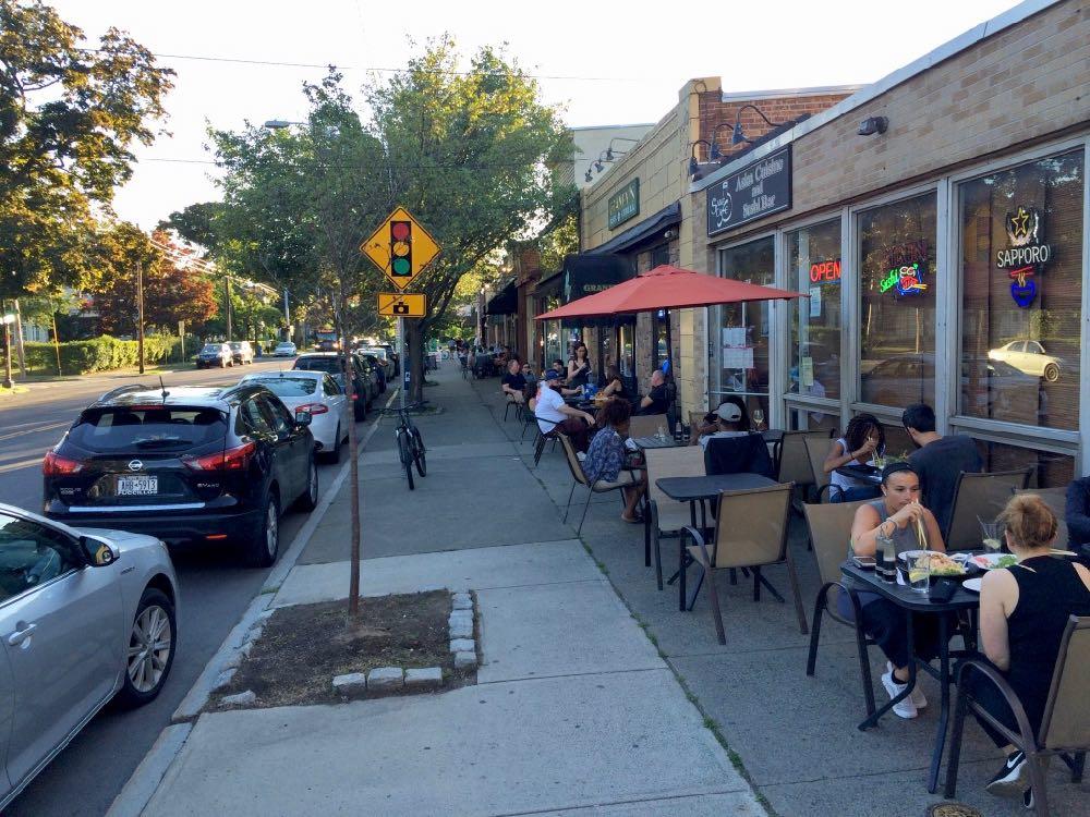
New sidewalks. New lamp posts. New trees. Maybe some safer pedestrian crossings.
Those elements are in the mix for the commercial strip along New Scotland Ave between Quail and Ontario, one of Albany's most vibrant neighborhood retail spots. (It's the strip with The Fountain, Restaurant Navona, Albany Ale & Oyster, Sake Cafe, the Capital City Gastropub and many other establishments.)
There was a public meeting about the planned upgrades this past Monday (as mentioned). Here's a quick recap about what's up.
Cruising along the second phase of the Madison Ave Road Diet
We got a chance to bike along the new section of the Madison Ave traffic calming project late Monday afternoon. New pavement + freshly-striped bike lanes = a nice ride, even alongside plenty of vehicle traffic.
The second phase of the "road diet" stretches from Partridge to Lark. It's part of an overall effort to reconfiguration the Madison Ave corridor from Allen to Lark to increase road safety and amenities for cyclists and pedestrians.
The new layout replaced a four-lane configuration (two vehicle lanes in each direction) with a three-lane layout (one vehicle lane in each direction, with a turn lane in the middle) and bike lanes on each side. Phase two also includes new traffic and pedestrians signals. Those signals are one of the keys to project -- traffic modeling indicated that signal coordination should be able to keep vehicle traffic travel times along the corridor at levels close to the old layout.
The new section isn't quite finished. Some of the striping -- including the zones for buses -- isn't down yet. But the city said Monday that the phase will be completed soon -- probably within the next week or so.
We'll circle back around to the project when it's officially complete (Update: And here's that post.), but just on first look it's remarkable how much different the corridor feels with the new configuration.
Here are a few more pics if you'd like to gawk...
Gawking at another city's elevated linear park
For Albany Skyway inspiration / comparison / gawking: That video embedded above is a short aerial clip of the new Rail Park in Philadelphia, a former elevated rail line that's been turned into a quarter-mile linear park. It's part of an overall plan to create a 3-mile park along the rail line with sections at various elevations.
From an article about the park at Architects Newspaper:
The first section of the linear park, located on the northern edge of Center City and designed by landscape architects Studio Bryan Hanes, reflects the neighborhood's industrial past. Native plants and trees were planted on top of the viaduct's steel arches, and remnants of the embedded rail track are woven throughout the zigzagging walkway. Riveted I-beams have been turned into seating, and structural steel beams are used to support the hanging benches. A timeline of the neighborhood and a historical list of the city's industrial manufacturers have been cut into a weathered Cor-ten steel "history wall" that visitors can walk beside.
Unlike New York's High Line, the Rail Park is wide enough to include both dedicated bike trails and footpaths for pedestrians, creating new links to traditionally underserved neighborhoods when the three-mile-long park is complete.
This first section cost a little less than $11 million to construct. (It sounds like Friends of the Rail Park is trying to cobble together money for all sorts of sources. ) There are more photos at the Rail Park Instagram.
And over at Plan Philly there's a long look at how the park came to be and the some of the tensions that were part of its creation.
Five takeaways from the start of the fifth major effort to redevelop 1 Monument Square
Monday night the city of Troy had a public workshop to kick off the fifth major attempt to redevelop the 1 Monument Square site. Yep, the fifth -- and the old city hall was only knocked down at the end of 2010.
Given all that's happened since -- arguments over form and function, allegations of incomplete disclosure, infrastructure complications, legal threats -- what hope is there that this time will be any different?
"Oh, you have to hope. We have to hope that it's going to be different," said Troy deputy mayor Monica Kurzejeski. "I think people are ready to come to the table. They're ready to have conversations. It's just the negativity is starting to -- you know, it's starting to be boring a little bit. Now we have to have some positive outreach."
For this fifth attempt, here are five takeaways from Monday's discussions...
Talking about streescape upgrades along New Scotland Ave in the Helderberg neighborhood
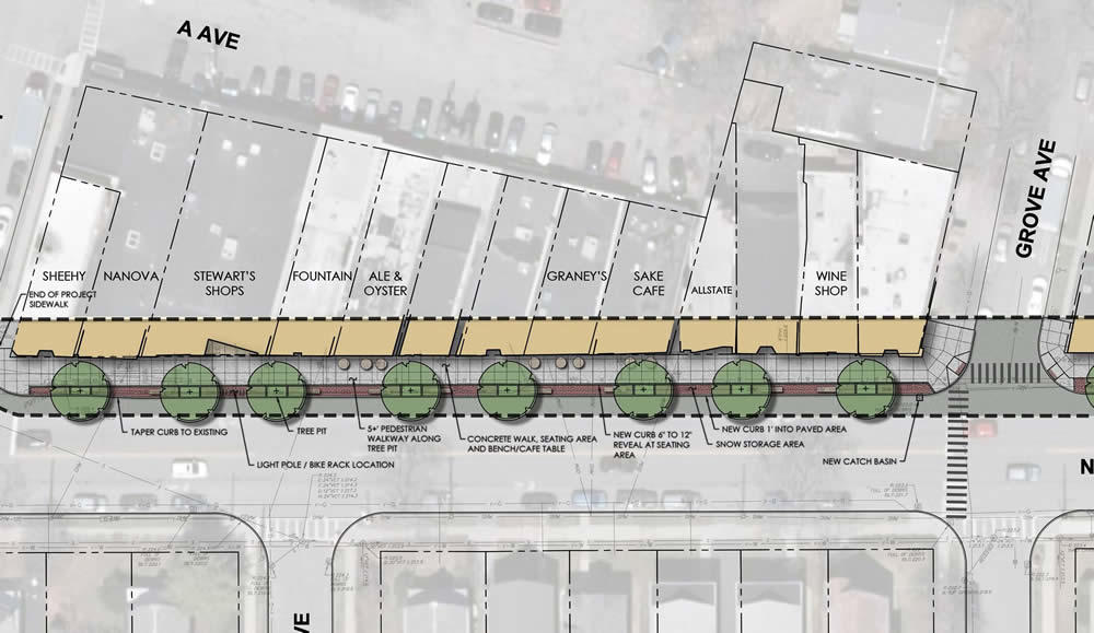
A clip from a diagram included with the event page listing. Here's the full version.
The city of Albany has a public meeting lined up for June 25 to talk about proposed streetscape upgrades along the New Scotland Ave commercial strip in the Helderberg neighborhood. Blurbage:
Join the City of Albany Department of Planning and Development and consultants from Chazen Companies for a public meeting to discuss streetscape and pedestrian improvements to the New Scotland Avenue commercial district between Ontario Street and Quail Street.
This project intends to improve traffic flow and public safety. The potential improvements may include but are not limited to:
• New granite curbing and sidewalks
• New decorative lighting
• Improved ADA access to existing buildings
• New ADA compliant pedestrian curb ramps
• New street trees
• Improved streetscaped pedestrian crossing(s) at intersections of Ontario Street, Grove Avenue and Quail Street
• Potential widening of sidewalk along the north side of New Scotland
• New amenities including benches, bike racks, signage and trash receptacles
• Public safety improvements on Avenue A including enhanced lighting
The meeting is Monday, June 25 from 6-8 pm at the First Congregational Church of Albany (405 Quail Street).
Sections of the city such as downtown or Lark Street or the Warehouse District get a lot of attention as hot spots of activity and development, but Albany has a handful of smaller retail corridors that are vibrant and add a lot to their surrounding neighborhoods in form of services, walkability, and just local places to get something to eat and hang out. And this strip along the Helderberg neighborhood is a prime example.
Now, if there's some way to get cars to actually stop for pedestrians at the cross walk at New Scotland Ave and Grove...
Earlier: Studying one of the channels of the daily commuting tide into and out of Albany
All the Capital Region's sidewalks
We enjoy both maps and sidewalks.
So, not surprisingly, we were interested in this new map of all the sidewalks in the Capital Region. That's some 1,225 miles of sidewalk.
The map is the the product of three years of work by the Capital Region Transportation Committee. It was created primarily for compliance work for the Americans with Disabilities Act, and also to assist with planning for pedestrian infrastructure.
Also: It's a map of all the sidewalks.
Here's the full map and a few bits...
An old Northeast city, historic sites, a protected bike track
Farther afield, but interesting in light of conversations here...
Check out this short Streetfilms video about the new Connect Historic Boston Bike Trail -- a protected bike lane that winds its way between historic sites in Boston. (As you might have guessed from the name.)
Boston is not Albany or Troy or Schenectady, obviously. But like the cities here, it is old and (even more) dense and in the Northeast. So apparently it's finding ways to overcome the sorts of issues and complaints that often accompany proposals for this sort of bike infrastructure here -- like the effect on car traffic and parking and snow removal. And there's research that indicates this sort of robust bike infrastructure is both safer and encourages more people to ride.
Anyway, here's a ride-along video of the Boston trail from last month.
By the way: The under-construction South Troy Riverfront Bikeway is in line to get a two-way cycle track like this, which would be the first for this area.
Earlier
+ Albany's sister city bike paradise
+ Another push to get e-bikes up the hill to legalization in New York State
Apartments, apartments, and more apartments
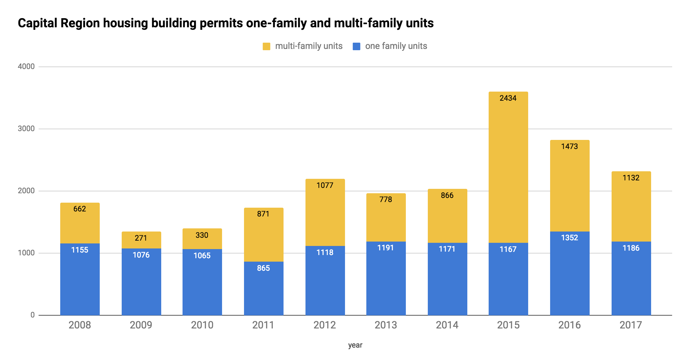
Capital Region building permits for residential units over the last decade -- for single family homes and units in multi-family buildings.
Sometimes during episodes of Exciting Tales of the Albany Planning Board and related whatnot, we refer to the apartment building boomlet that's been going in Albany and around the Capital Region.
Right, so about the specifics of that boomlet... The Census Bureau collects data on the number of building permits for housing units issued each year in each municipality. And those numbers help draw the outline of this trend.
For example: The chart above shows the number of overall units covered by building permits issued for the four core Capital Region counties over the last decade -- along with how many of those units were in multi-family buildings (yellow). And as you can see, there's been an upswing in multi-family units in that time, especially the last few years.
More context? More details? OK, let's have a look...
Working out the design of the Albany Skyway
One of the renderings shown at the meeting giving a sense of what might be possible. It does not represent a final design. (There's larger version inside.)
The Albany Skyway project is continuing to move forward, and this week the engineering team heading up the design work presented a few potential concepts for how to use the space on the new linear park/riverfront connector in downtown Albany.
So let's have a look at those ideas, and also talk about some of the key choices that have to be made...
The Helderberg-Hudson Rail Trail is set to get a new paved section this summer, and a few more bits about its future
Albany County's Helderberg-Hudson Rail Trail is already one of the most popular bike/hike trails in the region, even though it's just a few years old.
And this summer is shaping up to be a big season for the path as the county prepares to pave the segment from Slingerlands to Voorheesville, adding another four miles of asphalt path.
Here are a few things about the future of the trail -- both in the short term and farther out...
Blood plasma, another mixed-use project approved, that Western Ave apartment, and other exciting tales of the Albany Planning Board
The Swinburne Building project on Central Ave was up for approval.
Exciting Tales of the Albany Planning Board is a program recorded before a live studio audience once a month in which the fates of multi-million dollar projects around the city are (partially) decided.
This month: Blood plasma centers, approval for another large mixed-use project, continued neighborhood criticism of that apartment building on Western, and a proposal for affordable housing...
That proposal for a big residential project on Western Ave in Albany has resurfaced
A new rendering for the project.
There's been a small boom in apartment building construction over the last few years in Albany, and officials have hailed it for bringing new development, residents, and housing options to the city.
But as these projects have spread into the lower-density neighborhoods of the city, they've also gotten pushback from residents who say the scale doesn't fit.
The project that prompted maybe the strongest neighborhood criticism has been the proposal for a six-story private dorm at 1211 Western Ave, near the edge of the UAlbany uptown campus. The response was negative enough that mayor Kathy Sheehan made the unusual move of asking the planning board to not approve the proposal in its then-current form -- and the developers pulled the project.
Now it's back, reformulated. And there's still skepticism.
"Race, Place, Power & Privilege" at Albany Roundtable

An illustration from The Arsenal of Exclusion & Inclusion.
This looks interesting: The Albany Roundtable's annual meeting on May 23 at the Albany Institute will feature a talk by urban planner Daniel D'Oca titled "Race, Place, Power & Privilege" -- about "tactics to make cities more equitable and inclusive."
D'Oca is a principal and co-founder of the Brooklyn-based architecture, planning, and research firm Interboro Partners. The firm published the book The Arsenal of Exclusion & Inclusion last year. Book blurbage:
Urban History 101 teaches us that the built environment is not the product of invisible, uncontrollable market forces, but of human-made tools that could have been used differently (or not at all). The Arsenal of Exclusion & Inclusion is an encyclopedia of 202 tools--or what we call "weapons"--used by architects, planners, policy-makers, developers, real estate brokers, activists, and other urban actors in the United States use to restrict or increase access to urban space. The Arsenal of Exclusion & Inclusion inventories these weapons, examines how they have been used, and speculates about how they might be deployed (or retired) to make more open cities in which more people feel welcome in more spaces.
Here's a review at Architect magazine.
The Albany Roundtable event is Wednesday, May 23 starting at 6 pm at the Albany Institute. Tickets are $40 and must be purchased by May 18. They include light fare and open bar.
Approval for another big apartment project, Warehouse District reuse, Pine Hills demos, and more exciting tales of the Albany planning board
The planned apartments on at Sandidge Way and Fuller Road.
Exciting Tales of the Albany Planning Board is a program recorded before a live studio audience once a month in which the fates of multi-million dollar projects around the city are (partially) decided.
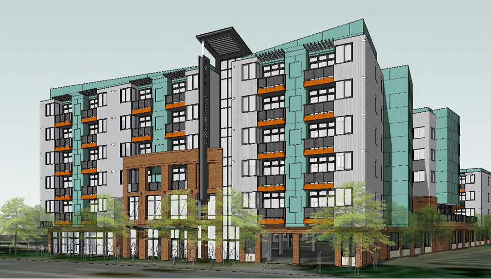
This month: Another large -- and controversial -- apartment development, an odd triangle-ish shaped piece of something, Pine Hills demolitions, the new Northern Rivers facility, and the annals of sewer equipment...
There's another public meeting coming up to talk about that new sewer facility planned for Albany's Lincoln Park
The Albany water department has another public meeting set for next Monday, April 23 to talk about the Beaver Creek Clean River Project -- the new sewer facility planned to be built in Lincoln Park in an effort to mitigate the effects of combined sewer overflows on one of Albany's main sewer lines.
Press release blurbage:
The Beaver Creek was once a major watercourse in the City of Albany. The project location is just west of Dr. Martin Luther King Jr. Boulevard at the access road to the Thomas O'Brien Academy of Science and Technology.
The project, led by the City of Albany Department of Water & Water Supply, will address sewer overflows in the ravine to the south of Park Avenue between Delaware Avenue and Dr. Martin Luther King Jr. Boulevard, and includes significant community benefit elements designed to work closely with the education mission of the Thomas O'Brien Academy of Science and Technology.
The project is currently in preliminary design and is scheduled for construction to start in 2019, and be completed and enter operation in 2022. The $45 million satellite treatment project was identified in the 2014 NYSDEC Consent Order. agreed upon by the Albany CSO Pool Communities (Albany, Troy, Cohoes, Watervliet, Rensselaer and Green Island).
The project is the recipient of a $10 million Intermunicipal Grant Award from New York State. The project presentation will solicit input on the proposed design and community benefit proposals.
The meeting is Monday, April 23 at 6:30 pm at the Thomas O'Brien Academy of Science and Technology (TOAST) (94 Delaware Ave).
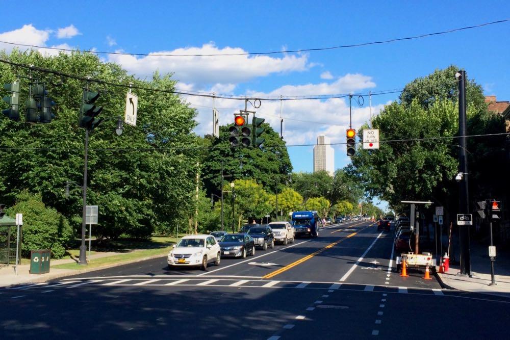
Thinking about the future of Washington Ave
Could there be a safer, friendlier, better version of upper Washington Ave in Albany?
That was the question at the heart of the the public kickoff meeting Wednesday for the Washington Avenue-Patroon Creek Corridor Study. The Capital District Transportation Committee is working with the city of Albany, the University at Albany, and engineering consultants to look at how the important transportation artery could work better for all sorts of people -- pedestrians, cyclists, and drivers.
This topic has been popping up a lot in recent years because of the ongoing development along the corridor, including the addition of private student housing. As a first step in addressing some of these concerns, the city of Albany lowered the speed limit on the stretch from 45 to 30 mph in 2016.
"We want to know from the users of the road, the neighbors of the road, what you think of the road, what you think the problems are," CDTC executive director Mike Franchini told the crowd.
Here are three quick takeaways...
Who owns this street, grinder pumps, just-arrived email, a school expansion, and other exciting tales of the Albany Planning Board
Who owns this street? Good question!
Exciting Tales of the Albany Planning Board is a program recorded before a live studio audience once a month in which the fates of multi-million dollar projects around the city are (partially) decided.
This month: City streets that aren't actually city streets, an entry from the annals of sewer equipment, late-arriving inter-agency email, and school expansion, and more exciting tales...
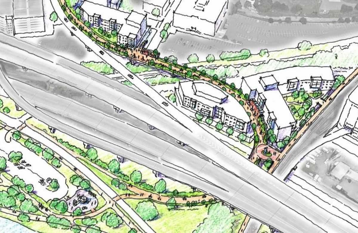
787 is sticking around for a long time, but if you want to change it the time to start is now
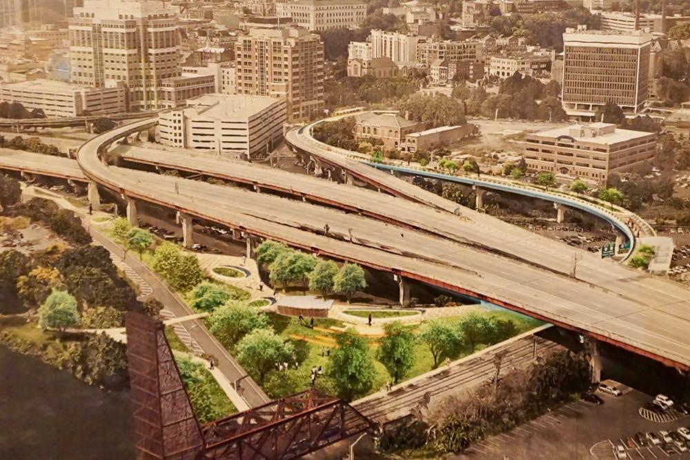
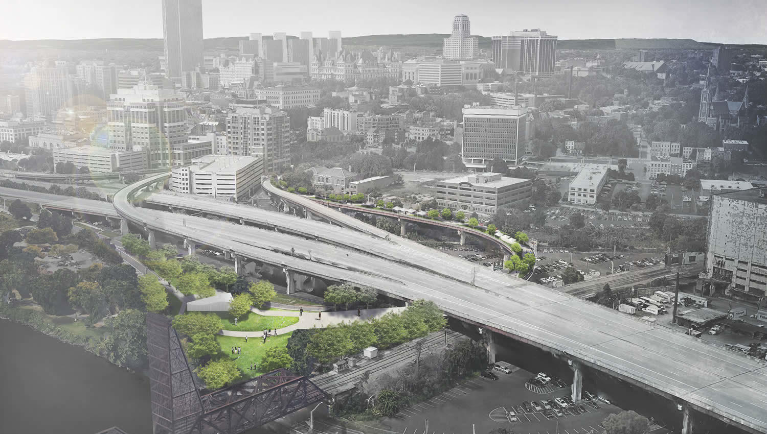
Let's just get right to the point most people want to hear about: The new draft of the I-787/Hudson Waterfront Corridor Study doesn't lay out a detailed plan for making the sort of radical changes to the highway that so many people have desired for so long.
But the long-awaited report -- the product of a process that stretches back to 2014 -- does provide an extended outline of possibilities for potentially making over one of the Capital Region's key pieces of infrastructure and the Hudson River waterfront.
"We have options, what we need is a champion, we need support, we need funding to go to the next step," said Capital District Transportation Committee executive director Mike Franchini this week at an open house for the project at the Albany Public Library. CDTC headed up the report in collaboration with the state Department of Transportation, the city of Albany, and a team of consultants. "And that's really going to depend on the public and the municipalities in the area whether they want to go there or not."
Here's a big overview of what's in the report, along with a few thoughts for the future...
Studying the future direction of Washington Ave
What sort of (figurative) direction should upper Washington Ave in Albany take?
That's the question at the center of a new project to study the corridor -- and there's public meeting coming up next week to talk about it. Project blurbage:
The Washington Avenue - Patroon Creek Corridor Study is a collaborative feasibility study for the area along Washington Avenue, between Brevator Street and the Eastbound I-90 On-ramp (Exit 2), across from the University at Albany main campus entrance.
?This part of Washington Avenue is a major arterial roadway--connecting residential and commercial properties that have grown along Washington Avenue Extension, west of the project area, to Albany's midtown and Downtown core, east of Brevator Street.
The Capital District Transportation Committee, in coordination with the City of Albany and the University at Albany, NY, are investigating this area to identify key opportunities for complete street design elements. Further modifications to the corridor will improve safety and reduce roadway conflicts to compliment the newly reduced speed limit.
The public meeting is Wednesday, March 21 from 4:30-6:30 pm in the Hall of Fame Room at the SEFCU Arena on the uptown UAlbany campus.
There's been a lot of development along this stretch of Washington Ave in recent years, including more pedestrians thanks in part to the new private dorm (with another on the way).
In 2016 the city lowered the speed limit from 45 mph to 30 mph. But the design of the road is the same -- and it's designed for much higher speeds, so 30 feels very slow and it's easy to go faster than that if you're not paying close attention.
So, it will be interesting to see if something like the Madison Ave Road Diet would be appropriate there.
Earlier:
+ A way to say "more like this" when it comes to talking about how streets are designed
+ A cookbook for designing Albany streets
Ideas for the Albany Skyway
One rendering of one possible version of the project.
Three million dollars has a way of changing people's perspective of what's possible.
The idea behind the Albany Skyway -- to convert a lightly-used off-ramp from I-787 to Clinton Ave in Albany into a connection between Broadway and the riverfront -- first popped up in plans for the Corning Preserve and downtown four years ago. It was, as mayor Kathy Sheehan said at a public planning meeting Thursday evening, a "sort of pie in the sky, almost dream" idea.
The almost dream is now almost reality thanks in large part to $3.1 million in funding the Cuomo administration announced for the project this week, a surprise boost that now has the planning moving forward.
"We're in a unique position of starting off on a planning exercise that ... doesn't have have us going out at the end of the day and hoping to make this project a reality," Sarah Reginelli told the crowd. She's the president of Capitalize Albany, which has been heading up the planning. "This project will be a realty."
So that's what members of the public, along with all sorts of officials, got together to talk about.
Here are a bunch of bits about what people said they'd like to see happen, along with a few thoughts about this project.
The city of Troy wants to plan for the future of 1 Monument Square. Again.
The site back in 2016.
This all sounds familiar.
The city of Troy says it's aiming hold a three-day public design event -- a charrette -- about the future of the 1 Monument Square site. Press release blurbage:
Mayor Patrick Madden said, "The design charrette process offers a fresh start for the redevelopment of Monument Square. With assistance and input from our community, we can create a collective vision for the site that respects Troy's unique and historic character while enhancing our city's valuable assets and expanding access to our unique waterfront location."
A charrette is an intensive planning and design session where residents, business owners, designers and other stakeholders collaborate on a vision for development. A design charrette provides a forum for ideas which offers a unique opportunity to give designers immediate feedback while creating mutual authorship among participants in the plan. The City is not advancing any predetermined concepts with the exception of a 50-foot deep esplanade along the Hudson River and connection from the esplanade to River Street.
The city has issued an RFP for a consultancy to hold the event, which does not have a date:
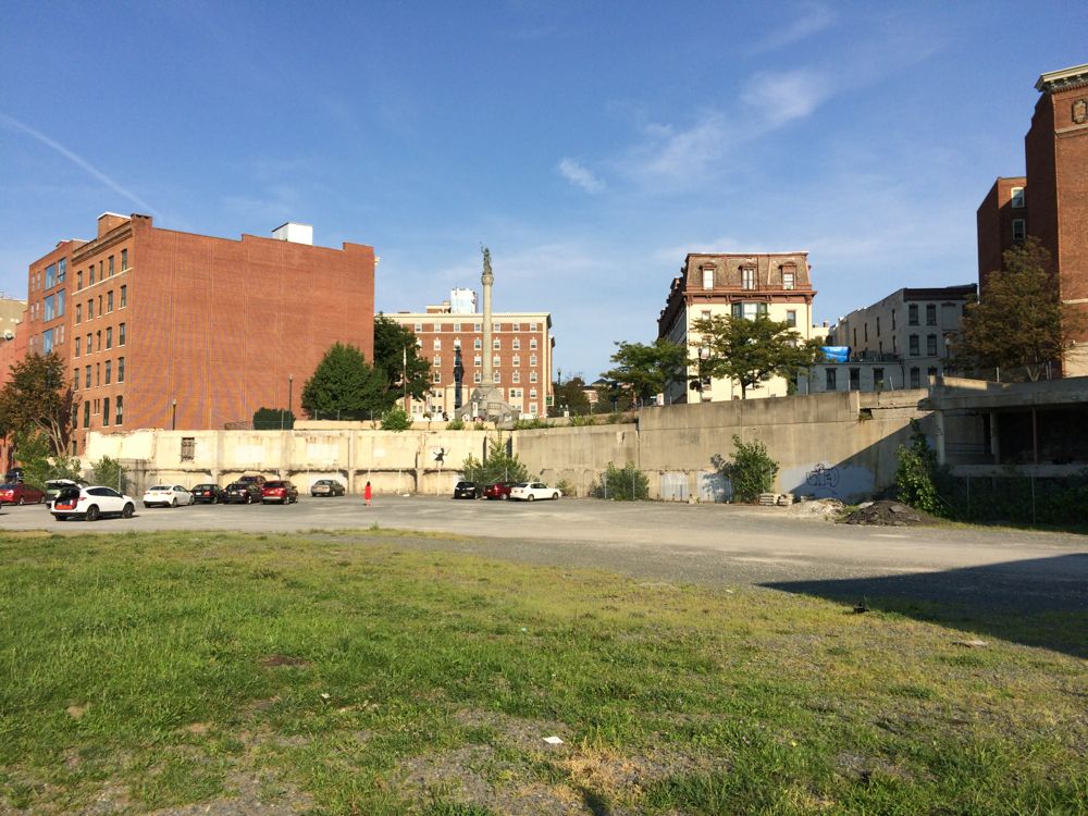
Proposed apartment project at the Playdium site set to move forward
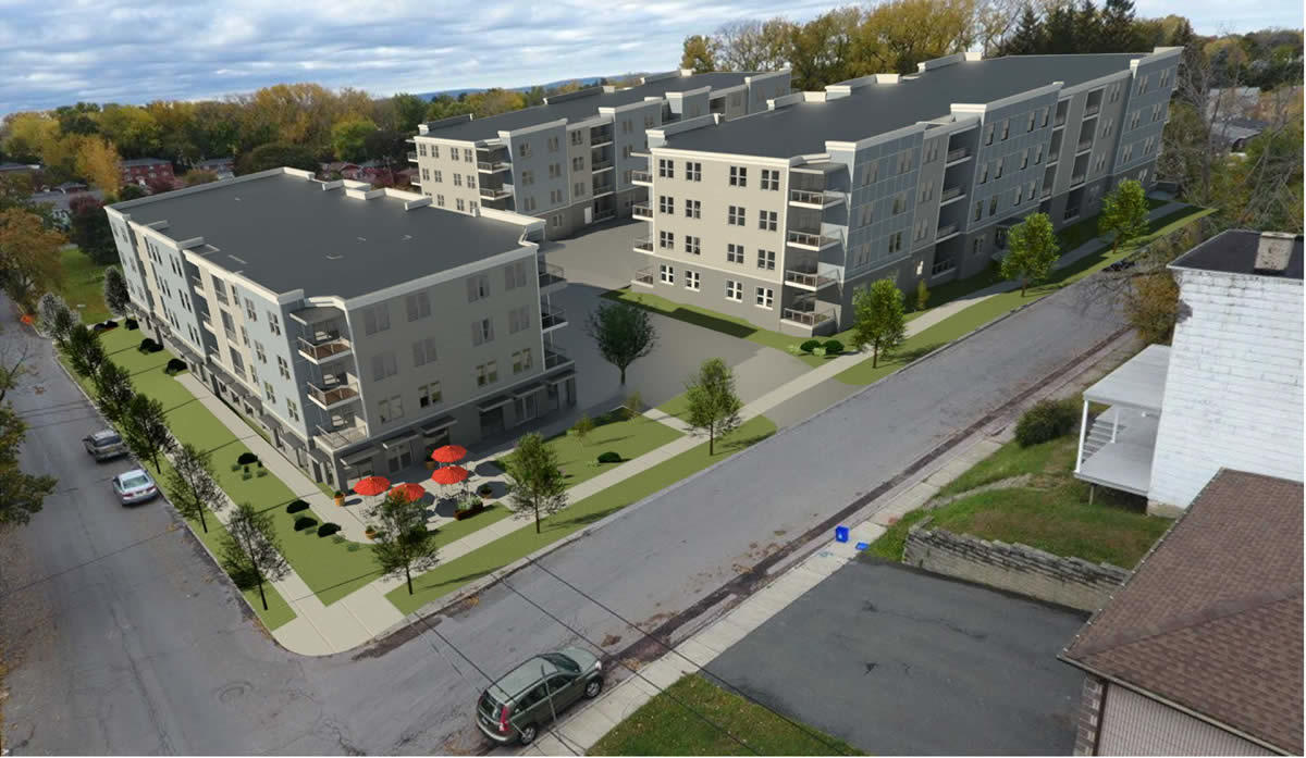
A rendering of the planned apartments.
The proposed redevelopment of the Playdium site in Albany is set to move forward after the Albany IDA approved a PILOT agreement and tax breaks for the project at a special meeting Thursday.
The project -- backed by the Jankow Companies -- involves demolishing the bowling alley to make way for the construction of three new apartment buildings. The proposal has gotten a lot of attention because it's set to replace a neighborhood landmark. And it's become a high-profile example of the simmering discussion in Albany about the density and height of new development around the city's neighborhoods.
The developers have a tentative closing date in early April, according to real estate agent David Phaff, who's been representing the project. Construction would start immediately after.
Here are a few more bits...
Capital District Trails Plan
The Helderberg Hudson Rail Trail
One multi-use trail for walking and biking is good. Two is better. But a network of interconnected trails is best.
Toward that goal, the Capital District Transportation Committee is working to develop a Capital District Trails Plan, and it's looking for public input:
The Capital District Trails Plan is a strategy to link together the various multi-use trails in Albany, Schenectady, Rensselaer and Saratoga counties into a single connected network of trails for everyone in the region to enjoy. This planning effort will identify existing trail locations throughout the region and work with local communities to envision potential new trail routes which will infill missing segments, connecting to each other and to key points of interest. This plan, sponsored by The Capital District Transportation Committee (CDTC), will involve the input from residents, community leaders and stakeholders through different public meetings, workshops and surveys as they are scheduled throughout the coming year. The goal is to develop a vision for a connected, regional network of multi-use trails that is accessible to all Capital Region residents.
Here are a few ways to offer input, whether it's a public meetings*, a survey, or a crowd-sourced map (check out the "trail concept" for a loop through Albany off the Helderberg-Hudson Rail Trail).
Paths such as the Mohawk Hudson Bike-Hike Trail and Albany County Helderberg-Hudson Rail Trail are already popular. And there are some interesting projects like the Albany Waterfront Connector and the Albany-Hudson Electric Trail in the works. From our perspective, one of the challenges/opportunities now is figuring out ways to connect local neighborhood routes to these paths so they can be more useful as transportation corridors and just offer more general access.
* Maybe these meetings could have been scheduled at times that would have made it easier for people to attend. Update: We hear these meetings are primarily for trail groups, planners, and public officials.
That long awaited report about the future of 787 is almost ready and there's a chance coming up to learn more and make your voice heard
The formal process for thinking about the future of 787 -- the I-787/Hudson Waterfront Corridor Study -- has been in progress for years. And now it looks like there's a product.
There's a public meeting to discuss the study report March 13 at the Albany Public Library Washington Ave branch. Event blurbage:
Learn about the study findings, progressed and potential strategies, and provide your thoughts on the study's report. This public open house will exhibit informational boards, invite your input on the report, and provide a presentation about the study findings by the project team at 4:30 p.m. and 6:30 p.m. on Tuesday, March 13th. The content of each presentation will be the same.
The open house is from 4-7:30 pm in the auditorium toward the rear of the APL branch.
This report -- headed up by the Capital District Transportation Committee, in collaboration with the state Department of Transportation and the city of Albany -- is the culmination of a process that started in 2014 and has moved slower than originally expected.
Big downtown residential project approved (again), street ownership intrigue, and other exciting tales of the Albany Planning Board
The plan to build a hotel and multiple retail buildings on Southern Boulevard was approved.
Exciting Tales of the Albany Planning Board is a program recorded before a live studio audience once a month in which the fates of multi-million dollar projects around the city are (partially) decided.
This month: Approval -- again -- for a big new residential project downtown. One of the last turns in a years-long story. Street ownership intrigue. And more exciting tales...
A potential map for Troy's future
A conceptual plan for a reconfiguration of the riverfront in downtown Troy.
The draft of Troy's new comprehensive plan -- Realize Troy -- was released this week after more than two years in the making. It's basically a proposed road map for the city's future over the next 25 years and beyond.
The full draft is available over at the Realize Troy site.
We read through the plan this week and picked out a handful of bits that caught our eye -- from a major reconfiguration downtown to... forks.
UAlbany wants to upgrade its Alumni Quad, and it's looking for input from the public
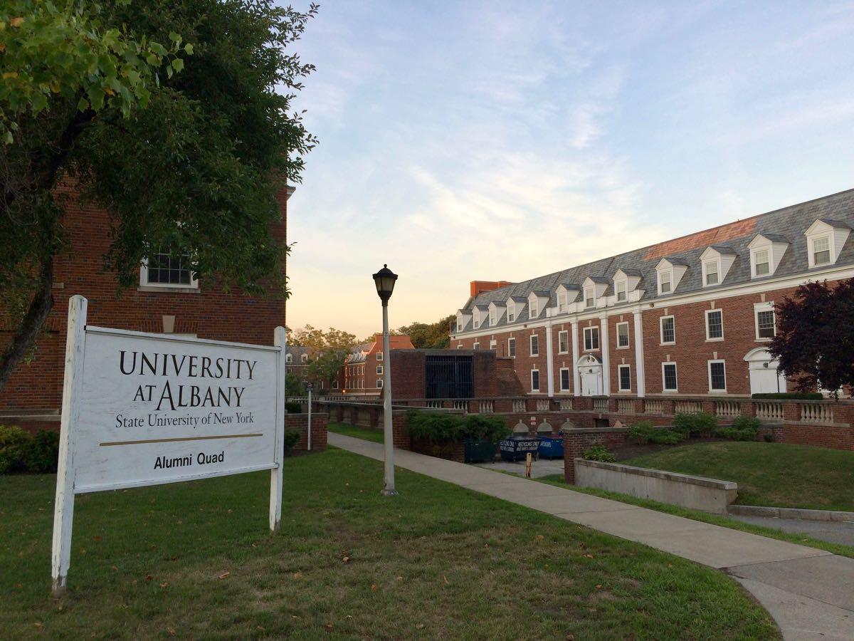
Alumni Quad in the summer of 2016.
Update update: The rescheduled public meeting is March 8 in the Husted Hall Amphitheater on the downtown campus at 6 pm.
Update: This public meeting has postponed to a later date because of weather.
UAlbany is thinking about the future of its Alumni Quad -- an almost-10 acre piece of land that sits right in the heart of Albany's Pine Hills neighborhood -- and it's looking for some community input about that possible future.
There's a public meeting about those plans February 7 on the downtown campus. The university says officials will be talking about the current state of Alumni Quad, what's in the works for there, and then they'll throw it open for comments from community members.
Here's a little bit more about UAlbany's thinking about, along with a few things about how it connects to some other projects and the wider neighborhood.
A big step forward for the Quackenbush Center mixed-use project, and other exciting tales of the Albany Planning Board
The latest rendering for the Quackenbush Center project.
That big mixed-use project proposed for just north of Quackenbush Square in downtown Albany took an important step forward this week when the city planning board approved its site plan.
The project includes residential, commercial space, and a hotel. And it holds the potential to dramatically change the feel of that section of town.
Here are a few more bits about what's up with the project -- and a handful of other mildly exciting tales of the Albany Planning Board...
Checking out the first phase of the Ida Yarbrough redevelopment
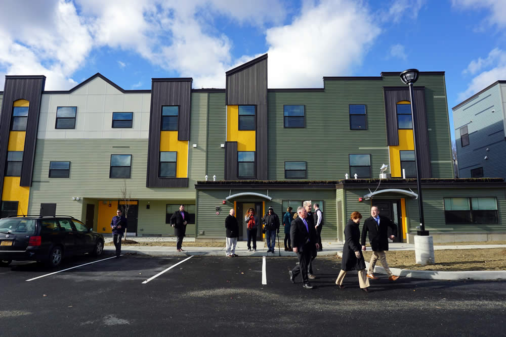
Construction on the first phase of the redevelopment of the Ida Yarbrough Homes in Arbor Hill is finished, the Albany Housing Authority formally announced this week.
The redevelopment project will ultimately include 137 newly-built units, and it's part of a plan to create mixed-income housing near downtown Albany.
Here's a quick look, along with a few bits about what's up...
The Swinburne Building! New Scotland Village! Apartments near SUNY Poly! And other exciting tales of the Albany Planning Board
A new version of the exterior for proposed apartments for a site across from St. Peter's Hospital.
Exciting Tales of the Albany Planning Board is a program recorded before a live studio audience once a month in which the fates of multi-million dollar projects in the city are (partially) decided.
From this month's episode*: The Swinburne Building! New Scotland Village! And more than 200 apartments near SUNY Poly!
What's up with the Albany Skyway, and a few bits about plans to makeover a key piece of downtown
A rendering of what the skyway project might end up looking like.
The Albany Skyway project -- which aims to turn a lightly-used off-ramp into a linear park connecting downtown Albany with the riverfront -- is set to take a step forward next year.
And the skyway is potentially one piece of a larger puzzle that officials are looking to rearrange with the hope of creating better links between parts of the city.
Here's what's in works...
What's next for the CDPHP Cycle bike share
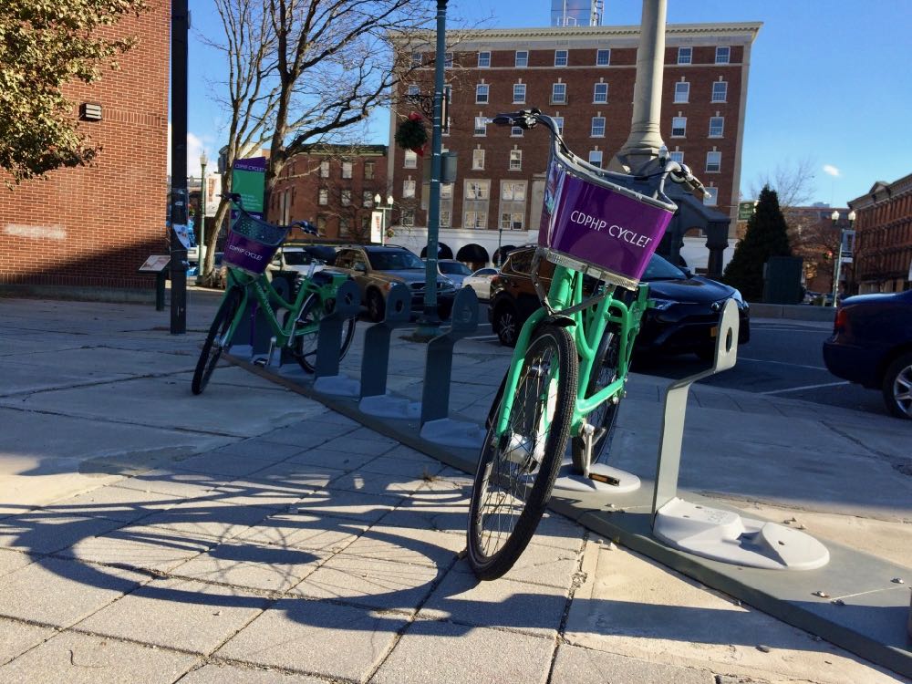
Today (Thursday) is the last day of the season for CDPHP Cycle, the new bike share run by CDTA.
A few of the first-year stats released by the transit org for the system, which included 40 stations and 160 bikes:
+ The bike share signed up 2,467 members
+ The system logged 11,481 trips
+ Those trips covered 26,877 miles (2.34 miles per trip on average)
Here's more about the bike share's first season and what's in the works for next year...
Playdium redevelopment takes a step forward
A quick update on the proposed redevelopment of the Playdium site in Albany, which has been a prominent of example of two recent trends in the city: 1) the construction of new, large residential projects and 2) pushback from neighborhoods about the taller, denser development...
The Albany Board of Zoning Appeals granted an area variance for the height of the project at its meeting the evening before Thanksgiving.
That variance will allow the 109-unit apartment project to be four stories tall if it ultimately gets approval from the city planning board and moves forward.
Private dorm opposition, a big downtown residential conversion, and other exciting tales of the Albany Planning Board
A rendering of the proposed private dorm project on Western Ave.
Exciting Tales of the Albany Planning Board is a program recorded before a live studio audience in Albany City Hall once a month in which the fates of multi-million dollar projects are (partially) decided.
This month: Opposition to a new private dorm on Western Ave! Approval for a big residential conversion downtown! A new turn in a long running drama! And more exciting tales...
A few more details about the proposed mixed-use development near St. Peter's hospital
The proposed new retail strip (top) and the proposed new apartment building.
The city of Albany has a bunch of large residential projects either already in the pipeline or up for planning review right now. Among the newest is "New Scotland Village," a mixed-use project that would significantly remake a section of the retail strip across from St. Peter's hospital.
There was a community meeting about the project Tuesday night that included new details -- and plenty of criticism...
Two large residential projects proposed for Albany, one on New Scotland Ave, the other on Western Ave
Proposed for Western Ave near the UAlbany uptown campus.
A few clips from the trailer for the upcoming episode of Exciting Tales of the Albany Planning Board...
Two large residential projects are on the agenda for the Albany Planning Board meeting next week -- one across from St. Peter's Hospital on New Scotland Ave; the other on Western Ave near UAlbany.
And based on the site plans and renderings/elevations filed, both look like they have the potential to significantly change the streetscapes of those areas...
Mapping out a future for bikes in Troy
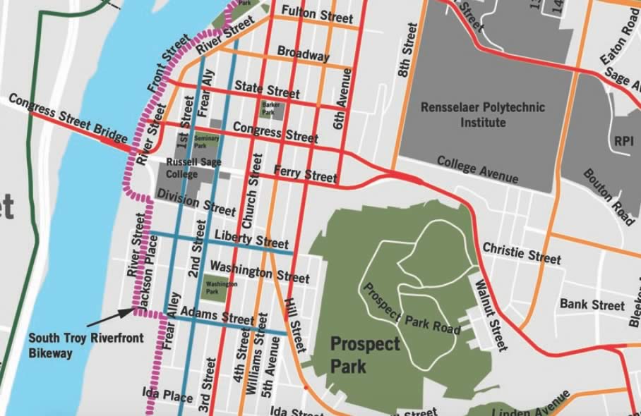
What's the route to follow to make Troy more bike and pedestrian friendly?
That's the question at the heart of the current push to create the Troy Bike Connections Plan. The backers of the project -- which include the city of Troy, the Capital District Transportation Committee, and Parks & Trails New York -- released a draft of the plan at a public meeting Wednesday evening.
And the materials are now online, if you'd like to have a look.
"There are a lot of streets in Troy that can be transformed with not a ton of engineering to become more bike friendly," said CDTC's Jennifer Ceponis Thursday, emphasizing the plan is a way of mapping out a direction for future projects as money and opportunity present themselves. "This is going to be incremental, for sure."
A few things about the proposed plan...
What's up with the planned redevelopment of the Playdium site
Here's an update on the proposed redevelopment of the Playdium site in Albany's Pine Hills neighborhood, which has prompted a bunch of conversation as well as some pushback from neighbors over the height of the residential project.
It went before the Board of Zoning Appeals last week as part of the developer's efforts to get a variance to exceed the 3.5-story limit for the zoned area.
This project has been interesting to follow because it highlights the recent mini-boom in large residential projects in the city. And it also touches on issues related to in-fill development and the feel of neighborhoods.
Here are a few bits about the evolving design and the rents for the project...
New look for the Playdium redev! 5-story building for Central Ave! Apartment project pushback! And more exciting tales of the Albany Planning Board
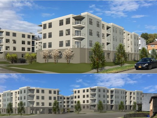
The proposed redevelopment of the Playdium site has a new look.
Exciting Tales of the Albany Planning Board is a program recorded before a live studio audience in Albany City Hall once a month in which the fates of multi-million dollar projects are (partially) decided.
Renderings! Massing! Stormwater! Public comments! And don't forget... TRAFFIC AND PARKING! (Ha, just kidding, no one ever forgets traffic and parking.)
Here's what was in the spotlight this Thursday...
A snapshot of the Capital Region pitch to Amazon
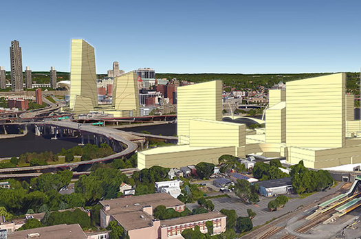
Today is the day that cities and metropolitan areas all around the country are offering themselves up to Lord Bezos as his empire looks to build an off-world colony beyond Amazon Prime in Seattle.
The Capital Region is one of those metros, and the Center for Economic Growth has posted an overview of its pitch. It centers on a a potentially massive new complex spanning the Hudson River at Albany and Rensselaer. A clip:
With Amazon specifying an interest in a downtown or urban location with a layout similar to its Seattle campus, CEG's centerpiece proposal is the Amazon Promenade. This downtown headquarters would straddle the iconic Hudson River, with a capacity for 2 million square feet of office space in the City of Albany's 25-acre site between the Times Union Center and Broadway and an additional capacity for 6 million square feet on 75 acres directly across the Hudson in the City of Rensselaer. The Albany and Rensselaer sites could be connected with a pedestrian bridge across the Hudson, water taxies and/or a gondola.
There are a handful of renderings -- and we've pulled them out for easy gawking. The online pitch also argues the region's case in terms of aspects such as education, housing affordability, natural disaster susceptibility, and crime.
The assimilation of the Capital Region by the Bezos is a low probability event -- this place is competing against pretty much every other relatively large metropolitan area in the US and Canada. That said, here are a few very quick thoughts...
How I ended up riding a bike as one of my primary ways of getting around town -- and how that's gone

So here's something I've been hearing lately: "You rode your bike here!?"
Because I did.
This past summer I made an effort to become a bike person. That is, not just a person who rides a bike for fun, but a person who uses a bike for transportation around town. (Though, really, it's still fun even if you use it that way.)
Here are a few thoughts on how that's gone...
The 1 Monument Sq movie theater project is off
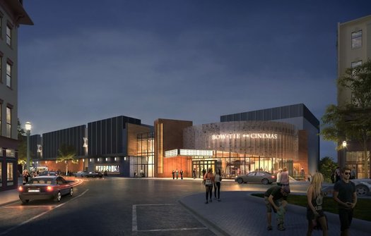
The proposed Bow Tie movie theater project at 1 Monument Square in downtown Troy is off, the administration of mayor Patrick Madden announced late Friday afternoon. A clip from Madden's statement:
"As a result of multiple and ongoing legal actions brought by a neighboring property owner against the City of Troy, Bow Tie Cinemas has notified the city of their decision to terminate the development agreement for the One Monument Square site. We are deeply disappointed with this lost opportunity to construct a world-class cinema in the Collar City.
"For several months, my administration and representatives of Bonacio Construction met on multiple occasions with the neighboring property owner to address his demands, including those not contained within the multiple legal actions filed against the city. Unfortunately, a mutually agreeable resolution to resolve these additional demands could not be reached.
"My administration strongly believes the issues identified in the multiple legal actions were solvable, but due to concern over potential future litigation Bow Tie Cinemas opted to end their involvement in the project.
The "neighboring property owner" is developer Sam Judge, who himself had once tried to develop something on the site. His early-September lawsuit alleged the Bow Tie project would do "irreparable harm" because of traffic and parking issues. It also argued a full environmental review would be necessary for the project. The Bow Tie project's movement through the city planning process was paused when the lawsuit was filed.
A way to say "more like this" when it comes to talking about how streets are designed
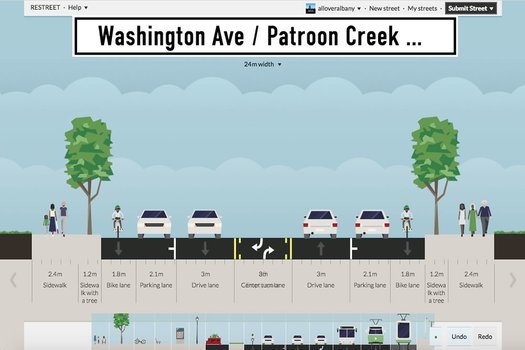
Just a quick example of what the app can do.
One of the difficult aspects of having public discussions about projects like the Madison Ave Road Diet is that it's hard for non planners/engineers to explicitly show what they'd like to see (it's true of building projects, too). And, maybe as a result, the discussion ends up being centered around what people don't want.
So this web app looks like it could be interesting and helpful: ReStreet allows anyone to plan the design of a street, laying out sidewalks, bike lanes, vehicle travel lanes, transit lanes, whatever. And then you can share the design with other people.
That image above is a screengrab of a sample design that we worked up this afternoon for upper Washington Ave in Albany.* The design includes wide sidewalks, protected bike lanes, a single travel lane in each direction, and middle turn lane.
What we like about this app is that it enables members of the public to essentially say "more like this," which seems like a path toward more productive discussion. So go give it a try.
[Via CityLab, which has backstory on the app.]
____
* Why upper Washington Ave? We've been thinking about it because the Capital District Transportation Committee, city of Albany, and UAlbany have been laying the groundwork to study the corridor in order to possibly change the design to better fit the recently lowered speed limit there.
Parking, free or otherwise
Some of the discussion this week around the gondola and projects before the Albany planning board have ended up touching on parking. Because it always come back to parking.
So we thought you might find this Vox video interesting. It's basically a quick overview of the thoughts of Donald Shoup -- UCLA urban planning professor, author of The High Cost of Free Parking, and the patron saint of parking skeptics. It touches on the history of parking, pricing of street parking, and the requirements for off-street parking that municipalities fold into their zoning.
If you're curious, the parking requirements under Albany's new zoning code are in this pdf on p. 170. It's important to note that developers can get the requirements relaxed by doing things like siting a project near transit or including affordable housing.
Buffalo got some national attention recently because it got rid of parking minimums when it overhauled its zoning.
The Playdium redevelopment! Downtown residential! Neighborhood critics! And more exciting tales of the Albany planning board
The proposed redevelopment of the Playdium was among the projects up for review.
Despite the fact that they often focus on multi-million-dollar projects that can literally change the shape of the city, Albany planning board meetings are often quiet affairs, attended by few (or no) members of the public.
That was not the case for Tuesday's meeting, which featured a packed gallery, a bunch of neighborhood critics, and even a loud, happy round of cheers.
Here's what had people fired up...
The flashing yellow arrow
Turn signals w/ flashing yellow arrows are coming to your town! After green-yellow-red phase, turns to flashing yellow. Let's more ppl turn pic.twitter.com/pMY0wXIlZt
— NYSDOT (@NYSDOT) September 18, 2017
News to us: There's such a thing as a flashing yellow arrow traffic light.
The state Department of Transportation has been installing them around state in recent years, including a handful here in the Capital Region. Press release blurbage on what the signals mean:
Traffic signals with a flashing yellow arrow phase are used at intersections where there is an exclusive right- or left-turn lane with a protected green arrow, which allows motorists to turn while oncoming traffic is stopped. The signal changes from a green arrow to a solid yellow arrow, indicating that a red signal is coming and turning motorists should not enter the intersection. A red arrow is then displayed, allowing traffic from the oncoming direction to begin proceeding through the intersection. After opposing traffic gets the green phase, the turn arrow begins flashing yellow, indicating that turning vehicles must yield to oncoming traffic but may proceed when there is a safe gap in traffic. The signal then turns returns to a solid yellow arrow and then to a red arrow as traffic on the other road is allowed to proceed through the intersection.
Pedestrians crossing the road always have the right-of-way over turning vehicles.
So, boiled down, it's like a yield sign for traffic light arrows. See also this explainer image.
The flashing yellow arrow is a relatively new type of signal that's been spreading around the country. There's apparently research that indicates the signals are easier for people to understand and lead to safer intersections.
If you want to provide direct feedback on that Capital District Gondola idea, here's your chance
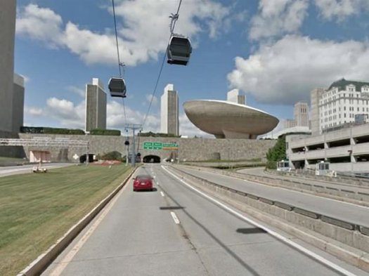
This image is from the feasibility study released last year.
The backers of the proposed aerial gondola between the Albany-Rensselaer train station and downtown Albany are surveying people this week about the idea. If you'd like to provide input, here's the online survey -- enter code "aoa" with no quotes to access it (it's case sensitive).*
The consultancy Steer Davies Gleave is conducting the survey for the McLaren Engineering Group. The survey asks about how often people travel to downtown Albany, how they get there, what they do there. And then it proposes a series of tradeoffs -- both time and price -- between transportation options and the proposed gondola. The answers will be folded into a model to help determine what sort of demand there might be for the gondola.
Representatives will also be around downtown Albany this week handing out postcards with info about the survey. And people taking the survey will be eligible for a $100 cash prize if they're willing to share their contact info at the end of the survey.
Here's the latest outline of a plan for redeveloping the former convention center site in downtown Albany
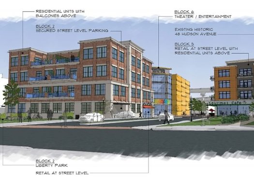
What could be built on the former convention center in downtown Albany? What should be built?
Those are two questions at the center of a report Empire State Development released Thursday that proposes an outline of a plan for developing the large site on the southern end of downtown -- AKA, The Parking Lot District -- that's sat underused for years, and without purpose since the convention center project moved up the hill.
Here are a few clips from the report -- yep, there are renderings and similar whatnot -- along with a few thoughts.
Whatever happened to that study about the future of the I-787 corridor?
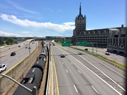
Back in 2015 there was a series of public meetings to kick off the I-787/Hudson Waterfront Corridor Study, a project intended to help plot the future of 787 from the Port of Albany north to Watervliet. The study got a lot attention because many people saw it as the first step in moving toward knocking the elevated portion of the highway.
Two years later the study is still not out. So what's up?
Sprawl without growth
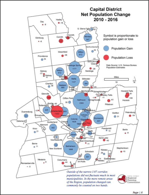
Net population change by city and town 2010-2016, according to Census population estimates. / map: CDRPC Capital Region Data
During conversations here at AOA and in other venues about the region's cities, very often the focus settles on a question that's more or less: Why can't we have (thing) in Albany/Troy/Schenectady/somewhere?
And often (thing) is something along the lines of streetcars, or densely packed blocks of retail, or downtown supermarkets -- the sorts of things that usually require relatively high population density.
So, with that in mind, this bit from the latest Capital Region Data from the Capital District Regional Planning Council caught our eye. It's about population and development patterns across the area's municipalities (emphasis added):
From 1995 to 2015, development of single family homes across the Region totaled 35,111 units, occupying 55,928 acres. Development in this 20-year period expanded the total acreage consumed by single-family housing in the Region by 38% from levels in 1994. In that same period, the population of the Region grew by roughly 7%. Quite simply, the Region consumed land at almost five and half times the rate of population growth. ... To add even more context on a micro level, from 1995 to 2015, the Region's population increased by roughly 55,000. This means that the Region developed roughly an acre of land for each new person.
As population growth continues to slow, and housing construction begins to increase, the disconnect could between the two could become larger. While new housing construction slowed significantly during the Great Recession, it has recovered to a greater degree than population growth. If these trends continue, they could amplify our Region's current pattern of sprawl without growth.
Studying one of the channels of the daily commuting tide into and out of Albany
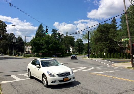
New Scotland Ave and Buckingham Drive at midday.
Taxes, the budget, crime and policing -- they're all important topics that frequently come up for discussion in the city of Albany.
But if we had to guess the topic that bubbles up most often in the most places -- public meetings, neighborhood associations, online comments -- it would be this: The idea that people drive too fast and too recklessly through Albany.
On Wednesday the city announced that St. Peter's Health Partners is putting up $100k for a traffic study of the busy New Scotland Ave corridor. People who live along the corridor say it feels like traffic volumes are up significantly in recent years and that's led to congested, unsafe streets.
And while the study will just focus on this one section of the city, the situation touches on bunch of issues and challenges that are facing all of Albany.
Imagining possibilities for Sheridan Hollow
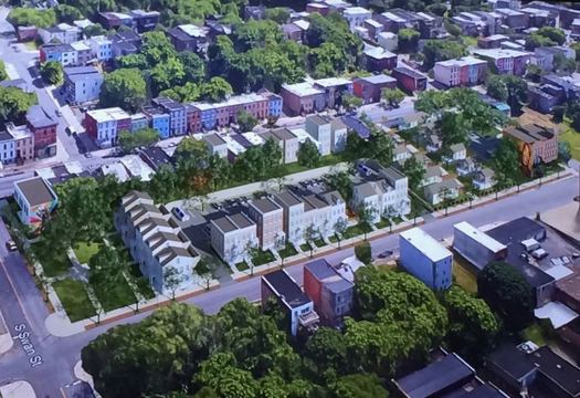
Sheridan Hollow is one of Albany's oldest neighborhoods. And throughout much of that history, the neighborhood has repeatedly been overlooked, bypassed, or excluded. It's gotten the short end of the stick many times.
But in recent years the neighborhood tucked into the center of Albany has added new, affordable housing and mixed-use space, and it appears to be gaining some positive momentum.
How to keep that going was one of the central questions in a recent week-long intensive look at the neighborhood, an extension of the city's Rezone Albany initiative. Consultants were in town studying the neighborhood, talking with people, and imagining new possibilities -- which they presented at a public meeting last Thursday.
Here's a look at what they came up with. (Are there renderings? You know there are renderings.)
Van Rensselaer Boulevard, on a diet
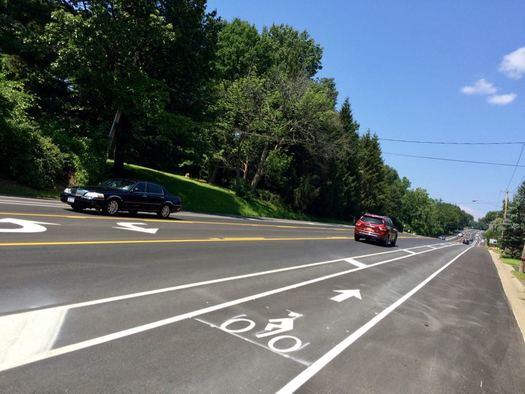
You can see the old configuration on Google Street view.
We got a chance the other day to to head over to Van Rensselaer Boulevard in Albany/Menands and check out the road diet reconfiguration there.
The state Department of Transportation paved and re-striped about one mile of the road this summer, from Northern Boulevard to Menand Road. The new configuration reduced the number of travel lanes from four to two with a center turn lane, buffered bike lanes along each side, and wide shoulders. The speed limit is now 45 mph, down from 55 mph.
A spokesman for NYSDOT says there are still a few minor details to finish up, including some signage.
The goal is to make the street -- which borders a residential neighborhood -- friendlier to pedestrians and cyclists. It was the scene of two fatal crashes in recent years, one involving a pedestrian. Neighborhood residents had been pushing for changes to make the stretch safer. [TU x2]
Search Albany
The city's new zoning map as displayed through Search Albany.
The city of Albany unveiled a new online tool -- called Search Albany -- for accessing all sorts of info related to properties around the city Tuesday.
It's basically a map through which you can access details about individual properties -- such as the name of the owner -- as well as neighborhood-level info such as zoning districts and Common Council wards.
The best way to get a feel for it is to just play around with it, so go for it.
But here are also a few quick things about it...
Thinking about the future of Sheridan Hollow
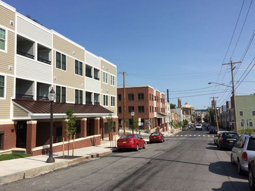
The Habitat/Housing Visions developments in Sheridan Hollow.
What are the possibilities in Sheridan Hollow?
That question is at the center of a series of events this week focused on the future of the Albany neighborhood.
The events are the latest in a string of similar neighborhood-focused reviews during Rezone Albany that also looked at the Warehouse District, the South End, Central Ave, and the area around the downtown UAlbany campus. Consultants from the national firm Dover Kohl are in town talking with people, gathering input, and mapping out potential plans for the neighborhood.
City planning director Chris Spencer said the Sheridan Hollow review is focused on issues such as in-fill development (tiny houses maybe?), streetscape design, stormwater, and codes and safety. Many of these topics are connected to the actual physical landscape of the neighborhood, which is tucked into a valley between the Capitol and Arbor Hill, just west of downtown proper.
Sheridan Hollow has seen a burst of development in recent years, thanks in large part to new housing and mixed-use buildings built by Habitat for Humanity Capital District and Housing Visions.
The opening public workshop for this week's series was Monday evening. There are open design studio sessions at 200 Henry Johnson Blvd from 9 am-6 pm this Tuesday and Wednesday. And on Thursday the consultants will do a public work-in-progress presentation at 6 pm.
Earlier
+ Imagining possible futures for the neighborhood around UAlbany's downtown campus
+ A few versions of the South End's potential future
+ Thinking about the direction of Central Ave
+ What sort of place should Albany's Warehouse District be?
The Albany-Hudson Electric Trail
One of the photos from the project presentation showing a portion of the proposed route in Kinderhook.
The proposed plan for the Albany-Hudson Electric Trail -- which aims to connect Rensselaer and (almost) Hudson via a (mostly) shared-used bike path -- is out. And there's a public meeting about it Tuesday evening in East Greenbush.
Here are a few details...
A brief history of the Capital Region's much-admired light rail system
The light rail line along Madison Ave -- following an old trolley route -- has proven to be very popular, carrying students and neighborhood residents to work, shopping, and entertainment along the busy corridor. / streetcar photo: Wikipedia user Pi.1415926535 (CC BY-SA 3.0)
#/media/File:Inbound_train_at_Tappan_Street,_June_2014.JPG)
It's Other Timelines week on AOA, in which we'll be looking at alternate histories of this place, about big and small things that did or did not happen.
It's 2017. As the Capital Region looks back on the first fifteen years of the 21st century, it can be proud of its transit system -- and the inextricably linked patterns of land use that it has built -- even as the rest of the country debates the merit or even the very concept of public transit.
Looking back at the past eight decades, there were a few turning points -- inflection points, one might say -- at which regional leaders made choices that could have resulted in a very different future if another path had been taken.
So how did Albany, Schenectady, and Troy end up with a transit system that would be the envy of cities many times their size?


Where things are at with the 1 Monument Square movie theater project
Updated with a new set of renderings.
The latest chapter in 1 Monument Square saga arrived at an important plot point Wednesday evening when the proposed movie theater project for the site went before the Troy planning commission.
A lot of people turned out for the presentation, and they had a lot to say. That's not a surprise -- this is one of the most high-profile real estate projects in the whole Capital District, and it's the fourth major attempt to get something built at the site.
Here's a quick scan of what people had to say, and a few thoughts about where things are at...
New York State Bike Summit
The first New York State Bike Summit will be at the Hearst Media Center* September 15. Blurbage:
This Summit will provide a forum for advocates, industry, policy makers, government officials at all levels, planners and engineers, allied environmental and other non-profit organizations as well as concerned individuals to meet, network, strategize and prepare for the transformation of New York into a leading state for safe and shared bicycling, pedestrian and active transportation.
Biking is on the rise in NYS. The challenges facing the bike movement have shifted from explaining why biking is important to how we can move toward more complete, shared and connected roads and trails throughout New York State. This cultural shift has primed the state for a "big tent" event - bringing together advocates, planners, engineers, public officials, legislators, business interests, concerned citizens, environmental and conservation interests, and law enforcement.
The attendance fee is $110. It's an all-day event -- here's the schedule of talks, panels, and whatnot. It looks like there will be a bunch of interesting bike-related topics up for discussion, many that often pop up here. It's organized by the New York Bicycling Coalition.
* It's the new venue Hearst built to host events at the Times Union building on Albany Shaker Rd near the north end of Wolf Rd.
Walking the new (very, very, very green) multi-use path along Corning Riverfront Park
Some quick photo follow-up on the pedestrian and bike upgrades project at the Corning Riverfront Park in Albany. This is the $5 million project that was under construction last year, and prompted the move of Alive at Five to Broadway last summer.
The goal of the upgrades was to widen the (now vibrantly green) multi-use path through the park, provide a route for through walkers and bikers to bypass events in the park by going along the back of the tidal ponds, and making it easier for people to find connections between downtown and the park.
The project is finished and so we figured we'd swing back and walk it...
The plan to connect two major bike paths at the Albany waterfront
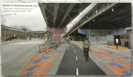
Part of the plan includes a new multi-use path that runs through the space under 787.
Two major bike paths -- the Mohawk-Hudson Hike-Bike Trail and the Helderberg Hudson Rail Trail -- run into Albany's South End. But they don't connect. They're separated by roughly two miles filled with interstate off-ramps, truck traffic, and trains.
For the past year the city of Albany and consultants have been working on way to connecting these bikeways. And now there's a plan.
Rezone Albany gets the OK -- and a quick overview of what this was all about
Ahead of Monday's vote.
After more than 2.5 years, the big Rezone Albany project reached its conclusion Monday night when the Common Council approved it by a vote of 12-3. It's the first major overhaul of the city's zoning since the 1960s. It takes effect June 1.
As we've said before, zoning might sound sleep-inducing, but it touches on a bunch of questions that regularly get people fired up, such as: What sorts of businesses can open where? How late can they be open? How can old buildings be adapted for new uses? How can neighborhoods suffering from disinvestment gain new life?
Here's a recap of some of the discussion ahead of Monday's vote, along with an overview of what the heck Rezone Albany is...
Inclusionary zoning added to Rezone Albany -- and vote for approval delayed at the last minute
Mayor Kathy Sheehan delivering her remarks on the Rezone Albany plan at Monday's Common Council meeting.
There were two big things in the lead up to the Albany Common Council vote on Rezone Albany Monday night:
+ A provision for inclusionary zoning -- in which the city will require developers of some market-rate projects to include affordable units -- was added.
+ At the last moment, the vote on the major zoning overhaul -- more than two years in the making -- was delayed by two more weeks.
Tracking trucks in Albany's South End
South Pearl Street last summer.
People in Albany's South End have long been calling for attention and resources to focus on air quality and other environmental health issues in the neighborhood. And there's a project coming up that's using an interesting tool to study truck traffic along the South Pearl Street corridor -- one of the factors related to air quality.
The city of Albany and the Capital District Transportation Committee will be using automatic license plate readers to better understand how trucks move through the neighborhood. From a CDTC press release:
Instead of assigning people to record license plate numbers at several locations for 24 hours a day for 1-2 days, this survey will install and use automatic license plate readers (ALPRs) over a longer period of time to obtain the same data, in greater quantity with more reliability.
The goal of the survey is to identify truck travel patterns and generators, and to develop possible alternative routes. The data collected will only be used for these purposes. ...
The study area will be bounded on the north by the intersection of Green Street and 4th Avenue, on the west by South Pearl Street, on the south by the City of Albany boundary, and on the east by Smith Boulevard and Church Street in the Port of Albany. The ALPRs will be installed at 6 intersections in this area. The project is expected to be completed in September 2017 with a final report.
CDTC will be working with a company called FES Installations to study the data generated by the 15 license plate readers.
This is a different sort of use for the technology that the one for which it's been most famous in recent years: Law enforcement agencies have made extensive use of license plate readers over the past decade, scooping up huge amounts of data about where vehicles have been spotted, including here in New York State. That's prompted debates about how the tech should -- or should not -- be used, and some of the civil liberties and ethics issues involved. [Democrat and Chronicle] [TU] [The Atlantic]
The Madison Ave Road Diet moves to phase two
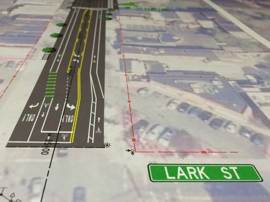
The second phase of the Madison Ave Road Diet -- one of the area's most interesting transportation projects -- is set to start this summer, and officials say they hope the bulk of the work will be finished this year.
That timeline was one of the details discussed a during a public meeting about the project Thursday evening at Saint Rose in which the city and project engineers continued to express optimism about the traffic calming plan in the face of skeptical comments and questions from the crowd.
A peek at what the proposed movie theater at 1 Monument Square in Troy might look like
Don't squint -- we've posted the images in large format.
The first renderings of the propose movie theater at 1 Monument Square in downtown Troy are out.
The backers of the project -- Bonacio Construction and Bow Tie Cinemas -- pitched the idea before the Troy City Council Wednesday evening, touting it as a luxury movie theater. [Troy Record] [TU]
The city of Troy selected the proposal from two entries earlier this year. The super quick overview: The $18 million project would include a 9-screen movie theater, 3,000 square feet of street level retail space, 100-150 parking spaces underneath, and the potential for additional floors in the future. Bonacio and Bow Tie will also be redeveloping the American Theater space, located 500 feet down River Street from the site. The projected opening date for the 1 Monument Square theater would be the fall of 2018.
A look at the plan for new bus and pedestrian amenities at Lark and Washington in Albany
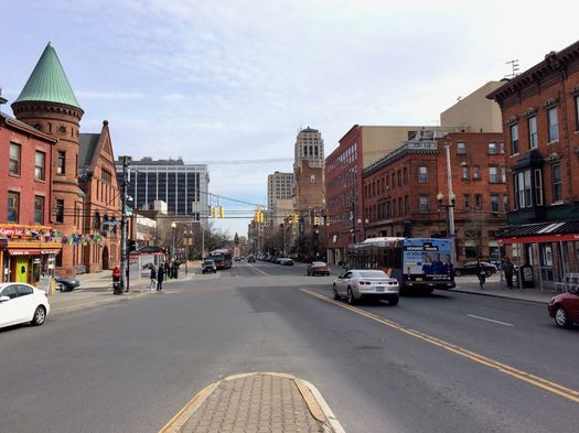
The spot where Washington Ave, Central Ave, and Lark Street run together in Albany is one of the city's busier intersections -- and not just because of cars. It also funnels many of the most popular bus routes into downtown, and it bustles with pedestrians from the surrounding walkable neighborhoods.
And this summer it's getting a bit of a makeover as part of a plan to reconfigure CDTA's facilities around the intersection.
Public meeting for second phase of Madison Ave Road Diet in Albany
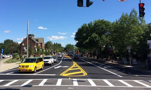
The second phase of the Madison Ave Road Diet in Albany is set to start later this year and the city has a public meeting coming up April 6 to offer info and answer questions about the plan:
Continuing the transformation of Madison Avenue into a complete street and consistent with the theme developed publicly during Phase 1, the City of Albany is now progressing Phase 2 of the project to add bike lanes, improve transit stops, and improve pedestrian accommodations on this important City Street. During this public information meeting, project representatives will provide information about the Phase 2 scope and schedule, and address questions during a brief Q&A period. Similar to Phase 1, Phase 2 proposes to reduce the number of travel lanes in the corridor from four lanes to three, upgrade traffic signals, provide signal coordination for motorists, and provide improved accommodations for non-motorized users in the corridor.
This next phase will cover the stretch from Partridge Street to Lark Street.
The lead up to the road diet prompted a lot of discussion -- from cycling advocates, from businesses expressing concerns about parking, from people who just had a hard time believing that reducing the number of travel lanes wouldn't create traffic problems. And when that first phase -- from Allen Street to Partridge -- was reconfigured, it set off a whole new flurry of comments and criticism, with city officials calling for people to be patient and adjust.
So this meeting will be a good opportunity to take a stock of how things have turned out so far. (An informal take based on our own experiences: The reconfigured section feels safer and more humane, and the transition from the new segment to the not-yet segment is jarring.)
And as we mentioned last year, this project is a test of the road diet concept. If it works out, it's not hard to see other streets getting a similar treatment.
The public meeting is Thursday, April 6 at 6 pm at the College of Saint Rose's Touhey Forum (Lally School of Education building, 1009 Madison Ave).
The big Rezone Albany process is almost finished
Officials say the buildings at 268 and 288 Lark Street are two examples of how the city's current zoning holds back development.
More than two years after it started, the city of Albany is close to finishing the major overhaul of its zoning -- a process city officials say will make the city's development rules easier to understand and consistent, opening the way for millions of dollars in new development.
The city formally released the final Rezone Albany draft Monday. It's the first major update since 1969. And in the time since, city officials say the city's zoning had become a knotted pile of variances, complications, and inconsistencies. The aim of the new rules is straighten out that tangle.
"One of the things that has struck me through this process is that when we look throughout the cities as some of the challenges that we have in our neighborhoods, particularly challenges with vacant and abandoned buildings particularly commercial, sometimes we found the enemy and the enemy was us," said mayor Kathy Sheehan at a city hall event for the draft's release. "In other words, our antiquated zoning was ... driving a lack of ability to more forward with business decisions that would help our neighborhoods."
We've written about Rezone Albany a bunch over the last few years. And while zoning might sound like some sort of sleep aid, the questions it involves are the sorts of things people routinely get fired up about: What sorts of businesses can open where? How late can they be open? How can old buildings be adapted for new uses? How can neighborhoods suffering from disinvestment gain new life?
Here's a quick example of how the new zoning could potentially simplify things.
The new new plan for 1 Monument Square

The site last summer, looking up toward River Street and the square.
The city of Troy announced Wednesday that it's selected a plan for the redevelopment of 1 Monument Square: a new Bow Tie movie theater built by Bonacio Construction.
Said mayor Patrick Madden in a press release:
Their proposal to build a nine-screen cinema will strengthen our city's growing economic resurgence while further boosting Troy as a regional destination in the Capital District. With an estimated 10,000 weekly visitors this exciting project will support our downtown restaurants and small businesses while helping to attract additional investment to our community.
Bonacio's proposal is part a plan that would also redevelop the former American Theater space nearby on River Street into a one-screen theater, also run by Bow Tie. (The small theater project was awarded $600k in the state Regional Economic Development Council grant process this past December.)
The city council still needs to approve a development agreement for the 1 Monument Square site, and the project will have to go through the usual planning approval process. The Madden administration is projecting that construction could start in late fall of this year and be completed by late 2018.
The project will be the fourth major attempt to redevelop the site on the riverfront in the heart of Troy.
How we all ended up talking about a gondola between downtown Albany and the train station
Last fall the McLaren Engineering Group floated the idea of building a gondola lift to ferry people between downtown Albany and the train station over in Rensselaer. The initial phase of the project would have a price tag $16.6 million-$19.5 million. (That image is from the feasibility study.)
The concept of building a gondola or aerial tramway across the Hudson River from the Rensselaer Amtrak station to downtown Albany and the Empire State Plaza has generated a considerable amount of debate in the Capital Region over the last several months.
Readers of my previous commentaries in this space know that I'm suspicious of the need to spend tens of millions on capital-intensive infrastructure projects in the region, preferring to spread the money around to more fundamental improvements such as increased local bus service and CDTA's planned Bus Rapid Transit lines.
The gondola concept, though, presents an opportunity to consider a more basic question: Just why do quirky, perhaps absurd ideas like the gondola keep popping up in regional dialogue about transportation infrastructure?
The Albany metro fares well compared to other large metros for pedestrian deaths -- but there's room to improve
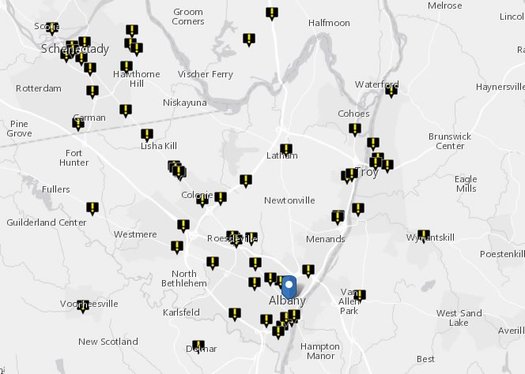
A clip from the report's map of pedestrian deaths in this area between 2005 and 2014.
The Albany metro is one of the nation's safer large metros in terms of pedestrian deaths, according to analysis out this month by Smart Growth America. Each year the advocacy org releases a report called "Dangerous By Design" that tracks and compares pedestrian deaths across the nation's 100 (or so) largest metros.
The Albany metro ranks #94 out of 104 metros in the new report's Pedestrian Danger Index -- that is, it was the 11th safest for pedestrian deaths. The index attempts to adjust the number of total pedestrian deaths per capita in area for estimates of the number of people who are walking to work. In terms of raw number of pedestrian deaths per capita, the Albany area fared a bit worse -- 23rd out of 104. (The data are from 2005-2014.)
The rankings for other New York metro areas: Syracuse (#99), New York-Newark-Jersey City (#95), Rochester (#91), Buffalo-Cheektowaga-Niagara Falls (#72). The metros pegged as most dangerous were mostly in Florida and other Sun Belt areas.
The report also ranks states -- New York ranked 38th out of 51 (including DC) for highest Pedestrian Danger Index.
From this year's report, which highlights that older people and people of color are disproportionately killed more often in crashes while walking:
Troy's request for another attempt at 1 Monument Square
The site this past August, looking up toward River Street.
"Now is the time to develop this key parcel in downtown Troy."
That's the last line of the opening page of the new request for proposals that the city of Troy posted Monday for the 1 Monument Square site, one of the most prominent pieces of undeveloped real estate in the Capital Region core. The request is looking to spur the fourth major attempt since 2011 to redevelop the old city hall spot.
Here's a quick scan of what the city is looking for this time around...
The new plan for the First Prize Center
The First Prize Center is one of the most prominent sites in the Capital Region core. It sits on the border of Albany and Colonie, right alongside I-90. And even though it's been been crumbling for decades, multiple attempts to redevelop it over the years have fizzled.
And now there's a new a plan: The development firm Richbell Capital announced Thursday its intent to completely replace the site with a large mixed-use development that would incorporate housing, retail, entertainment, and offices.
Here are some details...
A few bits about the proposed Albany Skyway
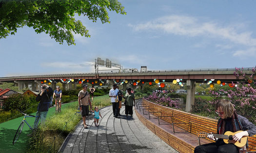
A rendering of the proposed park.
Updated with comment from NYSDOT.
One of the more intriguing Capital Region projects to pop up in the state's Regional Economic Development Council funding announcements this week is a linear park that would take over an off-ramp that connects currently connects Quay Street along the Albany riverfront to Clinton Ave downtown.
Here are a few details about the "Albany Skyway"...
What if Albany is upstate, but not "Upstate"?
What are we really talking about when we use the term "Capital Region"? Is it a geographic place? A population of people? A set of economic connections? A culture?
That's one of the questions we were thinking about while looking over a recent attempt by researchers to define megaregions and lay out a "functional economic geography of the United States." The work -- by Garrett Dash Nelson of Dartmouth and Alasdair Rae of the University of Sheffield (UK) -- takes a ton of Census data about commuting patterns and processes it into a series of maps. It's published in PLOS One.
So, let's have a look at those maps for this area, along with a few thoughts about the results.
About that idea to connect the train station with downtown Albany via a gondola lift...
Maybe you remember a while back the idea popped up of constructing a gondola lift to ferry people between downtown Albany and the train station over in Rensselaer.
Well, the engineering firm that floated the possibility -- McLaren Engineering Group -- released a feasibility study Wednesday that concludes the project is workable, and "retains the potential of being a transformational project that will create a spark of increased mobility, tourism, and economic development in two areas of the cities of Albany and Rensselaer that are currently underdeveloped."
Here's a quick overview and a few thoughts...
The ongoing debate over what Lark Street is and should be
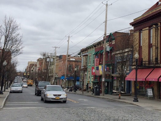
You've probably heard at least a little bit about the big Rezone Albany project, which is working to completely overhaul and modernize the city's zoning code. The process is nearing its completion, and as that approaches, people are starting to get a sense of what sorts of changes the project might prompt.
One that's getting a lot of attention is the zoning designations for parts of Lark Street between Madison and Washington and adjacent areas of neighborhoods there. Specifically, the new "mixed-use neighborhood center" designation along parts of Madison, Lark, and Washington will eventually require businesses to close by 2 am. And the "mixed-use neighborhood edge" designation for zones around the area will eventually require an 11 pm closing time.
Public meeting on West Hill/West End revitalization plan
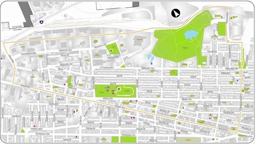
The study area.
The city of Albany has an event lined up for November 1 to get public input on a draft revitalization plan for the West Hill and West End neighborhoods.
There will be a presentation of the draft plan, and a question and answer session. From the city's press release: "Plan is part of initiative to create a vibrant, economically strong, and walkable neighborhood."
Here's a clip from a report pulling together input from a community summit this past summer -- it was produced by Kevin Dwarka Land Use & Economic Consulting, the consultancy handling the project for the city:
A few overall themes emerged from the public engagement process:
+ Addressing the issue of public safety, both real and perceived, is of paramount importance if other strategies produced through the revitalization effort are to be successful.
+ Improved education, workforce training, and career mentorship services are the preferred methods for indirectly addressing the prevalence of crime and illicit activities, while simultaneously improving employment and economic factors within the community.
+ Housing issues within the community are varied and nuanced, and as such will require a comprehensive and collaborative approach amongst the various housing agencies and stakeholders at play.
+ The pedestrian experience, including the existence of crosswalks, the quality of sidewalks, and the aesthetics of streetscape within the community are seen as achievable and high value improvements that can significantly enhance the mobility of residents and visitors within and around West Hill and West End, as well as, enrich overall community character.
This project isn't part of the ReZone Albany project -- but Rezone included a look at the future of Central Ave, which runs along the edge of both these neighborhoods. And as noted during a discussion of the Rezone Albany focus on Central Ave, that neighborhood is one of the area's most vibrantly multicultural places, with a strong immigrant presence.
The public meeting for the neighborhood revitalization plan is Tuesday, November 1 at West Hill Middle School (395 Elk Street) from 5:30-8:30 pm.
Schenectady bike lane demonstration
The city of Schenectady's ongoing work toward a master plan for bike infrastructure includes a demonstration project that starts today (Wednesday) and runs through the weekend on Craig Street in Hamilton Hill that's focused on bike lanes, shared lanes, and street calming. Blurbage:
As part of the Schenectady Bike Infrastructure Master Plan, riders and residents are invited to participate in this community demonstration project showcasing street-level bicycle improvements designed to increase safety and connectivity. The temporary installation through funding from CDTC, is designed to explore bicycle-related Complete Streets options for improving Craig Street as a City, Neighborhood and Schools connection.
Here's a map and other backgroun about the project.
The demo includes a bike fest Wednesday afternoon from 2-6 pm with bike-themed activities and prizes. And the Electric City Bike Rescue will be there helping with repairs and maintenance.
This is the second demostration project as part of the bike master plan process. Earlier this year there was a demo of a contra-flow bike lane on Washington Ave.
The draft of Albany's new zoning map is out
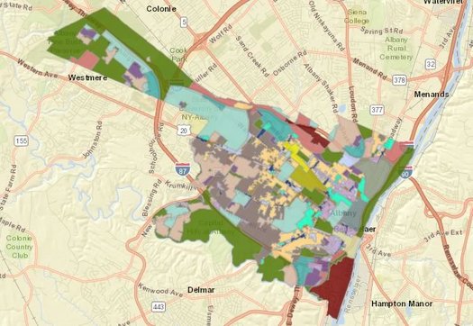
The big ReZone Albany project has reached another big milestone: a draft of the city's new zoning map.
The proposed map incorporates the new types of zoning districts included the comprehensive overhaul of the city's zoning rules -- the first since the 1960s -- that's currently in progress. (Here's the current zoning map.)
We've embedded the proposed map and the current map in large format if you'd like to compare (somewhat) side by side.
Zoning might sound like a really boring topic. And it's certainly complicated. But the issues it deals with cover many things that people regularly get fired up about: How can buildings or properties be used? What sort of new buildings can be built? What should projects look like? And so on.
ReZone Albany draft out, public meetings this week
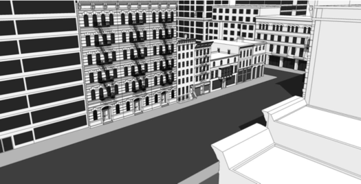
A concept drawing from the part of the draft detailing the rules for a mixed-use downtown district: "The purpose of the MU-DT district is to provide for a wide range of uses and encourage infill redevelopment while reinforcing existing, well-defined urban character of Albany’s historic downtown area."
The draft of the city of Albany's new zoning code is out, and there are two public meetings this week to discuss it:
+ Wednesday, August 31 at the Albany Public Library Washington Ave branch from 2-4 pm
+ Thursday, September 1 at College of Saint Rose Lally School (1009 Madison Ave) from 6-8 pm
The Rezone Albany process has been going on for almost two years now, and it's the sort of thing that might be easy to just be like, "Zoning? More like zzzzzzzzzzzzzzzonig, amirite?!"
But the issues up for discussion are all the sorts of things that people regularly get fired up about: What sorts of buildings are built, complications that keep rundown properties from being redeveloped, what projects look like, what people are allowed to do with properties, and everyone's favorite topic, parking. Given that the city's zoning hasn't gotten an overhaul since the 1960s, there's plenty to update in order to make the code more in line with the direction the city wants to go, and along the way make the rules more clear, consistent, and predictable.
Here's a short, quick example of how the Rezone Albany process has already made a difference.
Adapting to the Madison Ave Road Diet
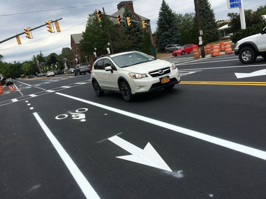
Some follow-up on the roll out of the Madison Ave Road Diet in Albany...
Since the new striping has gone down on the section of Madison Ave starting at Allen Street this week, we've heard a lot of comments from people hailing the traffic calming project for slowing vehicle speeds and providing bike lanes.
We've also seen a few complaints that traffic has become very slow during the late afternoon. For example: one person said it took her 25 minutes to get from New Scotland Ave to Allen Street on Wednesday, a distance of 1.3 miles. (Though maybe there was an unusual circumstance contributing to the backup.)
So at the city of Albany's official unveiling of the project's first phase Thursday afternoon, we talked with city officials about these complaints.
They urged patience as construction continues and they work out the snags. But they also called for people to adapt.
How to move forward at 1 Monument Square?
What should go here?
More than a hundred people showed up for a public meeting Wednesday evening in Troy to talk about how to redevelop the 1 Monument Square site. And toward the beginning of the event, mayor Patrick Madden mentioned that the city was hoping to have a request for proposals out to developers sometime early this October.
But by the time the event was ending, Madden said his administration would be rethinking the process.
Here's what happened in between...
Madison Ave Road Diet, now lined up
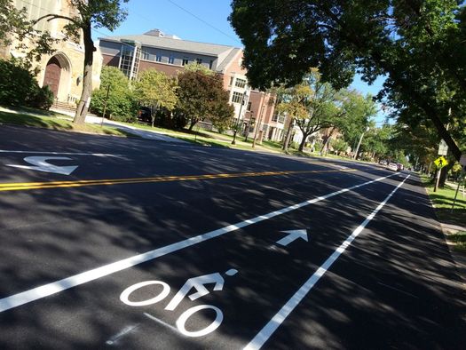
As mentioned, the city of Albany has started re-striping Madison Ave has part of the road diet in the works for the corridor between Allen Street and, eventually, Lark Street. So we took a a few minutes Tuesday to stop by the western-most section to see how it's looking.
That's a pic above, and there are more after the jump if you're curious.
The Madison Ave Road Diet is changing the street from two travel lanes in each direction to one travel lane each way with a center turn lane and bike lanes running along both sides.
The goal behind changing the road design is to "calm" traffic -- getting cars to move slower and making the corridor more friendly to pedestrians and cyclists -- with an eye toward making the street safer. A representative of Creighton Manning, the firm that's overseeing the road diet project, said at a public meeting earlier this year they're projecting a 25 percent decrease in accidents because of the redesign.
An outside perspective on Albany
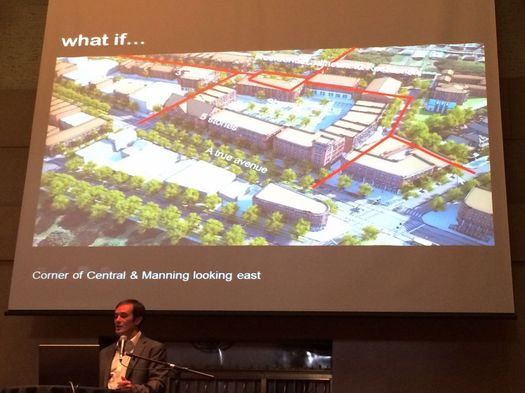
Jason King presenting some ideas for the Central Ave neighborhood at a ReZone Albany event at The Linda last summer.
One of the most interesting parts of the ReZone Albany project has been the series of events focused on the futures of specific neighborhoods around the city. The last one, about the neighborhood around UAlbany's downtown campus, was just this past week. Here's a recap of the ideas that came out of that.
These events have been interesting because they've been opportunity to hear what members of the public think about these neighborhoods right now -- what they hope for these neighborhoods in the future.
Another interesting part of the series has been to hear the perspective of the consultants heading up the sessions. The reps from Dover, Kohl -- which is based in Miami -- have had a chance to get to know Albany over the past year. But they also bring a national perspective to what's going on here because they do similar projects all over the country.
So after last week's event at UAlbany, we took a few minutes to talk with Jason King -- the firm's senior project director -- about how he sees things here in Albany. Some of the things he said we suspect will have you nodding your head. And we're guessing some of you will also hear some things with which you disagree.
Here are a handful of quick clips from the interview.
Imagining possible futures for the neighborhood around UAlbany's downtown campus
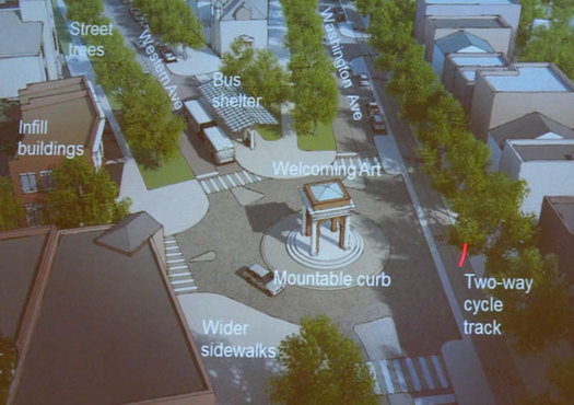
A new gateway for the neighborhood?
The ReZone Albany project was focused on the neighborhood surrounding UAlbany's downtown campus last week, a process that culminated in a few "big ideas" for the neighborhood and a bunch of renderings imagining how the future could play out there.
The focus on the neighborhood at the heart of the city was prompted in part by UAlbany's planned $60 million renovation of the former Albany hight school building at Western and Lake into the home of its new engineering college. As Jason King of Dover, Kohl -- the consultancy heading up last week's program -- said in reference to the investment and its potential spillover effects: "That makes this one of the most promising parts of the city."
Let's have a look at those ideas and renderings...
Thinking about the future of the neighborhood around UAlbany's downtown campus
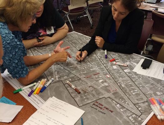
What should the future version of the neighborhood around UAlbany's downtown campus look like? What sorts of services, establishments, and amenities should it have? And what the heck do you call that area?
Those were some of the questions that came up Monday evening during the first Rezone Albany public event focused on imagining and shaping the future of the neighborhood at the heart of the city of Albany. It is, as Albany planning director Christopher Spencer explained to the crowd, an attempt to see how connections can be made among the university, the neighborhood, residents, and businesses.
Monday's event was about gathering ideas from the public. Here's a distillation of what people had to say, along with a few thoughts.
A few more bits about the potential sale of a chunk of the Harriman State Office Campus
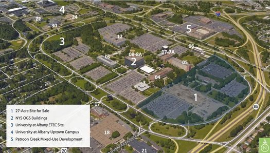
A site map from the state's request for proposals (RFP).
As you might have heard, the state has put a large chunk of the Harriman State Office Campus up for sale. It could be a big deal for the city of Albany because it holds the potential of adding taxable land (which the city's budget could use) and transforming a large site.
The state held a webcast about the sale Wednesday. It's online if you'd like to watch it, and only about 15 minutes. But we watched it so you wouldn't have to.
Here are a handful of interesting bits we took from it...
Rezone Albany: UAlbany downtown corridor
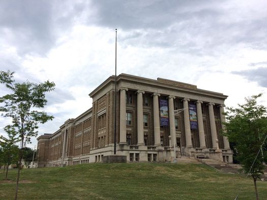
The building UAlbany would like to transform into the home for it new engineering college.
Here are the details for those upcoming public events that are part of the Rezone Albany focus on the downtown UAlbany campus corridor. The events will be in Milne Hall room 200 (135 Western Ave).
+ Monday, August 1: hands-on design workshop with input from the public from 6-8 pm
+ Tuesday, August 2 and Wednesday, August 3: open design studio from 9 am-6 pm at which members of the public can drop in
+ Thursday, August 4: work in-progress presentation from 6-8 pm
From a UAlbany email about the events:
On the agenda are issues like walkability, traffic calming, future development needs, safety, neighborhood identity and parking. Input from people who live, work and otherwise use the neighborhood is essential to crafting a cooperative vision for the area's future.
The consultancy holding the events will be Dover, Kohl & Partners, the same group that ran the neighborhood-specific Rezone Albany events -- the Warehouse District, Central Ave, and the South End -- last year. All three of those mini-series were interesting -- not only to see what members of the public were interested in, but also to hear from the consultants about how what's going on here fits into broader trends around the nation.
Based on these earlier events, if you're thinking you'd like to go to just one of the events, the first one will probably be the best bet for offering input, and the last one for seeing renderings and potential neighborhood plans.
Schenectady bike infrastructure plan survey
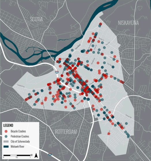
The website for the project includes includes a handful of maps that you might find interesting. The example above plots bike and pedestrian crashes around the city between 2010 and 2015. / map: City of Schenectady / CDTC / Alta / LAndArt Studio
The city of Schenectady is working toward a bike infrastructure plan and is looking for input via an online survey. Blurbage:
This plan is being developed to address the needs of all user types ranging from novice neighborhood and trail bicyclists to expert road bicyclists. Please take 5-10 minutes to fill out this questionnaire. Your response will help to build a better understanding of area needs and priorities. Even if you do not bicycle regularly, your feedback will be helpful.
The survey is pretty much what you'd expect: questions about why people bike, what would encourage them to bike more often, and priorities for making bike infrastructure upgrades.
The city is working with the Capital District Transportation Committee and Alta Planning + Design on the bike plan. (Alta is a go-to consultancy for bike projects -- it's also working with the city of Albany on the waterfront bike trail connector.)
Looking at the future of UAlbany's downtown campus -- and the neighborhood around it
This was once the Albany High School building. UAlbany is planning to turn it into a home for its new engineering college.
In what way should the area around UAlbany's downtown campus grow in upcoming years?
Are there opportunities for the city and university to set the stage for the neighborhood to evolve into a better version itself?
Those are some of the questions at the heart of a new project announced Monday by the city of Albany and UAlbany to study the Western Ave/Washington Ave corridor along the university's campus locations in the heart of the city. The process is part of the city's ongoing ReZone Albany project, and there will be events coming up soon at which the public can voice its opinions about which way the neighborhood should be headed.
Here are a few more details, and a few thoughts...
A cookbook for designing Albany streets
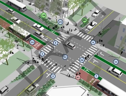
An example intersection from the manual that highlights bike and transit amenities. (The example doesn't reference a specific intersection.) Here's a larger version.
The city of Albany's ongoing process to plan for a more walkable and bike-friendly future took another step forward this week with the public presentation of a draft of the city's "complete streets" manual.
And if that sounds a little wonky... well, it is. But think of it this way: The manual is like a cookbook for city streets, with recipes (so to speak) about how to incorporate elements such as bike lanes. And it's online for public review -- the city will be accepting comments July 27.
Here's a little bit more about the idea, and a few things that caught our eye while looking over the manual...
Funding for reconfiguring Washington Ave between Lark and Dove
The Cuomo admin announced a new statewide pedestrian safety campaign with $110 million for projects -- and one of the Capital Region items caught our eye:
$770,000 for a Capital District Transportation Authority project to reconfigure a one-block section of Washington Avenue in Albany between Lark Street and Dove Street to enhance safety for pedestrians, transit riders and motorists. The project will construct a travel lane exclusively for westbound left turns, consolidate six heavily used transit stops, provide a signalized, mid-block pedestrian crossing and extend curbs and revise parking to reduce speeds and traffic congestion.
CDTA has been wanting to reconfigure the bus stops there for a while (you might remember there was some outcry about how such a consolidated stop could affect the Iron Gate Cafe). It'll be interesting to see how this design shapes up. [TU+]
Info about the rest of the Capital Region projects getting money via this program is after the jump -- items include the rest of the Madison Ave Road Diet and improvements along Brandywine Ave in Schenectady.
Also: Apparently the technical term for a rumble strip is "Milled-In Audible Roadway Delineators."
Thinking about Capital Region light rail
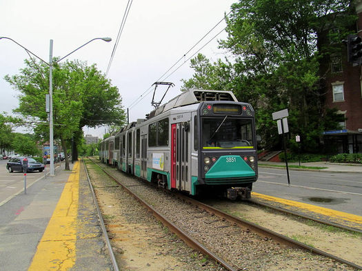
An example of light rail in the Northeast: The MBTA Green Line near Boston. / photo: Wikipedia user Pi.1415926535 (CC BY-SA 3.0)
A couple of weeks ago I tackled the question of whether the Capital Region should build a commuter rail system, answering with a resounding "maybe... at least not yet."
As promised then, today I'm taking on whether our area should embrace a different mode of rail transit: light rail.
Plotting a path for the Albany waterfront bike trail connector
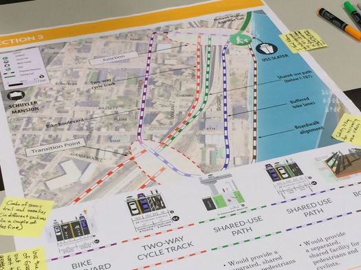
A paved section of the Albany County's Helderberg Hudson Rail Trail recently (officially) opened from Slingerlands to Albany's South End neighborhood. That end point on South Pearl is just about two miles from where the Mohawk-Hudson Hike-Bike Trail picks up along the Albany riverfront.
And that proximity, of course, prompts the idea: Hey, maybe these should be connected in some meaningful way, right?
The question of how that make connection happen is at the center of the Albany Waterfront Connector project. And Thursday night there was a public meeting laying out some of the possible options.
Here's a quick look.
Thinking about Capital Region commuter rail
A Shore Line East commuter rail service train in Connecticut. / photo: Pi.1415926535 on Wikipedia (CC BY-SA 3.0)
The topic of bringing rail transit to the Capital District is one that comes up regularly every few years. Certainly, there are a good number of well-intentioned advocates out there in the region who believe that to have a serious transit option, the Capital District must have rail.
I don't -- at least, not yet. And here's why.
Talking about making a connection at Albany's waterfront
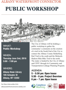 The project aiming to connect the Helderberg Hudson Rail Trail and the Mohawk-Hudson Hike-Bike Trail in Albany's South End has a public meeting lined up for June 2. The purpose of the event will be to gather comments from the community about the creation of the trail connector.
There's been a lot of work going on recently with both of these bike/hike trails. The paved segment of Albany County's Helderberg Hudson trail between Delmar and the South End will officially open this month (it's been unofficially open for a while). And the city of Albany has a $5 million project under construction to upgrade pedestrian and bike amenities along the Mohawk-Hudson trail along the Hudson riverfront.
So this connector project is about figuring out the best to link these two trails. As Kate Lawrence, a senior planner and sustainability coordinator for the city of Albany, told us recently: "With [the waterfront connector] study what will be important is to get feedback from people in what they want to prioritize for that multi-use path because there will be a few options available." Among those options will be deciding the route of the connecting path, whether it bypasses or goes through the neighborhood, and how it negotiates I-787.
The public workshop is Thursday, June 2 from 5-7 pm at the Howe Branch of the Albany Public Library (105 Schuyler Street). There will be a project open house from 5-5:30 pm, a presentation from 5:30-6:30 pm, and the open house will continue from 6-7 pm.
(Thanks, L!)
Designing for safer Capital Region streets
Central Ave at Quail Street in Albany.
Street safety has been a major topic of discussion in the Capital Region recently, from Albany's red light cameras to the Madison Avenue road diet to the death of a young boy in Albany and far too many others across the region. It's pretty clear that everyone agrees something must be done.
To a large extent, though, it seems that the discussion about road safety for all users has focused on more and better enforcement of existing laws as a solution to the toll. And while enforcement of speed limits and road safety -- which, in my experience, is pretty nonexistent in much of the region -- is absolutely part of the ultimate fix, the focus on it ignores that there is, in fact, a much more effective solution at hand: better design of our streets and roads.
Here are a few examples:
Walk [Your City] founder at Albany Roundtable
 The founder of Walk [Your City] -- Matt Tomasula -- will be the featured speaker at the Albany Roundtable annual meeting May 18 at the University Club in Albany. It's open to public -- tickets are $40.
If Walk [Your City] sounds familiar, it's probably because it's been implemented here in Albany. Maybe you've seen the signs around downtown that note the walking time to various destinations.
Tomasula started Walk [Your City] in Raleigh, North Carolina in 2012 as a guerilla project that eventually won acceptance from the city government there. The idea has now been implemented in cities around the country.
Here's a 2014 profile of Tomasula and some of his "DIY urbanism" projects in the Raleigh-Durham area, which include a pop-up biergarten based out of a shipping container.
The Albany Roundtable event is Wednesday, May 18 from 6-8 pm.
photo via Matt for Raleigh FB page
Opportunities to learn more, and offer feedback, about the latest chunk of Rezone Albany
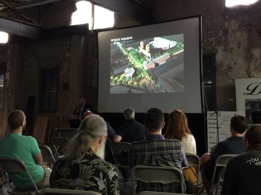
A scene from an earlier Rezone Albany public meeting.
The latest chunk of the Rezone Albany project has been released and there are two public meetings this week to discuss the installment: Module 3: Return of the Rezone.* The events:
+ Wednesday, May 11, First Presbyterian Church of Albany (326 State Street) 6-8 pm
+ Thursday, May 12, Albany Public Library Delaware Ave Branch (331 Delaware) 6-8 pm
A meeting about zoning might sound like a ticket for the train to Snoresville, but zoning touches on a lot of topics that people regularly get fired up about, including what sort of development should go where and what it should look like. Rezone blurbage:
ReZone Albany is a major initiative to update and streamline the City's antiquated zoning code. This two year effort - funded largely by the New York State Energy Research and Development Authority (NYSERDA) - is designed to reduce make the City a better place to live, work, invest, and play. The project will create a new Unified Sustainable Development Ordinance (USDO) that:
+ Is simpler, more user-friendly, and highly illustrated
+ Is better aligned with the City's Albany 2030 planning priorities,
+ Promotes energy conservation and sustainable development,
+ Reduces burdens on small business owners,
+ Streamlines the City's procedures for reviewing and approving new development, and
+ Protects established neighborhoods.
This is the first major revision of the city's zoning almost half a century. An example of how this process is already affecting things: The new mixed-use overlay district that's been applied to the Warehouse District has smoothed the way for residential conversion projects there.
West Hill/West End
Another planning event: The city of Albany is starting work on a West Hill/West End neighborhood plan this weekend with a party at Swinburne Park Friday from 5-7:30 pm. And then on Saturday, April 14 there will be a neighborhood planning summit at Philip Schuyler Achievement Academy (676 Clinton Ave) from 9 am-4 pm. "This event will include a review of neighborhood assets, walking tours, as well as resident input, ideas & vision for the West Hill/West End Neighborhood Plan."
____
* It's possible it's just called "Module 3" and we got this mixed up with the sequel of a different franchise.
Signs of caution
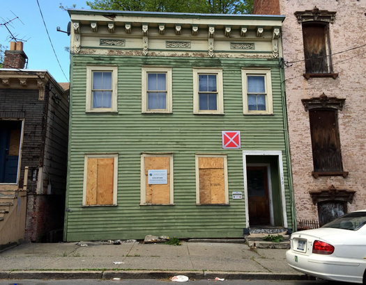
A row of three buildings on Broad Street in the South End are marked with the boxes.
You might notice these red-and-white signs popping up on buildings in in the city of Albany. So... what's that about?
From a city press release Monday:
The 2X2 foot building identification signs, which will consist of an "X" inside a red-colored square, will be placed on [vacant] buildings that have interior hazards, warning first responders during emergencies such as fires that the building is unsafe to enter. But emergency responders will still enter these buildings if people are believed to be inside one of the designated buildings.
Albany firefighters will be inspecting 600-800 buildings around the city over the next six months making assessments about which buildings should get the warning box, according to the city. The review will also serve as a code enforcement check and violators will be cited.
Earlier on AOA: Map: Vacant buildings in Albany (2012)
Connecting Albany's riverfront park
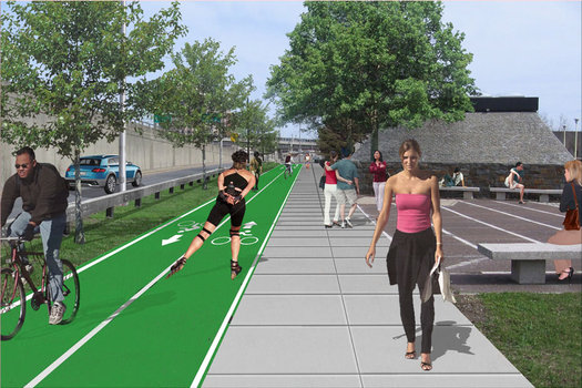
Corning Riverfront Park -- wedged between I-787 and the Hudson River -- has always been like a stray puzzle piece for the city, with people looking at it, scratching their heads, and asking: "How does this fit?"
It took the city decades to figure what to do with the slice of land. Should it exist as a nature preserve? Maybe farm land? If it's an active park, what should it include?
More than anything, though, the spot has just been persistently difficult or confusing to reach. It is the place in Albany that you can't get there from here.
But now there's a $5 million project aimed at upgrading pedestrian and bicycle amenities in the park -- and making it clearer how exactly it connects to other parts of the city.
Comparing transit service both within the Capital Region and beyond
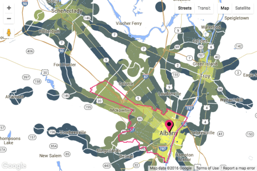
Check out the map clip above -- it's from a new site called AllTransit and it shows the number of transit routes within mile for places around the Albany-Schenectady-Troy area. (There's an interactive version at that link.) The brighter the yellow, the higher the number of routes.
AllTransit has all sorts of maps and rankings and data like this for metros all around the country. Here's a whole bunch of potential uses for info, broken out by type of person who might be using it (city residents, business owners, elected officials, and so on).
The maps might first draw your eye, but the rankings and scores are interesting for getting a bit of context about relative levels of transit services both (with)in the Capital Region and elsewhere. For example, the Albany-Schenectady-Troy metro ranks #42 among metros with more than 500k people for AllTransit's Performance Score, "an overall transit score that looks at connectivity, access to jobs, and frequency of service," with a score of 3.39. But, as you might expect, if you look within the metro area, there is a lot of variation. For example: The city of Albany's performance score is 7.8, the city of Schenectady's is 6.3, and areas of Clifton Park range from 1.4 to 0.
[via CityLab]
screengrab from AllTransit
A few visions of a possible future Troy
Catching up a bit: Plans, renderings, and slides from the recent public meetings for Realize Troy -- effort to develop a new comprehensive plan for Troy -- and are online. And they're worth having a look if you haven't seen them. If you'd like to just flick through one deck of slides, here's the overview presentation.
A lot of the ideas and themes are similar to what's been discussed in Albany in recent years for that city's comprehensive plan and the current Rezone Albany project: developing downtown, making better connections to and use of the waterfront, providing job opportunities, fostering neighborhoods, adjusting codes so buildings better fit their contexts. The "big moves and plan directions":
1. A sustained program of reinvestment
2. Grow people, jobs, and the City's tax base
3. Position the downtown as the cultural and creative hub of the region
4. Grow and expand the success of downtown to the north and south
5. Revitalize neighborhoods and improve access to local amenities
6. Grow the city's skills and knowledge base
7. Reconnect the city to the waterfront and improve its recreational, development and cultural potential
8. Protect and enhance Troy's historical assets
9. Promote an inclusive, healthy, sustainable and green city
10. Continue to engage the broader community in making the Plan a success
The part we suspect that will first catch most people's eyes are some of the ideas floated for downtown Troy, including a re-imagining of the area just south of the Green Island Bridge with a permanent home for the farmers' market and a replacement for the Atrium. We've clipped those slides out -- they're after the jump if you'd like to have a quick look.
The project is currently in the "plan development" phase. It's gathering feedback on the draft plan via an online comment form.
"It is a highway, it is asphalt and concrete, we get a shovel and we hit it enough times it cracks up ... put it in a truck and there is no more highway."
The Cuomo admin released these images for the project today (we gif'ed them). Here are more, and larger, images.
Farther afield, but maybe of note because of the ongoing 787 discussion: The Cuomo admin announced today it's directing $42 million toward ripping out a two-mile section of the Robert Moses Parkway along the Niagara River and gorge in Niagara Falls. The project will include reconstruction of a parallel street, along with new bike trails and green space. Local representatives have been pushing for the highway's removal for years. [Cuomo admin] [Buffalo News]
There are a lot of differences between the Robert Moses Parkway and 787 -- including scale. The parkway carries not quite 3200 vehicles a day, according traffic volume estimates. The segment of 787 just north of the South Mall Expressway carries almost 46,000 vehicles.
But if you're a tear-down-787 person, some of the remarks Andrew Cuomo made today might make your ears perk up.
Ideas for Lark Street's longterm future
In my previous post, I took a crack at explaining some of the dynamics behind the economic and cultural malaise that many people feel is afflicting Albany's Lark Street.
But since every good analysis of a problem demands a solution, here's a followup: What can Lark do to get its mojo back in the face of significant competition?
Lark Street and the competition among the Capital Region's hip urban areas
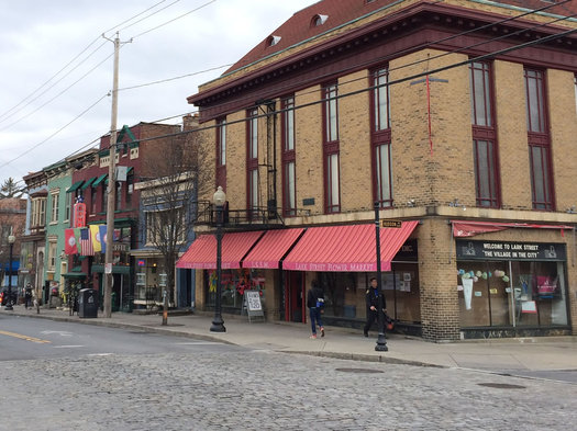
In January AOA ran a piece with a variety of thoughtful responses about the future of Lark Street. I'm grateful to be given the opportunity to chime in a little, as a planner and as a resident of the neighborhood.
As a relative newcomer (I've been on Dove Street since August 2013), I can't claim to have experienced what many people seem to regard as Lark's heyday; but, as is probably apparent if you've read my writing before, I believe strongly that while localized familiarity matters, comparative experience is highly useful as well.
Though reasonable people disagree on the extent of the problem, there seems to be a general sense that Lark Street is suffering from something of a commercial and cultural malaise.
But why? Surely there are multiple factors, but perhaps we can identify a primary one. In the spirit of Hanlon's Razor, I think the most obvious answer is probably the biggest single factor: the stagnation of Lark, perceived or real, is intimately linked to the exciting growth of other neighborhoods in the Capital District that offer similar cultural amenities.
"Realize Troy" events this week
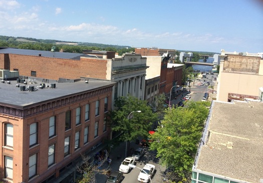
The ongoing effort to develop a new comprehensive plan for Troy -- Realize Troy -- has a series of public events lined up for this week as the final plan is taking shape:
Monday: Draft Comprehensive Plan Overview
"The evening presentation will provide a high-level overview of the Draft Comprehensive Plan directions and transformation over time. This will be followed by break-out group discussions to capture feedback on the information presented." Monday 6:30 pm at the RPI Heffner Alumni House, 1301 Peoples Avenue
Tuesday and Wednesday: Detailed Directions Workshop
The consultants for the project will be giving short, detailed presentations on a range of topics in the plan, including neighborhoods, the waterfront and downtown, and open space. (There's a schedule at that second link above.) Tuesday and Wednesday 6 pm at RPI Heffner Alumni House, 1301 Peoples Avenue
So, what is this comprehensive plan thing? Here's some blurbage from the about page:
The Comprehensive Plan will be developed through significant public consultation and will establish a clear community based vision and action plan to guide the city's overall development over the next 20 years addressing both the current and future needs of the community. The Comprehensive Plan will chart a clear roadmap for the future of the city and it will guide municipal decision-making, investment, development, and land use planning. ... The planning process presents an important opportunity to demonstrate bold leadership and innovation while strengthening the quality of life the city offers and its competitive advantage as a dynamic and desirable place to live, work, invest and recreate.
In other words, if you'd like to see Troy head in a certain direction, this is one opportunity to formally express that.
Here's the plan for the Madison Ave Road Diet
Standing at Madison and Main ahead of Wednesday night's meeting.
The city of Albany has made a choice of which direction to go on the much-discussed Madison Avenue Road Diet, a plan to calm traffic along the busy corridor in an effort to make it safer -- and, at the same time, friendlier to pedestrians and cyclists.
The long-developing project has recently been getting more attention because of a push for the inclusion protected bike lanes in the road re-design. A coalition supporting the idea has argued the lanes are both safer for cyclists and feel safer, which would lead to more people cycling.
Consultants for the project explained the reasons for the selected choice at a public meeting Wednesday evening at Saint Rose. So, without further ado, here's the selected plan.
Meeting to talk about two alternatives for the Madison Ave Road Diet
The city of Albany has a public meeting set for March 9 at Saint Rose to discuss options for the Madison Ave Road Diet. As you know, that's the project to reduce the number of traffic lanes along the corridor and, perhaps, add some sort of bike lane.
Blurbage from the meeting flyer:
The City of Albany is progressing a Locally Administered Federal Aid project to design and construct a road diet along Madison Avenue from South Allen Street to Lark Street. The project will reduce the number of travel lanes, while improving bicycle accommodations and completing all work between the existing curbs. The purpose of the meeting is to review concepts and trade-offs for two feasible alternatives and to obtain public input on the preferred Complete Streets solution.
Update March 7: From a new press release from the city Monday: "The meeting will present the preferred Complete Streets alternative, including the selected bicycle infrastructure."
The path to this point hasn't been a straight line. After the city presented five options for the road diet last summer, it scheduled a public meeting last November to present proposed plan -- and then the meeting was cancelled.
One of the most vocal groups leading up to road diet decision was a coalition pushing for protected bike lanes along the corridor -- these would lanes that are separated in some way from car traffic, either by some sort of barrier or parked cars. The argument for these lanes is that they are not only safer for cyclists, but they also feel safer, encouraging more people to bicycle. The argument against is that they could cut into the number of parking spaces available and would be more costly to maintain.
It appeared at the time, based both on the earlier public presentation and unofficial word circulating, that the city was probably leaning toward "regular" bike lanes rather than protected bike lanes. But then the meeting was cancelled and the city said the road diet was getting further review.
So... it'll be interesting to see which options are presented at this meeting -- and the arguments made for and against those options.
The public meeting is Wednesday, March 6 9 at 6:30 pm in the Lally School building (1009 Madison Avenue) at Saint Rose.
Earlier on AOA: A new pitch for protected bike lanes in Albany
Approvals for Warehouse District projects, and a potential complication
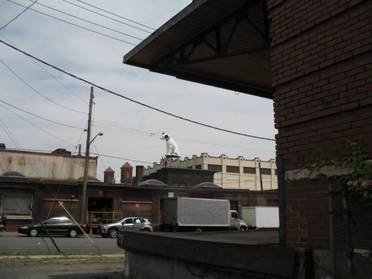
Nipper has a good view of the parking spaces.
Two projects in fermenting Albany's Warehouse District -- the 24-unit residential/restaurant conversion in the old liquor warehouse building at 960 Broadway, and the wine bar in the building next to Wolff's -- got site plan approvals from the city planning board Thursday night. (The approvals are conditional on a handful of reviews for things like sewers, traffic, and street trees.)
So, here's a little bit more info about that wine bar project -- and also a quick look at an issue that could potentially complicate development in the neighborhood.
The latest chunk of the Rezone Albany project is up for a public look
The new designated areas in Warehouse District. It's one of three new "form-based" districts that include proposed specific standards for shaping the look and feel of new development.
The draft of the latest module for the Rezone Albany project is out, and there are two public meetings coming up next week to go over them.
A meeting about making over the city's zoning code? That might sound like a business-class trip to Snoresville. But all sorts of issues that often interest or fire up people are wrapped up in this project -- including which sorts of businesses go where, what neighborhoods look like, and everyone's most favorite of all topics... parking.
So we flipped through this latest of chunk of documents this week, and here are two things that caught our eye...
A new complex for UAlbany, and a few thoughts about the future of the Harriman State Office Campus
A rendering of the Emerging Technology and Entrepreneurship Complex (ETEC).
UAlbany will be building a new complex on a chunk of the Harriman State Office Campus for the new College of Emergency Preparedness, Homeland Security and Cybersecurity, the Cuomo admin formally announced today.
That's a rendering of the complex above. Here's a larger version, along with an aerial view of the complex's position on the Harriman campus.
The development -- called the "Emerging Technology and Entrepreneurship Complex" or ETEC -- will be on 12 acres in the southwest corner of the Harriman campus. (Yep, that's the portion right next UAlbany's uptown campus.) It'll house both the new college and New York State Mesonet, the statewide weather monitoring system that's currently being rolled out.
Press release blurbage:
The $184 million project will be financed through $92 million in previously appropriated State capital funds grants as well as $92 million in previously appropriated Campus-funds. It is anticipated that 1,600 construction jobs will be created by the project. When fully occupied, the complex will become an active hub of research, instruction and business development, with some 1,000 daily occupants including faculty, researchers, industry partners, and students. Site planning is underway and construction is expected to begin in 2017, with completion targeted for 2020.
About the Harriman campus and the city of Albany
The Harriman campus is ongoing issue not just for the state, but for the city of Albany -- because it's enormous, roughly 330 acres within the city limits. And it's tax exempt, a fact that Albany leaders routinely bring up when banging the drum for more state aid.
What if tearing down I-787 could actually improve traffic?
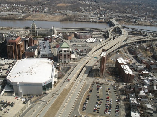
The future of I-787 often pops up in conversations about downtown Albany - specifically, the desire that many people apparently have to see the elevated highway torn down.
There's a currently a longterm effort by a group of state and local agencies to study this overall topic. And you're probably already familiar with some of the potential benefits the tear-it-down crowd touts: A boulevard replacement would reconnect the city with the waterfront. It could improve air quality, especially in some underprivileged areas. And it could open up considerable portions of land for development.
Of course, one of the counter arguments is that 787 is necessary to handle the large amounts of traffic that flow into Albany each weekday, and tearing it down would tip downtown into traffic gridlock.
But what if it was just the opposite -- what if tearing down 787 could actually make traffic in Albany flow more smoothly and efficiently?
A new pitch for protected bike lanes in Albany
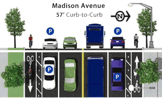
A possible future for Madison Ave?
Back in November the city of Albany was set to present the much-awaited plan for the Madison Ave Road Diet. And then, just a few days before the public meeting to announce plan, the city canceled the announcement and there's been no public word since then about what's up.
There are a bunch of interesting ideas wrapped up in the road diet, among them that the city can reduce the number of travel lanes to slow speeding vehicles while at the same time maintaining overall volume and flow of the corridor. But the idea that's gotten the most attention is the possible inclusion of protected bike lanes -- both from advocates who say the lanes would be a big step forward in the city's effort to become friendlier to cyclists, and from skeptics who worry about the cost of maintaining the lanes and their effects on the number of parking spaces.
It's hard to say what exactly is holding things up. A spokesman for mayor Kathy Sheehan told us this week that the city is still gathering info from its consultants on the project and there weren't any new developments. But there's a sense among cycling advocates that the bike lanes are probably a sticking point.
So now those advocates have a new pitch that is, essentially, the city should do an experiment.
Thinking about the future of Lark Street
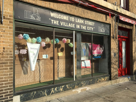
The state of "The Village in the City."
If there is one constant about cities, it is that they are always changing. Businesses open and close. People move in and out.
In Albany a lot of the recent discussion about neighborhood ebb and flow has been focused on Lark Street and the Washington Park neighborhood. The last few years have seen a lot of change on the stretch of Lark between Madison and Washington, and the recent closing of Justin's leaves another empty storefront on the street.
So is this part of the natural ebb and flow of a neighborhood? Or is it something more?
We asked a handful of people who live, work, and own businesses on Lark Street and in the surrounding neighborhood to share some of their thoughts about the direction of Lark Street -- and to tell us what they'd like to see happen in the neighborhood.
A few versions of the South End's potential future
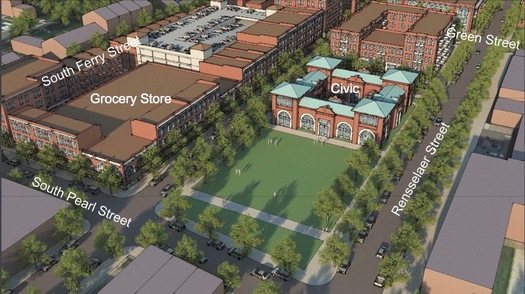
That would be a bit of a change for the DMV site on Pearl Street.
Some quick follow-up to that series of Rezone Albany events focused on the future of the South End last month: The work-in-progress presentation from that week is online, and we've pulled out some of the renderings for easy gawking (they're after the jump).
Here's a clip from one of the presentation slides, summing up what the Rezone Albany consultants -- the firm Dover Kohl has been handling these neighborhood-focused, "form-based code" reviews -- gathered while working with the public that week from working with the public:
big ideas for the south end
• strategic infill & redevelopment street-oriented buildings; reconnect historic grid; mix of uses; mix of housing types; focus on blighted properties; vibrant activity
• improve access & enhance the waterfront connect the neighborhood to the waterfront; develop the waterfront with market-rate housing, hotels, parks, amenities to create an environment not available elsewhere
• lasting economic development diversify local economy; add quality jobs; education & training; redevelop aging affordable housing; mix in market rate housing; add missing housing types
• balanced transportation & better connectivity more transit; bike facilities; connect under highways both physically connections and mental connections; utilize underside of 787 to support connections to the waterfront
• strengthen neighborhoods & create "gateways" unique sense of place; mix of housing types; community amenities, historic preservation, repurpose the Bath House & St. John's Church
The whole deck of slides is worth a look. And even without narration they provide a glimpse at potential possibilities for the neighborhood and some of the ideas discussed.
As with the two other neighborhoods that got an intense focus and visioning during the Rezone Albany process -- the Warehouse District and Central Ave -- we wonder where the people and investment would come from to fuel some of these proposed futures. But if anything, the ideas and renderings are a way of having a discussion about what people do and don't want for the neighborhood. (The whole Rezone Albany project has been interesting in that sense so far.)
OK, on to the renderings...
It always comes back to parking
Or, at least, it feels like this.
We had this thought a few weeks back during a public meeting. And we suspect it's true -- both in the real world and the virtual world. (Though maybe the line should slope even faster.)
By the way: If you've never been to a meeting of your local planning board (or similar panel), you should go sometime. A lot of things people tend to be interested in -- new buildings, news businesses, parking -- get discussed at these meetings. And, if anything, it gives you another peek into how local government works.
Thinking about the future of the South End
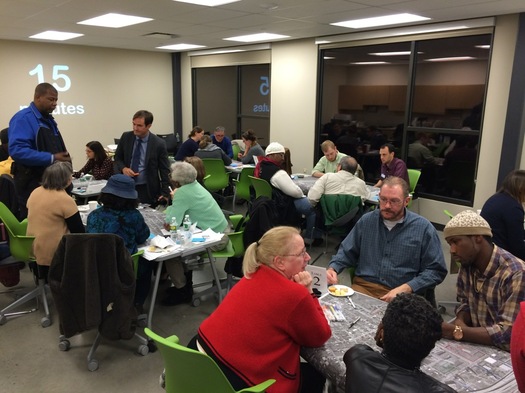
The Rezone Albany project is focused on the South End this week. And as with the other two neighborhoods that have gotten an intensive focus during this process -- the Warehouse District and Central Ave -- there was a an event Tuesday night at which members of the public got together in small groups to brainstorm ideas for the future.
As Christopher Spencer, Albany's planning director, said to us of the overall Rezone Albany project: "We want to have the right rules in place to get what the community is looking for."
Here are a few ideas and topics that bubbled up from the working groups Tuesday night...
Rezone Albany: South End
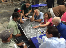 The Rezone Albany project's next neighborhood specific workshop is for the South End. Blurbage:
The South End Design Workshop is a three-day visioning, zoning and form-based coding discussion that will inform the City's ReZone Albany initiative. This workshop will focus on the area around Albany's South End, gathering input from members of the public in order to arrive at a collaborative solution. The Warehouse District Workshop began the process in May, followed by the Central and Manning Design Workshop in August. ...
This is your community. You are the expert. Who knows the community better than someone who lives and/or works here? ReZone Albany is a rare chance for you to be a part of creating positive change, impacting the growth of your City for years to come. We need your ideas, input and feedback to ensure that the vision reflects community values and aspirations.
The South End presentations are at the Capital South Campus Center:
+ Tuesday, December 8 from 6-8 pm for the hands-on design workshop
+ Thursday, December 19 from 6-8 pm for the work-in-progress presentation
We've stopped into the two previous workshops -- for the Warehouse District and Central Ave -- and they've been interesting, both as a way to learn more about the Rezone Albany project and just to hear the thoughts of the national consultants about various parts of the city. The South End workshop is the last of the currently planned events of its type.
The products of these workshops are being rolled into proposed mixed-use zoning district that will help direct what sorts of development goes on there in the future.
Arguing the case for protected bike lanes
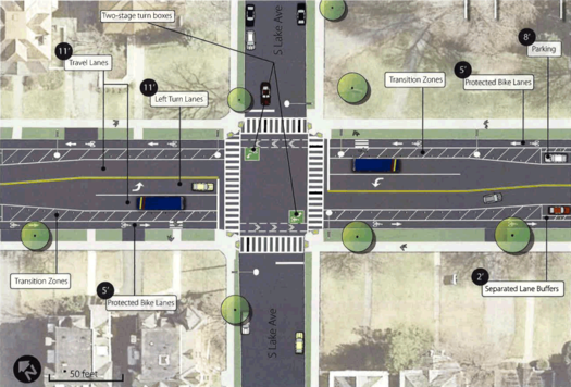
One of the coalition's two preferred options for the road diet.
At some point in the near future the city of Albany will be releasing its plan for the Madison Ave Road Diet, an effort to reshape the traffic flow a long a large portion of the Madison Ave corridor.
Bike lanes are expected to be part of the plan, and exactly what sort of bike lane has become a hot topic -- "regular" bike lanes separated from car traffic by a stripe on the road, or "protected" bike lanes that are separated by some sort of barrier (such as parked cars or vertial pylons).
Listening between the lines this past summer when the city and its consultants presented the options for the road diet, it sounded like the city might be leaning toward regular bike lanes because of concerns about the impact on the number of parking spaces and the costs associated with clearing snow. And ahead of a meeting that had been scheduled for last week (and was then canceled) to release the plan, word was circulating that the city would be heading in that direction.
Perhaps in an attempt to make a pre-emptive case, a group called the Albany Protected Bicycle Lane Coaltion released a report today that attempts to head off some of the arguments against protected lanes.
So, let's have a quick look.
City of Albany to present Madison Ave Road Diet recommendations
Update: The meeting has been cancelled, according to the Albany Police Department (traffic engineering is part of the APD), and will be rescheduled. [APD FB]
____
The city of Albany has a public meeting lined up for Monday, November 9 to present the recommendations for the Madison Ave Road Diet. The meeting is at the College of Saint Rose's Lally School Building (1009 Madison Ave) from 6-7 pm.
The Madison Ave Road Diet is a project to reconfigure the lanes on the busy thoroughfare with the aim of calming traffic and making the street more friendly to pedestrians and cyclists. That could involve reducing the number of traffic lanes from the current two in each direction, to one in each direction with a turn lane.
The part of the project that's gotten the most attention lately is the possibility of the addition of protected bike lanes to the corridor.
The next shapes of the Warehouse District and Central Ave
The first "module" of the Rezone Albany project, and there are two public meetings coming up to review it.
Zoning might not sound like the most exciting thing, but it plays a in role all sorts topics. Examples? Well, this first chunk of the project (technical term) describes new zoning districts and potential uses -- so there are proposed rules for marijuana dispensaries, urban agriculture, food trucks, electric vehicle charging stations, and live-work spaces.
But the stuff that will probably first catch your eye are proposed special mixed-use districts for the Warehouse District and Central Ave.
So, let's have a quick look at those...
The 1 Monument Square project and its opponents
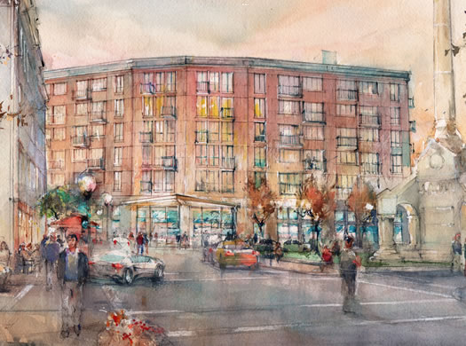
One of the latest renderings.
The development team backing the 1 Monument Square project presented the latest iteration of the mixed-use building to the Troy planning commission Wednesday night. The presentation included new renderings, a somewhat reconfigured plan for the river side of the building, and some discussion about what the space that has been set aside for the Troy Waterfront Farmers' Market might (or might not) be.
And then things took a bit of a turn toward the dramatic. An attorney representing a group called We Care About the Square stood up for the first public comment of the night and raised the possibility of legal action if the project moves forward.
Seeing the city for the trees
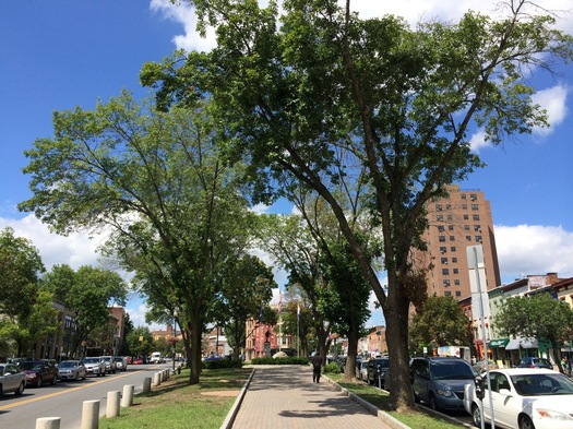
Albany's city forester says the ash trees in Townsend Park will probably have to be taken down.
Trees are often one of those things you don't really have a real sense of until they're gone. It's remarkable how much emptier, starker, hotter a street can feel after a few longstanding trees are taken down.
The city of Albany is facing the possibility of experiencing this sort of impact on a large scale. Last year an invasive beetle was detected in the city for the first time and the city's ash trees -- of which there more than 2,000 along the city's streets and in its parks -- are threatened with being killed off.
We talked with Albany's city forester, Tom Pfeiffer, recently about dealing with this threat, the problems associated with uniformity, trees that stink, and trees as infrastructure.
Thinking about the direction of Central Ave
What direction should Central Ave take? What are the possible destinations?
Those questions about direction -- metaphorical rather than geographic -- were the theme of a discussion this week about the corridor's future as part of the ongoing ReZone Albany effort.
"There seems to me, from the perspective of traveling around a lot, that there is a lot of untapped economic potential in this area," Jason King, from the architecture and planning firm Dover Kohl, said about Central Ave after Wednesday's public presentation at The Linda, the culmination of a three-day intensive look at the corridor. "And I do actually think it's inevitable that it will come. And the question is when it does, what form will it take. Will it be respectful of what's here or will it be intrusive. Will it be fought or will it be integrated and appreciated."
Here's a look at some of the potential visions presented for one of Albany's main arteries, along with a few thoughts.
Rezone Albany: Central Ave
The Rezone Albany project has another neighborhood-specific series of events lined up for next week: This time around Central Ave will be the focus. Blurbage:
The Central Avenue / Manning Square District Design Workshop is a three-day visioning, zoning, and form-based coding discussion that will inform the City's ReZone Albany initiative. This workshop will focus on the Central Avenue corridor, gathering input from members of the public in order to arrive at a collaborative solution.
The events will be at the The Linda (Central and Quail). Schedule:
+ Monday, August 10: hands-on design workshop for the public (6-8 pm)
+ Tuesday, August 11: open design studios for members of the public to drop in (11 am-noon, 11:30 pm-3 pm, 4-5 pm)
+ Wednesday, August 12: work in-progress presentation for the public (6-8 pm)
This focus on Central Ave follows a similar intensive look at the Warehouse District earlier this summer. Those events were interesting -- the consultants working the citywide rezoning effort explained some of the considerations that go into zoning, and looked at how rezoning could affect possibilities for the neighborhood.
Reading through the Impact Downtown Albany playbook
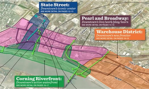
The plan identifies four zones downtown.
The "playbook" for the Impact Downtown Albany project is out. It's aimed to be a set of specific ideas and steps the city can take to continue the redevelopment of downtown Albany -- touching on topics such as residential and retail development, taxes, parking, pop-up events, and branding.
"Impact Downtown Albany was designed as a game changer," said Sarah Reginelli, the president of Capitalize Albany, the city's economic development arm. "It was designed as a tactical approach to downtown revitalization."
The report was produced for Capitalize Albany by a team of consultants over the last two years. Capitalize Albany released it this week so that it might help the Capital Region's bid for one of those $500 million Upstate Revitalization grants from the state.
"Downtown has wonderful assets already, downtown has a strong momentum," Reginelli told us Thursday. "Part of it is changing perceptions of downtown and understanding that this momentum has been occurring and that there is potential here for people to reach out and grab."
We read through the report. And there's approximately three tons of stuff in it. So, if this topic interests you -- go skim through it (pdf). But here are a few chunks of it that caught our eye...
Options for the Madison Ave Road Diet
Could it stand to lose a lane or two?
Can Madison Avenue in Albany's Pine Hills neighborhood be a better version of itself, one that both moves cars along but also provides a safer, more comfortable experience for cyclists and pedestrians?
That's the question at the heart of the proposed Madison Ave Road Diet, one of the region's most interesting transportation projects -- and a high-priority focus for cycling advocates pushing for protected bike lanes. Wednesday night at the College of Saint Rose city officials and consultants unveiled the menu of proposed options for reconfiguring the thoroughfare.
"It's most important that we get it right," Albany mayor Kathy Sheehan told the crowd Wednesday in emphasizing the importance of public feedback on the project. "We're really going to have one opportunity and then this will become the model for what we do in other parts of the city."
Here's the menu of options, along with a few thoughts...
Three thoughts about the push for protected bike lanes in Albany
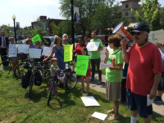
The rally in Albany this week for protected bike lanes.
This Wednesday is a big day for one of the most interesting transportation projects in the Capital Region because the city of Albany will be publicly presenting options for the Madison Ave Road Diet. The range of options will be on display, and public comments collected, at the College of Saint Rose Wednesday at 6 pm.
The project is aiming to make the popular thoroughfare through Albany's Pine Hills neighborhood safer by reducing the number of lanes in an effort to "calm" traffic. It's a notable example of how the thinking about the way people get around is evolving from a perspective that places a high, almost sole, priority on cars, to an approach that intends to be more friendly to pedestrians and cyclists.
The Madison Ave Road Diet is also potentially important because it could end up including the first protected bike lane in the city of Albany -- that is, a lane designated for bikes that's protected from car traffic by some sort of barrier. Cycling advocates have been pushing for such an amenity, and see it as a significant step towards more bikeable city.
Here are three thoughts about the push for protected bike lanes.
A look at the latest plan for the 1 Monument Square project in Troy
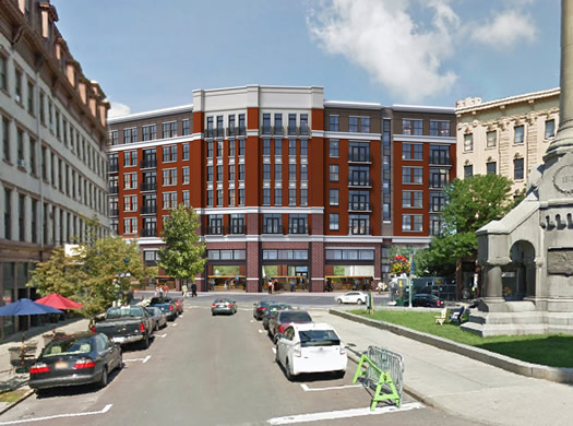
One of the exterior options presented.
The latest iteration of the third major attempt to redevelopment the 1 Monument Square site is down to a one building.
The development team aiming to build a residential/restaurant/farmers' market project on the prime spot in downtown Troy presented its latest plan Tuesday night to the Troy Planning Commission. And the commission gave the site plan a preliminary approval.
So, let's have a look.
Four takeaways from the kickoff for the study about the future of I-787
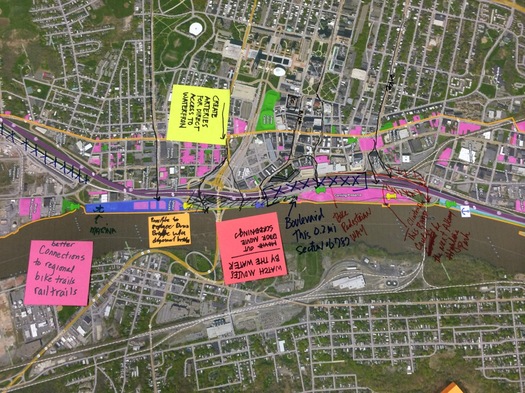
A large map was laid out so members of the public could annotate with ideas.
The planning project for the future of I-787 -- and the waterfront -- got off to its public start Wednesday with presentations at the Albany Public Library.
The I-787/Hudson Waterfront Corridor Study is sponsored by Capital District Transportation Committee, the state Department of Transportation, and the city of Albany. Its focus extends from the Port of Albany along the riverfront north to Watervliet. And its aims include helping develop strategies for improving waterfront access and guiding future transportation planning.
We stopped by for the early presentation (the same presentation was to be repeated in the evening), and took some time to check out the various posters and other "visioning" materials.
Here are four impressions/takeaways...
A plan for the state to remake a part of downtown Albany -- before the Empire State Plaza
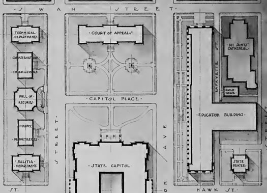
The Empire State Plaza and its history are getting a lot of attention this summer because it's the 50th anniversary of the official cornerstone being laid for the ESP (the exact anniversary was this past Sunday). And even in non-round number years, the ESP gets a lot of attention in discussions about the history, architecture, and planning of downtown Albany. Because of course.
But here's something new to us -- Albany Archives pointed it out to us this week -- so maybe it will be to you, too: There was was a proposed plan for the state to remake the area near the Capitol in Albany that pre-dated the ESP -- by more than 50 years. And the plan helps add some context for how things actually did turn out.
Planning for how we'll all get around the Capital Region in the future

If our future overlords will be self-driving vehicles, it's probably a good idea to have a plan fo them. (If only so we can properly welcome them.) / photo: Google
A bit of follow-up to that discussion about trends that are shaping the way people get around the Capital Region: The Capital District Transportation Committee has a couple of public meetings this week to go over the draft version of its New Visions 2040 Plan -- this is the map (of sorts) for thinking and planning all sorts of regional transportation stuff, including roads, bridges, traffic congestion, CDTA, bike lanes, car sharing, road diets, even stuff like self-driving cars.
The meetings are:
+ Tuesday, June 16 at the Empire State Plaza (Meeting Room 6, Concourse Level) from 6:30-8:30 pm
+ Thursday, June 18 at Niskayuna Town Hall from 6:30-8:30 pm
The full draft plan is online if you'd like to have a look (there's also an executive summary and listing of key recommendations.) If you're curious about any of the topics mentioned above, you'll probably find at least a few interesting bits.
After a quick read through, here are a handful of things that caught our eye:
Workshops on the future of I-787
The planning project for the future of I-787 -- and the waterfront -- has a pair of public workshops lined up for later this month. As the flyer for the events says: "Help Us Visualize the Future of the Corridor."
Expanded blurbage:
Join us at one of two public workshops on June 24th in Albany or June 30th in Watervliet to discuss the future of the I-787/waterfront corridor. The purpose of the workshops is to introduce the study and its objectives, to share information on existing land uses and the transportation system and to provide opportunities for input on short and long term transportation and land use strategies.
Along with a brief presentation, workshop attendees will be able to view study area maps and data, can offer initial input on strategy and evaluation criteria and can participate in a hands on "map your ideas" station.
The first workshop is June 24 at the Albany Public Library main branch on Washington Ave from 4-7:30 pm (with presentations at 4:30 pm and 6:30 pm).
The second workshop is June 30 at the Watervliet Senior Citizen Center (1541 Broadway) from 5-7:30 pm (presentation at 5:30 pm).
The I-787/Hudson Waterfront Corridor Study is sponsored by Capital District Transportation Committee, the state Department of Transportation, and the city of Albany. Its focus extends from the Port of Albany along the riverfront north to Watervliet. And its aims include helping develop strategies for improving waterfront access and guiding future transportation planning.
Whenever we ask people here at AOA about things they'd like to see changed about area, 787 gets mentioned. A lot. So this could be a good opportunity to get your concerns and ideas on the record with planners.
Furthermore: A lot of cities have been facing the issue of what to do with their urban (often elevated or waterfront) highways. Just down the Thruway, Syracuse has been trying to sort out what to do with I-81, an elevated highway that runs right through the middle of downtown, a process that's included conflict between the city and its suburbs. (Here's the latest on the I-81 storyline.)
As part of the planning process for the next I-81, the Syracuse Metropolitan Transportation Council put together a bunch of case studies about how other cities have handled remaking urban highways -- it's worth a look if you're interested in the topic.
One version of the next Warehouse District
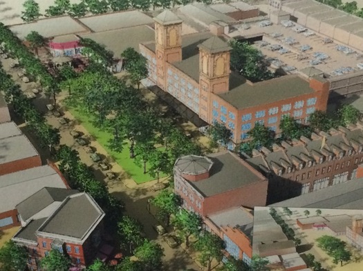
Quick follow-up on the Albany Warehouse District rezoning project: The consultants who were in town last week to study the neighborhood, talk with people, and start roughing out new guidelines for the Warehouse District presented some of their work at a public event Friday evening.
The presentation included what might be possible in the neighborhood with new design standards -- and the potential transformation is significant.
A couple of the renderings are after the jump, along with a few quick bits.
Realize Troy city summit
The cover of "Snapshot Troy."
The ongoing project to develop a new comprehensive plan for Troy -- Realize Troy -- has a "city summit" public event lined up for this Thursday, Friday, and Saturday. Blurbage:
The Realize Troy City Summit is a free three-day citywide community visioning and brainstorming event that will bring community leaders and residents together to explore key issues and challenges facing the city, and discuss ideas, opportunities and directions for the future. The Summit has been structured into a series of theme-based discussions, wherein participants will be presented with important background information relevant to a specific theme or topic, and then invited to explore opportunities within the theme that can best enhance Troy's quality of life, community enjoyment and prosperity.
There's a kickoff event Thursday, but Friday and Saturday are the visioning sessions at the Troy Italian Community Center -- you can register online, it's free.
To go along with the events, the consultants orchestrating the project have posted their take on the current state of the city -- "a synopsis of the strengths, challenges, issues and opportunities currently facing the city" -- it's called Snapshot Troy.
By the way: If you're curious about what a finished comprehensive plan looks like, the city of Albany went through a similar process a few years back -- the product was the Albany 2030 plan.
The Warehouse District and thinking about change
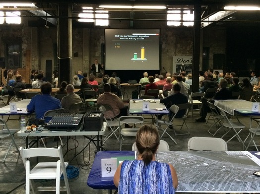
We stopped into the public workshop about rezoning Albany's Warehouse District Tuesday evening. It was interesting to hear people talk about their aspirations and concerns for a neighborhood that appears poised for a possible transition to something different. And if anything, it was heartening to see so many people -- more than 50, easily -- commit a few hours to discussing the future of their city on a beautiful summer evening.
Many of the ideas expressed will sound familiar: a desire for walkability, waterfront access, mixed-use housing, boulevarding 787, ways of possibly fostering businesses that draw on the arts, a supermarket. There was also a notable segment of people who wanted to make sure industrial businesses aren't pushed out.
This intensive look at the neighborhood continues through Friday, when there's another public session to discuss some of the work produced by the zoning consultants this week. So we'll probably circle back around to this topic again in the near future because there are a bunch of interesting threads.
But here's one sort-of-big-picture thought we had while listening Tuesday night...
What sort of place should Albany's Warehouse District be?
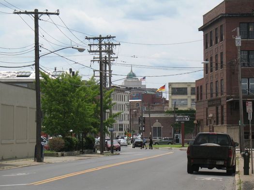
What's become known as the Warehouse District in Albany has a long history as an industrial area -- populated by foundries, factories, and breweries -- dating back more than a century.
But its future could look much different, in large part because people have started to view it as a scene for entertainment and residential, both now and in the near future.
So, what's possible in the Warehouse District? Or, to put the question a bit differently, what should be possible in the Warehouse District?
That's one of the questions people will be answering next week at an event focused on the future of the neighborhood.
The future of the Tivoli Lake Preserve
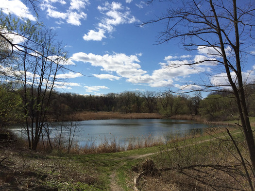
Tivoli Lake this week. (Here's a panorama photo.)
The city of Albany is more than three centuries old, so over the years some things are bound to be overlooked or lost in the shuffle. But an 80-acre nature preserve?
Yeah, that sort of happened.
"Tivoli Preserve has the potential to really be an attraction, and also a refuge, that is recognized by people within the city of Albany as an asset to the city. Right now, that's not true," Kate Lawrence, the city of Albany's sustainability planner, told us this week. "A lot of people don't know it exists. And the people who do know it exists avoid it because they don't know what's in there, because it's not very clear what the conditions are in there. Or it's a secret that only a few people can enjoy."
But there's a plan mapping out a possible new future for Albany's Tivoli Lake Preserve.
You are 20 minutes away
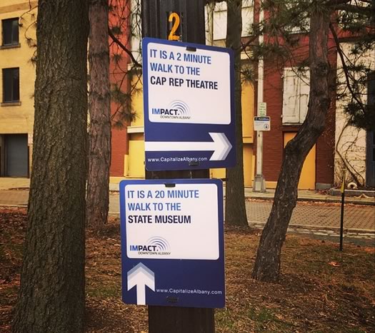
A few weeks back we posted a short bit about Walk [Your City], a project in other cities aimed at addressing the "it's too far to walk" issue.
As it turns out, there are already similar signs here in Albany. Nicole spotted a few of them in downtown Albany this week (that's her pic above).
The signs went up last fall as part of the "tactical urbanism" plan that Capitalize Albany is pursuing, the org's president, Sarah Reginelli, told us this week. The signs in Albany were inspired by Walk [Your City].
"The intent was to show the wealth of approachable opportunities within walking distance of the employment and retail center at Tricentennial Park," Reginelli said to us in an email. "It's all about embracing walkability. This method helps get the public, who may be used to walking directly to one destination, to alter their choice of transportation methods when going between others, or to explore their environment beyond what they are used to."
Reginelli said the current signs are a small test program -- there are seven of them around the Tricentennial Park area -- before possibly making a bigger investment in the idea. She said Capitalize Albany welcomes feedback about them as it thinks about the signage's future.
Speaking just from our own experience, the more you walk or take the bus, the more your mental map of a place -- and that sense of "how far" things are from each other -- changes. You can actually get pretty far in 15 minutes while walking. But that's sometimes hard to internalize until you make the trip a time or two.
Streetfilms Mini-Festival at The Madison
A "mini-festival" of films from the influential Streetfilms project -- which is focused on urban planning, cycling, and transit -- is queued up for the Madison Theater in Albany on April 13. Event blurbage:
These short films show how smart transportation design and policy can result in better places to live, work and play. The event will include a Q and A with Streetfilms' own Clarence Eckerson following the screening. Mr. Eckerson, a UAlbany alum, is often called, "the hardest working man in transportation show biz" for his dedication to making difficult, wonky concepts more accessible and entertaining to the general public. He's been documenting transportation advocacy for 15 years and has produced over 600 Streetfilms.
The short video embedded above -- Gronigen: The World's Cycling City -- is an example of the sort of film Streetfilms produces.
The Streetfilms Mini-Festival is being organized by the Albany Protected Bike Lane Coalition, which (as the name would imply) is working to get protected bike lanes built in the city. We hear that about eight short films will be screened, with a total runtime of about 45 minutes.
The screening at the Madison on Monday, April 13 is at 7 pm. (Information tables will be set up at 6:15 pm.) Admission is free.
It won't be the site of the Albany convention center, so what will it be?
What is the next life of the southern edge of Albany's downtown?
That's the question at the heart of the request for proposals (RFP) issued today by Empire State Development for the collection of land that had originally been gathered for a convention center. From the RFP:
With its large size and premier location in the heart of downtown Albany, this Project offers a unique opportunity for a major development in the City's urban core. The Site features convenient proximity to the area's transportation access points and is less than a quarter mile or closer to the City's commercial, cultural and governmental destinations. The Project will serve as a key component of the City's initiatives to attract urban re-investment downtown to meet market demand while simultaneously revitalizing the area with a vibrant mix of uses.
So, yeah, this project -- whatever it ends up becoming, if it ends up becoming -- could be an important part of the ongoing redevelopment of downtown Albany.
Here are a few bits from the RFP that caught our eye, along with a few thoughts...
Downtown Albany, before and after
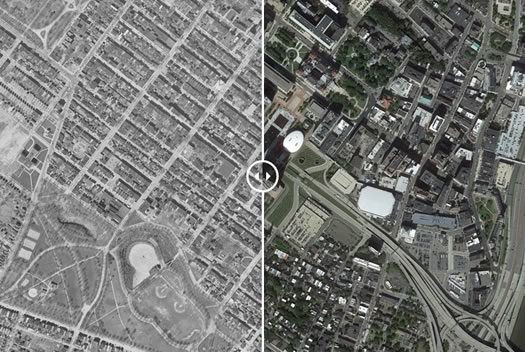
Head over to the OU site to use the photo slider.
Check out these before-and-after aerial photos of Northeast cities posted by an academic institute at the University of Oklahoma. Albany is among the cities featured -- that's a screengrab above -- in the series of before/after sliding photos.
From the Institute for for Quality Communities post:
60 years has made a big difference in the urban form of American cities. The most rapid change occurred during the mid-century urban renewal period that cleared large tracts of urban land for new highways, parking, and public facilities or housing projects. Fine-grained networks of streets and buildings on small lots were replaced with superblocks and megastructures. While the period did make way for impressive new projects in many cities, many of the scars are still unhealed.
We put together these sliders to show how cities have changed over half a century.
One of the things that struck us as we moved the slider back and forth on the Albany photos was that, sure, the Empire State Plaza took up a lot of space -- but it's remarkable how the wide path was plowed for the South Mall Arterial connecting I-787 and the ESP.
The institute's posted other series of sliding photos for Oklahoma and Texas, the Midwest, and Southeast.
[via @albanymuskrat]
photo compilation: Institute for for Quality Communities at the University of Oklahoma
Impact Downtown Albany's vision of what the city's downtown could be
The study identified four zones in downtown Albany.
This week Impact Downtown Albany -- the ongoing project to develop a "tactical" plan for downtown development -- released its vision of what downtown Albany could become over the next 5-10 years.
"This is the shared definition of success based on the hundreds of stakeholders that have been part of this process," Sarah Reginelli -- the new president of Capitalize Albany -- explained to us Tuesday afternoon. "This is really what's been identified as the opportunities that we need to take advantage of to make downtown the best downtown that it can be at this point."
Among the identified possibilities: continued growth of new housing units, unique retail, a "high line"-type park connecting downtown with the riverfront, and transformation of part of the warehouse district.
Here are a few things that caught our attention.
Albany Common Council passes red light camera ordinance: comments, votes, thoughts
State Assemblywoman Pat Fahy speaks during the public comment period ahead of Monday's night vote on red light cameras.
The Albany Common Council passed the ordinance for a red light camera demonstration project in the city Monday night. The ordinance passed 11-4 after some impassioned comments from council members.
Pending a signature on the bill from mayor Kathy Sheehan, who supports the measure, Albany will be on its way to becoming the first municipality in the Capital Region to get the automatic cameras.
Comments, the votes, the ordinance, and a few thoughts...
The Albany riverfront has been a topic of concern and potential for a long time
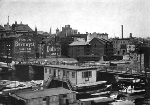
The State Street Pier on Albany's riverfront in 1914.
The Albany river front -- how to better connect it with downtown, how to add amenities, what to do with 787 -- has been a frequent topic of conversation for years.
How many years? At least a hundred.
Parking spot dog park
We took a few minutes Friday afternoon to check out some of the displays for Park(ing) Day in Albany (as mentioned), an event that temporarily repurposes parking spaces to help prompt discussion about how urban space is used.
The scene above is from Pearl Street -- it's a dog park set up outside the Downtown Albany BID offices. Some of the spaces around the city included a camp site, a play area, a pondside hangout with Adirondack chairs.
If anything, the displays put some attention on the amount of space that parking takes up along streets. Next year it'd be interesting to see if the event could take over a long strip of spaces for some sort use -- or, in a different sort of event/project, maybe even the city could experiment with temporarily making a few streets pedestrian zones. NYC experimented with this on Broadway in Manhattan a few years back (obviously a different scale and density compared to Albany) and it prompted some permanent changes.
The latest One Monument Square plan evolves
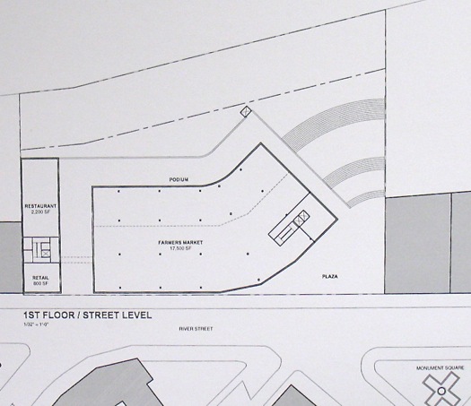
A massing diagram for the proposed project.
The proposed One Monument Square development in downtown Troy is one of the area's most interesting projects -- and it's evolving.
The latest version of the plan (itself the third major proposal for the site) sticks to the original concept -- a bunch of residential units, mixed-use space including a permanent spot for the Troy Waterfront Farmers' Market, a plaza with access to the riverfront -- but it shifts the arrangement of the two buildings planned for site.
The new massing diagaram for the project is above (and after the jump in large format) -- it was shared by the developers at a meeting of the Troy City Council's planning committee Tuesday evening. Where the original version of this plan had the two buildings roughly splitting the site down the middle, the new plan includes one wide building and one much narrower building.
Here's more about the current version of plan, and a few other bits...
Park(ing) Day
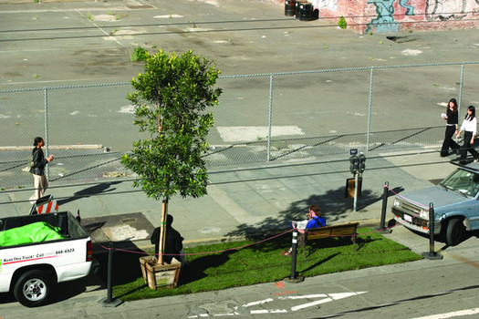
An example from another city. / photo: Rebar
What could a parking space be if it wasn't a parking space?
That's one of the questions posted by Park(ing) Day, an event that will temporarily repurpose parking spaces in cities around the world on September 19. One of those cities is Albany.
Park(ing) Day blurbage:
PARK(ing) Day is a annual open-source global event where citizens, artists and activists collaborate to temporarily transform metered parking spaces into "PARK(ing)" spaces: temporary public places. The project began in 2005 when Rebar, a San Francisco art and design studio, converted a single metered parking space into a temporary public park in downtown San Francisco. Since 2005, PARK(ing) Day has evolved into a global movement, with organizations and individuals (operating independently of Rebar but following an established set of guidelines) creating new forms of temporary public space in urban contexts around the world.
The mission of PARK(ing) Day is to call attention to the need for more urban open space, to generate critical debate around how public space is created and allocated, and to improve the quality of urban human habitat ... at least until the meter runs out!
The city of Albany is making spaces available at spots around the city from 11 am-4 pm on September 19. If you'd like to take over a space, contact Mary Millus in the city's Department of Development and Planning: millusm@ci.albany.ny.us. The deadline is September 15 (here's a pdf of the application).
One example of what people have planned: The Graduate Planning Student Association at UAlbany is working to cobble together enough spaces to create a pop-up protected bike lane on Madison Ave along Washington Park. If you'd like to help them do that, we get the feeling they'd be happy to hear from you (there's contact info at that link above).
A bit more about protected bike lanes in Albany
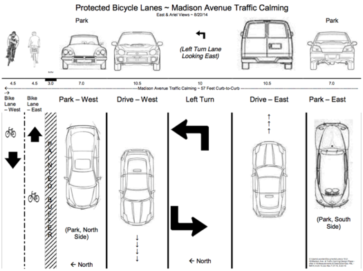
A few bits of follow up on last week's post about the Capital Region bikeshare:
Protected bike lanes
We mentioned that one of the ideas to make parts of the Capital Region more bike friendly are protected bike lanes -- generally speaking, these are bike lanes that are separated from car traffic by some sort of barrier. These sorts of lanes are said to be safer for cyclists, and they may help more casual cyclists feel better about using a bike for transportation.
As it happens, there's a group organizing to support the creation of protected bike lanes in Albany, specifically as part of the redesigned Madison Ave (the "road diet"). The group's FB page is posting information about protected bike lanes and other bike-friendly ideas.
Also, a proposed Madison Ave redesign that incorporates protected lanes floated our way. The design is above -- here's a large-format version. It was created by Lorenz Worden of the Albany Bicycle Coalition. And it provides an easy-to-understand layout of how redesigned Madison Ave could maybe work.
We gotta admit we're not totally sold yet that protected lanes will prompt a significant number of people to start cycling more often. But the idea looks promising and it's worth a shot. Madison Ave seems like as good a place as any to try it.
Bikeshare recap
Over at the TU, Tim O'Brien has some numbers from the Capital Region bikeshare now that the pilot has ended: there were more than 250 participants, who averaged 2.8 rides during the trial period.
Architecture gawking in Albany's warehouse district
Can you imagine Nipper as a neighbor?
The recently announced project to develop plans for reusing a handful of historic industrial buildings around the Capital Region -- and specifically, a very early plan for a restaurant/residential conversion on Broadway in Albany -- got us thinking (again) about Albany's warehouse district.
It's one of those areas that might necessarily jump out as a place with notable buildings, but there is interesting architecture there. And the neighborhood might have a lot of potential.
After the jump, a photo tour -- and a few thoughts on that potential.
Park South redevelopment plan gets final OK
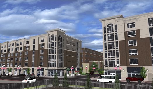
A rendering of the mixed use buildings along New Scotland Ave.
Updated with newer renderings
The plan to clear and redevelop two whole blocks in Albany's Park South neighborhood got approval to move ahead from the city planning board Thursday evening. Phased demolition of the existing buildings will be starting soon, and construction is slated to begin this October.
The $110 million project -- a collaboration between Albany Medical Center and Tri-City Rentals -- includes more than 265 residential units, retail space along New Scotland Ave, a large medical office building, and a parking garage. Much of the plan has been met with enthusiasm and support by city leaders and community members, but the garage -- and its size -- has been a frequent target of criticism. And Thursday evening was no different.
Albany, in an alternate future
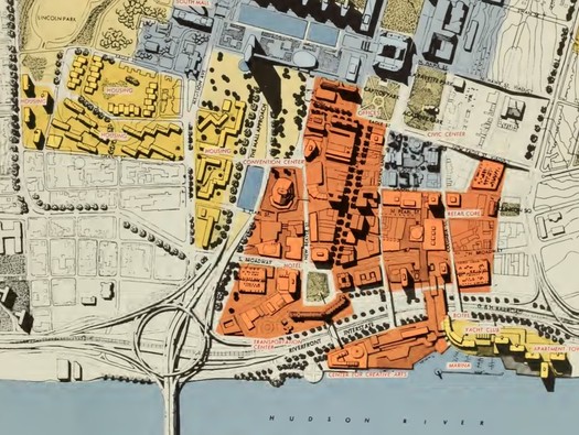
As proposed in 1963.
Check it out: A comprehensive plan for redeveloping the city of Albany -- as proposed in 1963.
Albany Archives sent along the link. And as AA commented:
A convention center on Elk St, housing at Jennings Landing, "The Washington Park Arterial"... it's so scary! Heres the take away quote: "By 1980, central area of Albany, like cities all over the United States, will be almost completely rebuilt."
The plan is fascinating, both because parts of it are remarkably prescient and others are totally bonkers.
We've pulled a handful of images and maps, along with a block of text that floats some options that now sound completely unbelievable...
How much parking is enough?
From the study: Where AMC employees live by ZIP code. (Don't squint, here's a larger version.)
How much is enough?
That's one of the questions at the center of the parking and transportation study for the plan to clear two whole blocks of Albany's Park South neighborhood near Albany Med, one of the most interesting projects in the Capital Region.
The study -- from Nelson\Nygaard Consulting Associates, a consultancy hired by the city -- looks at the projected demand for parking created by the residential/medical/retail project, and the number of spaces that would be available after completion. And it concludes that the current proposal exceeds the number of necessary spaces as figured under industry guidelines. The report figures that peak parking demand on the site would fall short of capacity by about 120 spaces.
That more-than-enough finding might not be notable if not for the attention the project has caught for the size of its parking garage, which developers reduced to about 816 spots after getting feedback. The consultancy's report doesn't frame the finding as a prompt for an even smaller garage, rather it's "a great opportunity to accommodate the parking for other future uses at this site."
But the report does focus some attention on details related to the parking garage, with an eye toward lessening the impact on appearance and pedestrian safety.
Watching the creation of the Empire State Plaza
Check it out: "The Making of the Mall," a short documentary produced in the 1960s and 70s about the creation of the Empire State Plaza. The doc includes film of downtown Albany before the ESP, scenes of the area being razed, and shots of the buildings under construction. It really puts the scale of the ESP into context.
From the narration:
The promise of the mall was magnificent. The reality discouraging. Ninety-eight acres of devastation, dust, and debris loomed more like the aftermath of war than urban renewal.
Violent legal and political wrangling had been in evidence from the outset concerning the feasibility and value of this grandiose project. 6800 residents and 350 small businesses had been displaced with no housing planned for their relocation and, it seemed, no concern for their future.
And then later in the doc...
Though the years that went into making the mall were often painful, especially for longtime residents who had seen their homes, their schools, and their churches obliterated to satisfy the ego of one man, today they are proud of what they once called Rocky's Folly. But which has transformed a 300-year-old Dutch town into the most spectacular capital in the country.
We came across the film via Carl, who in turn found it via the Albany... The Way It Was FB group. As Carl notes of the film:
Not entirely sure what year it was from, but it appears to have been the work of Helen C. Welsh, a school librarian, library studies instructor, and serious amateur filmmaker whose other gems, such as the story of the Tulip Festival, we can only hope to uncover.
The film is about 17 minutes long and well worth a look. We've pulled a few screengrabs to give you a sense of what it includes -- they're after the jump.
What would it take for a downtown Albany supermarket?

Maybe at the ESP? Maybe somewhere else?
Urban planning and development often prompt a lot of discussion here at AOA, so we thought it'd be interesting to have an actual urban planner look more closely at some of the topics that bubble up. Meet Alison Bates, who takes up the issue of a downtown Albany supermarket today.
As the discussion of downtown Albany's redevelopment progresses, the call for a neighborhood supermarket has become central to the conversation. A place close at hand to get good food if you live or work downtown, a way to avoid driving to a strip mall each week to do your grocery shopping -- many of us would like this.
Not only would it be a convenience, but it would speak loudly about downtown Albany. Downtown grocery stores are an important piece of a city's redevelopment. They're a classic urban amenity that sends a message that your downtown is doing well, and that breathing new life into your city is not only possible, it's already happening.
So what would it take to make this a reality? There are some sizable economic, political, and logistical challenges. But there is hope.
Let's look at some of the economics -- because urban planning usually comes back to the numbers (and because everyone secretly enjoys econometrics) -- and some different ways of thinking about the situation.
How the Albany metro area ranks for pedestrian deaths -- and ways it could be safer
A clip from an interactive map posted as part of the report. You can pick a point and the map will report nearby pedestrian deaths over a given time period.
There were 88 pedestrian deaths in the Albany metro area between 2003-2012, according to a recent report from the org Smart Growth America. The Albany metro area's rate of pedestrian deaths per 100,000 people was 1.06, which ranked in the lower middle of metro areas in New York State.
A handful of bits from the report -- which details some of factors in pedestrian deaths, and calls for changes in how roads are designed -- are after the jump.
Comparing the size of Capital Region supermarkets
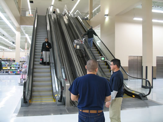
When you're the "world's largest" Walmart, you have some room for extra amenities. Like a cartscalator.
With the news that Walmart is planning an enormous (technical term) new supercenter at the Latham Circle Mall redevelopment, we were curious about how Capital Region supermarkets compare in terms of square footage.
So we looked up a bunch of examples.
A table with the results, and big graphical comparison, along with a few notes and thoughts, after the jump.
Thinking about residential development in downtown Albany

The Impact Downtown Albany project is focused tightly on core of downtown.
The number of residential options in downtown Albany has been steadily growing over the last few years. And as mayor Kathy Sheehan at an Impact Downtown Albany event Tuesday at 60 State: "We really are gifted with a lot of the great bones that we need to fulfill the promise of downtown living."
So, how does the city move from promise to actual development? What are the challenges? What's the potential?
The Tuesday event focused on some of those questions. Here are a few bits from the discussion...
The Quintessence building's current fate
The diner building that formerly housed Quintessence (that photo is from last summer).
When Albany Med introduced the big plan for the two-whole-blocks redevelopment in Albany's Park South neighborhood last summer, one of the questions was: What about the Quintessence building?
The Fodero diner building that housed the restaurant Quintessence -- twice -- has been in Albany since the 1930s (or 40s), after it was shipped up from New Jersey. And while the land it sits on is part of the redevelopment plan -- the building itself is not.
As a result, Albany Med was offering to give it away -- for free -- to anyone willing to move it. But word is that the building is in pretty rough shape, and even after about a dozen inquiries, there were no takers.
So, here's the current plan, according to Rich Rosen, VP of Columbia Development, which is coordinating the Park South redevelopment: Architects for the project are looking into which elements of the diner building have some sort of notable historic or aesthetic value. They'll then try to work those parts of the diner building into the new mixed-use building planned for the site along New Scotland Ave -- say, in the lobby, along with information about the diner building's history.
And if someone turns up tomorrow willing to take the building away, is the original offer still on the table? Maybe. Rosen told us that if the building would be staying in the area, then they'd consider the idea because it would preserve a bit of local history. But if the person wanting the diner would be moving it out of the area -- or scrapping it for parts -- they're not interested.
About the Park South redevelopment: The $110 million plan to completely redevelop two whole blocks of Park South took another small step forward Thursday evening when reps appeared before the city planning board for what was essentially a getting-to-know-you-again presentation. A few quick bits...
Another big step for the Park South redevelopment is coming up
One of the revised designs that resulted from the back and forth over the parking garage late last year.
The $110 million Park South redevelopment project in Albany headed for another important point on its timeline in early March when the proposal goes before the city planning board. The project is now on the agenda for the March 6 planning board meeting.
The large-scale redevelopment in the neighborhood just south of Washington Park was a big topic of conversation late last year. The part that caught the most attention: an 800+ space parking garage that critics said is too big for the neighborhood. Prompted by the reaction, the developers heading up the project returned with new designs for the garage that fit in better with the surrounding buildings -- though the number of spaces in the garage was still held in the 800-space range. Those changes helped open the way for the Common Council to approve amendments necessary for the plan to advance.
Throughout the back-and-forth on the garage, both advocates and critics of the plan pointed to the city's planning board as another step that would shape the final project. So it's worth watching how the project is adjusted (or not) by the planning board process. It's one of the last hurdles before construction starts. (When the project plans were introduced last year, the development team indicated it had hoped to have the site demolished by now.)
The Park South redevelopment is an ambitious, unusual plan. It aims to completely clear two whole blocks adjacent to Albany Med and rebuild with a collection of buildings that would include two six-story mixed-used buildings on New Scotland Ave, a medical office building, the parking garage, and 268 residential units. It could fundamentally transform the neighborhood, the sort of project that doesn't come along very often.
Earlier on AOA:
+ Park South redevelopment plan advances
+ Two new options for Park South
+ Six not-boring parking garages
+ A bit more about the Park South redevelopment and that big parking garage
+ A big topic for the Park South redevelopment: parking
+ The big plan for residential and retail redevelopment in Albany's Park South
The Atlantic: The future of urban highways is playing out in upstate New York
 Over at The Atlantic Cities today there's a good overview of the situation surrounding the impending replacement of I-81 in Syracuse, which runs right through the heart of the Salt City's downtown. The situation will probably sound very familiar to anyone who's thought about the future of I-787 in Albany. A clip:
City leaders like Robinson, along with downtown developers and advocates for smart growth, would like to see I-81 rerouted around Syracuse and replaced with a landscaped boulevard. But suburban business-owners and many of the 45,000 drivers who use the highway to commute fear that any change could hurt the local economy. It's a debate that goes beyond the immediate question of how Syracuse workers will get to work -- to what kind of city Syracuse will be in the 21st century.
Similar discussions are happening across the United States, says John Norquist, president of the Chicago-based Congress for the New Urbanism, which publishes an occasional list of interstates ripe for demolition. Many urban freeways -- a staple of mid-20th century car-centric development -- are beginning to fall apart, and today cities from New Haven to Seattle (not to mention others around the world) are taking the dramatic step of tearing them down. A former Milwaukee mayor, Norquist oversaw the conversion of an elevated highway to a boulevard there in 2002, following a model pioneered by Portland in 1978 and San Francisco in 1991.
"It's starting to happen all over the place, and there's a reason for it," says Norquist. "Freeways don't add value to cities. They're all about one dimension, which is just moving traffic. It's a rural form, visited upon the city, that destroys property values, commerce and vitality."
The article, by Amy Crawford, is a good overview because it captures many of the tensions of the situation -- between city and suburbs, between walkable and automobile infrastructure, between local and state decision making. And, oh yeah, cost.
As that clip mention, the thing about these elevated highways, 787 included, is that they eventually will reach the end of their lives -- because they will be literally falling apart. That will mean hard choices -- and maybe also big opportunities.
[via @rachbarnhart]
Earlier:
+ In another upstate city, a discussion about an urban highway
+ "The Life and Death of Urban Highways"
+ The Albany 2030 plan included a goal of evaluating possible alternative designs for 787
+ The Stakeholders org released a report in 2011 that imagines the Albany waterfront with a boulevard
map: I-81 Challenge
Soapbox: Expecting better for the One Monument Square redevelopment
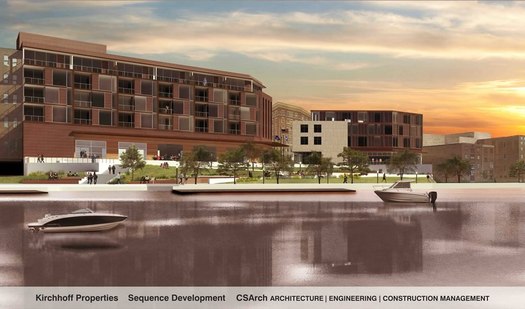
A rendering of the proposed project, from the river side.
Earlier this month the city of Troy announced that it had selected a redevelopment plan for the vacant Monument Square lot, the site of the former city hall. It's a prime piece of land offering a lot of possibilities. But Duncan Crary -- a Troy resident and urban design observer -- argues the current proposal could be a lot better.
Most developers can only dream of having the chance to shape a site like One Monument Square. The team chosen for this endeavor has the potential to create an enduring expression of our generation's best values and optimism, at the heart of our city. This is a legacy building commission, here.
So why, then, is this crew proposing to cram the worst architectural elements of the worst structures around into a couple of soulless boxes in the dead center of our charming 19th century downtown?
It seems completely at odds with what's happening here in Troy, and what's really behind the renaissance in this place "Where the Finest Antiques Can't Be Bought," and where "A wave of renovation is... (opening) ... the way for new urban economy and culture."
People actually travel here to admire our wealth of historic architecture and experience how it relates to the streets and blocks. Some stay, and become the characters who enliven this place.
But they don't come for the modern abominations in our built environment. They don't come to fawn over the Bell Atlantic switch building with its blank fortified walls, or the Troy Medical Plaza sheathed in black reflective glass.
I just don't get why anyone would want to replicate those loathsome styles at the focal point of our city, where beautiful architecture is our greatest asset.
The new plan for redeveloping the Monument Square site in downtown Troy
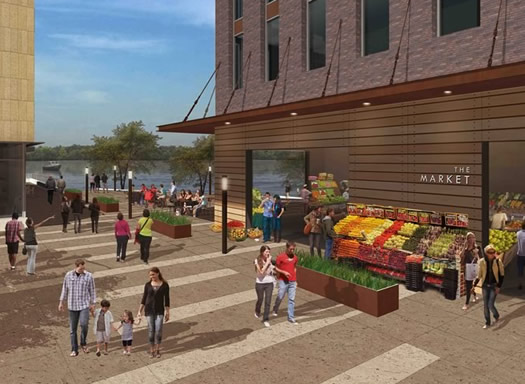
The proposed plan includes permanent space for the Troy Waterfront Farmers' Market.
The city of Troy formally announced today that it's picked a proposal for the redevelopment of the former city hall site on Monument Square downtown. And the proposed $27 million project includes a lot of potentially interesting bits: residential, retail, commercial space -- and maybe most interesting of all, a permanent home for the Troy Waterfront Farmers' Market.
Here's an overview of the plan with renderings, details, and whatnot...
An opportunity to check out the Corning Preserve Master Plan
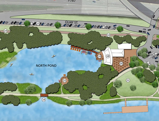
A clip from one of the images laying out concepts in the draft plan.
Albany has a riverfront. It's just that there's not much there. And it's hard to get to what is there.
In attempt to address both those issues the city of Albany is working on a Corning Preserve Master Plan that could serve as a map for improving riverfront amenities and access. And on Tuesday (January 28) there are two public "open houses" at city hall for people to get a look at what's being proposed:
noon-1 pm: lunchtime open house with illustrated displays
4:30 pm-6:30 pm open house with displays, presentations, and opportunities for Q&A
If you're interested in this topic, but can't make the presentations -- or just want to review ahead of time -- there are docs and images related to the master plan posted online (first link above, at the bottom).
Among the ideas proposed in the draft plan: a multi-purpose boathouse with waterfront dining, and "grand staircase" access to the river.
image: Albany 2030
Park South redevelopment plan advances
One of the two new options for the Park South parking garage presented by developers.
The Albany Common Council passed the resolutions necessary to advance the $110 million Park South redevelopment Monday night. The project -- which includes wiping two whole blocks clear in the neighborhood by Albany Med -- now moves on to further review by the city's planning board.
There wasn't really any drama about whether the resolutions would pass -- and they did so easily, each with 10 votes in favor (out of 13 present council members.)
A portion of the the council's actions Monday covered three amendments to a redevelopment plan approved in 2006: increasing the height of mixed-use buildings along New Scotland Ave, increasing the number of residential units, and changing the footprint of a parking garage. Those first two amendments weren't controversial, but the parking garage -- specifically its size and appearance -- had drawn a lot of attention during the process. And it did again Monday night.
It wasn't just the aquarium
 With all the talk about an aquarium for Albany, the Biz Review's Mike DeMasi went to Chattanooga to check out the Tennessee Aquarium, which has been used as case study in the aquarium conversation here. One of the things we took away from his article: The aquarium was just one part of an overall redevelopment picture. A clip:
Chattanooga and Albany are similar in other ways: Both are on a river, home to a major state university, and within a three-hour's drive of major cities.
There is another direct parallel: accessibility to the river.
One of the elements to Chattanooga's rebirth was removing what had been a physical and figurative barrier between downtown and the Tennessee River: a four-lane highway.
In the mid-2000s, then-Mayor Bob Corker, now a U.S. senator, drove the charge to raise $120 million in public and private money to expand tourist attractions downtown and upgrade the waterfront.
A key piece was reducing a portion of the highway next to the aquarium to two lanes and building new exits to alleviate traffic, making the area more welcoming.
"It's a huge asset if you can figure out how to integrate it," Arant said.
Also: "10 takeaways from Chattanooga, and why they matter to Albany."
Earlier on AOA:
+ Albany aquarium study: there's potential demand here
+ Thinking differently about what a destination museum in Albany could be
+ Push continues for Albany aquarium
+ "The Life and Death of Urban Highways"
photo: Tennessee Aquarium / Todd Stailey
Two new options for Park South
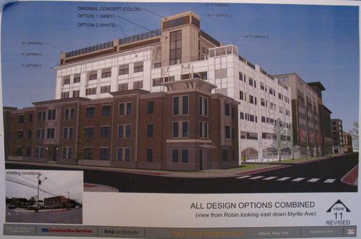
A visual comparison of the two new options against the previous option. (Don't squint, here's a bigger version.)
The evolution of the plan for the $110 million redevelopment of two whole blocks in Albany's Park South Neighborhood -- and the big parking garage that's prompted so much conversation -- continued Friday with two new options presented to the Common Council committee examining the plan.
New renderings, comments, and a few thoughts post jump...
Six not-boring parking garages
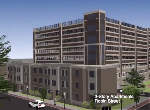
Probably not as creative as it could be.
There's been a lot of focus recently on the proposed parking garage for the Park South redevelopment in Albany. Much of the talk has been about the fact that the garage is, well, enormous relative to structures around it, prompting concerns that it's out of scale. Also: The thing just kind of looks boring.
So we thought we'd look around for not-boring parking garages. Many of the designs we found would be impractical for Park South -- because of setting, cost, or whatever -- but we thought it'd be interesting to see a wide variety of approaches to the problem of making a parking garage that's useful, appropriate to its surroundings, and visually appealing.
Here are six examples from other cities that caught our eye...
A bit more about the Park South redevelopment and that big parking garage
A rendering of the proposed parking garage and adjacent residential units, from Robin Street.
Some follow up on the Park South redevelopment in Albany, and the rather large parking garage that's raised a few eyebrows...
The city planning board gave the three amendments to the plan -- taller buildings along New Scotland, more residential units, the siting of the parking garage -- its "qualified" approval last week. The qualified part of that: the planning board noted the approval was "subject to further review of the elevations for the parking structure" (link added).
Also: The city's planning staff issued a memo on the parking garage, which highlights many of the concerns that have been raised about the size of the garage and how it relates to the other buildings around it. A clip:
The height of the parking structure should ideally not exceed that of the liner buildings proposed to buffer its presence on adjacent residential streets. The distribution of residential, office and commercial could be redesigned to allow for appropriately-sized liner buildings and/or below-grade levels could be incorporated into the design. In the event that any portions of the garage façade is visible beyond the buildings or from the street, it must be treated appropriately so as to not visibly detract from the surrounding areas.
The full memo is after the jump. It addresses not only the garage itself, but also the whole parking picture for this part of the project. The memo was flagged on Twitter this week by Common Council member Leah Golby, who's part of the council's ad hoc committee reviewing the amendments to the project.
The parking issue is shaping up to be the focal point of the debate over the amendments to this project, which aims to clear two whole blocks of the Park South neighborhood for new retail, office, and residential development. The companies involved with the development -- Columbia Development and Tri-City Rentals -- have asserted that without the parking spaces provided by the proposed garage, the project is not feasible.
A big topic for the Park South redevelopment: parking
The targeted start date for the $110 million redevelopment of two whole blocks in Albany's Park South neighborhood is fast approaching, so we stopped into a couple of public meetings Wednesday night to get a feel for how things are coming along. And -- surprise -- a lot of the discussion centered on parking. More on that in a second.
But first, check out the 3-D "fly around" of the latest proposed design of the development. It's embedded above, and there are a few screengrabs after the jump. The fly around really gives a better sense of the scale of this project than the flat renderings.
So, the thing that immediately jumped out for us: the parking garage. It's... big. The latest proposal is for a garage with 855 spaces. It would be the tallest structure in the development.
Six short takeaways from six short talks
From Kathy Sheehan's 5 minutes (or so) at the podium.
We stopped by the Impact Downtown Albany event Wednesday evening to check out the "Glimpse of the Future of Downtown Albany" Pecha Kucha-style presentations. We were kind of curious about both the format -- basically a quick succession of very short talks -- and what some of the speakers -- including Albany mayor-elect Kathy Sheehan and SUNY chancellor Nancy Zimpher -- would have to say.
It turned out to be pretty much what you might expect if you've been following the discussion about downtown Albany for a while -- talk of residential, retail, the waterfront, leveraging things.
But, in the spirit of the format, we figured it'd be interesting to pluck one quick takeaway from each talk -- whether it was a fact, an idea, an impression, whatever. And here we go...
Impact Downtown Albany
What would you like to see in Downtown Albany?
Capitalize Albany, one of the forces behind the increase in residential living in downtown Albany, is about to launch a new project, and it's looking for input from you.
On Tuesday Capitalize Albany be down at Ten Eyck Plaza interviewing people and collecting stories and ideas for improving downtown Albany. It's the launch of a twelve month public/private collaboration called Impact Downtown Albany.
Albany aquarium study: there's potential demand here
The Tennessee Aquarium in Chattanooga continues to serve as an example of proponents say an Albany aquarium could be. / photo: Tennessee Aquarium / Todd Stailey
The company that's been pushing the idea of an aquarium for downtown Albany -- Omni Development -- released the first phase of a feasibility study for the idea yesterday. And the very short story: the report concluded there appears to be demand for something like an aquarium here.
After hearing hearing a presentation about the study, and going over the materials distributed from the first phase, here are a few bits, observations, and thoughts...
NYS Neighborhood Revitalization Conference in Troy
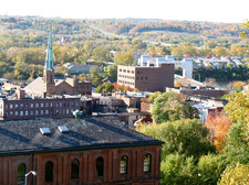 This Saturday at Russell Sage College: The second annual New York State Neighborhood Revitalization Conference. Event blurbage:
The purpose of our conference is to bring together neighborhood activists, educators, business people, and elected officials to share successes and develop strategies to maintain healthy and vibrant neighborhoods throughout Upstate New York. As residents and businesspeople, we believe that the strength of our past and our diversity in people, cultures, and businesses, will enable us to make our neighborhoods destinations to live, work, and visit.
Scanning through the list of conference workshops, it looks like there are a bunch of interesting people who are doing interesting things. Among the presenters: Abby Lublin from Troy Compost, Laban Coblentz from Tech Valley Center of Gravity, and Anasha Cummings from Project Nexus.
The conference starts at 8 am Saturday (September 21) and wraps up around 5 pm. Registration is $25 / $10 for students.
Bikes on the sidewalk?

It's a lovely idea.
Alison emails:
Can we talk about something? Bicycle riding on the sidewalks seems to be on the rise. I'm a believer that the sidewalk is for pedestrians, and that the bicycles go in the street (exceptions if you're under 15). I noticed that in west coast cities bicycling on the sidewalk was ubiquitous, but appreciated that our east coast corner of the country did a better job of keeping the wheeled traffic on the proper side of the walkway.
But there's a shift happening, and I don't like it. We can reverse this. And safety-wise, I know we're not a city replete with designated bike lanes, however, oddly enough, accidents decrease when there are no bike lanes in the streets. Because when you're right there next to the cars, the cars are more cautious. You don't have a siphoned off safe space...you know it, and the cars know it. It's human behavior at it's oddest (this isn't praise for our lack of lanes, just truth). So my question is this: adults on bikes on city sidewalks: friend or foe?
As avowed pedestrians, we generally frown on cycles on the sidewalk because we don't like dodging bikes, especially when they approach from behind without warning. And in many places -- such as the city of Albany -- it's against the law (if you're not under 10 years of age) to ride a bike on the sidewalk.*
That said, having seen some less than accommodating behavior by motorists with regard to bicycles on streets around town, well, we can't exactly blame someone for taking refuge on the sidewalk in some stretches. And while we've heard the claims (and counter claims) about how bikes and cars flowing together is a good thing -- as Alison states above -- we're skeptical. Maybe it works OK if you're a confident, in-shape cyclist. But you shouldn't have to be Hardcore Bike Guy to tool around town on a bike.
This specific topic -- and Alison's question -- get at the broader issue that legislation like Albany's recently-passed "Complete Streets" ordinance is intended to address going forward: that streets should be designed to safely accommodate cars, bikes, transit, and pedestrians.
One arrangement that we've thought could be good for the Capital Region: bike lanes like those in Copenhagen -- where it's traffic | parked cars| bike lane | curb. Of course, you need a wide street for that arrangement. But, as an example: one of the options in the "road diet" proposed for Madison Ave in Albany includes lanes for traffic, bikes, and parked cars (in that order). So maybe there's a way to make it work.
* Other parts of city code related to bikes: all bikes are required to have a bell, and there's an 8 mph speed limit.
Development company: We're paying for a closer look at a potential Albany aquarium
The concept floated by Omni Development earlier this summer. (larger)
Omni Development announced today that it's hired a consultancy to "study the potentials and challenges for an economically rejuvenating project to be located in downtown Albany." In other words: Omni wants to see how feasible it would be to build the proposed aquarium/science museum/IMAX theater/thing at the site of the land gathered for the Albany convention center project.
From the press release:
Omni decided to take the lead with this investment in the future of the Capital Region after receiving weeks of enthusiastic public support to their proposal for a destination-caliber project to transform downtown Albany economically and culturally. In June, Omni provided numerous examples of how such a venue -- featuring an aquarium as the hub of an educational, scientific and entertainment attraction -- would be a regional stand-out and generate extensive visitation and revenue for the area. The study now initiated by Omni will be specific to Albany, with expert analyses and projections of current and future demographics, revenue potentials, competition, trends and "right-sizing" of facilities.
Earlier this summer Omni pitched the idea of a large development at the convention center site that could include an aquarium, museums, entertainment venues, and parks. And, of course, the Albany Aquarium group has also been rallying attention and support along its own track.
So, this could be a good thing for the conversation. It's one thing to toss an idea like this out there for discussion, it's another to put a team of people to work on figuring what might it actually end up involving. (And yet another to find the money to pay for the project if it moves ahead.)
The consultancy that Omni's hired -- ConsultEcon in Cambridge, Massachusetts -- worked with a bunch of aquarium and museum clients around the world, and helps clients with "determining concept definition and refinement, establishing market proof of plans and concepts, determining financial viability, supporting project funding or creating sustainable operating strategies," according to its website.
Omni says it expects something back by the end of September, and that it will share the results with the public.
Update: Here's some good follow up by the Biz Review's Mike DeMasi about whether the consultancy would actually return a study reporting an aquarium is a bad idea, and skepticism from Albany mayoral candidate Kathy Sheehan.
Earlier on AOA:
+ Soapbox: Thinking differently about what a destination museum in Albany could be
+ Push continues for Albany aquarium
image: Omni Development / MLG Architects
Thinking differently about what a destination museum in Albany could be
A few scenes from Katie's recent visit to The City Museum in St. Louis.
Lately, plenty of people have been talking about building an aquarium in Albany. I support any efforts to make the Capital District more fun, informative, and entertaining for families, and I like aquariums and have visited several with my family.
But if we're trying to draw people into our area, I don't think that an aquarium is our best choice. There are some terrific ways to encounter water creatures not terribly far away, including the New England Aquarium in Boston, Mystic Aquarium in Connecticut and The Wild Center in Tupper Lake. Granted, these aren't close enough to be easy day trips for us locals, but the point is, don't we want to draw visitors from outside the Capital District? Who's going to drive from Boston or Connecticut to see an aquarium in Albany?
Is there anything we can offer that's unique enough to draw visitors from far and wide, while being fun and active enough to build memberships and repeat visits from us locals? My whole family was inspired by such an idea on a recent trip to St. Louis.
re:albany
Imagined.
We enjoyed flipping through this project Aaron sent along today: re:albany -- in which he basically re-imagines empty buildings around the city via Photoshop.
The image above is a good example. It's his imagining of what the long-empty Larkin building on Lark Street could be. As explains on the site:
Remember the Larkin? It used to be a great Lark street spot between Eldas and Crisan. ... I like the use of garage doors in bars/restaurants. If it's nice out, you're open to the outdoors. When it's cold, keep it closed and its still a good look. Wood siding on the upper half to balance out the industrial beams of the lower half. Hopefully it doesn't look too much like a wild west saloon.
Sometimes the here-let-me-redesign-that-for-you approach doesn't necessarily play well. But in Aaron's case, it seems to be coming from a good place. As he explained via email:
I believe in small cities. I think they are the key of getting the best of both worlds (character, food, and places as amazing as your closest big city, BUT without all the stress that comes with living there.) So, I wish nothing more than downtown Albany to be a destination, full of shops, restaurants, lofts, and bustling foot traffic. Something similar to what it was back in the day when breweries ruled and packed trolleys ran down the hill. However, the best I can do is give a suggestion and maybe some inspiration to someone who can do something.
His Tumblr has just a few re-imagines so far -- but it sounds like he has more in the works. We hope he keeps at it. (And we hear he's taking suggestions...)
By the way: You might know Aaron from Barons in the Attic.
The big plan for residential and retail redevelopment in Albany's Park South
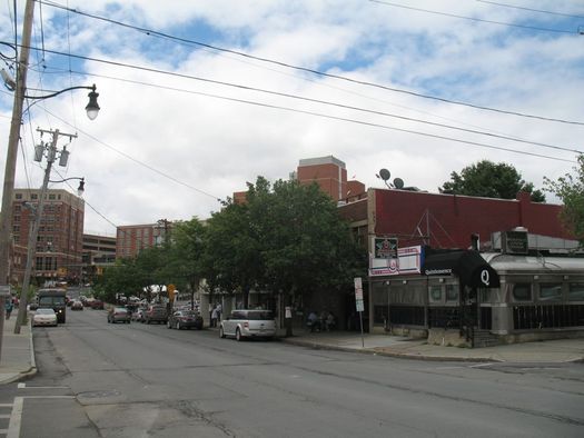
The plan is clear the two blocks between Dana Ave and Albany Med for new development.
Albany Medical Center announced today that it's ready to move ahead with the second phase of the redevelopment of Albany's Park South neighborhood.
The plan for this next stage -- a $110 million project focused on residential and retail -- will wipe clear two whole blocks of the neighborhood for new buildings. And it holds the potential to fundamentally transform the surrounding neighborhood.
Push continues for Albany aquarium
The Tennessee Aquarium in Chattanooga. It's being pointed to as a model project for what's proposed in Albany. Also: There was a penguin born there recently. (photo: Tennessee Aquarium / Todd Stailey)
A few more bits about the push for an aquarium in downtown Albany:
Omni and the convention center site
Omni Development continues to advocate for an aquarium/science museum/IMAX theater on the site of the land collected for the stalled Albany convention center project -- despite a cold shoulder from the convention center authority. ( The authority's executive director says it's staying the course of trying to build a convention center until directed otherwise by the state.) [Biz Review] [TU]
Omni has been using the Tennessee Aquarium in Chattanooga as a model for what an Albany aquarium could be -- and today in a press release it urged Jerry Jennings to talk with the mayor of Chattanooga and schedule a trip to see the aquarium there (it even said it would pay for the trip). Jennings told JCE he'd call, but he's not making the trip. [@JCEvangelist_TU]
More details about Omni's preliminary proposal -- along with concept renderings -- are after the jump.
Albany Aquarium
The Albany Aquarium group -- which has been rallying support for the idea on Facebook -- announced that it's organizing a public meeting July 15 at the Albany Public Library main branch. The goal: to "outline their vision and solicit public feedback."
In another upstate city, a discussion about an urban highway

Syracuse's I-81 viaduct.
Related to the I-787 discussion that pops up now and then: There's an interesting situation in Syracuse regarding what to do with the the elevated portion of I-81 that cuts right through the middle of that city. The thoroughfare is falling apart, so something has to be done -- and the options have been narrowed down to either: turn the stretch into a six-lane boulevard through the city, or completely rebuild the elevated highway. [I-81 Challenge] [Syracuse Post-Standard]
Some of the numbers involved in the decision are eye-popping: both the boulevard and reconstruction of the 1.4 mile stretch could cost as much as $900 million, according to the Syracuse Post-Standard article linked above. Other options -- such as burying the road -- have been dismissed because they'd cost in the $1.5 billion range.
The situation in Syracuse has ended up polarizing along city/suburb poles, with the county legislature and developers opposing the boulevard because of concern it would make it harder for suburban commuters to get in and out of the city. In a recent op/ed, David Rubin -- a former dean at Syracuse University, which sits right along I-81 -- called the project "the most important civic decision of the past 60 years or more" and argued for the boulevard plan. [Syracuse Post-Standard] [Syracuse Post-Standard]
Case studies: The state Department of Transportation and the Syracuse Metropolitan Transportation Council have collaborated on an ongoing public discussion about the project called "The I-81 Challenge." It produced a report that includes a bunch of case studies of how other cities have dealt with the reconstruction or reconfiguration of urban freeways. If you're interested in the future of 787, the case studies are interesting reading.
Earlier:
+ "The Life and Death of Urban Highways"
+ The Albany 2030 plan included a goal of evaluating possible alternative designs for 787
+ The Stakeholders org released a report in 2011 that imagines the Albany waterfront with a boulevard
+ The removal of 787 in downtown Albany was on Martin's urban wish list
map: I-81 Challenge
A pledge for pedestrians and drivers
This has been a bad week for pedestrians. One person was killed on Central Ave in Albany, another hit just up the street during a vigil for the first person. And in North Greenbush, a pedestrian was hit by truck with a snowplow attached. [TU] [Troy Record]
Unfortunately, a week like this isn't surprising. I walk a lot -- because I have a dog, because I prefer it to driving when possible, just because I like it. Rare is the week that I don't have a an encounter with a vehicle that's a little too close. A lot of times it's a result of something a driver did (or didn't do) -- roll through a right on red, not respect a crosswalk, or just not pay attention to what's going on. But I'm also sure there are times I could have been a better pedestrian.
So, pedestrians and drivers need to come to some sort of understanding. And toward that end, here's a pledge for pedestrians and drivers (and municipalities) to do better...
Map: vacant buildings in Albany
The zoomed-out view distorts things a bit -- zoom into an area to get a better sense of the share of buildings that are vacant.
Map of the day: Here's a map of vacant properties in the city of Albany, drawn from a recent vacant building report published by the city.
The map is courtesy of Tim Varney, who put it together after taking a look at the report and concluding it was something less than user friendly. He passed it along to us today: "You guys seem to like this sort of thing." (Tim, you know us well.)
Tim also made a map of the "buildings no longer vacant" list from the report. Both maps are after the jump in large format. (We've also embedded the report post jump.)
The map is not all that surprising. It really highlights how much an issue vacant buildings are in the city and how acute the issue is for some neighborhoods. It's been a controversial topic -- both in measuring the scale of the problem, and about how it should be tackled. [TU]
There are currently 809 vacant buildings in Albany, according to the report from the city's Division of Buildings & Regulatory Compliance. It says that as many as a third of those buildings "may require demolition at some future point" because they're "upside-down" -- the cost to renovate is much higher than the expected return on the investment.
(Thanks, Tim.)
"The Maple Avenue Mind-Set"
 The bizarre drama over whether a kid should be able to ride his bike to Maple Ave Middle School in Saratoga is rehashed in a recent issue of Bicycling magazine. The long article by David Darlington -- "Why Johnny Can't Ride" -- details the many turns in the story, but also argues it's part of a broader context involving health, urban planning, and helicopter parenting:
Schoolwise, this might be referred to as the Maple Avenue Mind-Set: passive acceptance of a status quo that promotes not only pollution and disease but also the lesson that children (who grow up to be citizens--and parents) are helpless. Amid this grand civic failure, the chief cause for encouragement comes from individuals who refuse to give in: the Marinos, Olsons, Skenazys, and Robinsons who prioritize fresh air and exploration and exercise, the powers-that-be be damned.
In a twist we wouldn't have guessed, the Shen school district and its superintendent -- Oliver Robinson -- are held up as an example of a more bike-friendly district.
(Thanks, Jess)
photo: Nathaniel Welch / Bicycling
New Urbanism at Albany Roundtable
 The Albany Rountable's annual meeting next Wednesday (May 23) at the University Club will feature John Norquist, president and CEO of the Congress for the New Urbanism. CNU describes itself as an org "promoting walkable, mixed-use neighborhood development, sustainable communities and healthier living conditions."
Before heading up CNU, Norquist was mayor of Milwaukee during 90s and early 2000s. During his tenure he made a successful push to replace the city's Park East Freeway with a boulevard. He also wrote a book called The Wealth of Cities, staking out a position that doesn't necessarily fit on the standard political spectrum: safety-focused, pro school choice, fiscally conservative, urbanist, pro public transit, and anti-sprawl.
Tickets for the Albany Roundtable talk are $35, and an RSVP is required by May 18 (this Friday).
Earlier on AOA:
+ "The Life and Death of Urban Highways"
+ The University Club
photo: Flickr user Center for Neighborhood Technology
Schumer on board with walkable, bikeable Livingston Ave Bridge
Chuck Schumer near the Livingston Ave Bridge today.
Chuck Schumer was in town today to push for the inclusion of a pedestrian walkway on the Livingston Ave Bridge -- regardless of what direction the project takes (rehab or total replacement).
Said New York's senior senator in a press release:
"For decades, people could easily walk over the Livingston Avenue Bridge and its sister, the old Maiden Lane Bridge, providing an important link between downtown Albany and the Rensselaer waterfront. ... Then all of that stopped, and the gates went up, shutting down the pedestrian link between these great cities. When the new bridge is built, we have a fresh chance to reconnect these two downtowns [Editors: Albany and Rensselaer] and funnel more visitors to key areas on both sides of the river. Failing to include a pedestrian component in this bridge would be shortsighted, and we can't make that mistake. That's why I'm urging everyone from CSX to Amtrak to NYSDOT to climb aboard with this plan, so that every design going forward will link up the biking and walking paths on both sides of the scenic Hudson."
In a Soapbox piece last fall, Martin Daley explained why local transportation planners are pushing for a pedestrian walkway on the bridge -- and the obstacles the idea has encountered:
Planning for a new Sheridan Hollow
Interesting: a coalition of groups, orgs, and firms is holding a charrette -- "a multi-day collaborative planning event" -- this week to create a plan for transforming the Sheridan Hollow neighborhood in Albany. From the blurbage:
The goal of a charrette is to identify the priorities for a community redevelopment project, create practical designs that address these priorities, incorporate feedback from local residents, and serve as a kick-off for the project. This planning session will help create strategies for eliminating blight and promoting re-investment in an important and historically significant Albany neighborhood.
In order to encourage as much community participation and input as possible, the charrette will be open to the public each day, with several specific public meetings focusing on transportation, housing, sustainability/environment, urban design/historic preservation, economic development, and parks and recreation.
Here's the schedule of events -- many are open to the public. The charrette is organized by Capital District Habitat for Humanity, the Touhey Home Ownership Foundation, the City of Albany, 3tarchitects, and Housing Visions, Inc. (Press release is embedded after the jump.)
Sheridan Hollow is the neighborhood in the ravine between the Capitol and Arbor Hill. It has a long history -- much of it downtrodden. There was an infamous garbage incinerator there during the 80s and early 90s.
More recently, though, there's been a lot of development at the eastern end of the neighborhood, including residential. There are the 24 condos at 17 Chapel, the 43 apartments planned as part of the Boyd Printing Co. building conversion ("The Monroe") at 47 Sheridan, and 13 units at 4-6 Sheridan.
How walkable, relatively, is Albany?
A heat map of walk scores for Albany. Here's the interactive map.
A post over at Atlantic Cities about the "most walkable cities" in the United States has been circulating locally on Twitter because it mentions that Albany is among the top 10 most walkable cities in the country, according to data from Walk Score.
It turns out that's not actually true.
But that doesn't mean Albany -- and a few other local cities -- don't fare well in the rankings.
"The Life and Death of Urban Highways"
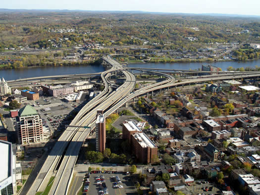
Another log for the "tear down 787" fire: The Life and Death of Urban Highways, a survey of why cities around the world have been tearing down urban highways -- and what has happened when they've done so. (Update: That link wasn't working for some reason Tuesday evening, so the report is now embedded after the jump.)
Among the reasons cited by the report that urban highways have fallen out of favor:
+ Costs of reconstruction and repair: Cities are finding out how much it costs to maintain these highways and are deciding the money is better spent other ways.
+ Economic revitalization: Removing the highways, which serve as dividers in the urban landscape, has opened the way for new development of neighborhoods -- and in many cases, higher property values.
+ Making accessible waterfronts: Many urban highways -- like 787 -- parallel waterfronts, and removing them reconnects the waterfronts to the city, again opening the way for parks, development, and higher property values.
The report also includes case studies from cities such as Portland, Oregon, San Francisco, and Milwaukee.
The orgs responsible for the report, Institute for Transportation and Development Policy and EMBARQ, advocacy orgs that both appear to be very much of the Jane Jacobs, pro-public transit school -- just something to keep in mind while reading through the report so grains of salt. It's interesting reading, and it's easy to see how many of the issues brought up could apply to the Capital Region.
The thing to keep in mind about 787 is that there's no "do nothing" option over the long run. If it stays, it has to be maintained -- and that's not cheap. If it goes... that's not cheap, either. So, the question really is: if we (the region/state) are going to spend (tens, hundreds of) millions on this key piece of infrastructure, what do we ultimately want to end up with? And is it worth it to us to spend more upfront to have something possibly better (though not necessarily guaranteed) in the future?
[via @SeanPCollins via Grist]
Earlier:
+ The removal of 787 in downtown Albany was on Martin's urban wish list
+ The Albany 2030 plan included a goal of evaluating possible alternative designs for 787
+ The Stakeholders org released a report last year that imagines the Albany waterfront with a boulevard (it's also embedded after the jump)
+ Syracuse has been considering the removal of the elevated portion of I-81 that runs right through the heart of the city [Streetsblog]
An urban wish list
On Martin's urban wish list: tearing down 787.
![]() I've written a lot about what I wish for in the Capital Region: A walkway on the Livingston Ave. Bridge (for which I have a petition), chickens, and preservation of our historic/unique architecture.
I've written a lot about what I wish for in the Capital Region: A walkway on the Livingston Ave. Bridge (for which I have a petition), chickens, and preservation of our historic/unique architecture.
These are fairly practical ideas. In fact, I think they're no-brainers, which is why I get more than a little irritated when I hear we can't have them or our elected officials brush them off.
But my imagination is filled with an even longer urban wish list filled with things I'd make happen if I had a billion dollars to spend.
A pedestrian mall for downtown Troy?
Church Street, the pedestrian mall in Burlington, Vermont.
Potentially interesting: Troy mayor Lou Rosamilia has floated the idea of permanently closing some downtown streets to vehicle traffic in order to create a pedestrian mall, the Biz Review reports. [Biz Review]
The most famous recent experiment of this type has been in New York City, which has closed off sections of Broadway in Manhattan. [NYT] [NYT]
But the pedestrian mall isn't a new concept. Kalamazoo, Michigan first tried it in 1959. Many cities followed with their own pedestrian malls -- and a large majority of them failed. (Kalamazoo re-opened part of its mall to vehicular traffic in the late 90s.) There have been some notable successes, though. For example, Burlington's pedestrian mall, Church Street, is great. [Wikipedia] [Indianapolis Downtown Inc. study] [Kalamazoo Public Library]
The thing about a pedestrian mall area is that you need people. Downtown Troy has good foot traffic during the day -- it's maybe our favorite Capital Region downtown in daylight. Will there be enough people the rest of the time to make it worth it? Public spaces without people tend to go the wrong way. If the City Center and City Station projects are successful, maybe. [Governing]
Of course, there are a lot of details that would have be figured out for this idea -- which streets, how to address parking issues, how to address access for shipments to shops and businesses. But it's an interesting idea.
photo: Flickr user redjar
An Albany aquarium?
From the National Aquarium in Baltimore's Inner Harbor area.
Rob (@paintaneight) pointed out a recent letter to the editor in the TU calling for the construction of an aquarium in downtown Albany instead of a convention center. From the letter by Lino Verelli of Slingerlands:
... An educational center to see, feel and be able to interact with the creatures and beauty of the oceans.
Open seven days, it would provide jobs for a dedicated staff of professionals and the countless support services necessary to its maintenance.
If managed correctly, this center would generate jobs, sales taxes, hotel taxes, visitors' fees and something totally unique to the fabric of this city.
Rob was curious what people thought about this idea (we get the sense he likes it, but we're just reading between the tweets) -- and so are we. So, aquarium -- yes/no/maybe?
We re-tweeted Rob's question yesterday and there were a handful of responses -- they're after the jump. Update: We've also embedded comments from AOA's Facebook page.
Our initial reaction to the idea: skeptical. It seems like an urban planning cliche, a possible white elephant (or maybe "white whale" is more apt).
photo: Flickr user seannaber
Duncan Crary, downtown disciple
Duncan holds a piece of the now-demolished Troy City Hall as he looks out of his downtown Troy apartment window.
Duncan Crary has been in love with Troy since he was a child, "hatched," as he puts it, "on a cul-de-sac in the American suburbs" in Delmar.
"Suburbatory."
Maybe it was the defiant brownstones, or the alleys that time forgot, that turned his head. Most likely it was the comic-book shop on Fulton Street. Troy was where he wanted to be.
But it wasn't until his teen years, when he devoured The Geography of Nowhere, James Howard Kunstler's attack on suburban sprawl, that he understood and could articulate why.
Brunswick
Debuting soon: Brunswick, a documentary by Nate Simms about the tension between development and farming in the Rensselaer County town. From the blurbage:
Brunswick is a film about landscape change, told through the personal story of a farmer's lifelong connection to his now-threatened land. The film weaves together the plight of Sanford Bonesteel, an aging farmer in his 90s, with the dynamics of small-town politics as a residential development is planned on Sanford's former land.
The film takes place in Brunswick, New York, a small country town facing the challenge of balancing economic growth with the preservation of its rural character. It is a story both specific to Brunswick and yet recognizable to rural communities all over the United States.
All we've seen of the doc is what it's in the trailer embedded above, but it appears to be about the proposed Highland Creek development, that was to be built on farmland acquired in a deal involving the town supervisor. The development was the subject of multiple lawsuits and allegations of conflicts of interest. Bonesteel passed away at the end of 2008. [Troy Record 2008] [Wikipedia] [Troy Record 2006] [Troy Record 2008]
The first screening of the doc will be December 7 at the Spectrum. Tickets are $6.
Bonus bit: The soundtrack for the documentary was composed and performed by Matthew Carefully, who will be performing the music at Caffe Lena on December 4.
The KunstlerCast book
 Check it out: Troy-based journalist Duncan Crary has written a book based on his many conversations with James Howard Kunstler on the KunstlerCast podcast. From the blurbage:
For four years, Kunstler and Crary met in person to record their ongoing conversations (totaling more than 150 hours) about suburbia, sprawl, car-dependence, cities, peak oil, American culture and many other topics for a weekly audio podcast (also called "The KunstlerCast"). Their ongoing dialogue revisited and updated many of the major ideas contained in Kunstler's body of work, while exploring many additional topics as well. The KunstlerCast book presents the best of those conversations in a highly readable, organized, indexed form.
The book will be released in November. But there's a book party Tuesday at Daisy Baker's in Troy -- both Duncan and Kunstler will be there to sign books. The party starts at 5:30 pm.
A walkable Livingston Avenue Bridge
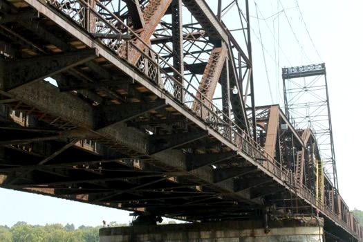
A way across the Hudson -- possibly for more than just trains.
![]() It's a frustrating thing to watch bureaucracy get in the way of great vision. It can result in some pretty bad decisions, the kind that make you look back and say "woulda, coulda, shoulda..." when it's too late to make changes. Which is what we may be saying soon about the pedestrian walkway on the Livingston Avenue Bridge.
It's a frustrating thing to watch bureaucracy get in the way of great vision. It can result in some pretty bad decisions, the kind that make you look back and say "woulda, coulda, shoulda..." when it's too late to make changes. Which is what we may be saying soon about the pedestrian walkway on the Livingston Avenue Bridge.
The bridge has become a very important issue to many cycling advocates and pedestrians. I am one of them. I tell people this is my "chickens issue" -- a project that could significantly transform Albany.
So what's so special about a walkway on a bridge?
Scanning the Albany 2030 draft plan
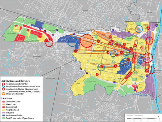
A map of "activity nodes and corridors." (pg 35 / pdf pg 45)
Albany 2030, the effort to develop a comprehensive plan for the City of Albany, released a draft of the plan this week. The "guide for the management of change" (or "a 'to do' list" for the city) is long, really loooong. The pdf is 272 pages.
Who would ever read through the whole thing? Uh, well... that would be us.
The draft plan mostly covers general goals, things like promoting economic development and increasing transit options. But it also includes specifics, some of which are worthwhile but still kind of oddly specific (example: incentives to increase the use of rain barrels).
If we had to distill the whole document down to one sentence, it would be, in our own words (deep breath):
Albany aims to become a prosperous, diverse, well-educated, safe city, ready for climate change, with a mixed-use downtown and neighborhood centers, where people walk more and drive less.
But there's a lot more to it. We've gone through the whole document and pulled a bunch of bits that we thought we were interesting and notable (with page numbers so you can reference the context).
A scannable list of those bits is after the jump.
The one-car household: a car junkie cuts back
![]() I am what you may call a recovering car junkie.
I am what you may call a recovering car junkie.
I. Love. Cars.
I've had over 10 of them -- even a couple of classics. And I still pine for the restored 1986 Jeep CJ-7 I once owned.
But a couple of years ago a muffler shop noticed a ton of frame rust on my barely-broken-in Toyota Tacoma and told me about a buyback program created to address the problem. After a month of back and forth, Toyota eventually bought my beloved truck back.
Since then, we've been a single car household.
Here's how it's worked out.
Look both ways
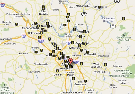
A screengrab from the map of pedestrian deaths in the Capital Region.
There were 92 pedestrian fatalities in the Capital Region from the years 2000-2009, according to a report out this week from a transportation advocacy org.
The Capital Region had one of the lower fatality rates in the state -- 1.1 deaths per 100,000 people. Of the four core counties, Albany had the highest pedestrian fatality rate at 1.3 deaths per 100,000 people.
Transportation America's report also includes a map of the pedestrian deaths. Of the 92 deaths reported in the Capital Region, 13 of them occurred along Route 5, according to the map.
[via @omarjpeters and @AbbyThyme]
The selected redevelopment proposal for the former Troy city hall site
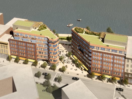
Troy City Center
The City of Troy announced today that it has picked a mixed-use proposal for the redevelopment of the former city hall site. From the press release about the "Troy City Center":
The $31.5 million project emphasizes two of the most important aspects of redevelopment: enhancing physical and visual access to the City's waterfront, and promoting the aesthetics and walkable nature of Troy's historic downtown. The design proposes to have a piazza acting as a pedestrian extension of Broadway and terraced grand entrance to Riverfront Park, which is undergoing its own multimillion dollar transformation. This piazza will be framed by two buildings that complement the historic Rice and Cannon buildings in height, construction, and sidewalk frontage, while adding new, high-end retail and residential space.
A "piazza"? Fancy.
The design still has to be approved by the city council before the project can move forward. That discussion could be... interesting. The city council and mayor Harry Tuntunjian have a relationship that doesn't lack for drama.
A few more details, the full release, and large versions of the renderings are after the jump.
What's this building?
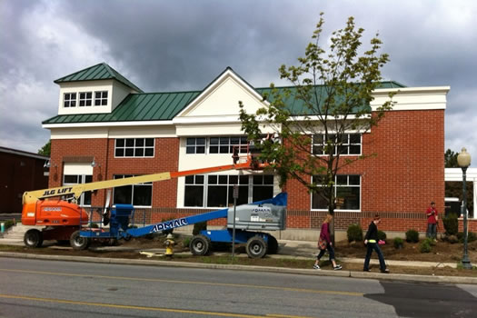
Medical practice? Real estate agency? Bank?
Quick commercial real estate quiz: what business is opening in this Saratoga building?
The answer might surprise you. It's after the jump.
Loving -- and hating -- the Empire State Plaza
Impressive -- and maddening.
![]() Like lots of Albanians, I have a love/hate relationship with the Empire State Plaza.
Like lots of Albanians, I have a love/hate relationship with the Empire State Plaza.
I've never known Albany without the ESP. It's just always been there for me. I know I'm coming home when I see it on the horizon. It's a symbol of this city, and there's no changing that.
Nelson Rockefeller sure knew how to make his mark.
The highway that was almost buried under Washington Park
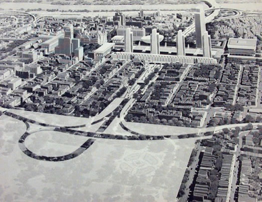
What could go wrong?
Ever wondered why the Dunn Memorial Bridge provides a ramp to thin air? Why the Livingston Avenue exit of I-90 is so overbuilt, and ends so abruptly? Why there are extra tunnels underneath the Empire State Plaza? Or why Corporate Woods has its own highway exit?
They're all vestiges of a highway system that was never built.
An urban planner grows in Albany
![]() We're pulling out the AOA soap box each Sunday for people to praise, complain, suggest, joke, or make an observation about things they see going on in the Capital Region.
We're pulling out the AOA soap box each Sunday for people to praise, complain, suggest, joke, or make an observation about things they see going on in the Capital Region.
Nostalgia can encourage people to play fast and loose with their memories.
I'm sure I remember my childhood in Albany's Helderberg neighborhood as far more exciting and enjoyable than it really was. I was born in Boston, but I was three when we moved here, and I can say with certainty that I'm Albany-bred, of Albany stock, a true Albanian.
As a kid, your definition of "worst things ever" is pretty undeveloped, so it's certainly likely I wallowed in the misery of dating (lack of), homework, and boredom, but my brain doesn't store much of that stuff. The good memories of childhood (including sunny summer days playing football; late fall nights playing street hockey; making race car tracks in the yard for matchbox cars; riding bikes; and general mischief) are the memories that resonate.
I didn't realize until years later that the layout and landscape of the neighborhood I grew up in played a strong role in shaping my values -- and my career.
I'll admit, there were signs very early on that I might grow up to be an urban planner: I loved Sim City, my favorite book was New Providence, and I had a gigantic Lego city laid out in the basement.
Sometimes, you just don't see the forest through the trees.
... said KGB about Drawing: What's something that brought you joy this year?